April 23, 2019: Data Plots and General Observations
Greetings from Silverton,
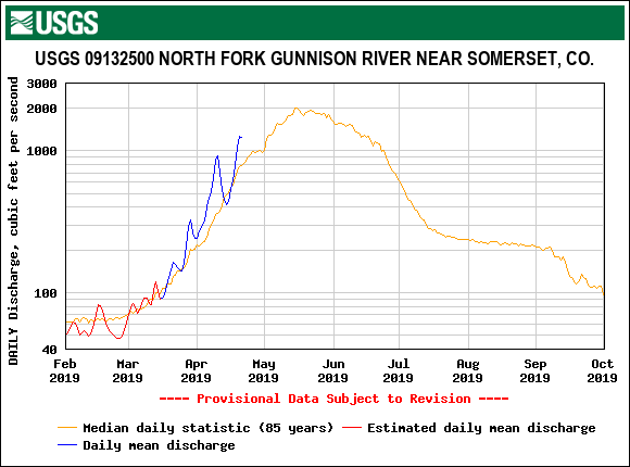
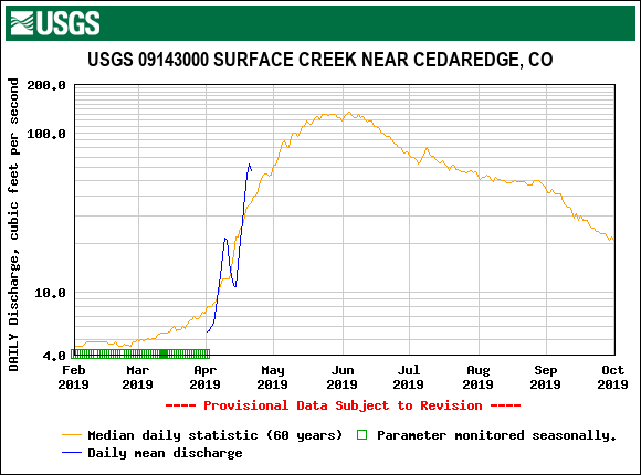
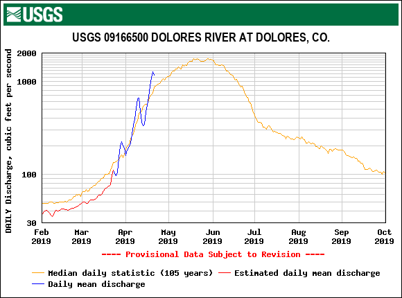
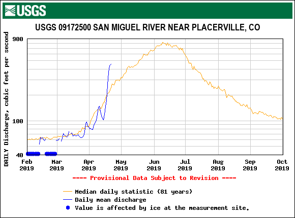
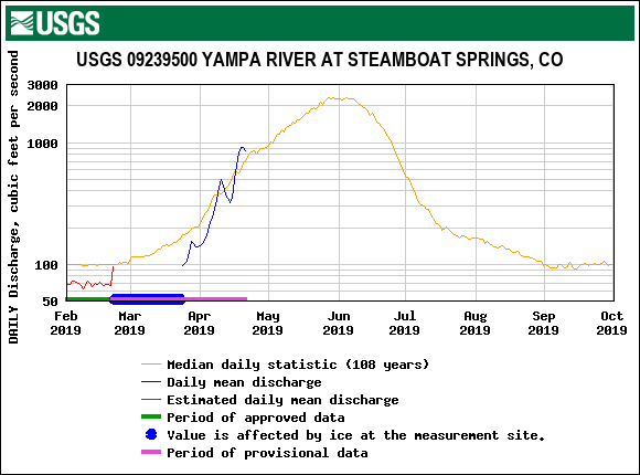
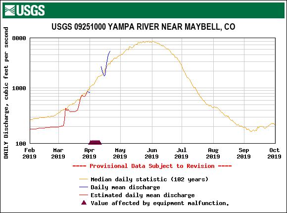
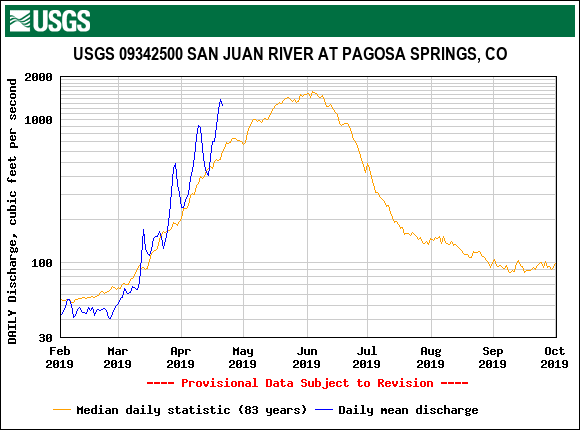
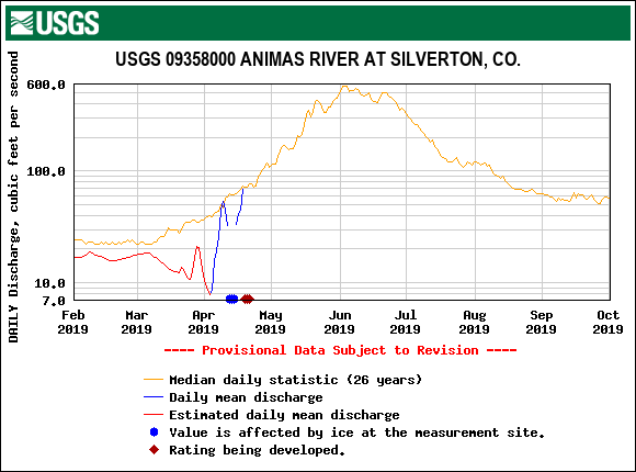
The last 8 days we have seen dry and hot conditions accelerating snowmelt causing a spike in streamflow statewide. In the San Juan Mountains a moderate dust layer on or near the surface has helped increase melting of the snowpack. Last week we noted this dust layer (D3), occurring April 9-10, was located ~6'‘ below the snow surface at SASP (11,060’) and was also visible at the usual suspect locations on the landscape. Currently this dust has predominantly surfaced. This weeks surge in streamflow has been well above median most notably for gauges in the southern part of the state. Going forward spring conditions are to be expected, variable weather with chances of precipitation but temperatures holding 3-6 degrees above normal.
With the deep snowpack likely to stick around later than usual and because we have recorded only one moderate event since our March CODOS tour, we are pushing our next state-wide CODOS tour into the last days of April and first few days of May to be more timely in our observations and reporting. We will look for D3 presence in other mountain regions and any other dust events that may have occurred. We have now inched our way past peak accumulation season hence now is the most crucial time to track the location and severity of any dust layers in the snow as we head into full ablation season.
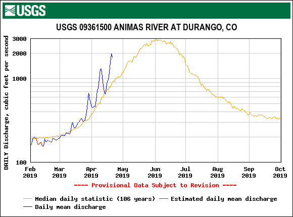
Below: Streamflow of the Animas River at Durango and SBB stream gauge (11,000’), with albedo at SBB and forecasted maximum and minimum air temperatures. SBB streamflow is scaled to better compare with Animas streamflow. With the cloudy and light precipitation over the last couple days we saw albedo increase slightly, tapping the brakes on the albedo degradation and slowing the snowmelt we have witnessed over the last ~8 days. The forecast is calling for chance of pm showers for the next 10 days except for Wednesday and over the weekend which is supposed to lean towards more sunny conditions. Air temperatures are expected to steadily climb upwards over next 10 days with minimum temperatures expected to remain near or above freezing

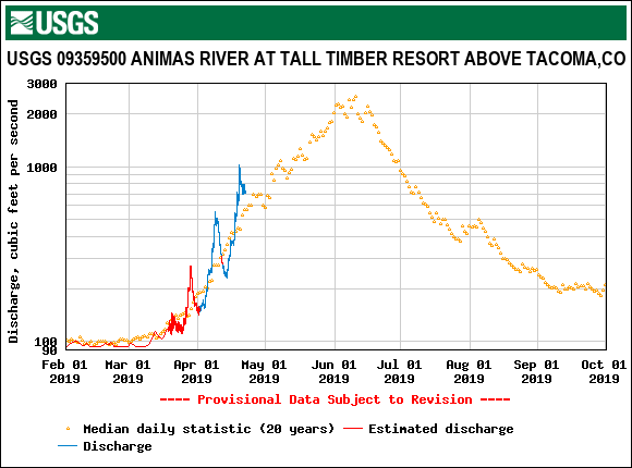
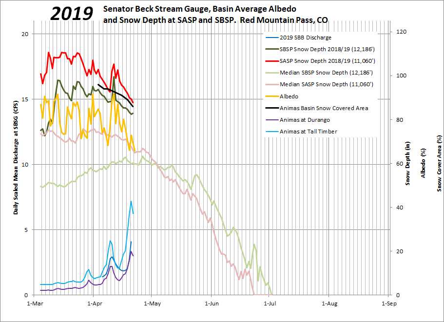
Below: Streamflow on Animas River at Durango, Tall Timber, and SBB gauge. Data scaled so timing of peaks and troughs can be compared more easily. Also snow depth at SBSP and SASP compared to median. Albedo at SBB and snow covered area on the Animas watershed.
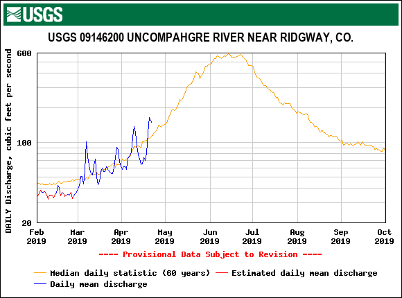
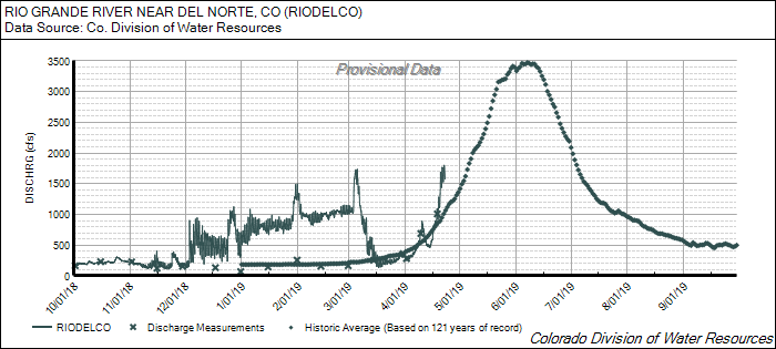
Below: The Uncompahgre River has responded very similarly to the Animas River over the last week to the dry, warm, and sunny conditions that degraded snow albedo and increased streamflow.

Below: Cumulative precipitation is up there with WY2008 and WY2011.

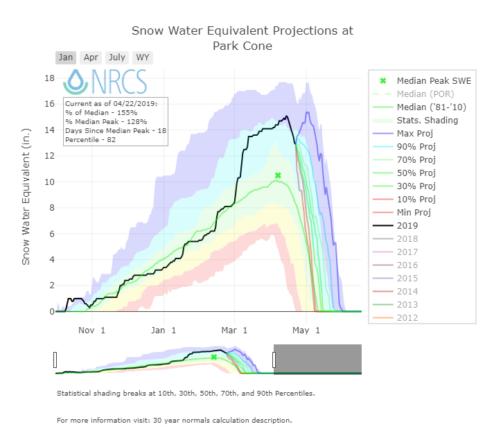
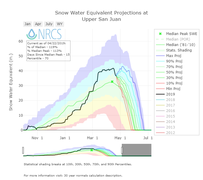
Below: Along with WY2005, WY2008 and WY2011, WY2019 is the deepest snowpack we have seen in our modest period of record. SNOTEL data tells the same story with most stations currently ranking the snowpack in their top five years in Southern Colorado, top 10 in Central Colorado, and top 20 in Northern Colorado (see NRCS data here).

Below: Higher elevations are going to have something to say this snowmelt season. At 12,200’ WY2019 is comparable to WY2005 and WY2011, and not so much with WY2008 as was the case at SASP (11,000’).