

CODOS Update April 11 2025: Statewide Dust-on-snow observations for April, just a dusting
Greetings from Silverton,
While a high pressure settled in over Colorado this week the statewide April CODOS survey was completed. We like looking for dust in sunny, bright conditions – better to see those faint dust layers that are so frequently present. Last month, we found very little dust statewide, just light layers in the central and southern sites. This month, we found a new, faint, dust layer under the surface in the northern sites as well as the southern sites, but largely, still very mild dust conditions. The dust-free snowpack sites on our tour were Berthoud Summit and Willow Creek. Loveland Pass has two faint layers with one being near surface and the other about mid-pack. Rabbit Ears has faint dust that came in on the front of the last storm and another faint layer about mid-pack. McClure has the most dust for the central sites that is sitting on the surface, it is very apparent but not exceedingly dark. Towards the San Juans, Wolf Creek and Swamp Angel have three and two layers, respectively, but again not exceedingly bad, which is a bit of a surprise for this time of year. We will keep you abreast as to any changes that may happen, as things usually change rapidly this time of year.
We are a third of our way into April. The forecast is for hot/dry conditions this week and essentially continuing for remainder of spring. This is worrisome, as over the last number of years we have had a few blistering hot April’s that greatly depleted the snowpack. For example, last year we were at median snowpack conditions on April 4, 2024, and by May 4 the southern basins lost a third to a half of its snowpack. Russ Schumacher discussed in a blog last year.
Climate.gov has declared that La Nina has ended. This was considered a very brief La Nina event. ENSO-neutral conditions is expected to continue through summer. Chances for El Niño or La Niña increase later in the year, with La Niña chances double those of El Niño, but neutral is still the highest probability through the early winter.
For specifics about our observations please see pictures and comments below. If you have any questions about your neck of the woods don’t hesitate to call or email.
You can view the snow profile forms here.
Take Care

Above: Going forth we will start showing this dust-on-snow severity map for Colorado. Right now conditions are considered light throughout the state. Keep in mind that the severity designation can change at anytime as dust events occur and as existing dust layers merge at the surface of the snowpack.
SWAMP ANGEL (Red Mt Pass): April 4
On April 4 SWE at Swamp Angel was 23.8” as measured in a snow profile. A new dust layer was deposited on the front of the April 1 storm. All-in-all still pretty light dust severity. We will have more plots and data to show from Senator Beck Study Basin within the next few days.


WOLF CREEK PASS: APRIL 9
The drive up to Wolf Creek Pass was largely devoid of snow until just a bit before reaching the Pass. The recent storm about a week ago laid down a wet white blanket that could still be seen in the higher elevations, and at the lower elevations some northerly aspects and shaded spots still showed the wet snow as proof of the event. The Wolf Creek snow pit was one of the shallowest we ever dug for this time of year. Typically the snowpack is ~2 meters deep, on April 9th it was just over 1 meter. SWE at the site was 14.6” while Wolf Creek SNOTEL reported 17.7”. There are only two dust layers, a couple others could have already merged at the surface forming just one layer. In terms of dust severity it is pretty mild overall. This is surprising as in our travels in the San Luis valley we witnessed a number of days of pretty bad airborne dust. Evidently, the strong Valley winds were not heading towards the west. So, as of now, the snowpack is very marginal, as is snow cover, but the dust severity is low. A reminder that even a little bit of dust can influence snowmelt, but currently it is not the typical dust severity that we see at Wolf Creek.
SPRING CREEK PASS: April 9
Spring Creek was looking good in terms of dust severity. There was very light surface dust and a possible very light dust layer ~8” below surface (so light it was hard to determine). There was a little bit of snow remaining from the recent snow event across the landscape. SWE was 11.3” at our profile while at Slumgullian SNOTEL reported SWE was 11.6”.
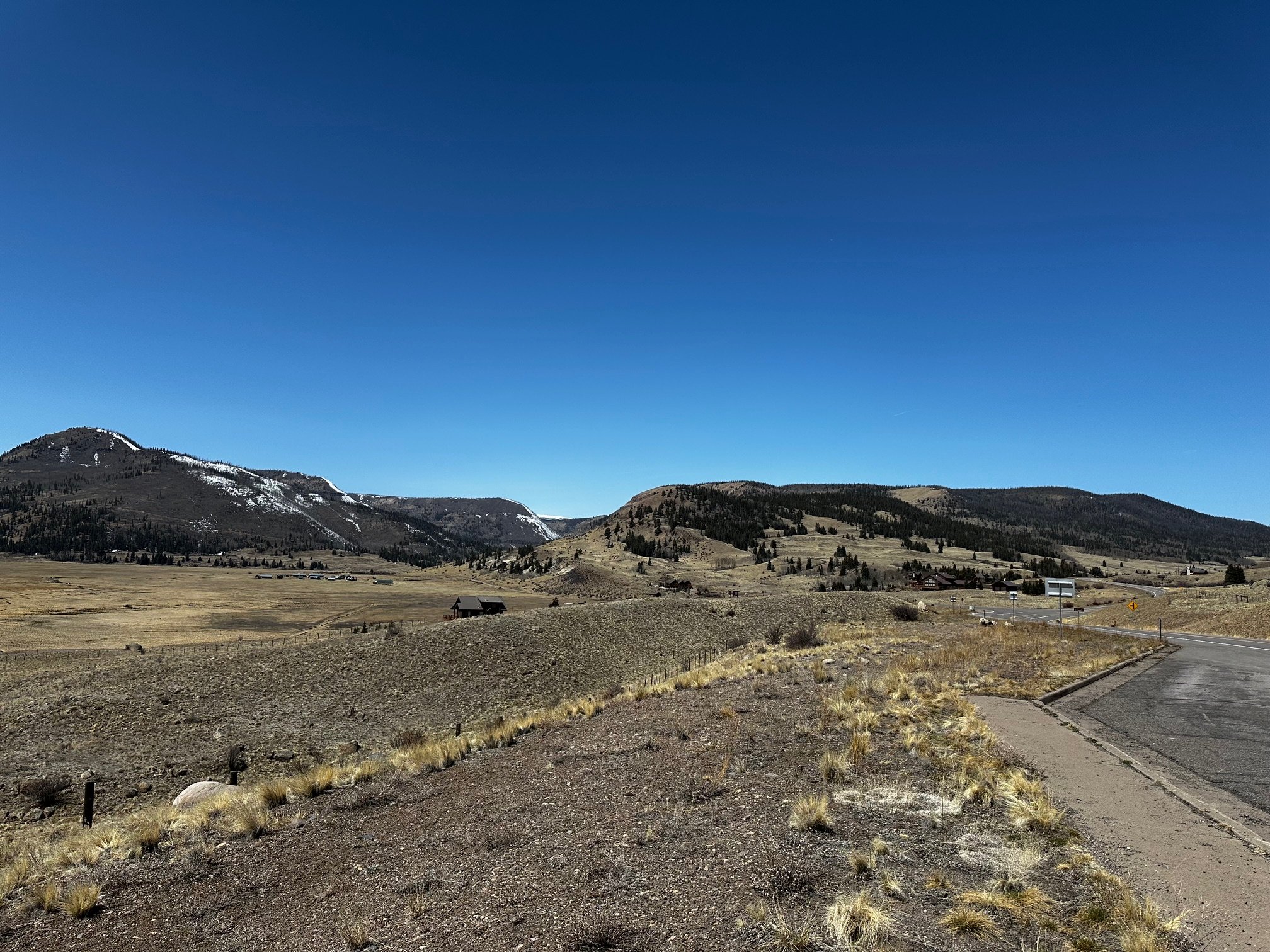
PARK CONE: APRIL 8
SWE at Park Cone was 8.4” while just a few yards away the Park Cone SNOTEL was reporting 9” SWE. Density was 334 kg/m^3. The snowpack was isothermal and moist (expected this time of year at this site). There was light dust on the surface but that is all that was observed.
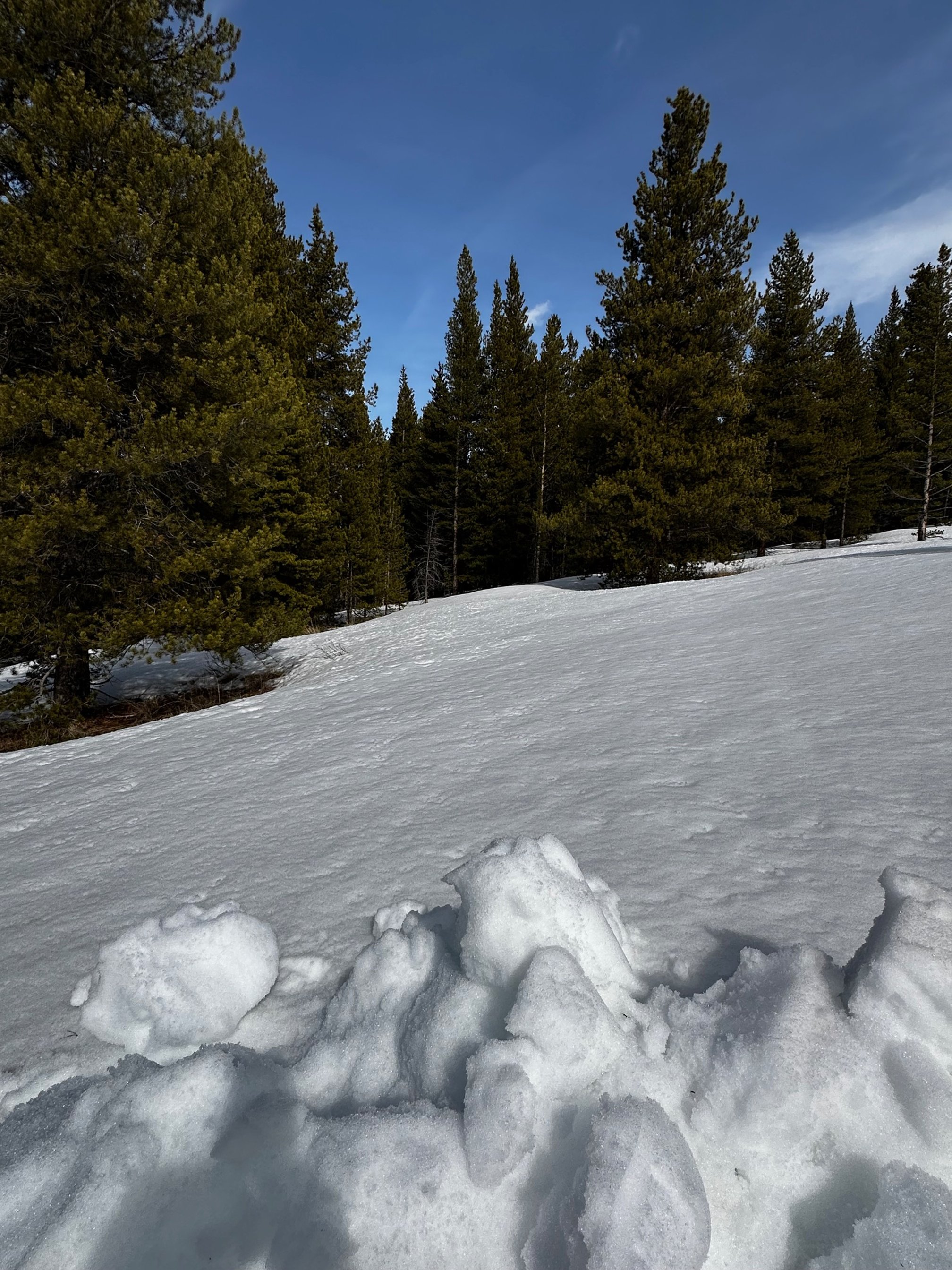
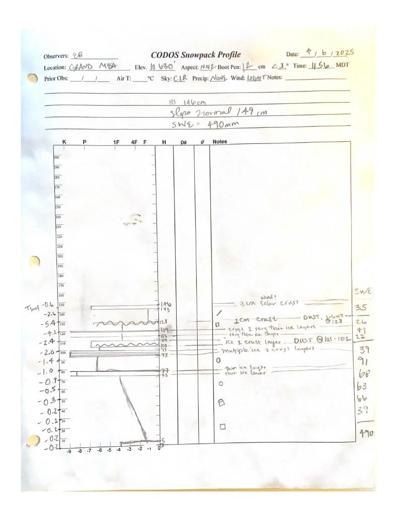
GRAND MESA: April 6
Ice and crust filled the top half of the 4’9” (1.46 m) snowpack at Grand Mesa. And, a new dust layer, possibly from the last week of unsettled weather. Last trip at Grand Mesa we had labeled ‘possible dust’ at about 5” below the surface, and this time, with more consolidation and settling, it has solidified itself about 15” below the surface. The new, faint dust layer is about 7” below the surface. Slope normal in our pit was 4’10” (149 cm) and SWE was 19.3” (490 mm), while Mesa Lakes reported 3’11” snow depth and 13.7” (348 mm).


McCLURE PASS: APRIL 6
Driving back down the Mesa and up McClure Pass, I was again struck by just how dry the lower reaches of the passes were. Our site had an obvious dust layer about 4 cm below the surface. The surface of the snow in the surrounding area was also a bit darkened. The 20” (51 cm) snowpack was isothermal with large rounded grains. We measured 7” (179 mm) of SWE at our site and SWE at McClure Pass SNOTEL was 10.6” (269 mm).


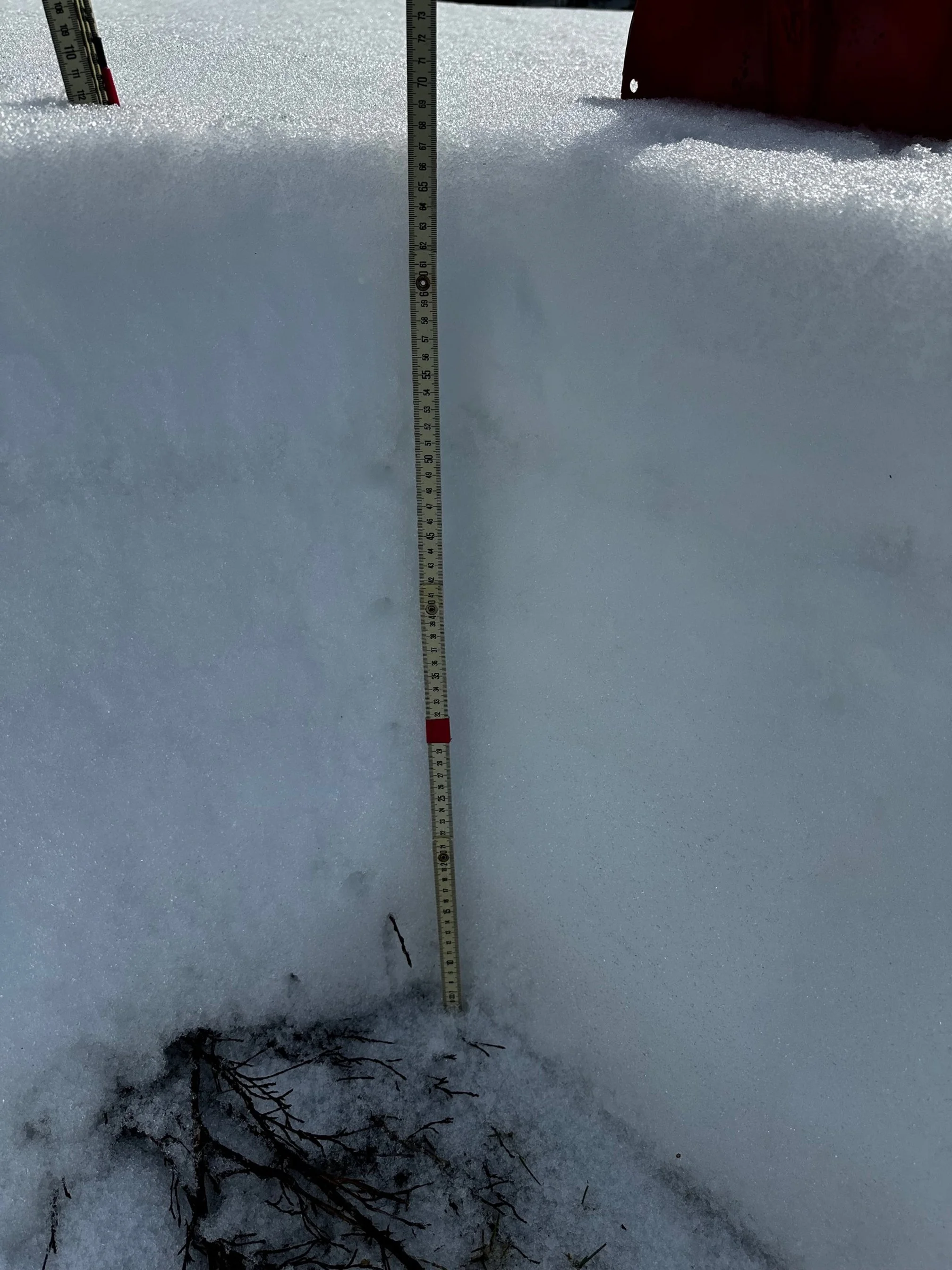
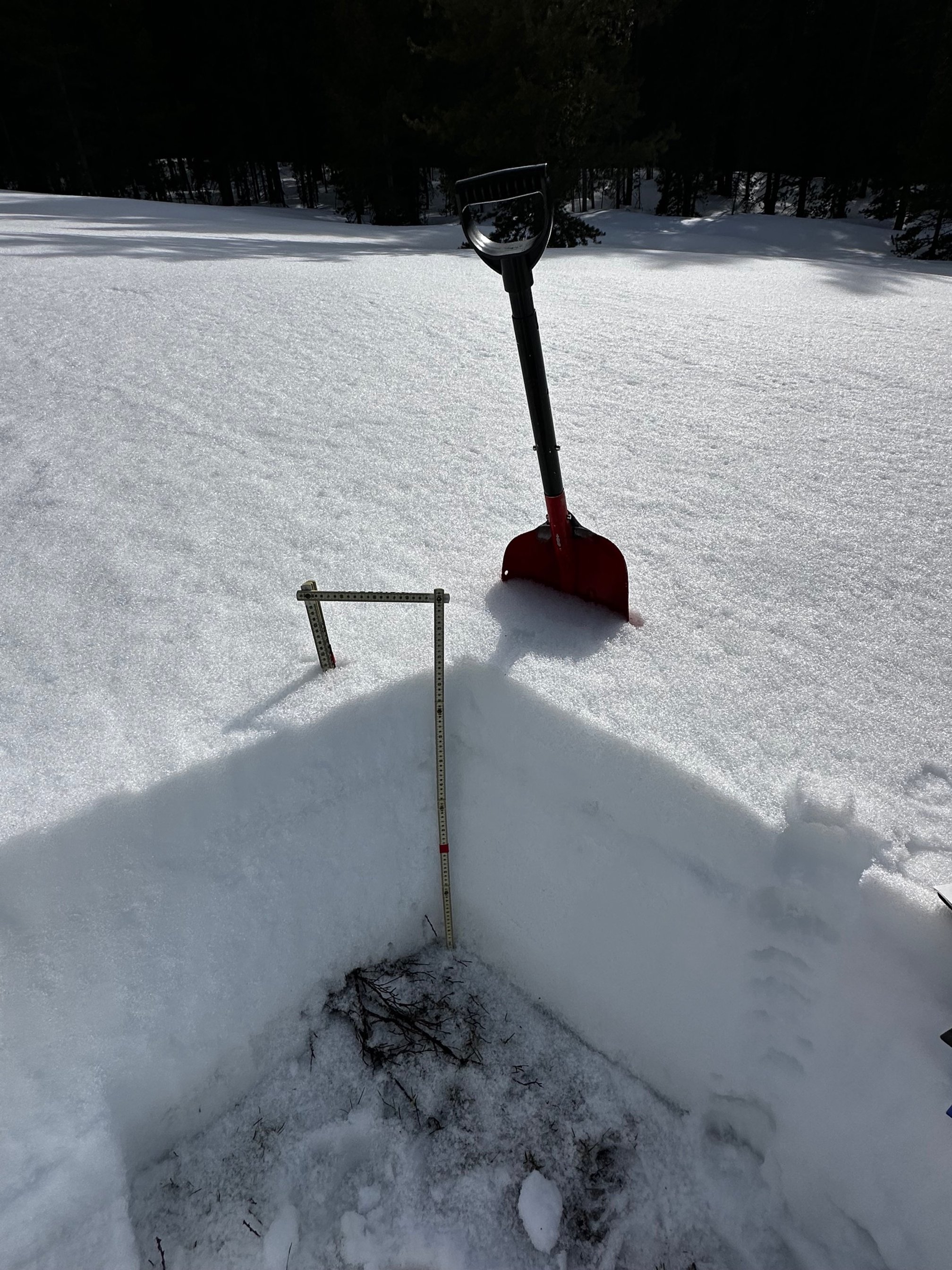
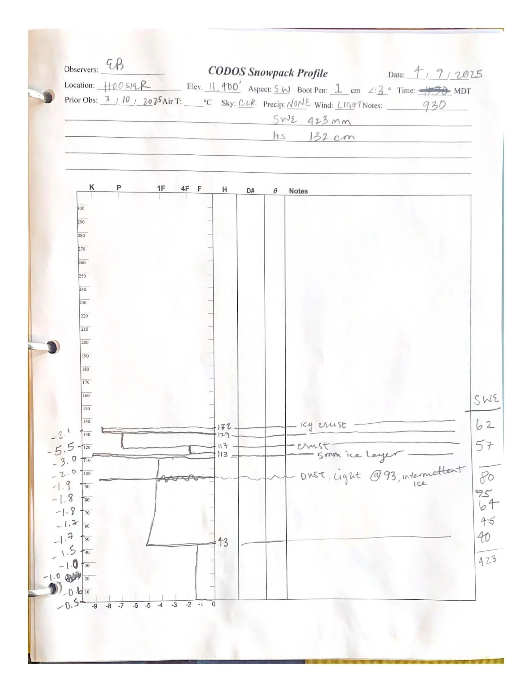
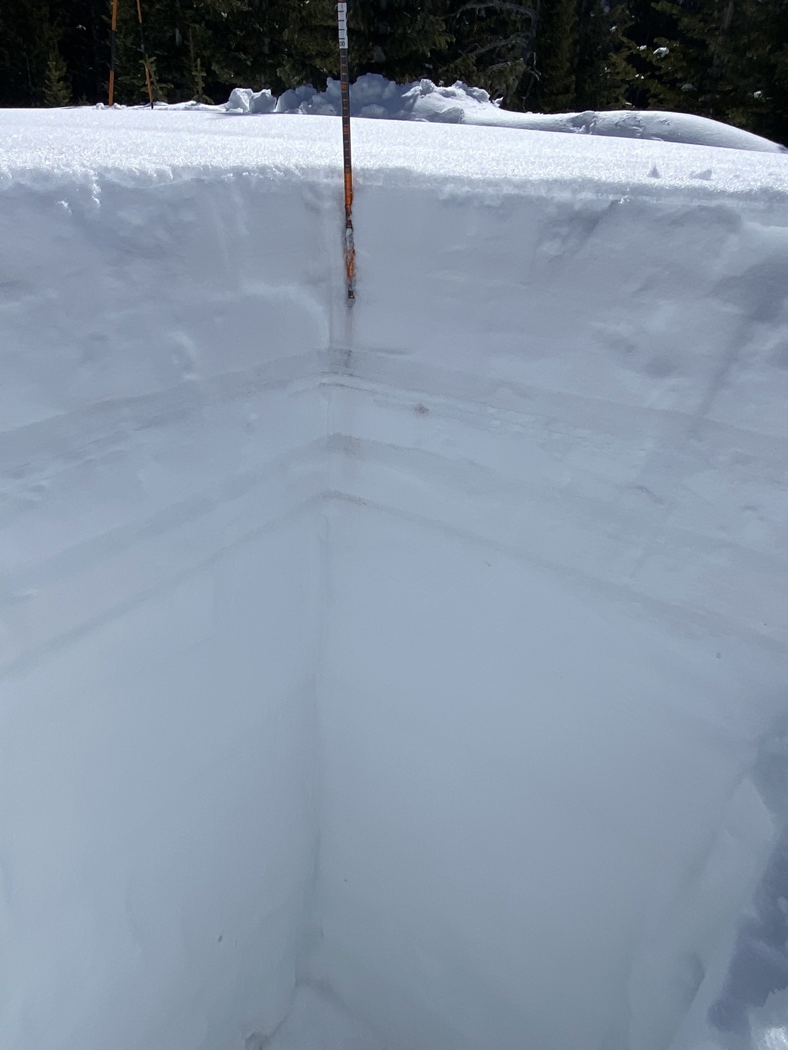
HOOSIER PASS: APRIL 9
Hoosier had just one light dust layer present at about 15” (39 cm) below the surface with 4.7” (119 mm) of SWE above. We measured total SWE to be 16.7” (423 mm) and height of snow was 52” (132 cm). Hoosier Pass SNOTEL reported 14.3” SWE and snow depth of 46” end of day on April 9th.


Berthoud PASS: April 8
There was no visible dust in the snowpack at the Berthoud Summit. The snowpack depth was 70” (178 cm). We measured 23.5” SWE (599 mm) and the SNOTEL a few feet away reported 22.2” (564 mm) with a depth of 63”.


Loveland PASS: APRIL 8
We measured 17.7” (450 mm) SWE in a 5’3” (161 cm) deep snowpack at Loveland Pass as Grizzly SNOTEL reported 21.2" (538 mm) with a depth of 5’4”. There is a mild dust layer mid-pack about 29” (74 cm) below the surface, and a possible yet very faint dust layer higher up about 3.5” (9 cm) below the surface just on top of an old surface crust/ice layer.


WILLOW Creek PASS: APRIL 7
Willow Creek is likely dust-free - there is a possible, faint layer 5” (13 cm) below the surface but it was too light to be confident in. We measured snowpack depth at 29” (99 cm) with 12.5” (317 mm) of SWE. The nearby SNOTEL had a depth of 50” (127 cm) with SWE reporting 13.8” (350 mm).


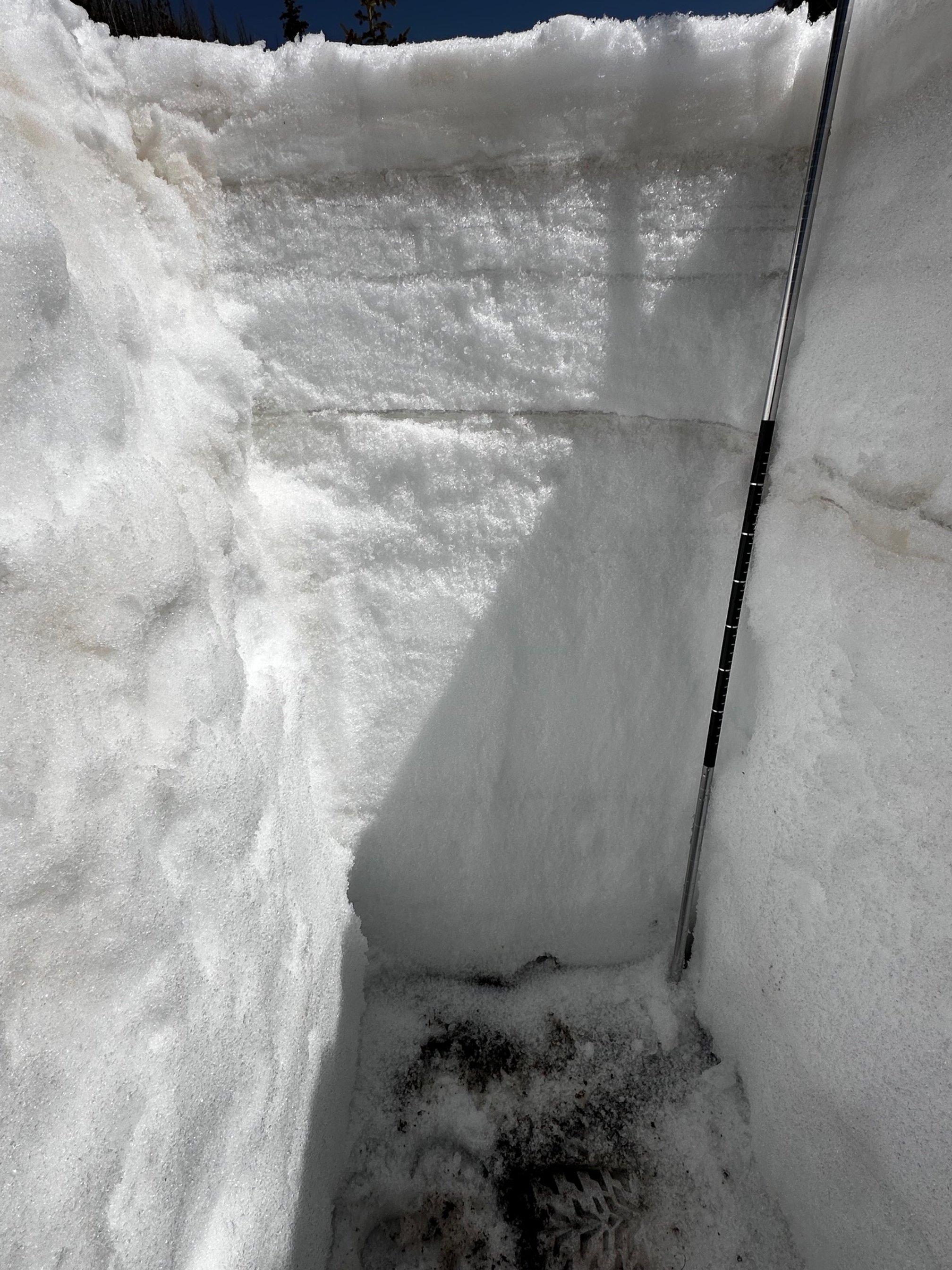
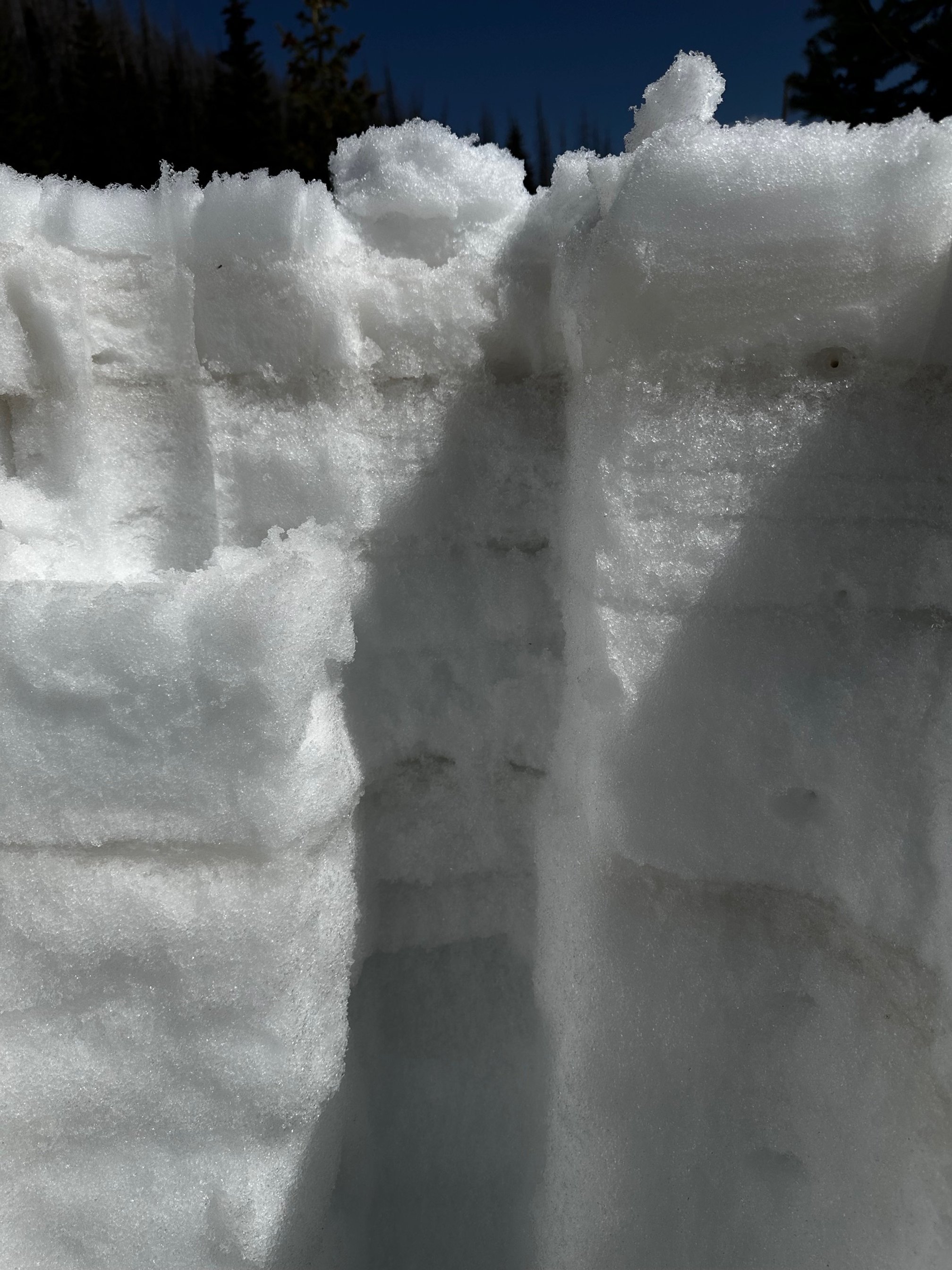
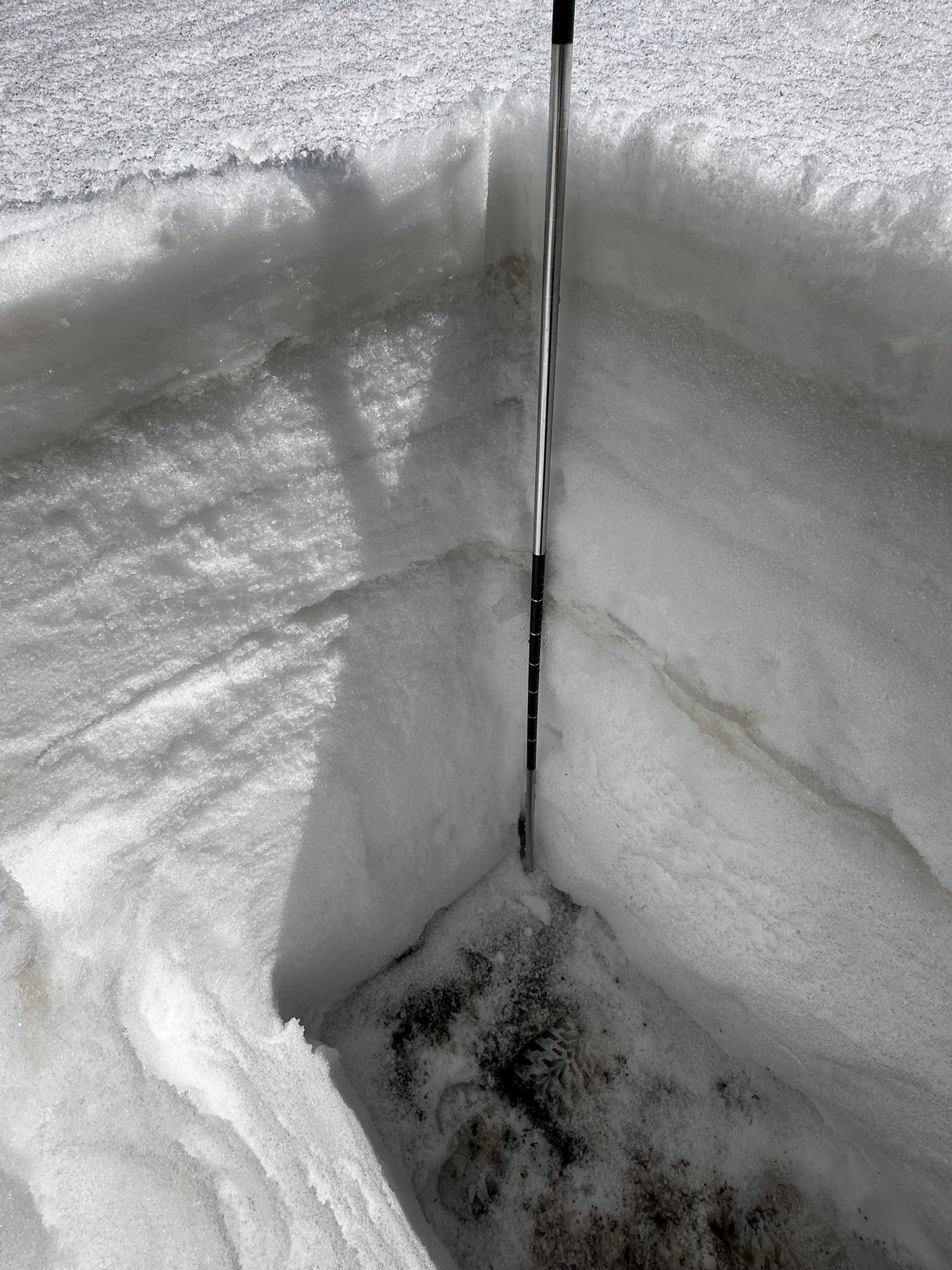
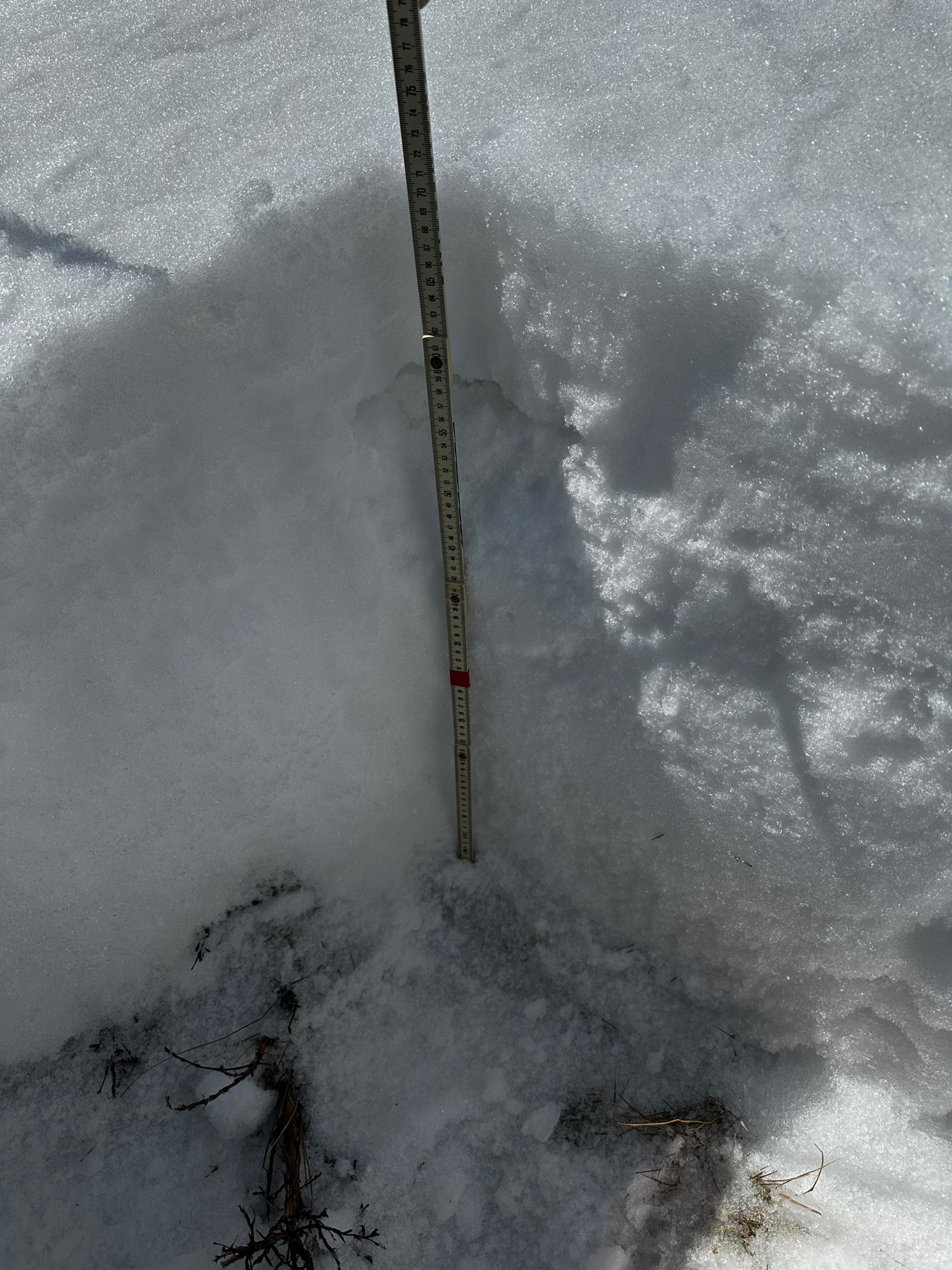
RABBIT EARS PASS: APRIL 7
Rabbit Ears snow pit was a typical back breaking 7’2” deep. A sun-crust sat atop a recent storm layer of 15” (38 cm), and within that storm layer a faint dust layer was present, right at about 11” (28 cm) below the surface with 2.2” (56 mm) of SWE above. Another light dust layer was present about 42.5” (108 cm) below the surface, mid-pack. We measured 29.3” (746 mm) of SWE. The Rabbit Ears SNOTEL reported 26.1” SWE and 69” depth on the same day.


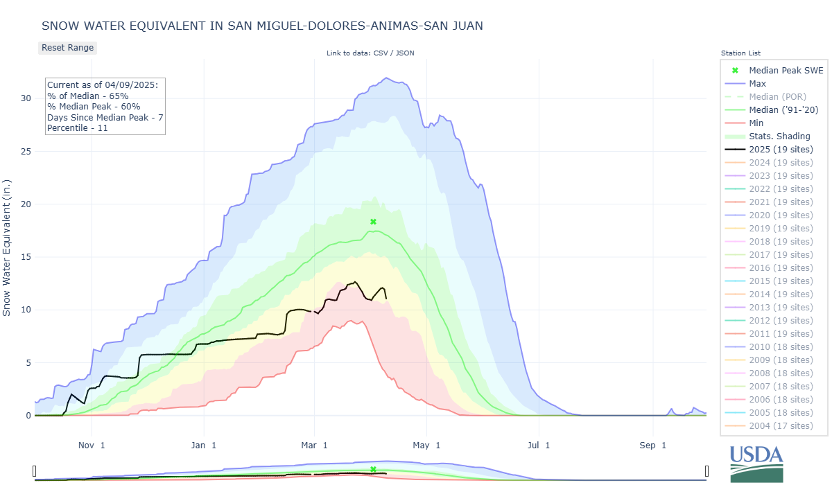


At the start of April in WY2024 we were at median conditions. A hot/dry April resulted in half to a third of the snowpack being depleted by May 6 in the southern basins. What will we see this year starting out 59-66% in the southwest and Rio Grande Basins?


