CODOS UPDATE JANUARY 20, 2025: Lagging snowpack in southern Colorado, Arctic Blast
Greetings from Silverton,
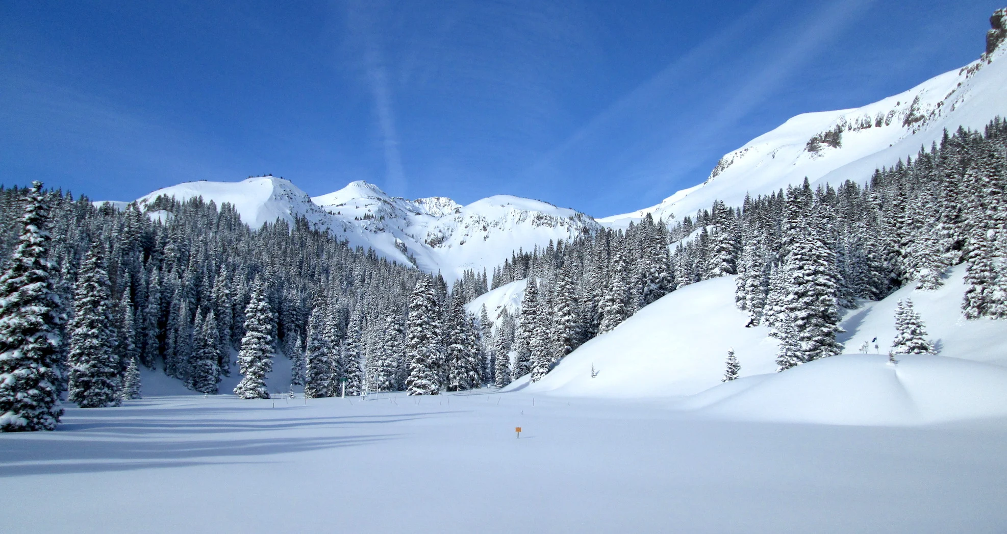
It is deep winter here. We have had significantly cold mornings the past few nights with a bit of flurries; the last week we had cold, clear nights, waking to surface hoar glittering everywhere. It was quite a beautiful sight. Avalanche danger has downgraded to moderate but the snowpack feels active in our neck of the woods still. Lots of whumping and shooting cracks in flat terrain during our monthly sampling for the US Bureau of Rec/CSU Cosmic Ray Neutron rover project along US-550 last week, though things have stabilized a bit since then. The weekend flurries amounted to a few inches accumulation as 0.35” precipitation – not even considered a storm by our minimum 0.5” requirement.
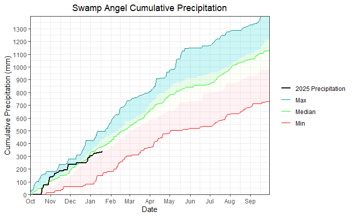
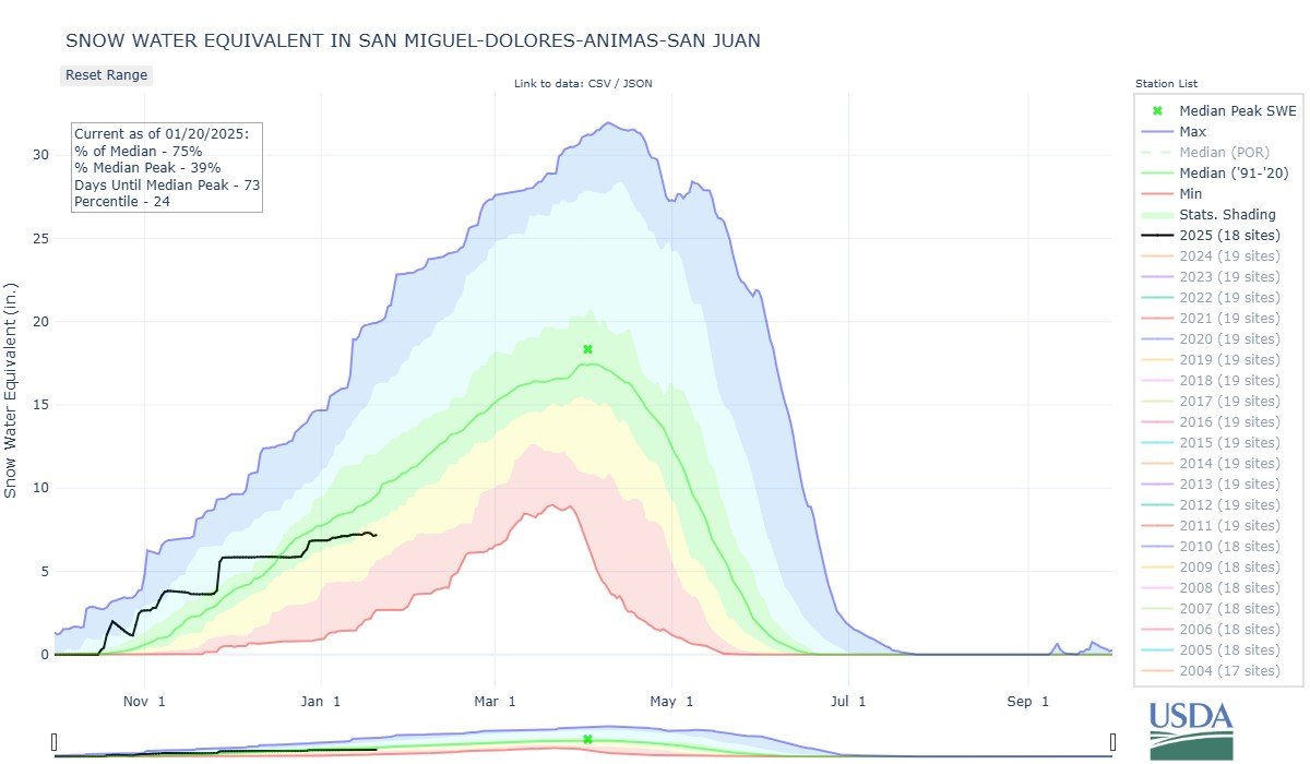
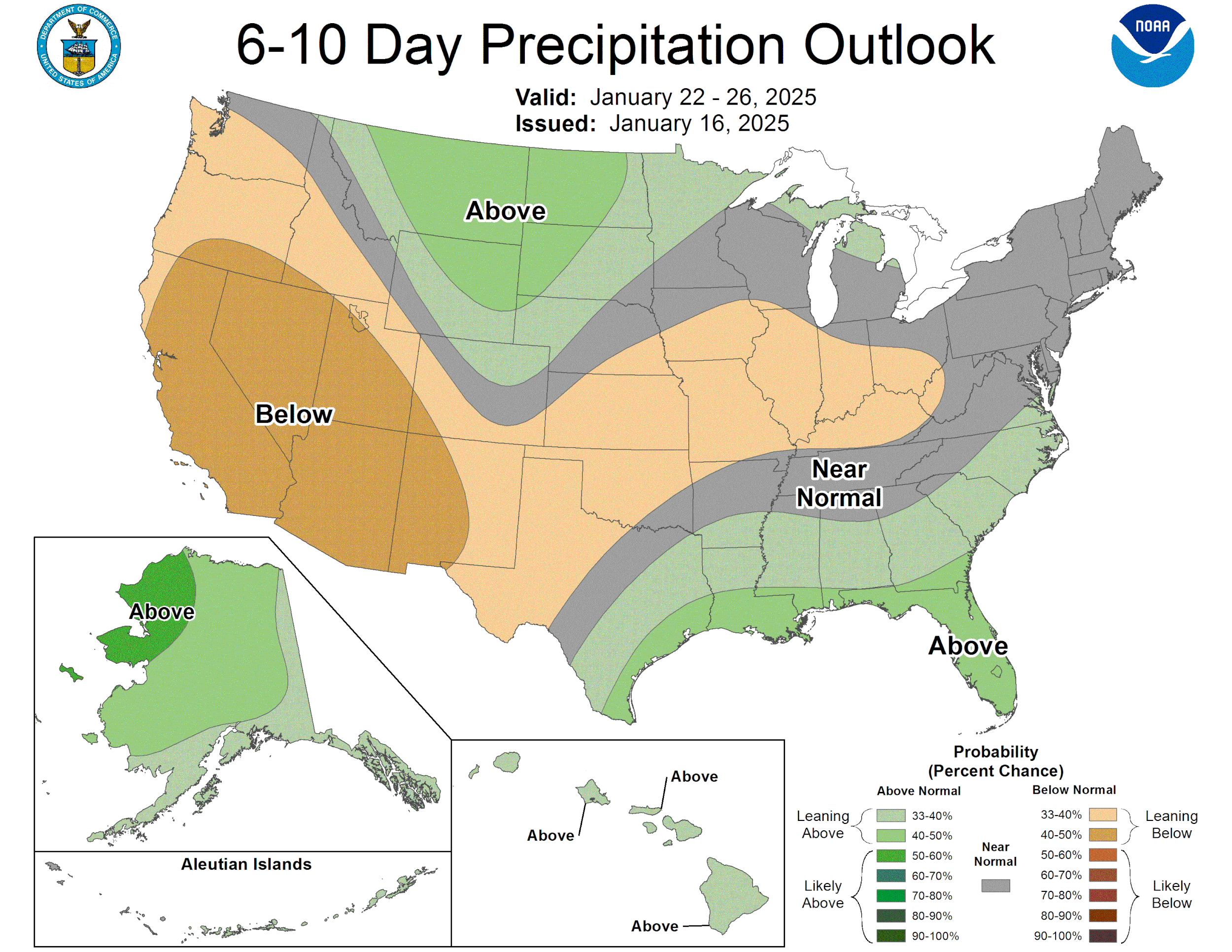
Currently, Swamp Angel is slightly below the median for seasonal cumulative precipitation, at 13.4” (see plots below). After an early season jump, December flatlined until the holidays. Since then, we’ve received a few bumps of precipitation but nothing ground breaking. Red Mountain SNOTEL is sitting at 101% of median SWE for this year. Particularly the Southern Basins are falling further behind; the Upper Rio Grande Basin is at 76%, Arkansas 99%, Animas/Dolores/San Miguel/San Juan 76%, Colorado headwaters 98%, Gunnison 94%, Yampa 94%, South Platte 101%. Nothing the Southern Basins can’t come back from but the ridge is still in place over the West Coast resulting in the next opportunity for significant precipitation not until next weekend. But it will be cold, record setting cold, so bundle up!
And in the tropical Pacific Ocean, weak La Niña conditions persist, with a 60% chance of neutral conditions developing March-May. Even though it is a weak La Niña, there is still possibility of strong La Niña conditions, meaning precipitation anomalies (dry for us). See charts below.
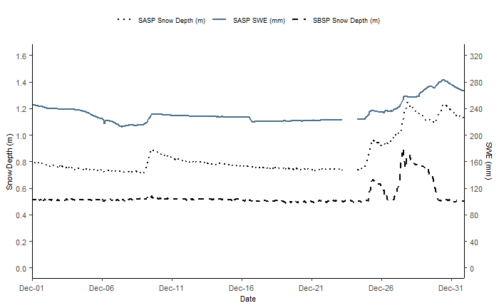
We have December monthly summary plots posted below for Swamp Angel as well. The station has been running smoothly, and progress is being made on getting camera images up and running!
As far as dust goes, it has been pretty quiet so far this season. We have not observed any dust at Senator Beck Study Basin or elsewhere. The lack of storms also means reduced chances of dust deposition. Starting in March we will begin the statewide dust-on-snow tours.
There are still a few spots left in the Snow School, see details below.
Stay safe out there!
Snow School:
Another shoutout for Snow School for Water Professionals . The class will be held February 19 - 21, 2025. The combination classroom and field course will begin on Wednesday morning at our office in Silverton and end on Friday afternoon (2.5 days). The class is perfect for anyone wanting to learn more about the role of snow and our mountain environments as it pertains to water resources, designed to enhance understanding of snowpack processes, snow monitoring and data. As in years past Karl Wetlaufer with NRCS will give the class a tour of Red Mt SNOTEL station. Click here to download flyer, please circulate in your workplace and forward announcement to folks you think might be interested. You can pay with credit card at snowstudies.org. Please do not hesitate to contact me with questions
