Greetings From Silverton,
It has been seven days since our last storm here at Senator Beck Study Basin. So far this winter we have documented 4 winter storms, typically by the end of December we see 8 on average. But we have also seen some precipitation events that just fell short of being considered a storm event. Since November 1 we recorded 113 mm (4.5”) of precipitation, 75 mm (3”) occurred during a storm event (defined at least 12 mm precipitation without a break in precip longer than 12 hours). No dust has been observed to-date in the snowpack at Senator Beck.
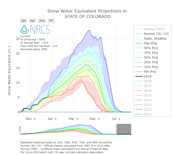
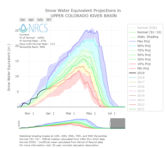
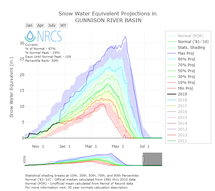
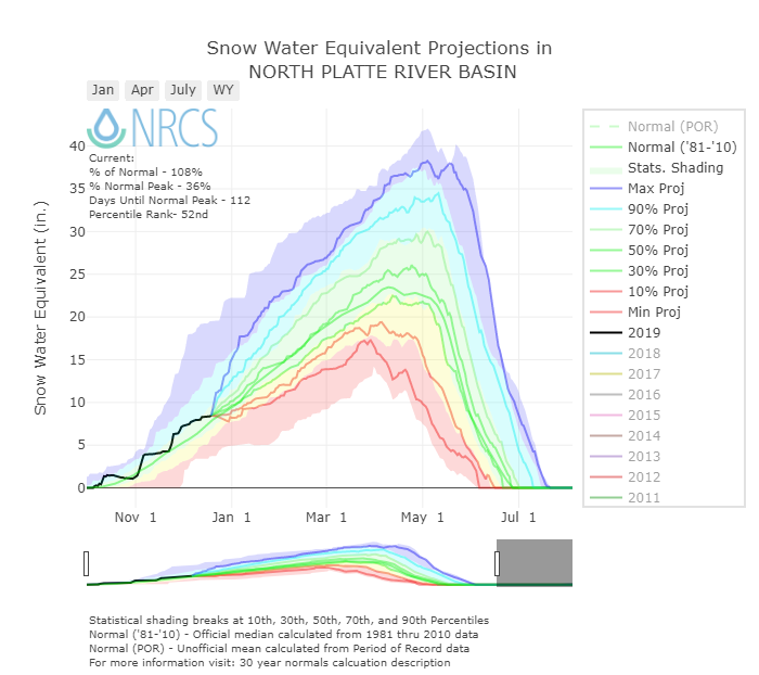
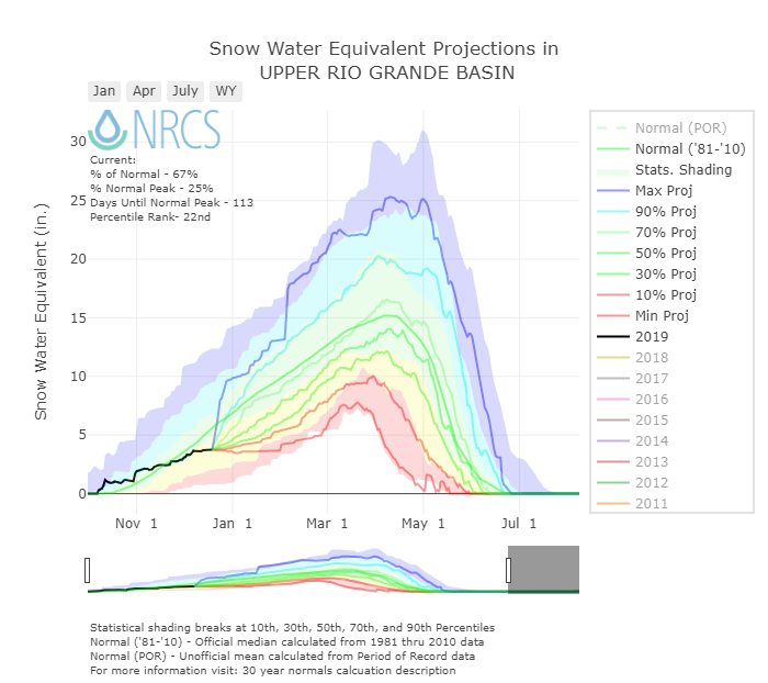
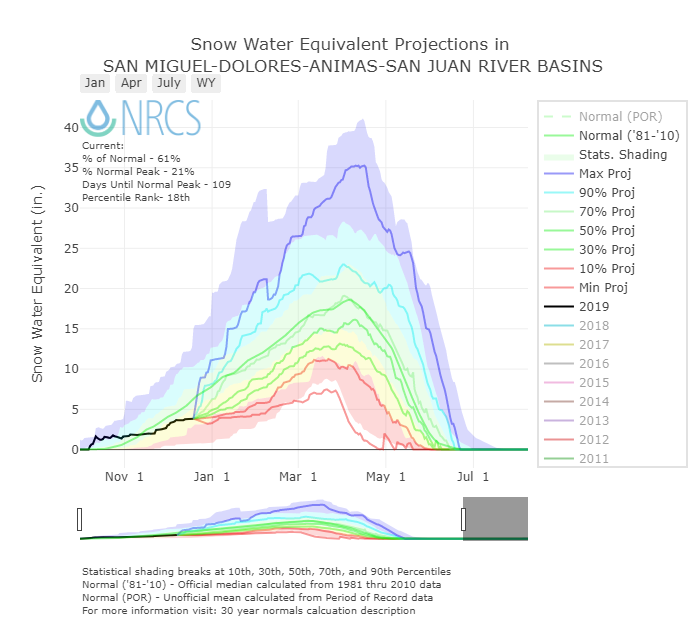
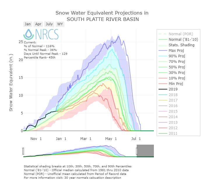
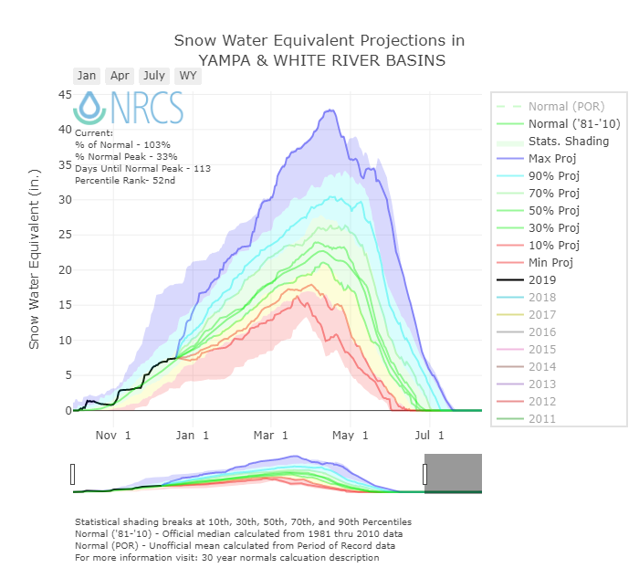
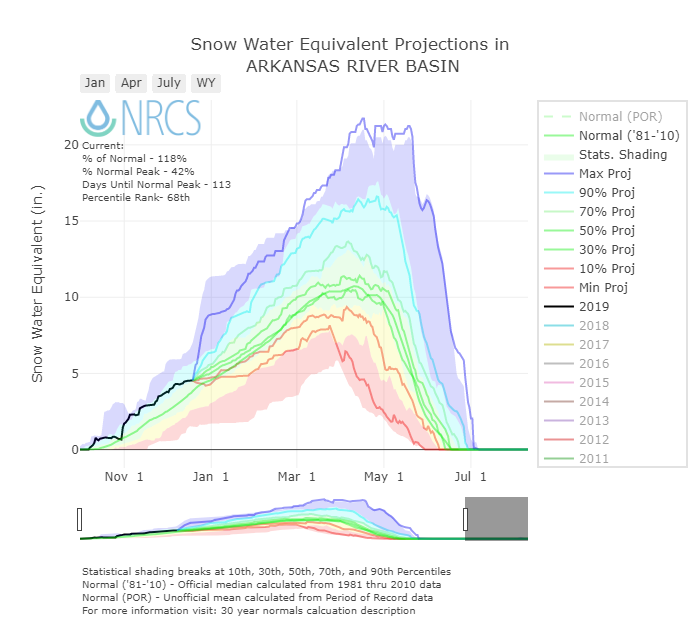
Colorado as a whole is not doing too bad for snow accumulation however there are some large discrepancies among basins. Taking on a north-south gradient (a trend that has been common at least the last few years), the South Platte is the big winner so far with 121% of median, Colorado Mainstem 111%, Yampa 109%, but then as we head south the Gunnison is 86%, San Miguel-Dolores-Animas 61%, and Upper Rio Grande 67%. This time of year don’t get too hung up on snowpack percentages. For example in the San Miguel-Dolores-Animas-San Juan Basin we are currently 61% of normal, we have 4.2” SWE compared to a median of 7”, an amount that can easily be made up and surpassed with a few good storms. As we get closer to the time-frame of peak accumulation is when it will be harder and harder to make up any deficits. And the good news so far this year is we are seeing active weather patterns, troughs and ridges are moving through and we have not been stuck under a stagnant blocking pattern.
The forecast is calling for Colorado getting a small portion of a trough passing to the north of us tomorrow benefiting the northern and central mountains but only amounting to 1-2” by Friday night. The good news is snow around Christmas is looking more promising. Model timing, location, and amounts are still nebulous. So keep an eye on the forecast if you are traveling or skiing over Christmas and hopefully you will see us issuing some storm reports very soon.
Snow School for Water Professionals: As a reminder, we are offering "Snow School for Water Professionals" again this February 20 - 22 2019 in Silverton, CO. Using a mixture of classroom discussion and hands-on field sessions, this workshop is designed to enhance understanding of snowpack processes, snowpack monitoring, and snowpack data. Please see details on our website and don't hesitate to contact me for more information.
Backcountry Safety: It being near the holidays with snow in the forecast I thought I would remind folks to be prepared and informed when playing in the mountains. Below are a few links to a few avalanche forecasting and education websites:
Off Piste, Tragedy in the Alps Video: https://vimeo.com/300630599
Know Before You Go, Online Education: https://kbyg.org/learn/
Silverton Avalanche School: http://avyschool.com/
Avalanche.org tutorial: https://avalanche.org/avalanche-tutorial/get-the-forecast/
Colorado Avalanche Information Center (CAIC): https://avalanche.state.co.us/
Utah Avalanche Center: https://utahavalanchecenter.org/
