

CODOS Update March 22, 2021: March Statewide Tour Part I, New Dust Event at SBB
Greetings from Silverton,
The CODOS team finished the first leg of the March CODOS tour on Sunday. We waited for the recent cycle of storms to pass before beginning the statewide assessment in order to observe the new snow accumulation and any dust that was present following these events. From March 19-20 we visited Rabbit Ears Pass, Willow Creek Pass, Berthoud Pass, Loveland Pass, and Hoosier Pass. More details and pictures are provided below, but starting at the most southerly Hoosier site no dust in/on snow was apparent. At Loveland Pass, near Grizzly SNOTEL, dust was not apparent either, if a faint amount of dust was present it seems likely in the top portion of the snowpack with a moist snow layer 8” below surface. At Berthoud Pass however, there is a distinct diffuse band of dust 8” below the snow surface. A bit further north at Willow Creek Pass orange dust is apparent 4” under snow surface. At Rabbit Ears Pass dust is very prominent at 6” below the surface. It is made of orange “clods” and appears to have coalesced since we first received pictures of it from a colleague 6 days ago. This event in the region of Rabbit Ears is definitely at least of moderate severity. And being 6” below the surface (1” of SWE sits on top of the dust), if there is minimal further snow accumulation this dust will be emerging to the surface in pretty short order, increasing snowpack warming and eventual melt early this spring. With peak accumulation usually around the April 1 timeframe, this will be the case for all regions with dust currently under the snow surface. Worth noting as well, the month of April is when we typically see the most dust-on-snow events, unfortunate as this puts the dust at, or near the surface in early spring.
New Dust Event (D3) at Senator Beck: On the incoming storm front Saturday night (March 20), a new tea colored dust layer was deposited on the snow surface at Senator Beck Study Basin, Telluride, and the surrounding region. This was soon followed by ~6” snow accumulation. There is also snow in the forecast the remainder of this week which will hopefully bringing much needed precipitation to southern Colorado and elsewhere, and further burying dust.
Practically, this makes two moderate dust layers in the Northern San Juan snowpack. The first dust event of the season is on the ground making it irrelevant in it’s influence on the snowpack energy budget. The second moderate dust event is currently ~18” below the surface and as mentioned the third event about 6” below surface.
Front Range Dust Event: The storm that brought plentiful snowfall along the Front Range, foothills, and adjacent mountains also sucked in a sizable amount of mobilized dust from Mexico. In a bit of a reversal, folks along the Front Range were seeing this very apparent dust layer in the new snow accumulation that was unique enough to make the headlines. Meanwhile, in Southwestern Colorado, where we see these events regularly and where we typically are the first and hardest hit by dust during the winter season, did not receive dust from this system. Practically, the dust in the snowpack in the Front Range cities does not matter in terms of its influence in melting the snowpack. This snow is almost gone as I write this report or piled in large mounds in parking lots. The reason the Colorado Dust-on-Snow Program exists is because when dust events such as the one experienced on the Front Range occurs in the Colorado Mountains, it completely alters the energy budget of the snowpack. Our mountains are nature’s water towers and the snowpack is a natural reservoir of water. Dust on the snow, by reducing albedo and drastically increasing the absorption of solar radiation, makes this reservoir melt fast and early. The then bare ground starts losing water through evapotranspiration, robbing water that should have gone towards soil moisture and streamflow, robbing precious water from Colorado and lower basin states.
A very interesting winter for dust so far. Two moderate events in the north San Juans. There was the Front Range dust brought up from Mexico with the March 13-14 storm. Northwest Colorado received the gnarly dust-on-snow event that likely originated in Uinta Basin in Utah. Globally, there was the Sahara dust storm that covered European mountain ranges. And there was a very big dust storm in the Gobi that shrouded Beijing and elsewhere with dust.
The second half of the CODOS tour, consisting of Wolf Creek Pass, Spring Creek, Park Cone, McClure, and Grand Mesa, will be completed early this week if all goes well. We will issue a report soon after.
Take care,
Jeff Derry

At a few sites SWE measurements were very similar to this time last year. What is different is mean snowpack temperature is slightly colder compared to last year.
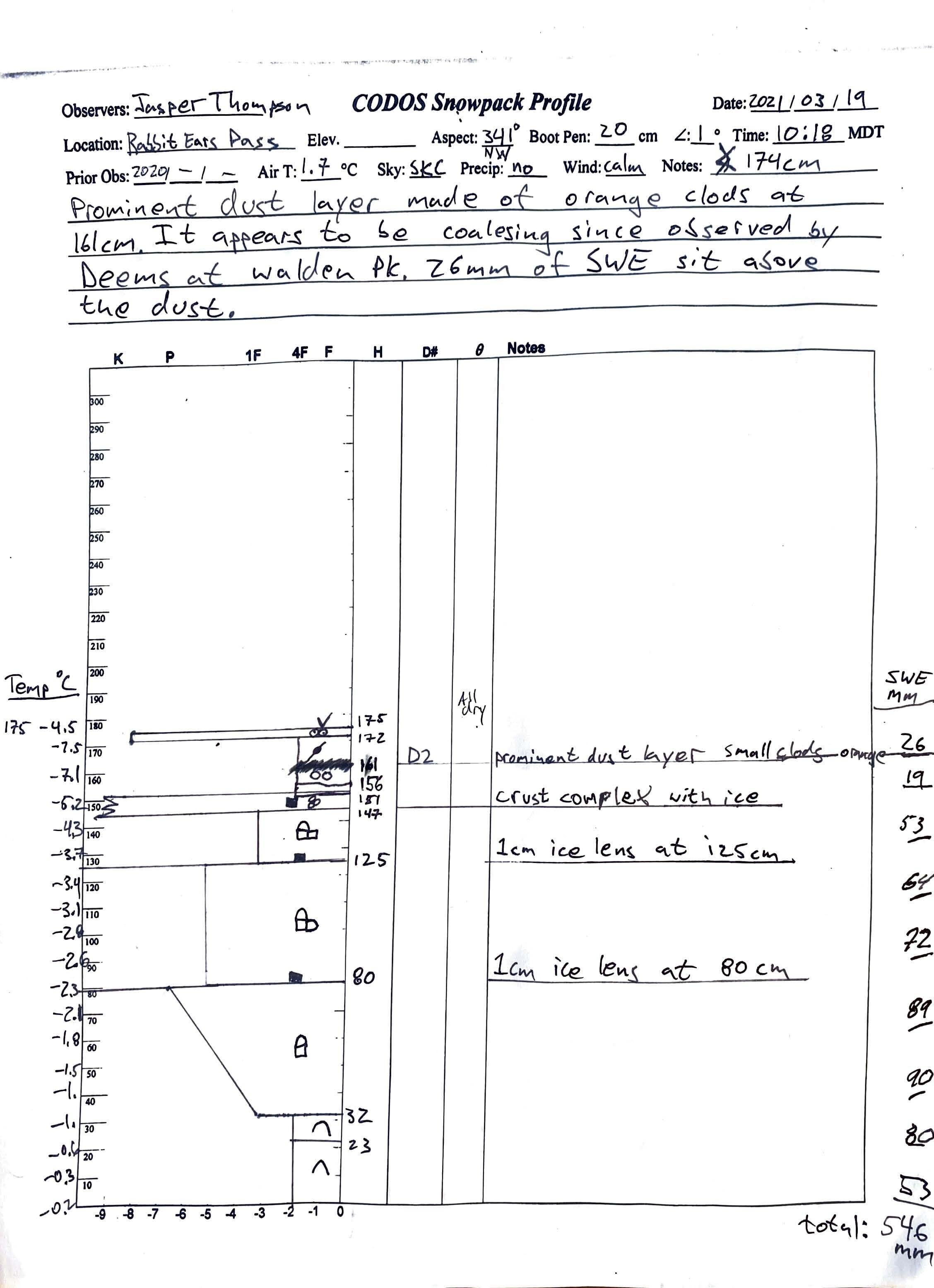
Rabbit Ears Pass
An obvious dust layer exists 6” beneath the surface. 1” of water sits over this moderate, at the least, dust layer. Considering the severity of this event in this region, imagery of storm/dust tracks, what we are seeing elsewhere, it appears the dust in this region originated in Utah, likely the Uinta Basin during the storm cycle around March 9. This is a more severe dust event that this region has received in a few years time. Usually the dust originates in the Four Corners area, so by the time it arrives to northern Colorado (if at all) it has already settled out of the winds. Snowdepth = 5.7’. SWE = 21.5”.


Hoosier Pass
No apparent dust. If dust was present it is suspected it would be 2-4” under surface. Snow Depth = 2.7’. SWE = 7.7”. Cold, dry snowpack with weak, well developed depth hoar.


Loveland Pass
Dust is not obvious. Faint local dust may exist possibly 8” below surface. Snowdepth = 4.4’. SWE = 15.7”.


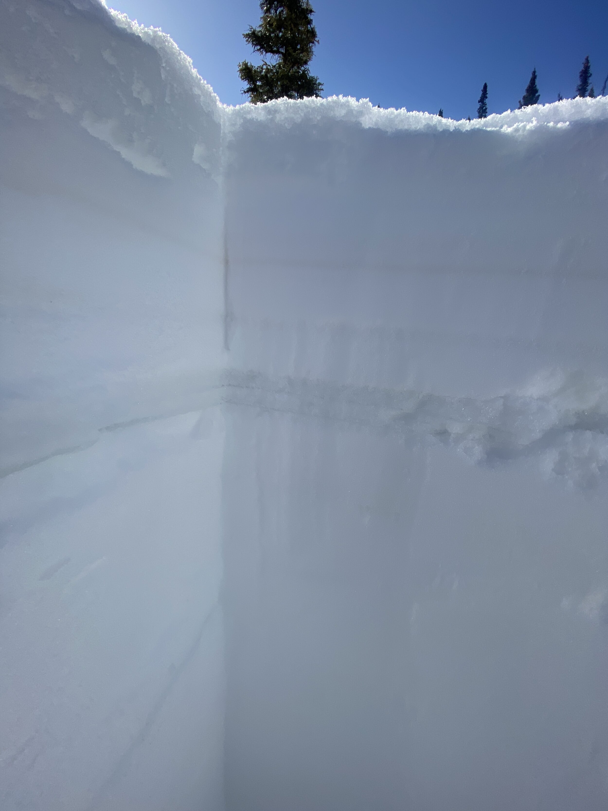
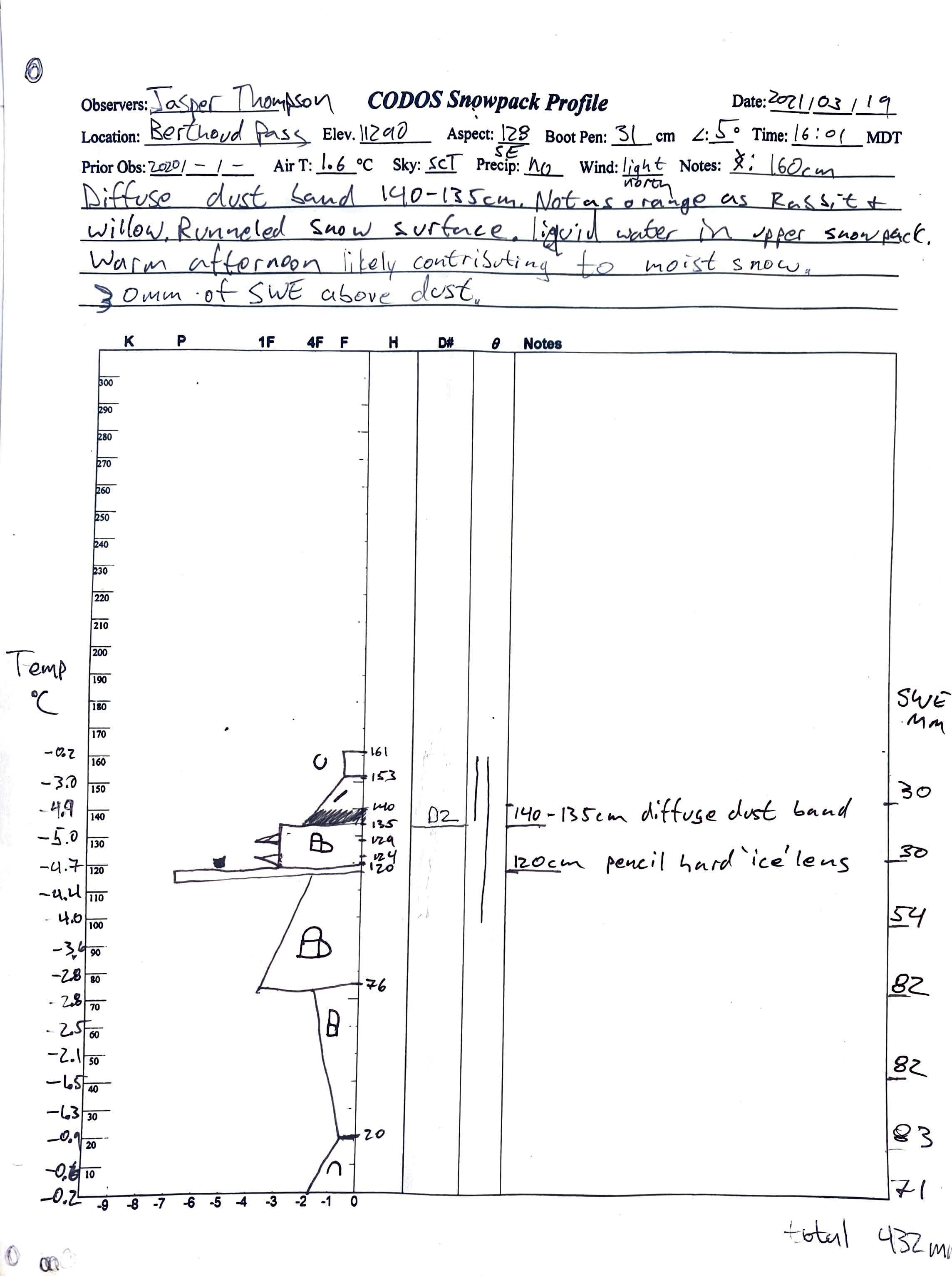
Berthoud
Diffuse dust band ~9” below snow surface. 1.2” of SWE sitting on dust layer. Dust not as orange in color compared to Rabbit Ears. Snowdepth = 5.3’. SWE = 17.0”.


Willow Pass
Dust 3” below snow surface, more faint compared to Rabbit Ears but similar in color. 0.75” SWE above dust layer. Total snowdepth = 3.2’. SWE = 10.2”.


Below: Dust event #3 for the season at Senator Beck Study Basin at Red Mountain Pass. The dust came in on the storm front March 20, between 1 pm and 11 pm. During this time wind gusts hit as high as 57 mph then snow accumulation soon followed. This dust layer is now ~6” below surface at Swamp Angel, our study site just a bit below treeline. And the forecast is calling for more snow remainder of this week!

Below: Picture taken by Douglas Woolridge in Golden, CO of dust layer that arrived from Mexico on the front of the March 13-14 storm.

