Greetings from Silverton,
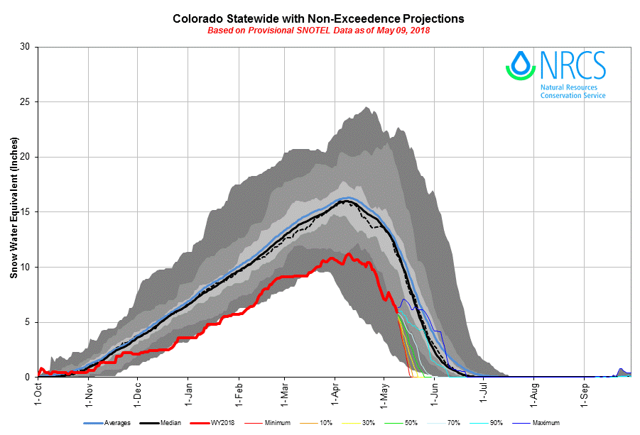
The CODOS team visited Central and Southern sample locations May 9-10. Snow was completely melted out at Wolf Creek, Spring Creek (which was already nearly fully melted out on April 16), and Park Cone sites. Wolf Creek Pass has some snow cover on north facing slopes above 11,000 feet but is otherwise melted out. At Grand Mesa there is absolutely no snow below 10,000', which has been the case for some time, with about 90% of snow coverage on the Mesa itself. At the Grand Mesa CODOS site we observed only 10" of snow depth and 3.6" of SWE, with dust conditions on the upper end of average (pretty dirty). Dust conditions are classified as "Average" across the state, but there is a little variation in dust intensity within that designation. The San Juans and Grand Mesa are on the high end of average, while Northern Colorado and Front Range locations sit more in the middle part of average.
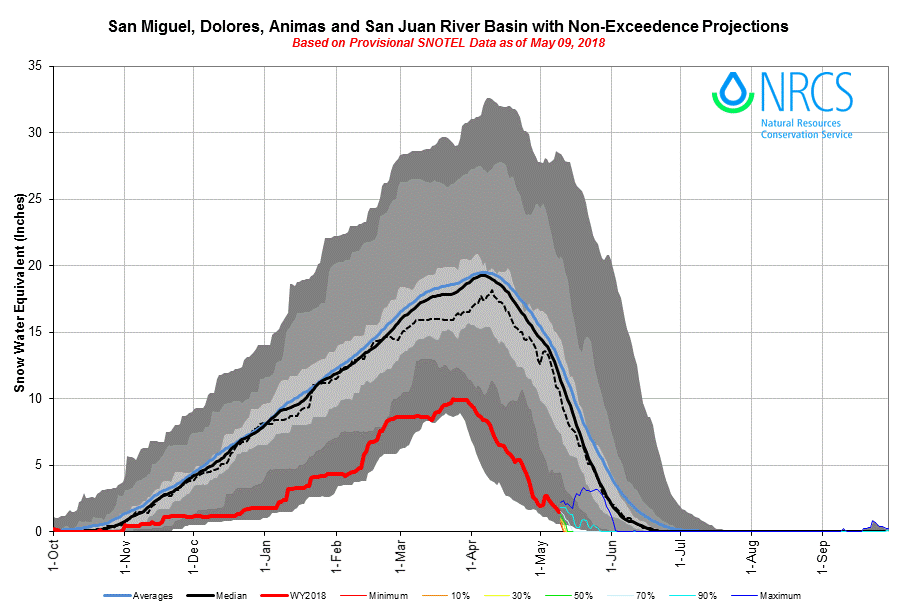
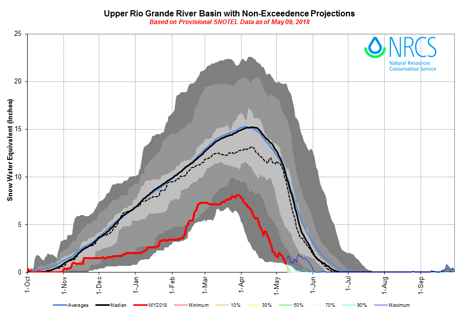
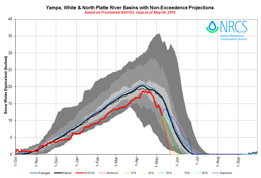
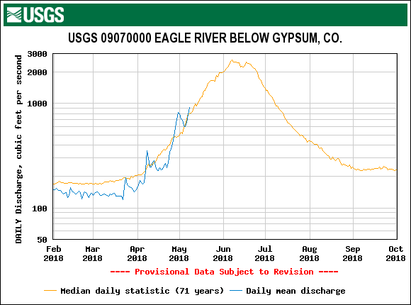
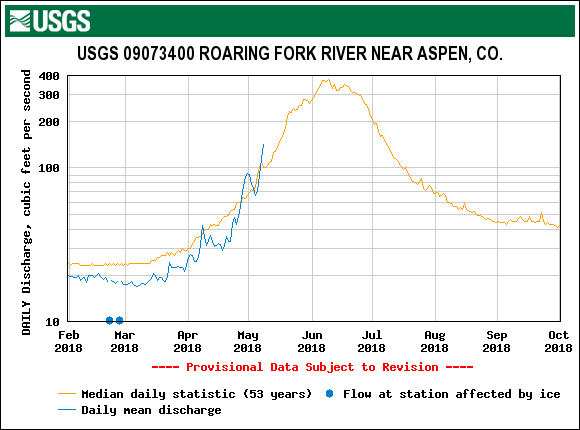
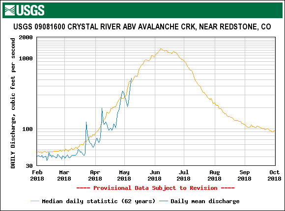
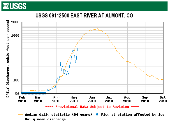
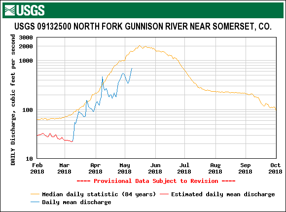
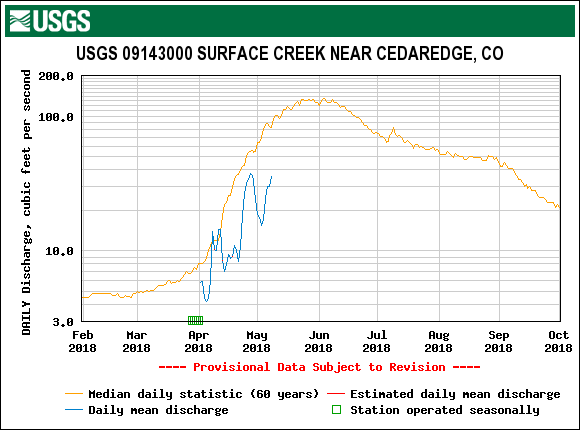
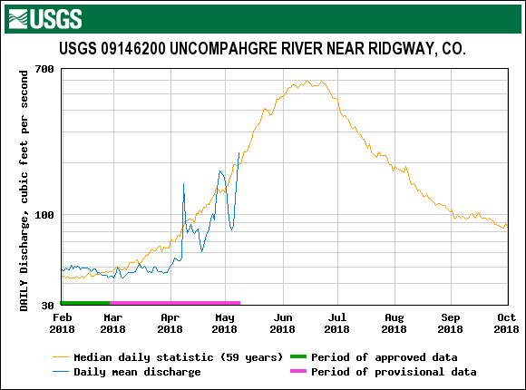
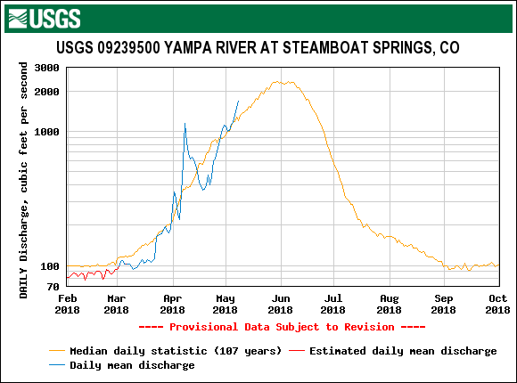
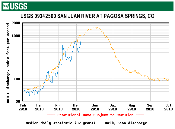
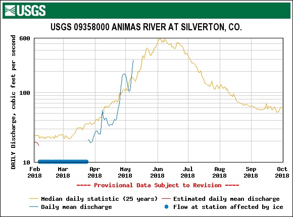
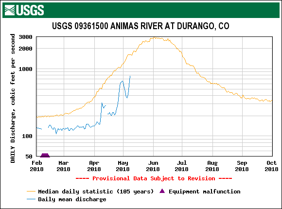
In a nutshell, the snow surface is quite dirty. The snow is melting fast after the rain and wet snow event on May 1-2, which deteriorated quickly giving rise to all dust layers at the surface of the snow. In response streamflows have been spiking. Seasonal peaks are expected at many locations with this melting surge. Given the weather forecast and dust conditions, projection plots show SNOTEL stations in the Rio Grande are on track to be melted out over a month earlier than normal. The San Juan/Dolores/San Miguel/Animas Basin will be about a month early. The Gunnison is on track to melt out about 3-4 weeks earlier than the median date.
The weather forecast over the weekend has changed from a good chance of snow/rain in the San Juans to sunny and windy. Added to that in the four corners region there is a wind advisory with expected areas of blowing dust. So instead of a chance of rain/snow we can expect it to be sunny/windy with a chance of more dust deposition on an already dirty snow surface - accelerating snowmelt and sublimation rates even further. As you go towards Northern Colorado chances of precipitation increase, mostly in the form of rain except at higher elevations. It does not appear the majority of the mountain regions are going to receive any reprieve from current conditions in the near future. The remainder of May is forecast to be warmer and drier than average across the Southwest.
Please see pictures, captions, and plots below.
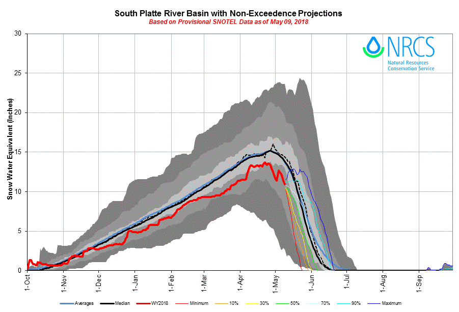
We will assess Northern Colorado CODOS sites in a couple days and report our findings ASAP.
More soon.

Wolf Creek Pass. Picture captures snow-all-gone conditions on southerly aspects and snow cover still remaining at higher elevations and northerly aspects.

Wolf Creek CODOS sample site essentially completely melted out. This site has a SSW aspect, across the highway the Wolf Creek SNOTEL reports 7.3" of SWE remaining.

Wolf Creek Pass, looking at southerly aspects of the landscape showing snow-all-gone.

Spring Creek Pass was nearly completely melted out on our last CODOS visit on April 16. Now there is no snow to be found anywhere in the area.

Looking in a northerly direction at Spring Creek Pass.

Looking toward Lake City from Slumgullion Pass. From where this photo was taken, dust was easily seen on the 14,000' peaks (on right side of picture).

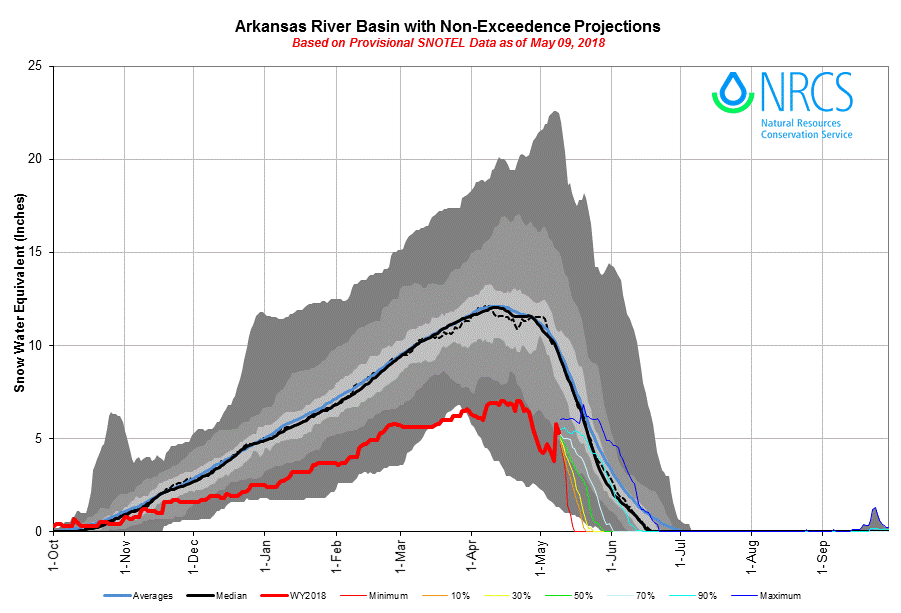
Looking out over Taylor Park Reservoir. Mid/Lower elevations are melted out but more snow exists in the high country than what is seen in the San Juans.

Grand Mesa sample site. 10" of snow depth and 3.6" SWE remains. All dust layers are at the surface.

Approaching the Grand Mesa dust sample site.

Look out over Grand Mesa.