CODOS Update may 15, 2024: Statewide Observations May10-13
Greetings from Silverton,
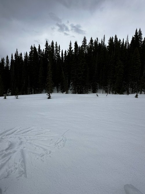
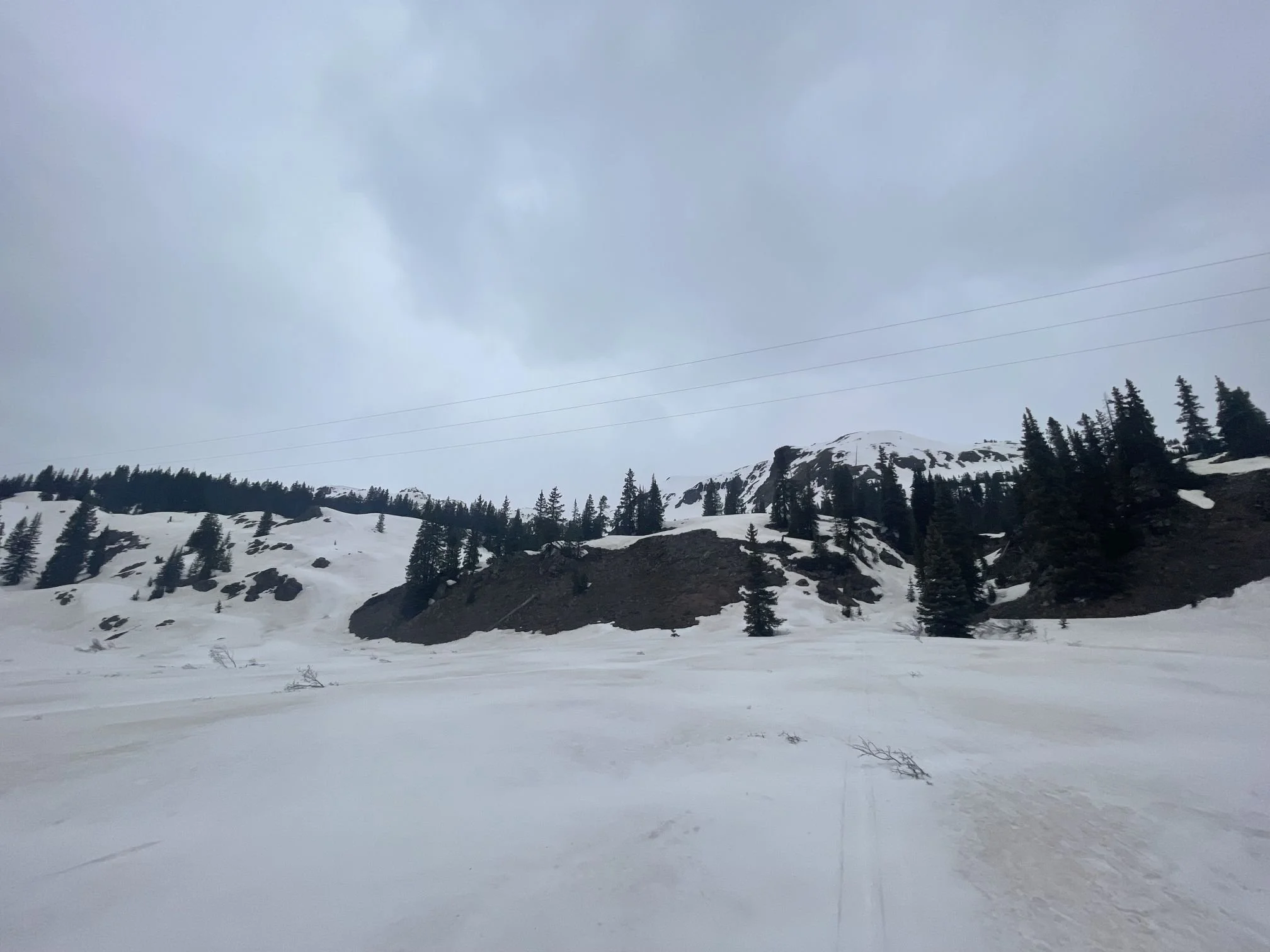
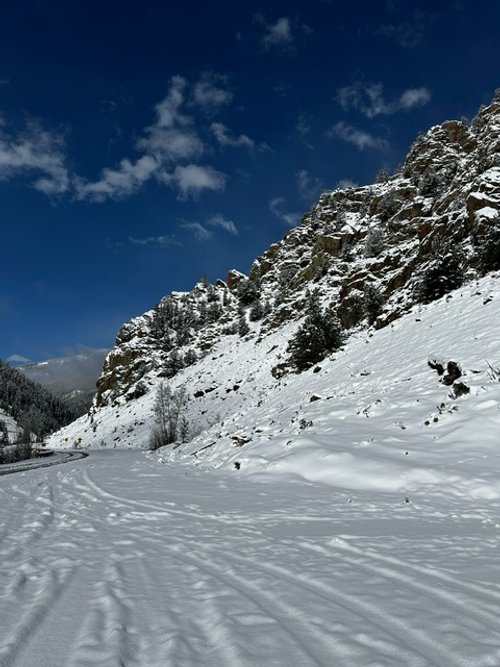
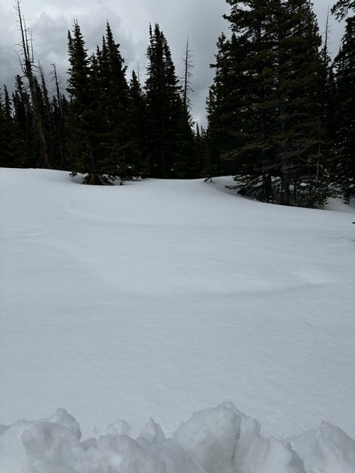
Touring Colorado to collect dust-on-snow observations from May 10-13 was picturesque at every turn. Rain and snow fell pretty much everywhere in the Western half of the state during this timeframe. A wet snow covered the mountains with a white fresh blanket. Driving through South Park you could see Pikes Peak at sunset covered from head to toe in snow. The valleys saw rain but the slightly higher bits also saw a little snow accumulation. It melted (ing) pretty fast. Driving over Red Mt Pass early Friday was a snowy mess, but by afternoon I hear the roads were dry. But still, however refreshing the cooler wet weather, this precip event made things difficult in our attempts to complete the dust-on-snow circuit. It was slow going, or not at all, over many of the mountain passes and remoter roads.
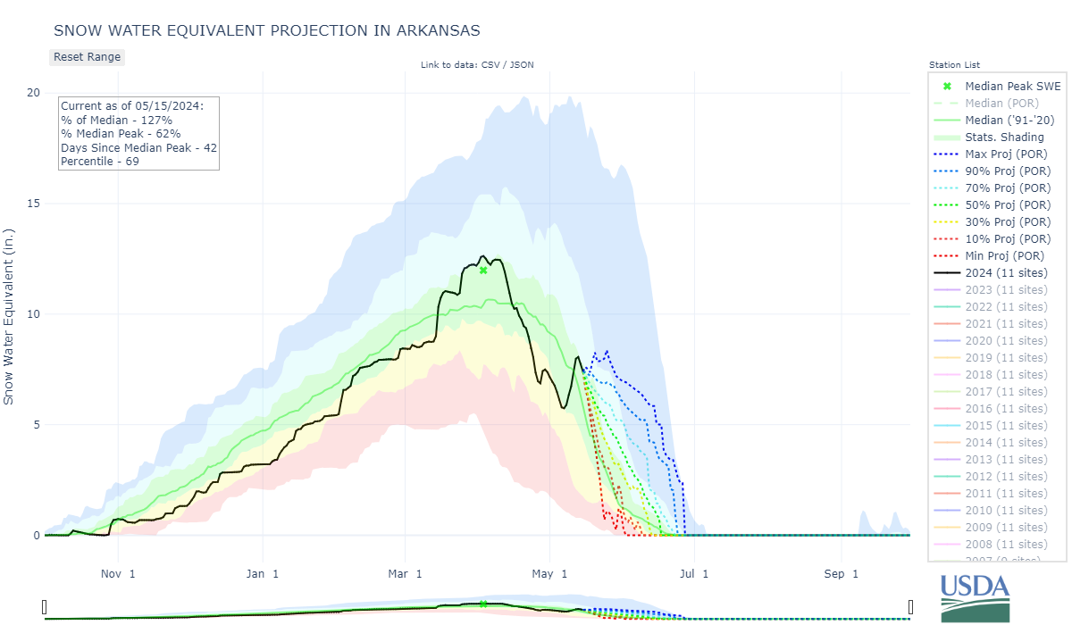
Returning to our sample sites after almost a month it was impressive to see how the northern regions have held onto, or even gained in snowpack. In April we saw rapid snowmelt that hit the Southern Basins the hardest. But beginning around May 1st a few storms (adding precip and covering dust) accompanied by cooler temperatures tapped the brakes on a concerning rapid loss of the snowpack. Our snow profiles and SNOTEL data show these storms largely arrested snowmelt in Central and Northern Colorado, and at least slowed snowmelt in the Southern Basins. One of the more impressive examples is the Arkansas Basin which now has 1” more SWE than it did April 27th.
As you can guess, this fresh dose of snow will slow melt until the near surface dust is exposed once again. The site specific info below hopefully will give a sense of how much new snow sits on the old surface as well the location of deeper dust layers that will surface as spring progresses.
Not much for precipitation in the forecast, a few slight chances. As the new accumulation settles and melts we will see the snowpack increase it’s melt rates and the resulting increase in streamflow.
If you have any questions about your neck of the woods don’t hesitate to call or email.
Take Care,
Jeff Derry
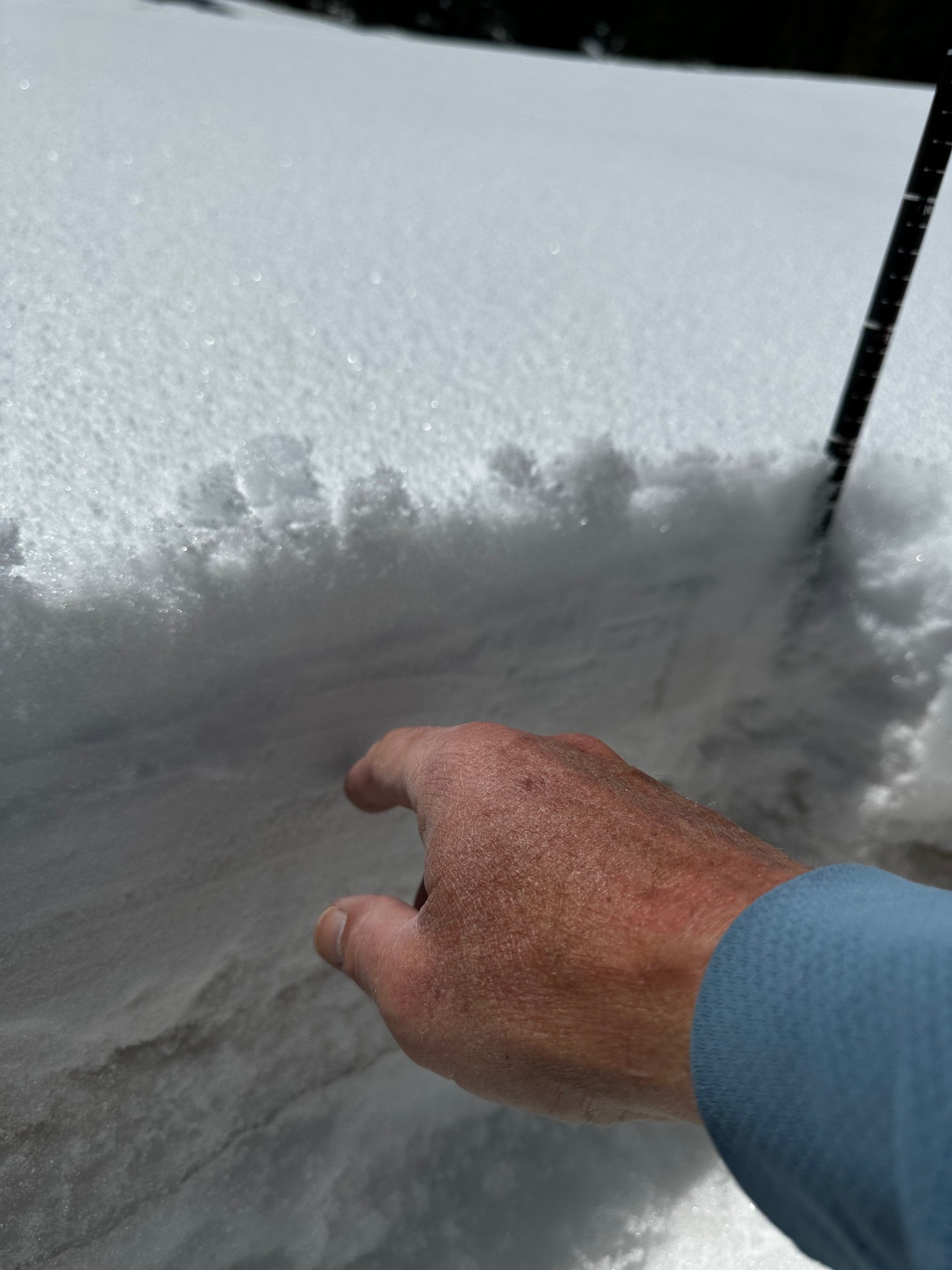
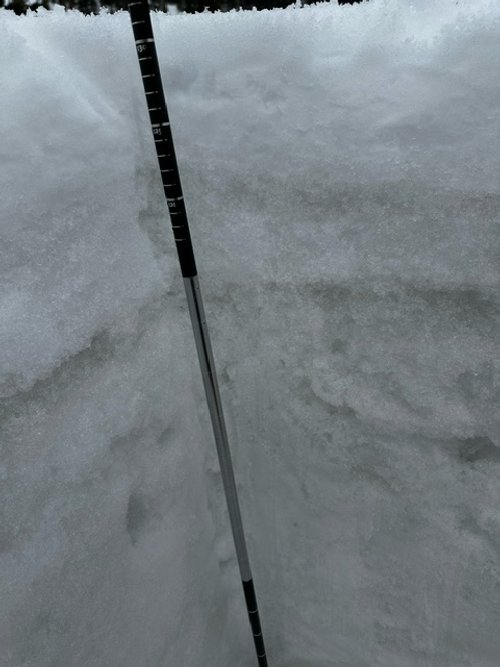
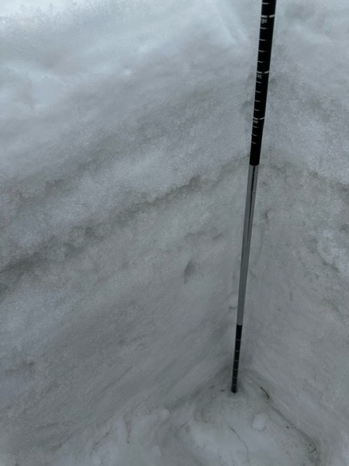
SWAMP ANGEL (Red Mt Pass): may 9
On May 9th all of the dust layers of the season were on the top 7” of the snowpack. May 10 bought almost 2” of precip and a bump up in snow depth. Snow depth is now less than it was before the storm, so we are likely seeing that top 7” dust layer re-exposed, which is confirmed by the drop in albedo. May 9 we measured 20.6” SWE at Swamp Angel. Nearby Red Mt SNOTEL reported 19.1”. There is not much in the weather forecast offering more snow, and warmer temps are expected, so look for snowmelt and streamflows to increase.


WOLF CREEK PASS: may 13
Wolf Creek and the surrounding region has the worst dust conditions in the San Juan Mountain region. Fresh snow slightly covered dust on the day of our visit but by now is likely exposed. Not much snow is left at Wolf Creek, SWE at the site is estimated 7.8” (there was an ice layer our plastic SWE tube could not penetrate), while Wolf Creek SNOTEL reported 16.4”.


SPRING CREEK PASS: may 12
Spring Creek had no snow at our sample site, it appears, prior to the weekend storm that deposited ~6” of wet snow. Nearby Slumgullion SNOTEL reports 2.5” SWE.


PARK CONE: may 12
We drove up towards Park Cone the morning on May 12th, it would have been better to wait for a plow truck to come through. There was a fresh 5-6” from the storm. The snow fell mostly on bare ground in the immediate elevations, and existing snowpack up higher. Nearby Park Cone SNOTEL reported 7.2” SWE. On May 15 it reports 5.9”.


GRAND MESA: may 10
Grand Mesa has significant dust. The dust from the high wind events on May 4/5 was apparent about 3” under surface. All the season’s dust was in the top 10” of the surface. Snowpack is 3.9’ deep. Mesa Lakes SNOTEL currently (May 15) reports 5.8” SWE.


McCLURE PASS: may 10
As noted last codos tour, McClure Pass and the Roaring Fork region was hit pretty hard from the March 2 dust event. Snow at McClure melted rapidly in April. McClure SNOTEL is essentially reporting no snow. We did not drive over McClure due to time constraints and also because snow was gone over majority of the landscape in that area.
HOOSIER PASS: may 11
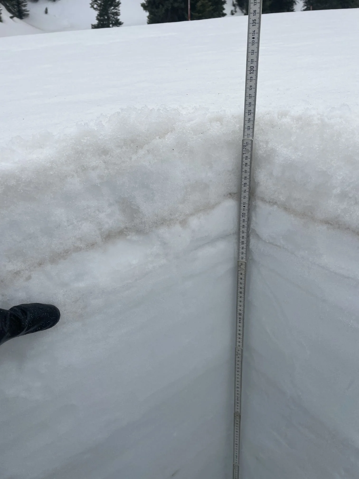
As mentioned last month, Hoosier and the Front Range sites have two distinct dust layers. The upper most layer is 7" below fresh snow, while the dirtier layer is 19” below surface. Snow melt will ramp up once the thin fresh snow melts and top dust layer is exposed, and kick in further when that dirtier layer is exposed. SWE at Hoosier SNOTEL reported 18.8”. We measured 21”.


Berthoud PASS: may 11
There was a few inches of fresh snow at Berthoud. The snow is 5.8’ deep. Dust layer #1 is 7” below surface, #2 is about 22”. The layers are less distinct than in April because, even though dust coalesces at the surface, a bit of leeching of dust occurs over a few inches from melt water. We measured 29.0” SWE and the SNOTEL a few feet away reported 24.1”.


Loveland PASS: may 11
There was about 4” fresh accumulation. We measured 23.5” SWE at Loveland Pass as Grizzly SNOTEL reported 18.4". Snow was 4.3’ deep. The uppermost layer is 6” below surface. The second dust layer is 12” below surface.


WILLOW Creek PASS: may 11
Dust at Willow Creek was under about 6” below surface under fresh accumulation. Dust severity is pretty bad for the Willow site as we reported last month. Willow Creek has 11.1” SWE. Willow SNOTEL reported 15.8”.


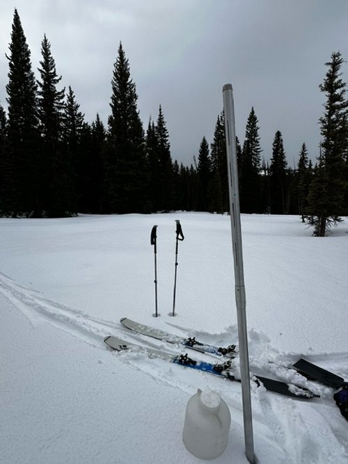
RABBIT EARS PASS: may 10
Rabbit Ears snow pit was 6.6’ of snow, compared to 7’ last month. We had a SWE of 40” while Rabbit Ears SNOTEL reported 26.2”. The upper most dust layer is 5” below fresh accumulation and just shy of 1.5’ below lies the deeper, more severe, layer.