Greetings from Silverton,
The Senator Beck Basin (SBB) received its fourth dust event of the season this week. From Sunday evening through Monday at midnight the Basin received a long duration dry event. This event was deposited directly on D3, which was still on the snow surface. D4 was a much stronger event than D3 and the two layers combined are now very evident in the snowpack. Being on the surface, their hydrologic implications are already in play. With incoming unsettled weather, we can expect them to be buried in the next few days, although not substantially.
CSAS will sample D3/4 today, and the merged layer will be analyzed for its composition and mass loading in the coming weeks. For now, the D4 wind rose is below and a picture of the dust and haze that composed this past event, taken on the morning Monday, April 2 from the Four Corners area.
Snowpack Conditions
Spring has sprung in the Senator Beck Basin. Yesterday, April 5th, the first isothermal snowpack temperatures of the season were recorded at Swamp Angel Study Plot (SASP). Isothermal snowpacks are 0° Celsius throughout the height of the snow, except the top 12" (30 cm) or so which is subject to diurnal temperature fluctuations.
Isothermal snowpacks are an important indication of the impending melt season, as it shows an acceleration in snowpack ripening, ripening is the process by which liquid water is introduced into the snowpack and percolates into the ground, and eventually into the waterways. It is not surprising to be finding isothermal snow at SASP given that in the past few days we have seen a slow increase in streamflow at our Senator Beck Stream Gauge (SBSG) for the first time this season.
Across the Senator Beck Basin, dust is sitting on the snowpack surface (merged layers D3 and D4) as well at 20-30 cm below the snow surface (D2). The exception is on south facing slopes, where layers D2-4 are all merged at the surface. These slopes, with their shallow snowpack and much more notable dust will melt at a faster rate than less solar aspects in the SBB and in the San Juan Mountains as a whole. Snow depth is highly variable across the region, so we can expect many slopes to melt out while others may hold snow into the early summer.
A Brief Weather Outlook
An atmospheric river event is impacting the Pacific Northwest currently and will move into the Rockies in the coming days. However, by the time the system makes it to Colorado it will be weak and scattered. We can expect intermittent and low intensity snow, although it is likely that a handful of specific areas will see notable snow totals. Because of the difficulty of predicting totals in these zonal events, the places where we might see higher snowfall totals are still a bit of a mystery.
Following the atmospheric river leftovers, the majority of Colorado can expect more of the warm and dry weather we’ve become so accustomed to. The end of next week looks windy with the possibility of a bit of precipitation. We’ll be on the lookout for snow and dust with any additional unsettled weather in the region.
The Colorado Basin River Forecast Center "Colorado Basin April Water Supply" webinar was held today, the presentation can be found at: https://www.cbrfc.noaa.gov/present/present2018.cgi. Encouragingly, they pointed out a couple possible active weather patterns towards mid-April that could add to the snowpack. Not to mention providing overcast skies, cooler temperatures, and keeping dust layers buried beneath the surface for as long as possible, delaying the bulk of snowmelt until a more normal time-frame.
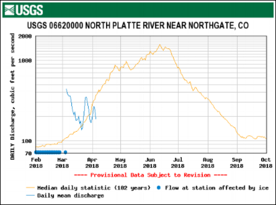
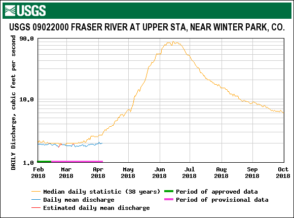
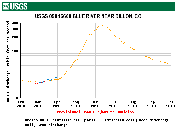
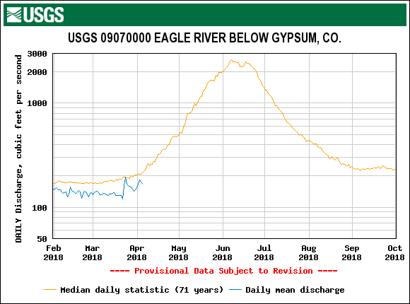
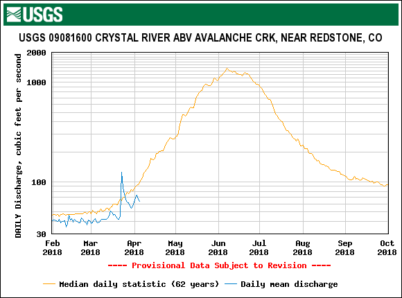
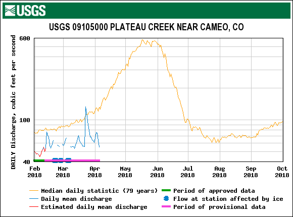
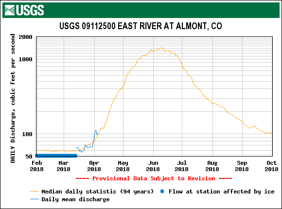
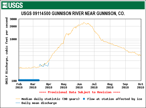
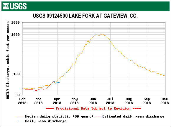
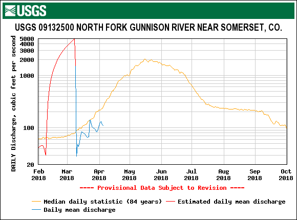
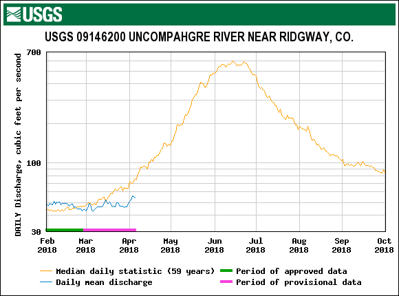
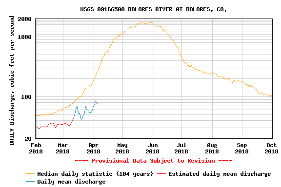
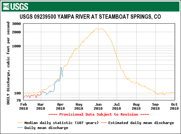
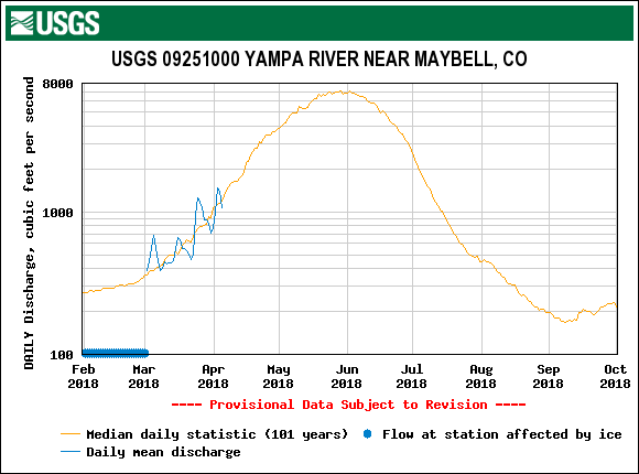
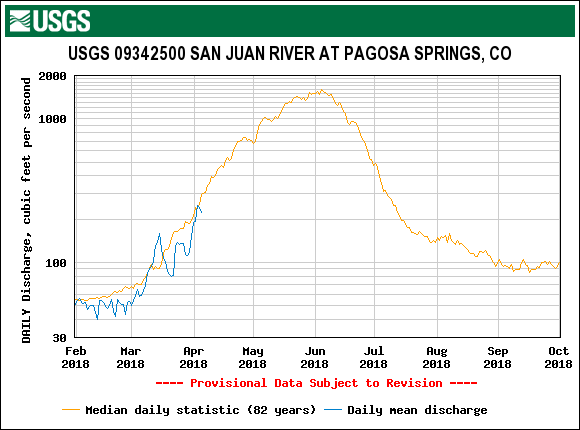
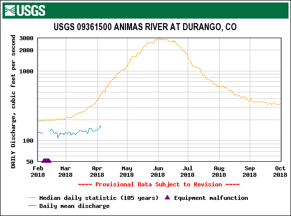
Please see USGS plots below.
More from Silverton soon.


Above: Orange, hazy skies observed near the Four Corners region on April 2.
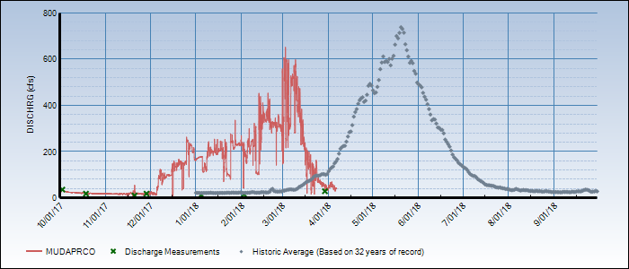
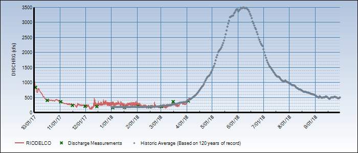
Below: For the stream gauges that are reporting, only a few are near median flows. Some gauges show the spike from the wet snow and rain event in latter March.