CODOS UPDATE February 6, 2025: Hot, Dry, and a LitTle Dust
Greetings from Silverton,
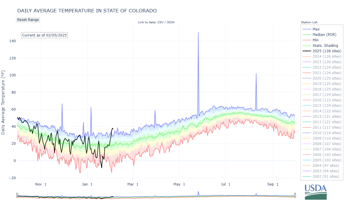
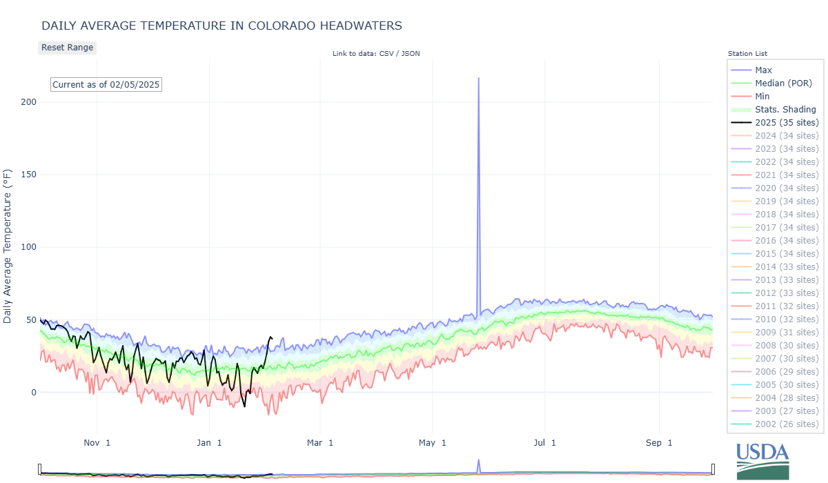
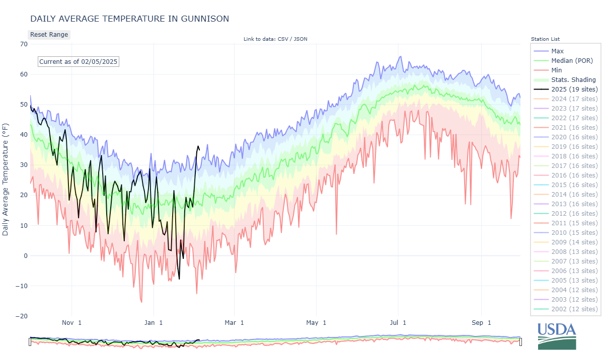
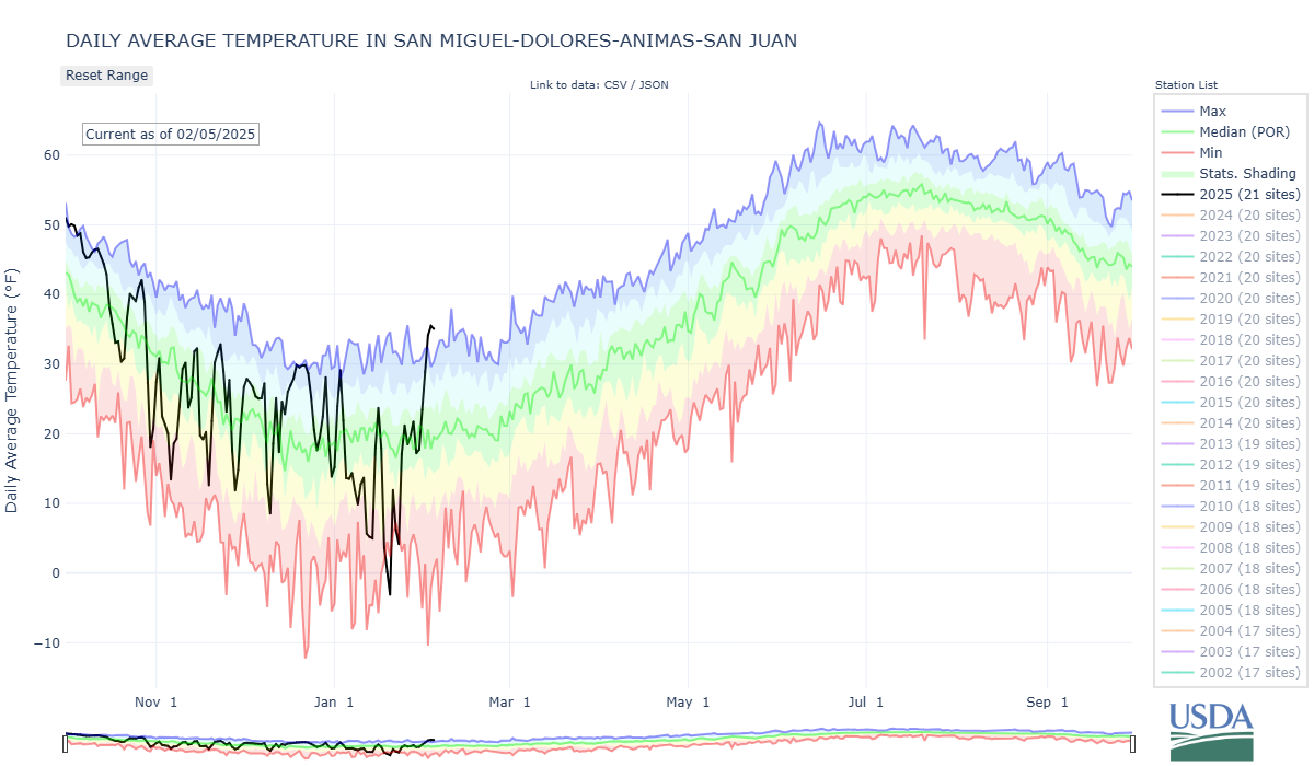
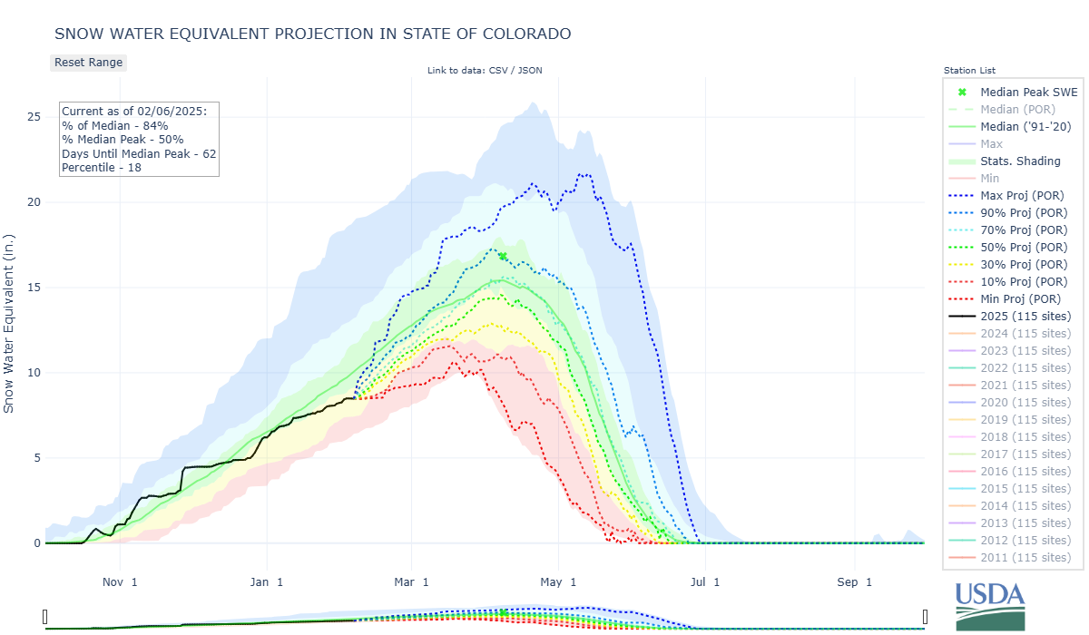
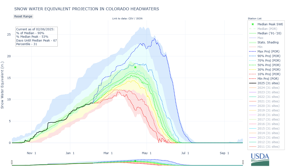
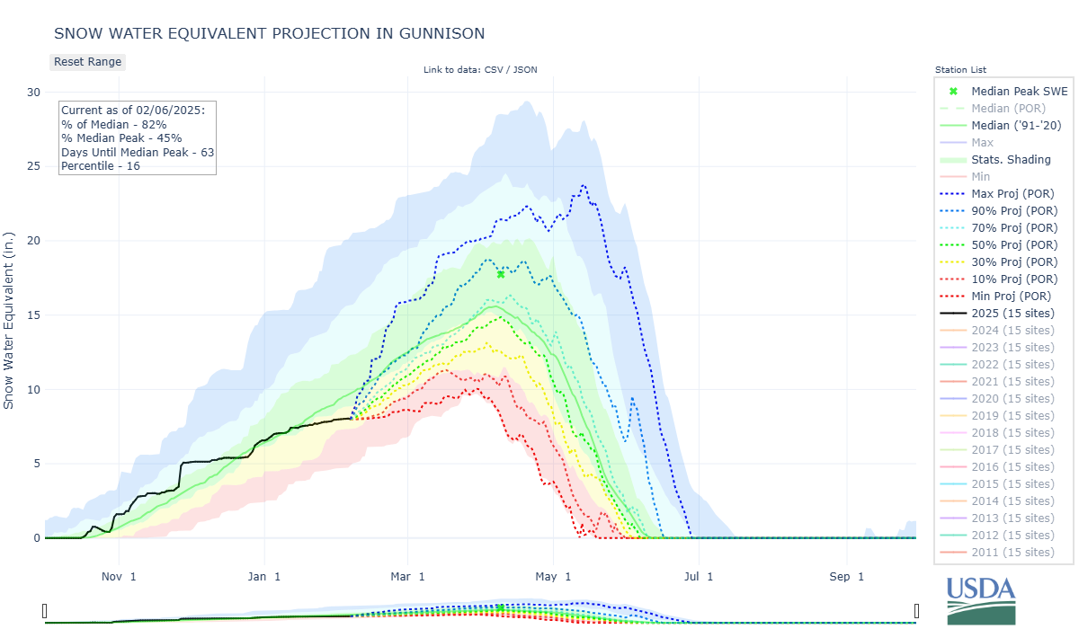
The calendar still shows on average 2 months left in the snowpack accumulation season, but walking around Silverton it feels like the latter part of spring. Driving along highway 550, adjacent slopes are riddled with wet avalanche activity. At Swamp Angel (11,060’) the snow is perfect for making snowballs. The data is a bit off the charts as well; we have never seen air temperatures this high at Swamp Angel (see below) and SNOTEL averages for the entire state are showing the same record highs.
The wee storm that passed through the San Juans about a week ago brought a little bit of snow (0.43” precip) and a little bit of dust (see picture below). On Jan 31 the dust was ~5” below the surface; now I expect with the warm-up, it is at or near surface at many locales. Given the current state of the snowpack, a dust event would be a welcome occurrence, since a dust event often means a snowstorm. The reason why dust conditions are pretty minimal for this point in the season is we haven’t received many storms in total and many of the early season storms have came down from the north.
This warm-up over these last few days (with the bit of dust near surface) has resulted in the snowpack taking a leap towards isothermal conditions. Our new vertical snow temperature sensor shows this really well (see below), where we have watched the snowpack warm to at least -5 degrees Celsius even at our higher Senator Beck station located at (12,200’). Qualitatively, snow cover is thin or non-existent in general, but particularly on southerly facing slopes and lower elevations. Over the last few days snow covered area dropped off at least 10% in most Basins as well.
In terms of the near forecast, it looks like this weekend the San Juans will get missed by a middling storm that might drop a few inches on the northern mountains of Colorado. In terms of mid-month: NOAA’s 6-10 day outlook (starting February 11th) foretells a cooling down, and some good chances for significant precipitation in the middle of the month. Some very good chances? We will see.
Our USGS colleagues have been very prolific, in addition to the recently published paper about microplastics in our snowpack, they just published another journal article titled Light Absorbing Particles Deposited to Snow Cover Across the Upper Colorado River Basin, Colorado, 2013-2016: Interannual Variations From Multiple Natural and Anthropogenic Sources. CSAS and the Colorado Dust-on-Snow Program provided the samples used in the analysis for both of these publications.
Snow School:
Still thinking about Snow School for Water Professionals? Just tell your supervisor it is the best training around. The class will be held February 19 - 21, 2025. The combination classroom and field course will begin on Wednesday morning at our office in Silverton and end on Friday afternoon (2.5 days). The class is perfect for anyone wanting to learn more about the role of snow and our mountain environments as it pertains to water resources, designed to enhance understanding of snowpack processes, snow monitoring and data. As in years past Karl Wetlaufer with NRCS will give the class a lecture and then a tour of Red Mt SNOTEL station. Click here to download flyer. You can pay with credit card at snowstudies.org. Please do not hesitate to contact me with questions.


Above: A lot of squiggly lines, but these plots are showing the temperature of the soil and snowpack at 10 cm increments. Depth below ground and height above ground are color coded. Soil temperature at 50 cm below ground to ground surface is near zero degrees C. Starting at the ground/snowpack interface (SnoT_GndC_Avg) the snowpack is near zero and as you go up the snowpack towards the surface the temperature gets colder. Looking at this past week for both plots, the snowpack has warmed rapidly so now, both at 11,060’ and 12,200’, the entire snowpack is between 0-5 degrees Celsius.
Below: Daily average air temperature for Swamp Angel. Extreme temperature swings in the past few weeks.


Something that never gets enough attention, sublimation. estimated sublimation rates have been high with the warm-up. The modeled sublimation map for 24 hours ending Feb 5 shows around 0.5 - 5 mm in one day.

Plot of SWE, snow depth, and cumulative precipitation for both Swamp Angel and nearby Red Mt SNOTEL.
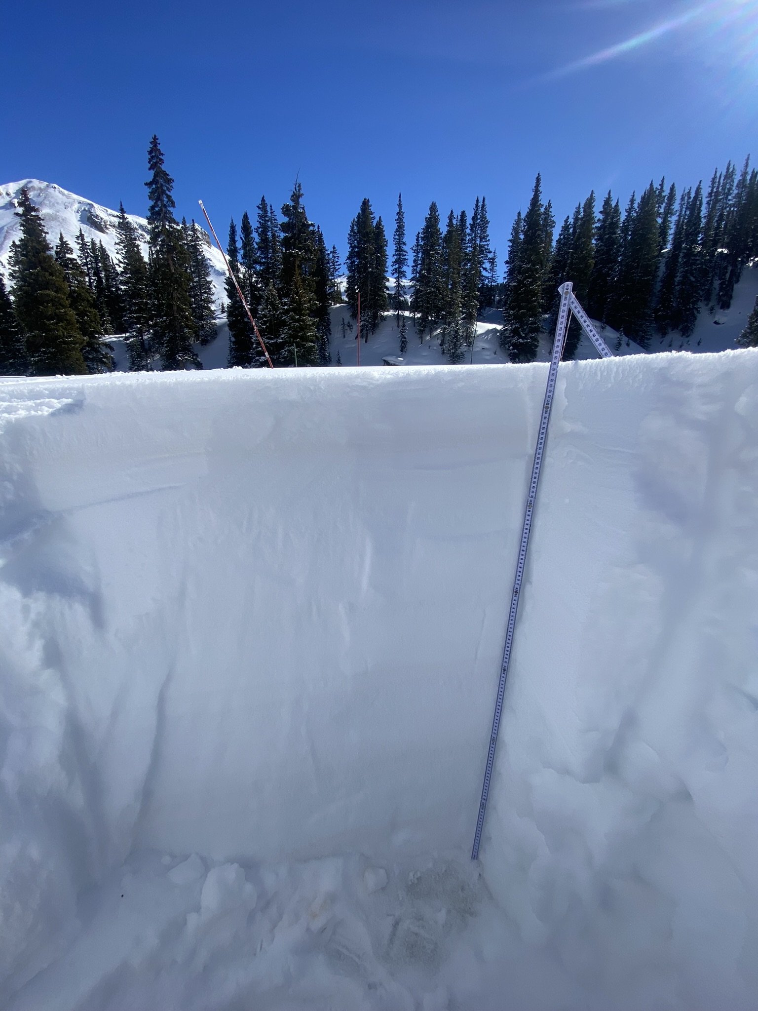
Snow profile at Swamp Angel on January 31. Note the dust layer at about 6” below surface.