CODOS UPDATE FebruRY 17, 2025: sTORM UPDATE, wHERE THE rUBBER mEETS THE rOAD
Greetings from Silverton,
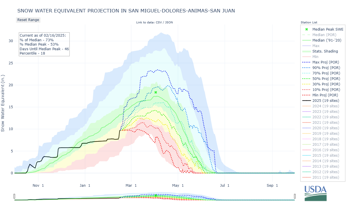
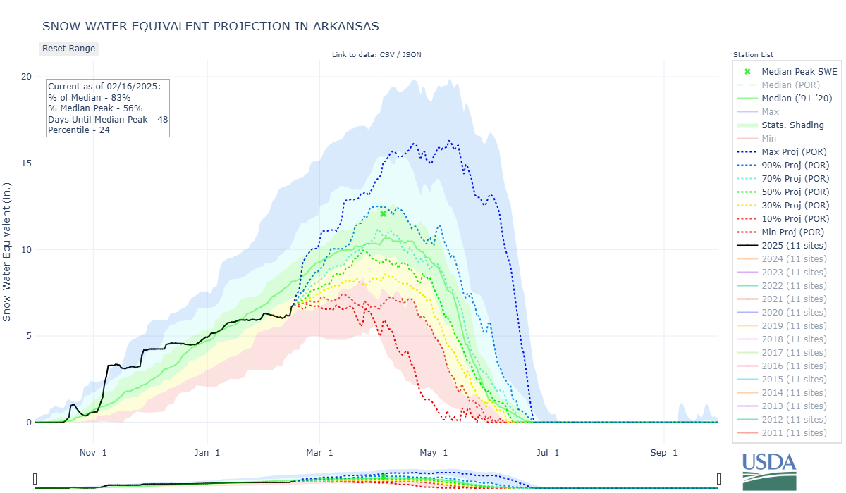
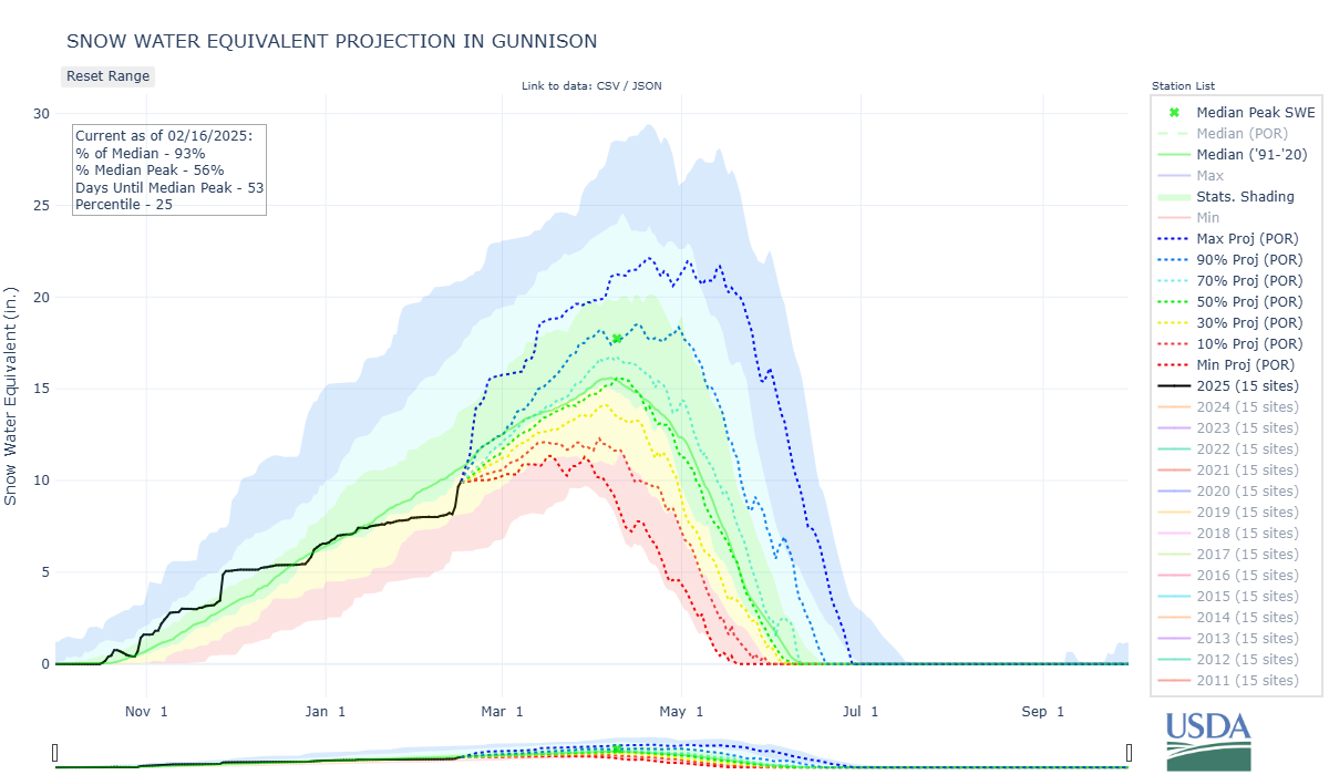
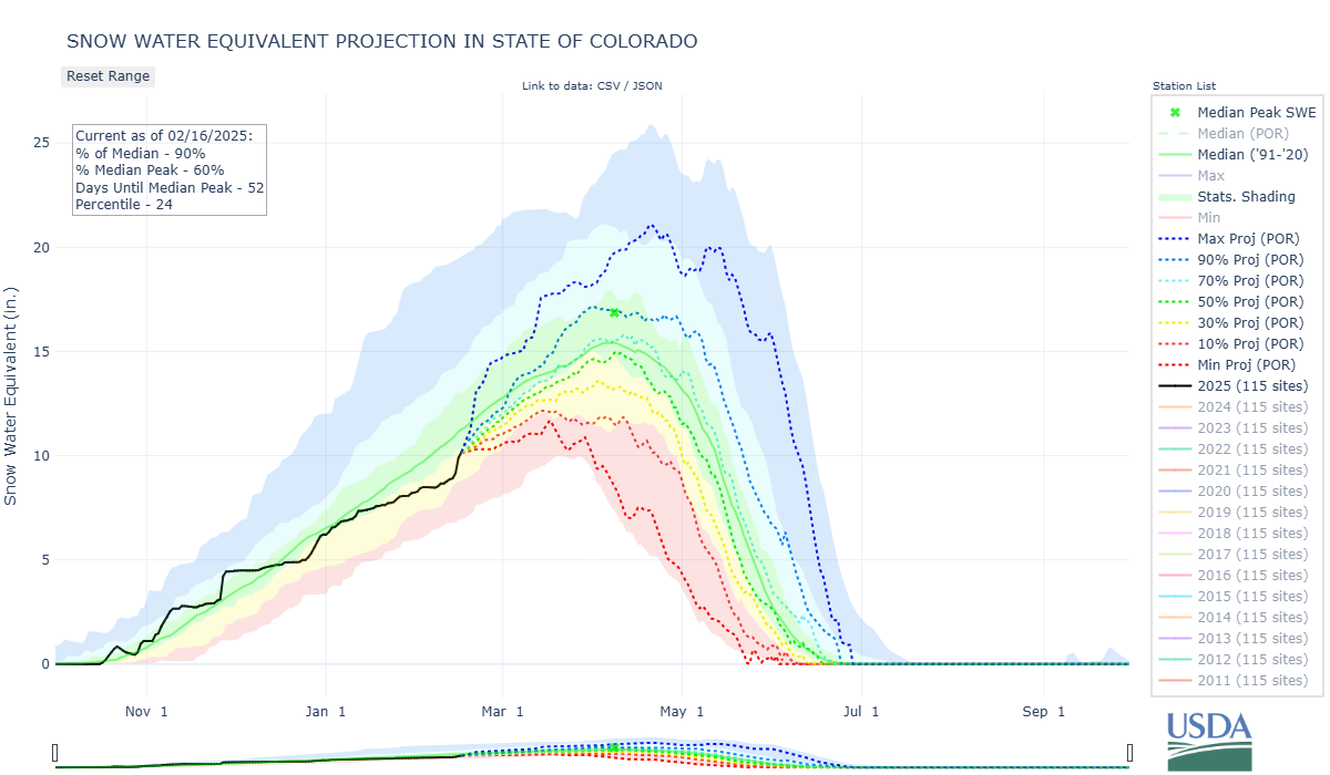
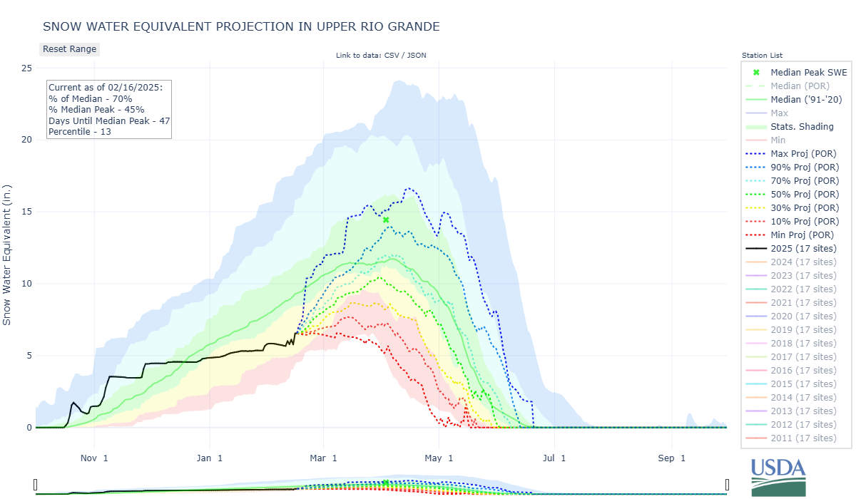
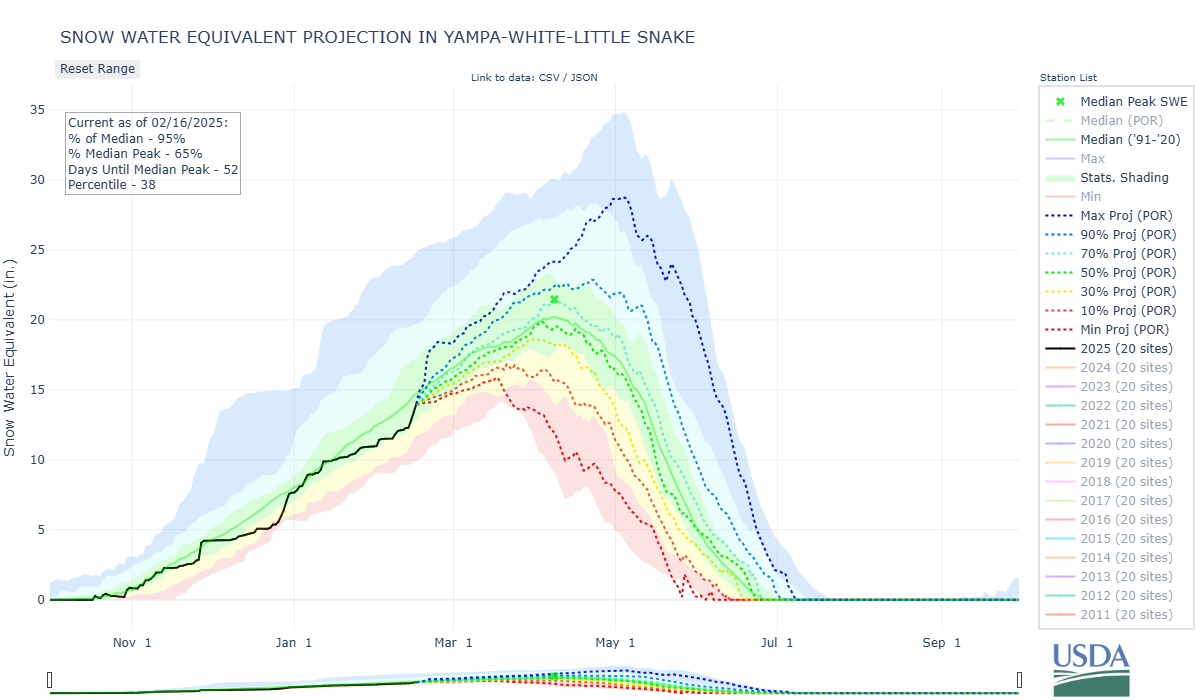
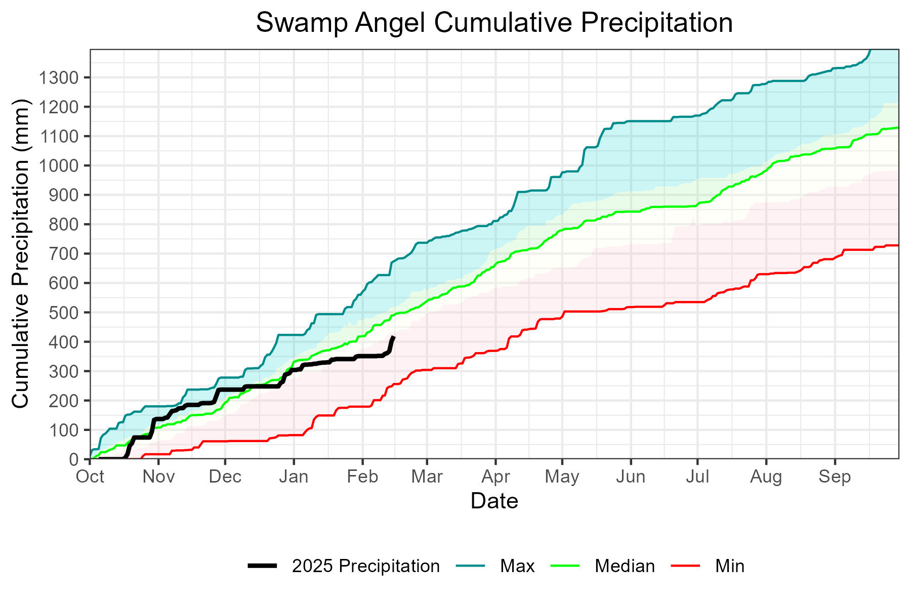
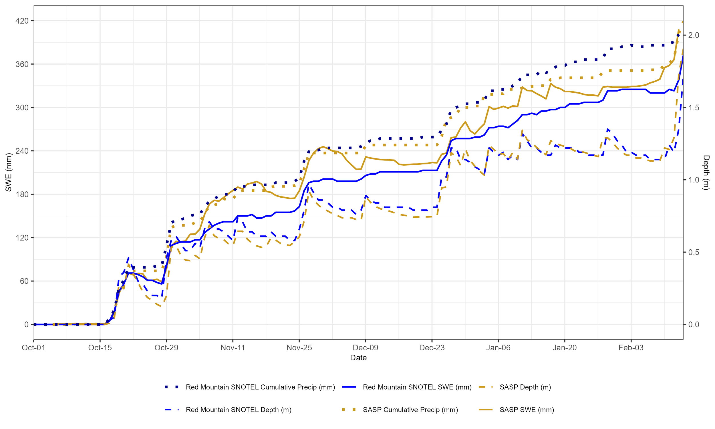
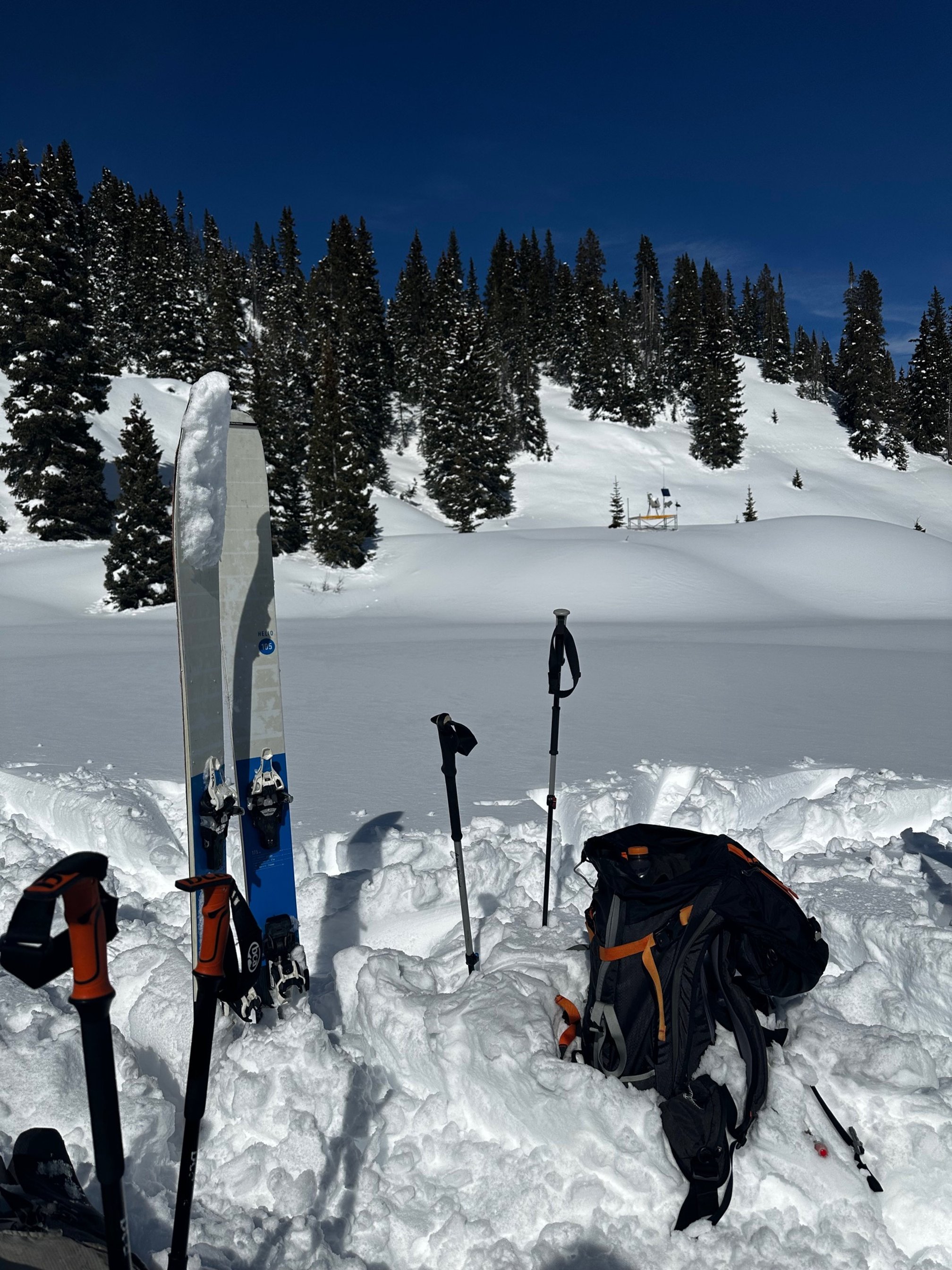
Finally, a storm to write home about. Things were looking pretty bleak in the Southern Basins where not much has happened really all winter, but the last four-five days have yielded some very respectable storm totals. Swamp Angel showed 29” and Red Mountain Pass SNOTEL about 24” of fresh powder for the masses - not bad for our recent track record. We had a big November and the last notable storm was latter December. Watersheds starting in the Gunnison and going north are doing much better by holding near median. See the Storm Report here.
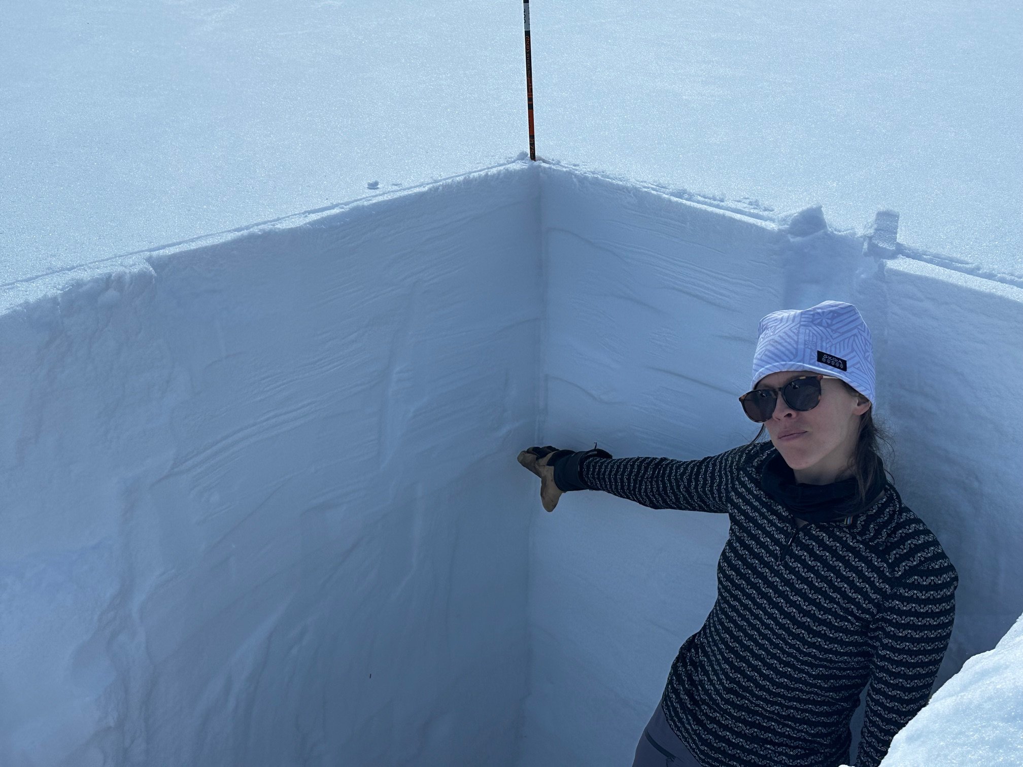
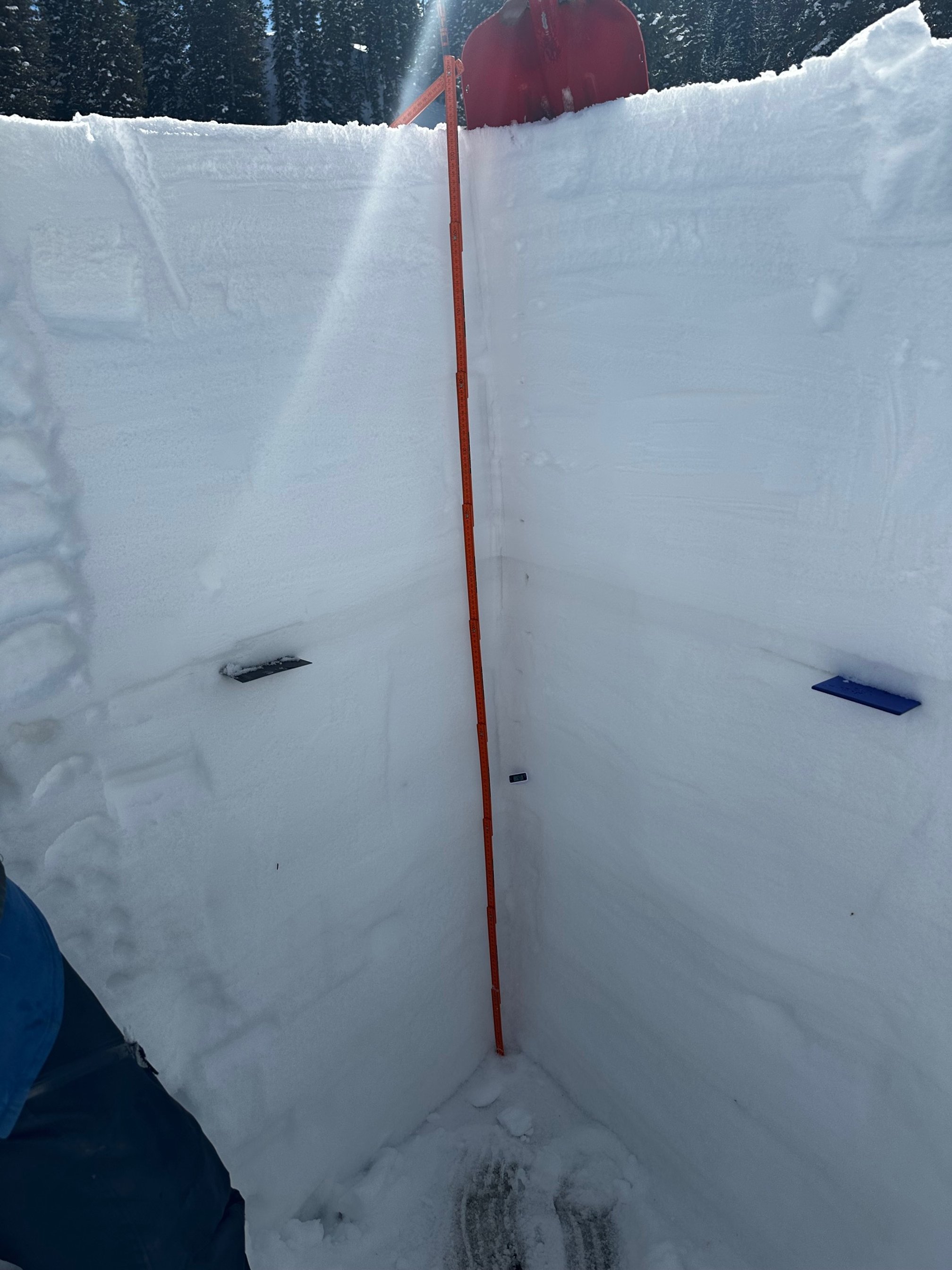
At Swamp Angel we measured 2.2” precipitation. On the SWE sensor we measured a 2.5” gain over the last few days. A good storm. We received about half as much as needed to get to median levels - it’s nice to see an upward spike, but keep hoping for more!
Surprisingly, we did receive any dust with this storm. So now, we still have just one moderate dust layer in the snowpack and it is under the recent ~2' of new snow accumulation.
The forecast is a bit more precip mostly for Northern Colorado on Monday/Tuesday. Longer term forecast is looking dry and warm. In terms of ENSO, it looks like we might transition from a La Nina to neutral somewhere from March to May (66% chance). Could this help us out?
Our USGS colleagues just activated a new webpage on the USGS website titled “Where the Rubber Meets the Road and Ends Up in Snow: The Hidden Effects of Tire Matter on Snowmelt and Mountain Ecosystems”. This informative page is a follow up to two recently published articles titled Microplastic and Associated Black Particles from Road-tire Wear: Implications for Radiative Effects across the Cryosphere and in the Atmosphere and Light Absorbing Particles Deposited to Snow Cover Across the Upper Colorado River Basin, Colorado, 2013-2016: Interannual Variations From Multiple Natural and Anthropogenic Sources. Samples collected by CSAS as part of the state-wide Colorado Dust-on-Snow Program provided that data for both publications.
More Soon