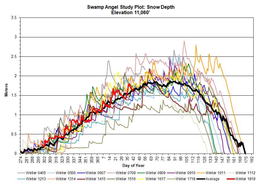
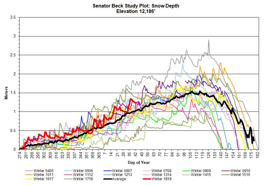
Greetings From Silverton,
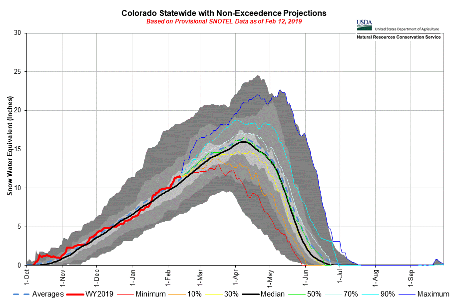
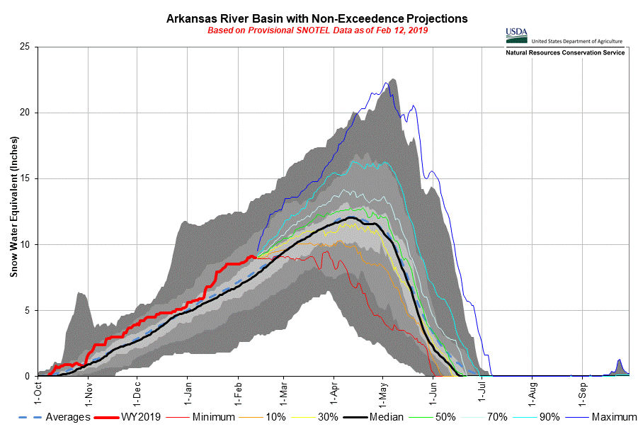
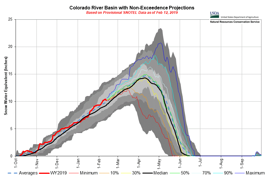
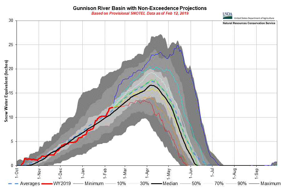
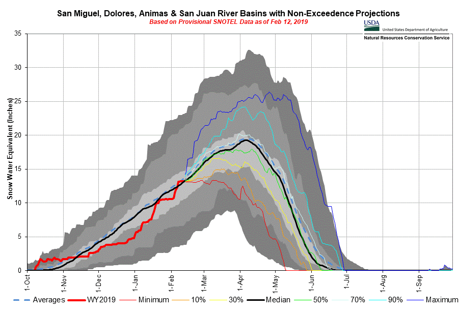
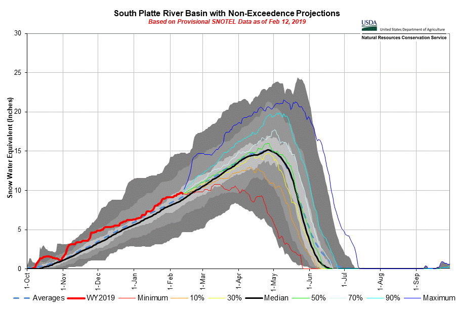
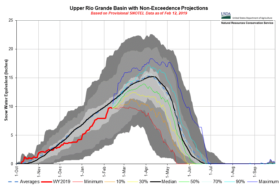
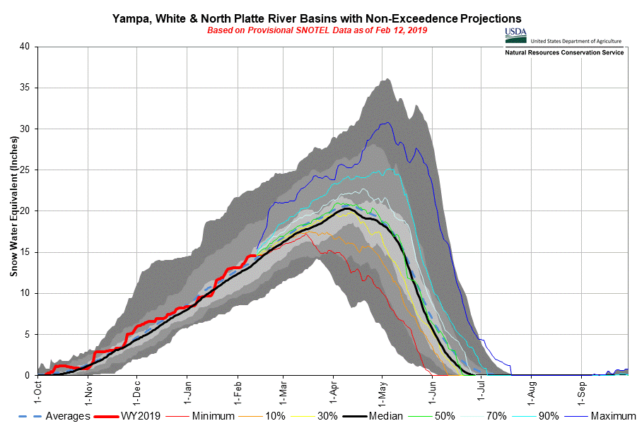
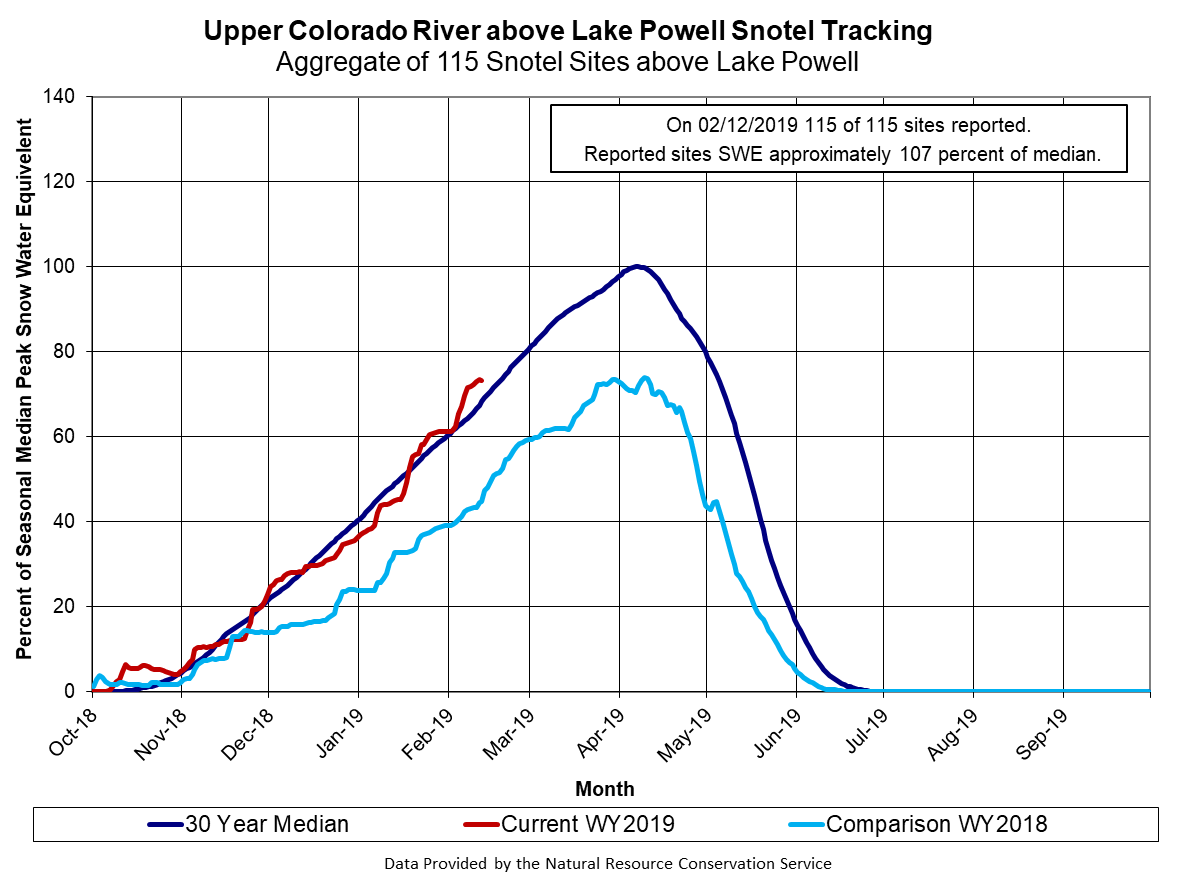
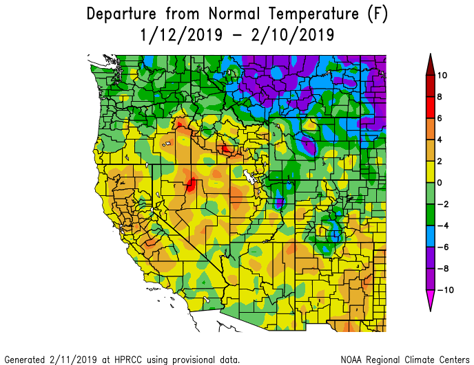
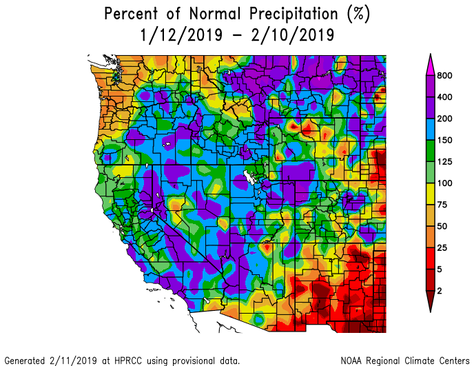
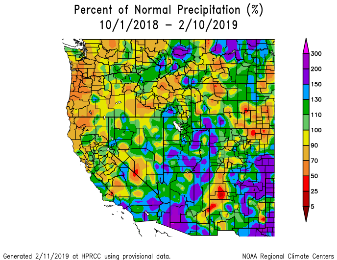
The last month and a half we witnessed the San Miguel/Dolores/Animas/San Juan and Upper Rio Grande Basins climb out of a deficit that existed the first of January when the Basins were reporting 71% and 76%, respectively, of median SWE. They are currently sitting at 100% and 97%. The other major Colorado basins did a good job of adding to the snowpack during this time as well, but the blue ribbon goes to these two southern basins for most improved. Please see the basin SWE plots below.
Dust: CSAS staff has observed a light, diffuse, band of dust near Lizard Head Pass on the bottom portion of the new snow accumulation from Storms #13 and #14 that occurred February 3-7. On the other side of the hill in Senator Beck dust is not visible in snow profiles, but there are some locations across the landscape where a slightly darker shade of snow is seen in contrast to a whiter, scoured area of snow. Before, during, and after the two storm events winds were strong with gusts up to 67 mph (from Feb 3-Feb 10 average daily wind speeds were 25 mph). Any dust deposition would be highly variable across the mountain environment. We will keep an eye on this and any new dust events as we enter dust season. April, March, and May (in that order) are Colorado’s biggest months to receive dust-on-snow events, so things are just starting up.
Water Supply: The CBRFC held their water supply briefing on February 7 (https://www.cbrfc.noaa.gov/present/present2019.cgi). The additional precipitation received through January and the first week of February (February 1 estimates takes into account the precipitation events occurring the first week of February for most forecasts) improved the outlook from last month. The Duchesne Basin forecast improved 15-35%, now ranging between ~60% - 115% of average. For the Colorado Mainstem the forecast is ~85%-95% of average. Gunnison/Dolores Basins ~70% - 90%, and San Juan Basin ~55% - 70% of average (improving 5% – 10%). Lake Powell now sitting at 74% of average. The forecast may seem low but remember it is still early in the season and we have dry soils and below normal base flows to contend with.
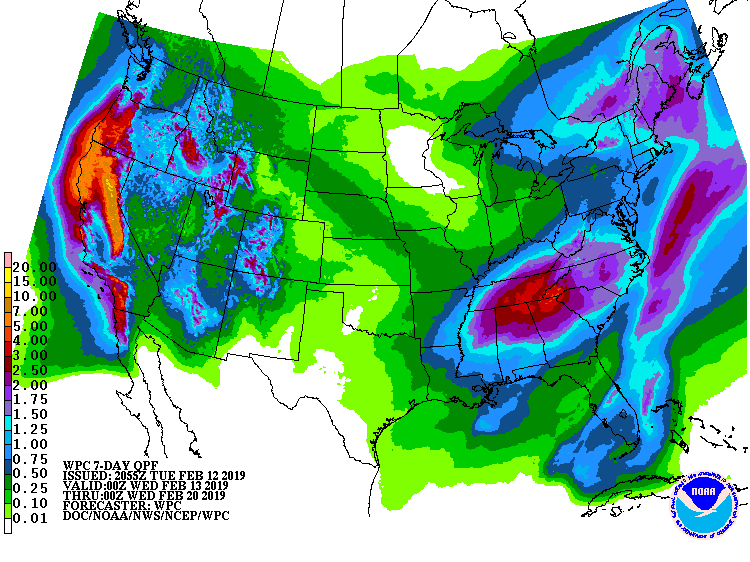
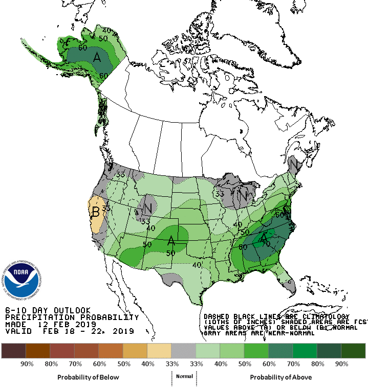
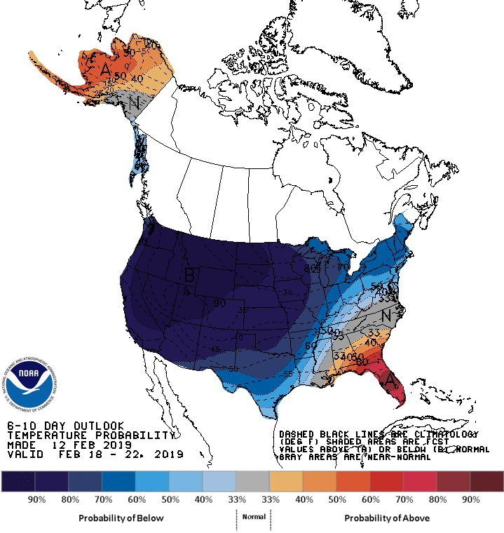
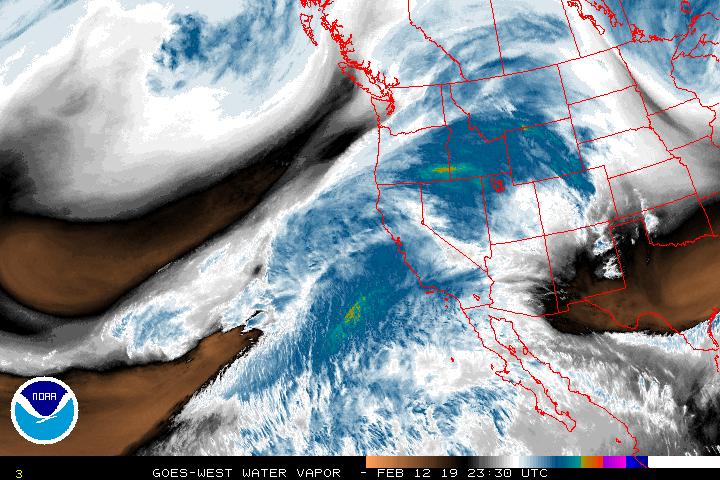
Forecast: I am seeing my favorite two words in the forecast, “atmospheric river”. Finally (it seems) a system looks to favor the San Juans with SW flow. The first wave begins Wednesday favoring Southern and Central Mountains. Thursday afternoon the next episode is projected to begin, the NWS forecast describes “a long band of moisture moves into the area that stretches to the southwest well out into the Pacific”. Please see forecast images below. Unsettled weather is expected to continue through the weekend as the trough moves east.
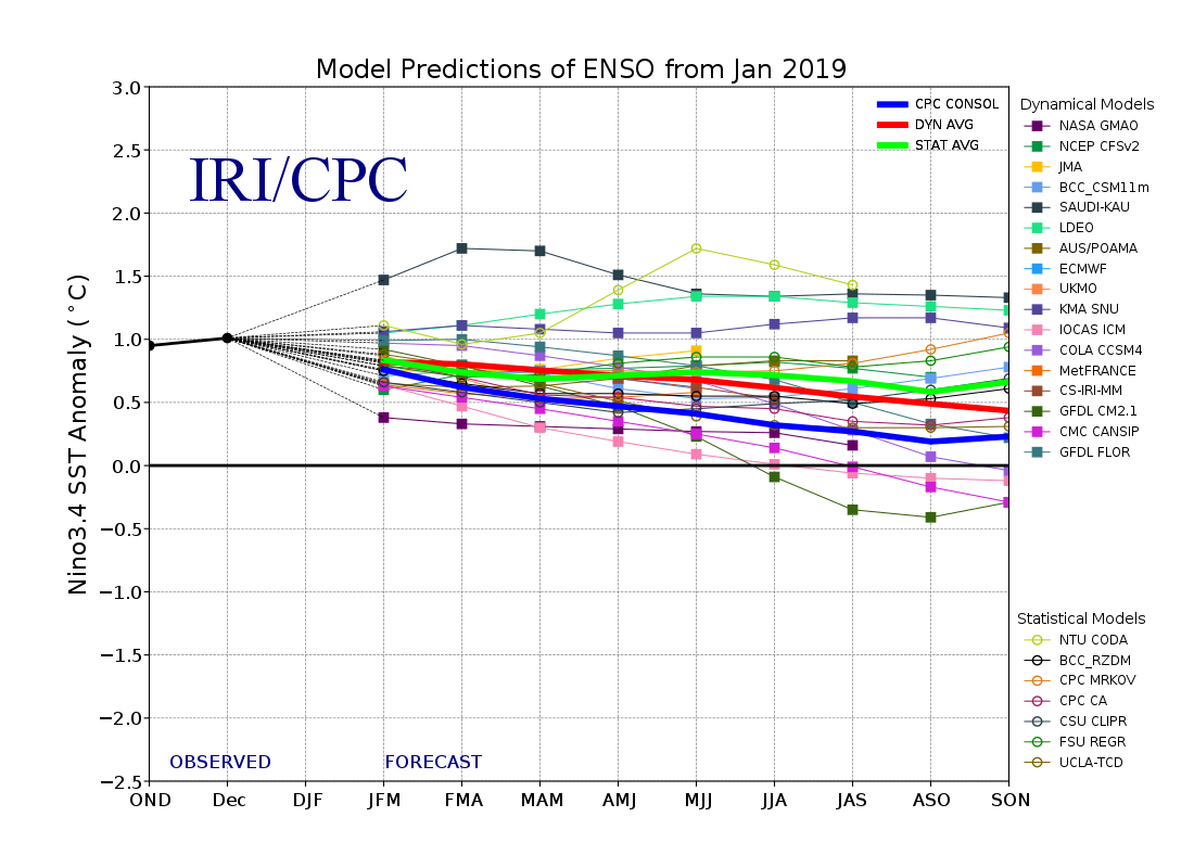
El Nino: Last month NOAA published their latest ENSO discussion. ENSO neutral conditions remained in place despite above average sea surface temperatures across the equatorial Pacific Ocean. However, late winter and early spring is supposed to be favorable months for “coupling” of atmospheric circulation and ocean sea surface conditions. So it is believed that a weak El Nino will develop (65% chance). Due to the timing of any development of an El Nino there are no significant impacts anticipated during remainder of this winter. Even though an El Nino has not taken shape the features are there, meaning active weather patterns and strong jet stream. NOAA will publish an update here in a few days and we will discuss in our next CODOS Update.
Snow School: I am really looking forward to Snow School for Water Professionals next week, starting February 20. We have an interesting and diverse group of folks attending; Denver Water, Bureau of Reclamation, CWCB, Tri-County Water, Desert Research Institute, to name a few. It is a great venue to not only learn about our mountains, snow, snow data collection, and data resources, but to learn from each individual’s particular field of expertise. If you want to attend I am sure we can find another chair somewhere in the office and vehicle that will take us to Swamp Angel for the field portion. See this Snow School for Water Professionals link for more info. If not this year, maybe next.
