

SUMMARY
Colorado snowpack is holding strong with March 1st SWE conditions above median for the entire state. The Southern Basins have made a notable comeback from well below normal conditions six weeks ago. This update summarizes snowpack conditions state-wide and evaluates March 1st snow water equivalent (SWE) data from SNOTEL stations associated with our eleven CODOS sites and places them within the framework of the Dust Enhanced Runoff Classification scheme (DERC) developed by CODOS. The intent is to offer a glimpse of plausible WY2019 hydrograph characteristics based on current snowpack and dust conditions compared to similar conditions in our period of record.
SNOWPACK CONDITIONS
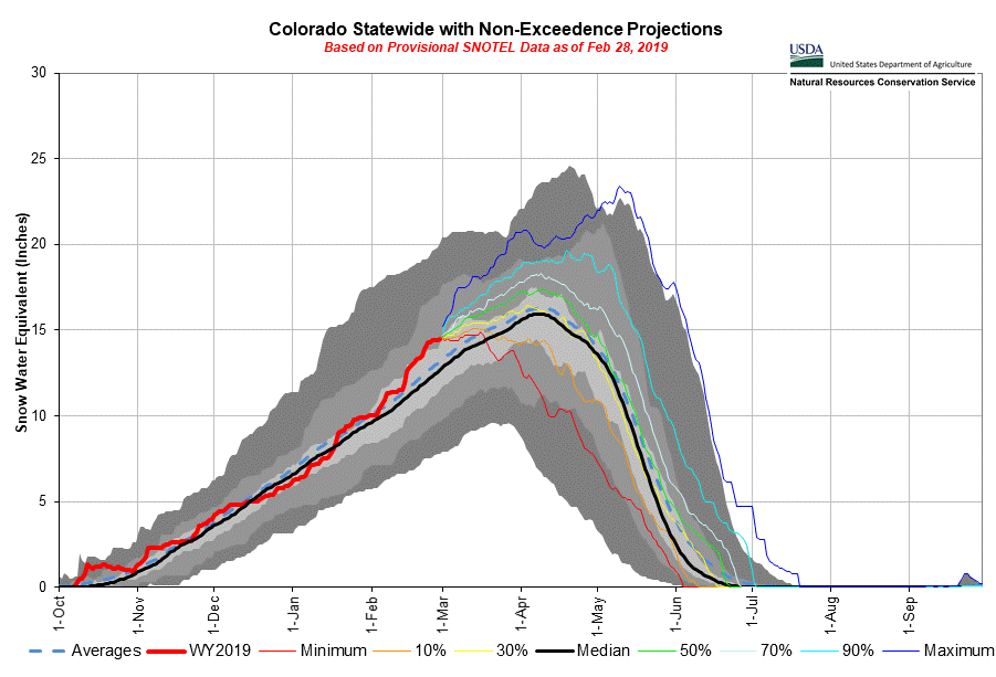
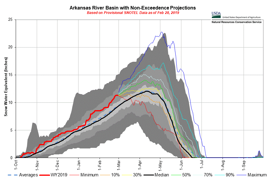
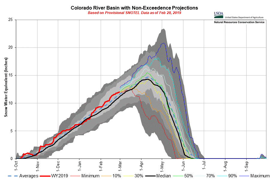
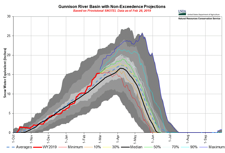
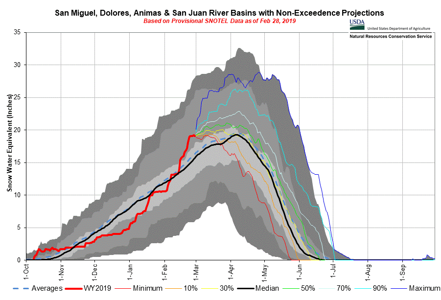
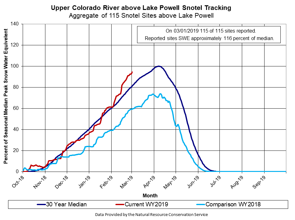
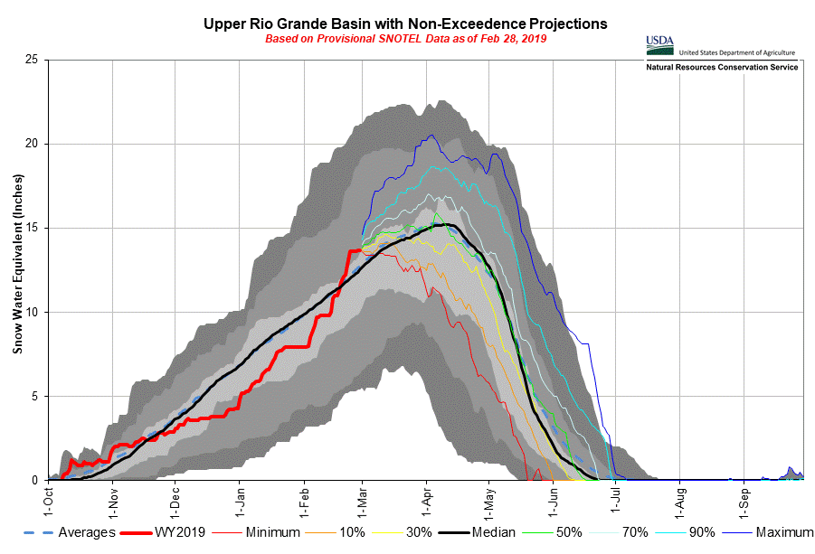
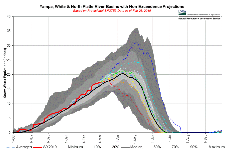
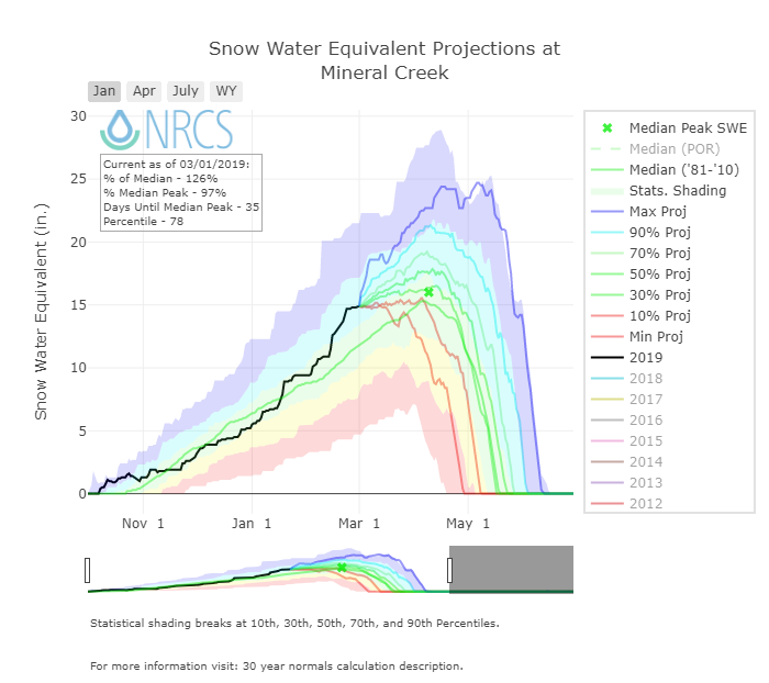
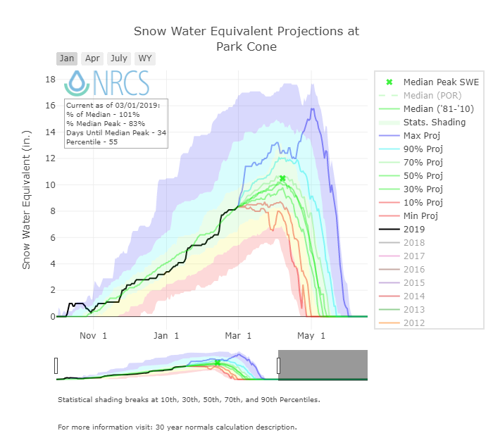
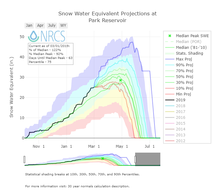
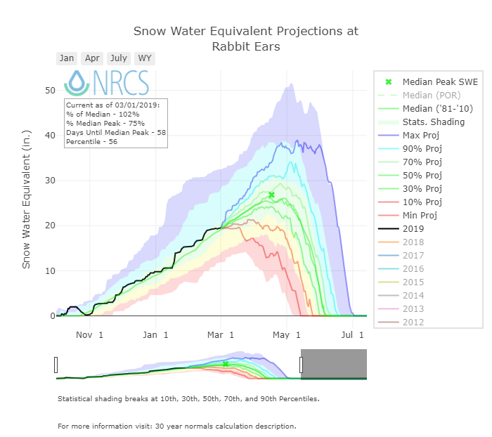
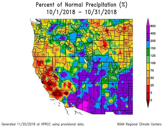
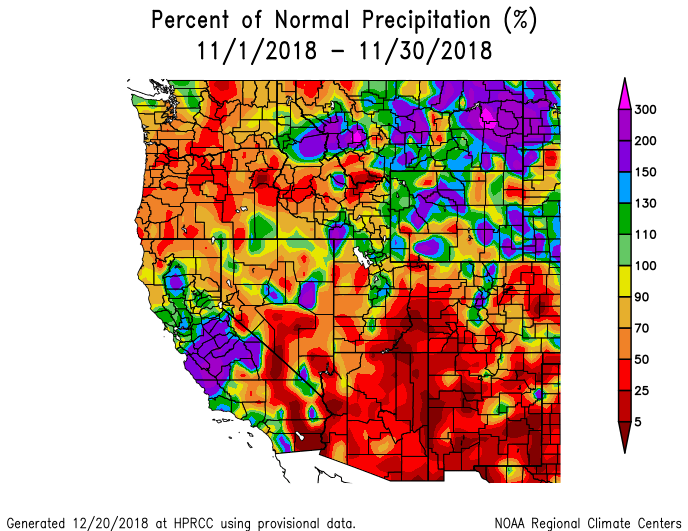
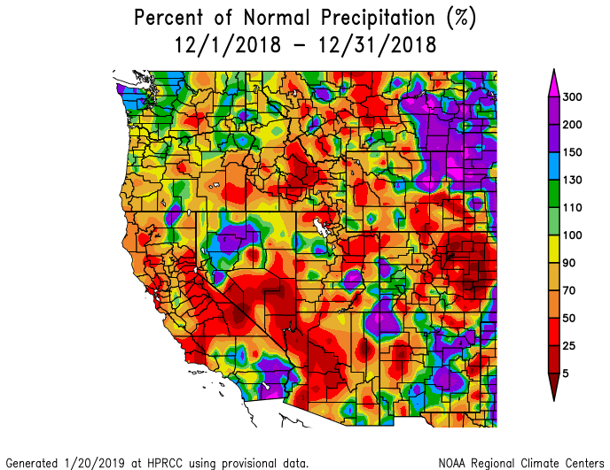
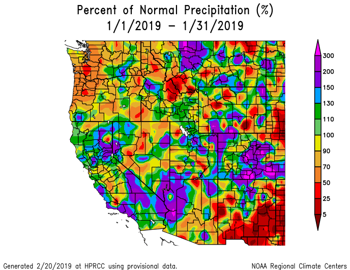
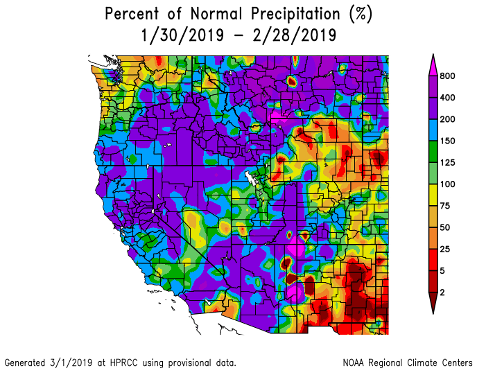
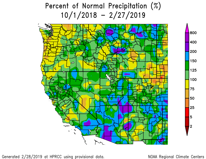
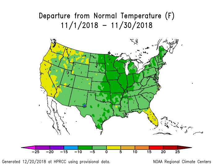
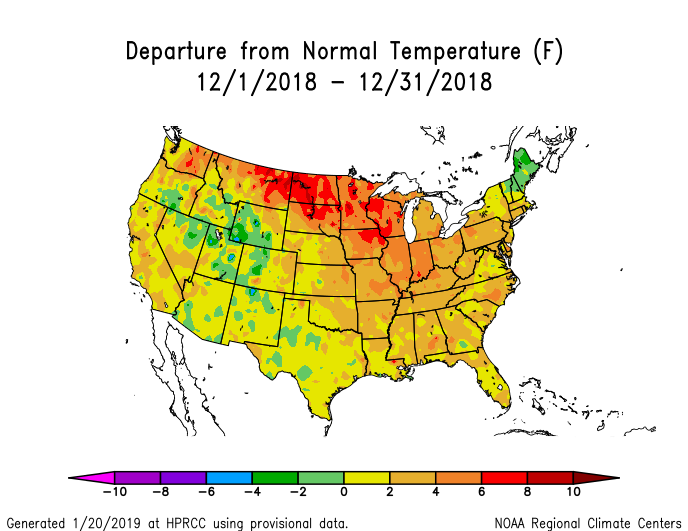
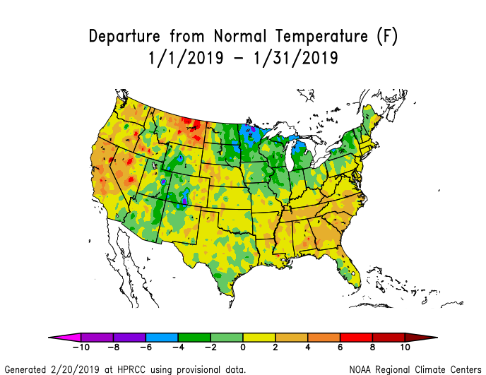
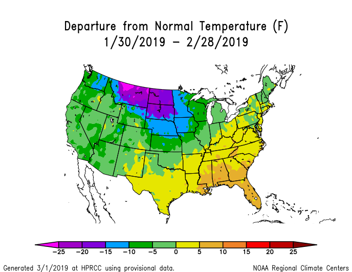
Snowpack conditions are very healthy for this time of year. The snow season is roughly half over and peak accumulation about one month away, all major basins are currently 106% - 122% of median. The Central and Northern Basins have been near or above median since October when the snowpack began building rather early in the season. In the San Miguel/Dolores/Animas/San Juan and Upper Rio Grande it has been a nail-biting roller coaster ride. These two basins did experience the early season snow but did not benefit from mid-November to mid-December storms as much as the Central and Northern basins. Events turned around the latter part of December when the season’s strong jet stream began routing more storms towards the south. January brought a respectable amount of water with 4.5” measured precipitation, but things really kicked into gear mid-February when an atmospheric river (think a subtropical warm, moist air mass) ushered in 11 days of snow, bringing 4.5” of water. The month of February brought a 6.6” of precipitation, a near record for our dataset going back to 2003/2004. This resulted in bringing the San Miguel/Dolores/Animas/San Juan back from 60% median on December 20 to the current 122%, and the Upper Rio Grande from 67% to 119%. A review of winter storms to date can be viewed on the storm reports page on our snowstudies.org website.
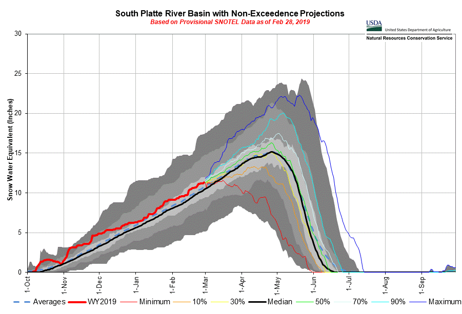
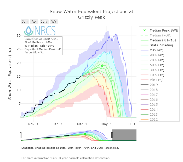
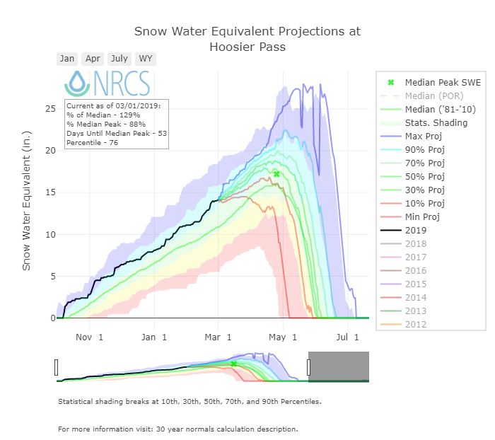
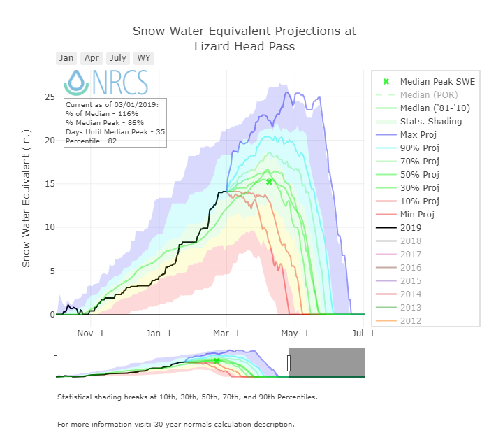
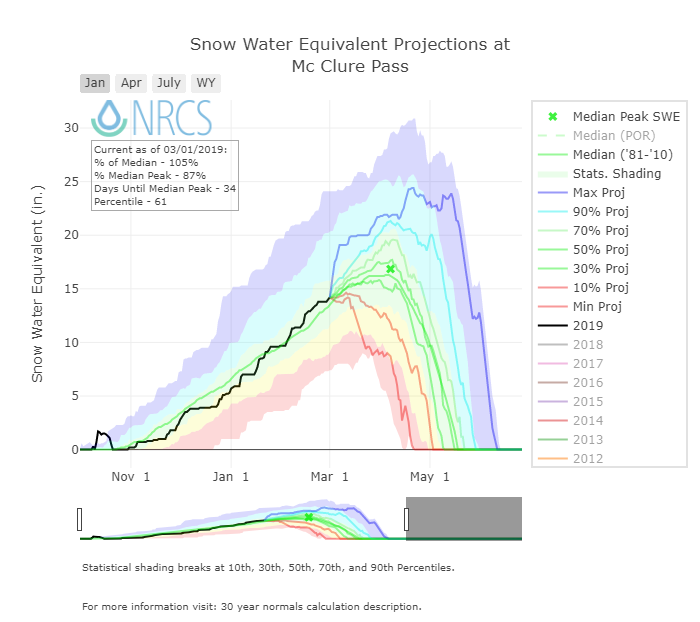
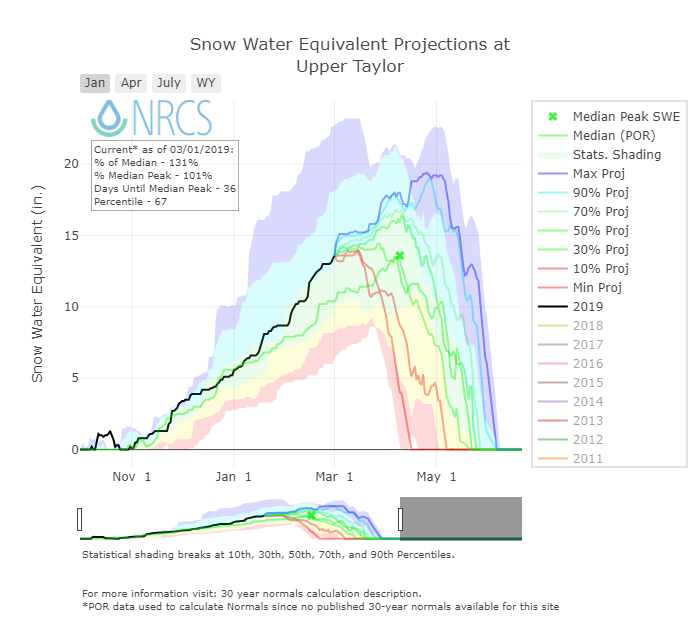
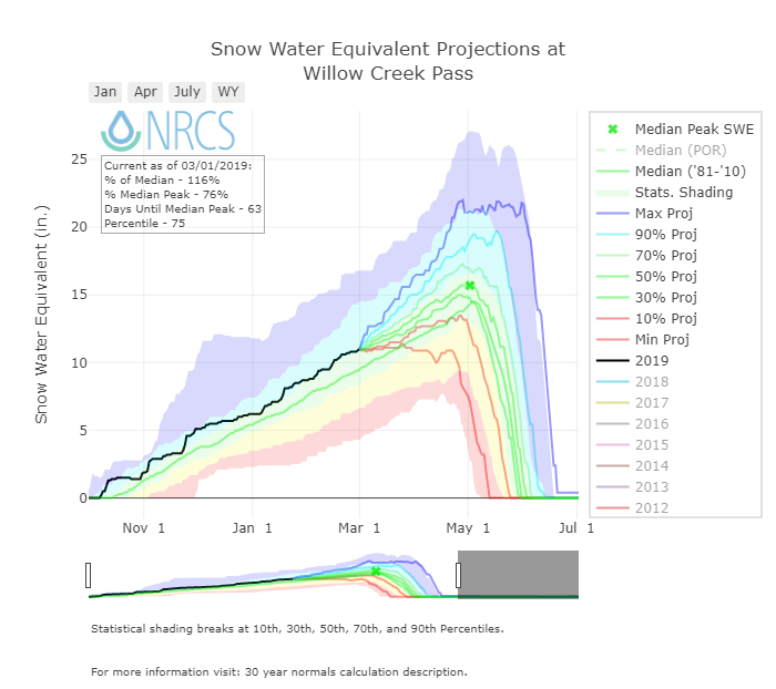
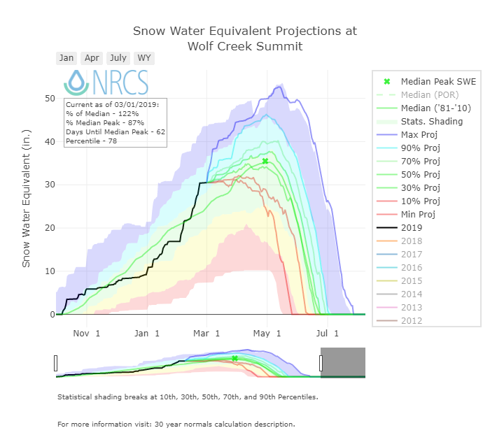
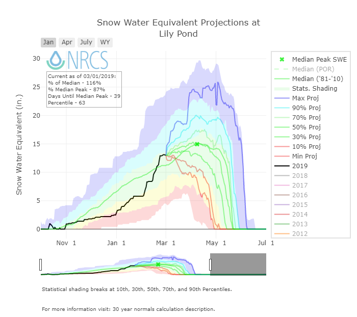
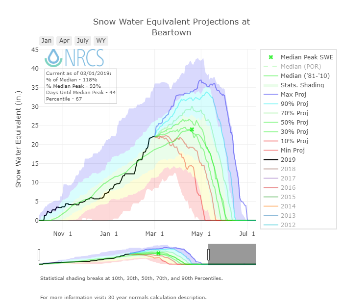
The NRCS basin-scale SWE condition plots below use non-exceedance probabilities to project a range of future snowpack conditions, from the least likely (historical max and min traces) to the most probable (50% trace).


VIC Soil Moisture Percentiles
Due to low soil moisture conditions runoff forecasts are lower than would otherwise be the case given the current snowpack conditions. Overall, since the start of the water year the dust source area in some areas of the southwest has received over 200% of normal precipitation. This is lessening exceptional drought conditions and helping put a damper on dust mobilization. Dust cameras in the southwest are regularly showing snow.
DUST-ON-SNOW AND DERC CLASSIFICATION
Over the course of our 2005-2018 period of rigorous observations, March 1st has marked the beginning of the heart of “dust-on-snow season” for the Colorado Mountains (see the CODOS Dust Log chart of dust events by month). So far for WY2019 we have only observed a very light, diffuse, band of dust near Lizard Head Pass on the bottom portion of the new snow accumulation from Storms #13 and #14 that occurred February 3-7. However at Senator Beck Basin, the primary ‘sentry site’ for the CODOS program, we have not observed dust in snow profiles. It is likely that some portion of this dust made its way over to the Red Mountain Pass area, but it appears a negligible amount and will likely have minimal hydrologic consequences come spring. We have not observed or received reports of dust events in other parts of the state.
Unless conditions change, the CODOS team will do our first state-wide dust assessment of the season around March 17-23. We try to time our trips to best capture documenting dust in/on snow conditions, if there is plenty of fresh snow accumulation and minimal dust we delay the tour, but if we feel dust layers are near the snowpack surface we hit the road to determine the potential short-term and latter melt season impacts.
As of March 1st, Colorado SWE remains “high” among majority of basins. At the time of this writing (March 3), all basins are now in the '“high” category. DERC “Average” SWE equals day median +/- 10%, and deviation above and below those limits are assessed as having “high” or “low” SWE. The basins listed below are classified according to the appropriate DERC classification of either Low, Avg, or High March 1st SWE layer domains.
Basin scale WY 2019 March 1 SWE conditions (NRCS data) classified using the Dust Enhanced Runoff Classification Scheme. With the current forecast indicating sizable precipitation in the Yampa and White River Basin we are classifying SWE conditions as high.
As described on the CODOS website, the DERC framework is utilized to identify prior years with similar patterns of dust-on-snow intensity, March 1st SWE, and spring precipitation conditions, and their associated hydrographs. March 1st SWE analyses have been performed for each CODOS site. From this, hydrographs from 2006-2018 with associated March 1st SWE conditions have been identified and included in the analyses.
An ‘exploded view’ of the Dust Enhanced Runoff Space, separated by March 1 SWE classifications.
CODOS SITE-SPECIFIC ANALYSES
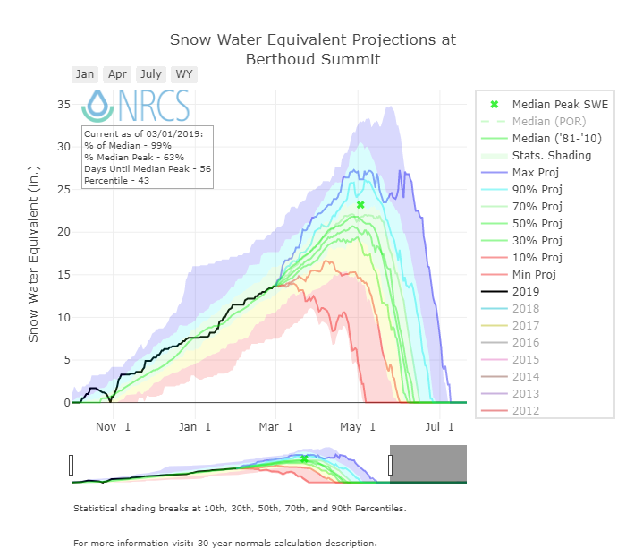
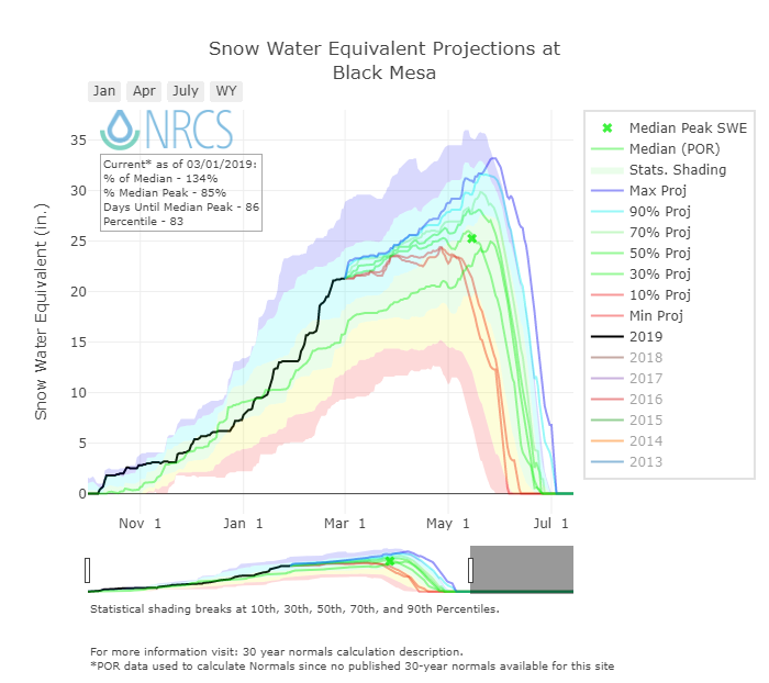
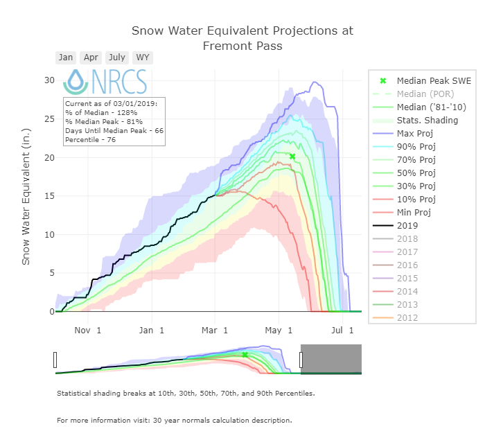
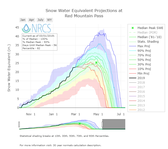
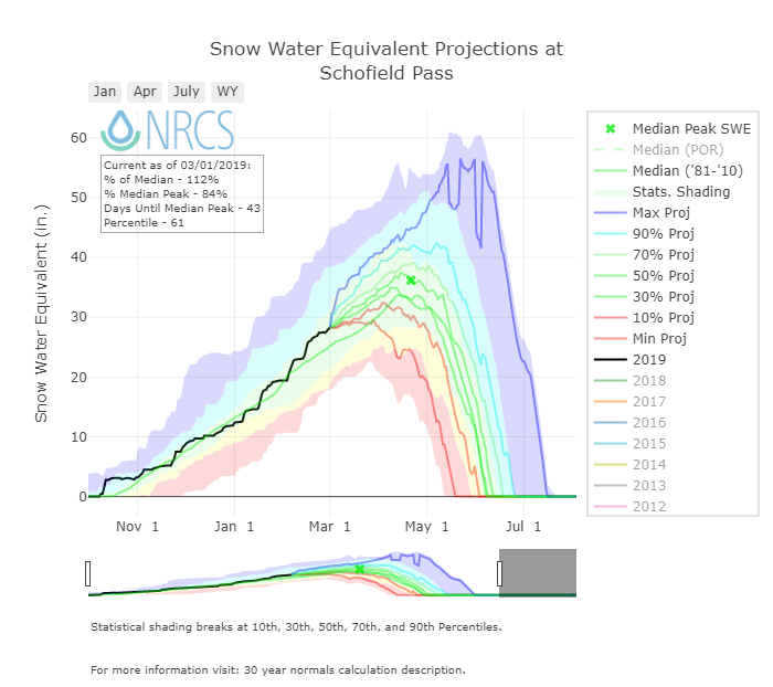
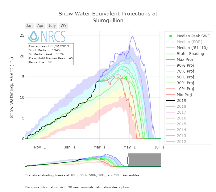
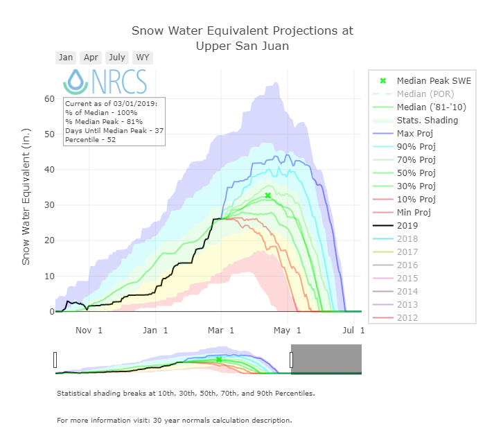
For individual SNOTEL stations associated with our eleven CODOS sites, March 1 SWE ranges from 99%-134% of median levels. March 1 SWE conditions were classified for the SNOTEL station directly associated with each CODOS site, and also for select nearby SNOTEL stations. Prior seasons with similar March 1st conditions were identified and placed within the appropriate dust enhanced March 1st SWE space. Local watershed hydrographs (from 2006-2018) associated with those March 1st SWE conditions are presented as plausible examples of runoff behavior in spring 2019, with the understanding that these prior years exhibit a limited variety of 2006-2018 dust and spring precipitation conditions for each CODOS site.
These analyses are presented in PDF format and are available for the watersheds listed below. You can see the entire period-of-record hydrographs as it relates to dust conditions on our CODOS website.
SENATOR BECK STUDY BASIN DATA PLOTS
To augment SNOTEL data and better understand snowpack conditions it is important to consider data collected in Senator Beck Study Basin (SBB). SBB is located at, or near, the headwaters of four major watersheds (Animas, Uncompahgre, San Miguel, and Rio Grande) and is the only high alpine study site in the region collecting comprehensive snowpack information. We regularly dig snow profiles to assess snow/dust conditions, and our meteorological stations measure the entire energy budget of the snowpack. Being a headwater study basin, the elevations that we collect snowpack information and continue meteorological station monitoring is well above the highest of most SNOTEL stations.
Snowpack at the Swamp Angel Study Plot (SASP) is above average in both snow depth and SWE. The same is true for the Senator Beck Study Plot (SBSP), which is more exposed and at a higher elevation than SASP. The SBB has received 17 winter storms so far this season - two storms greater than our average. Thus far, WY 2019 cumulative precipitation is 24.5" (570 mm), average is 21" (537 mm).

Precipitation at SASP, and snow depth at SASP and SBSP.

On February 27 observed was SWE 24.5”.

Snow depth at SASP for the last 16 years. WY 2019 is the red line.

Snow depth at SBSP.

Cumulative precipitation at SASP.

Storm count so far this year is slightly above average by two storms. Hopefully to increase further with the current forecast.

El Niño Southern Oscillation (ENSO) have finally formed during January 2019. It appears the coupling of above-average sea surface temperatures and overlying atmospheric circulation has taken place. This El Niño is considered weak and chances that it will persist beyond spring is 50% or less. Due to its weak strength significant impacts are not expected.


SENATOR BECK STUDY BASIN SETTING
Usually just before spring it is helpful to remind long-time CODOS subscribers and inform new subscribers where Senator Beck Basin (SBB) and it’s meteorological stations are located, so when we refer to data at SASP (Swamp Angel Study Plot) or SBSP (Senator Beck Study Plot) the reader understands the environment in which it was collected.
Senator Beck Study Basin location near Red Mountain Pass near Silverton, CO. Elevation of the Basin ranges from 11,030’ at the stream gauge to 13,510’ at the crest of the peaks. The blue line delineates watershed boundary. Senator Beck Study Plot and Swamp Angel Study Plot are the locations of highly instrumented meteorological stations and is also where snowpack data is collected. This picture was taken from our Putney station, where we collect “free air” wind speed and direction.
