June 16, 2019: Melt Rates, Plots, Still Lots of Snow
Greetings from Silverton,
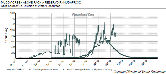
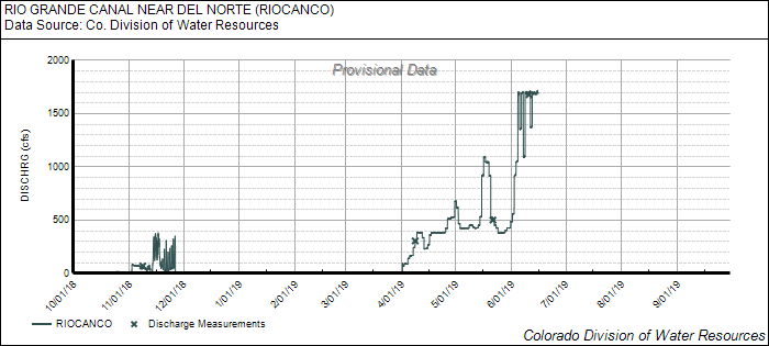
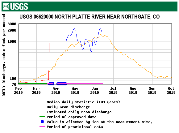
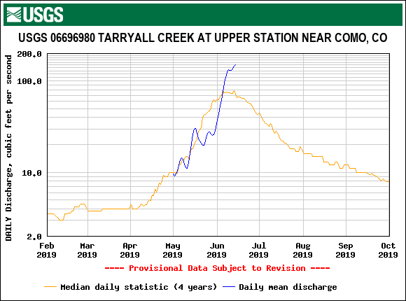
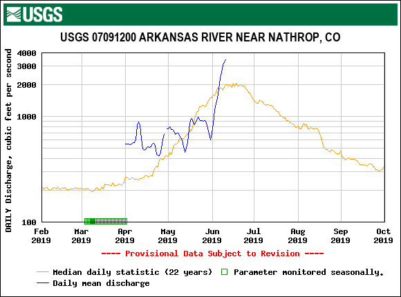
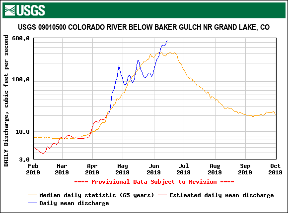
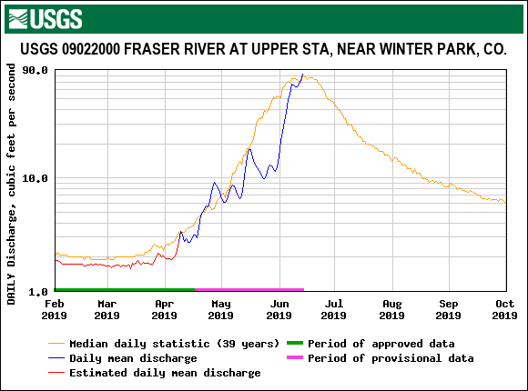
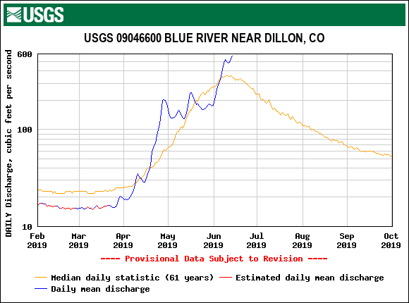
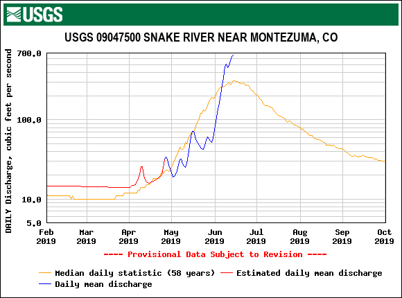
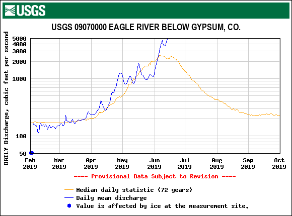
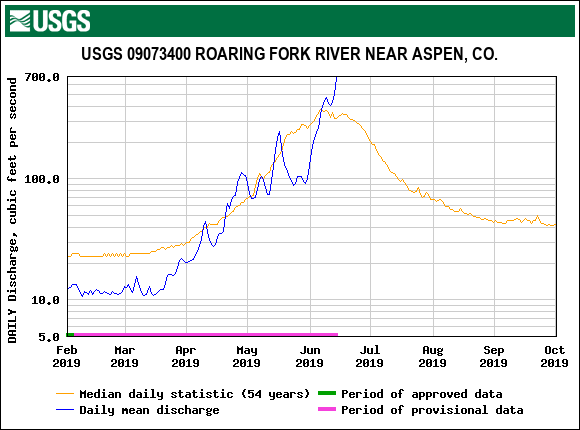
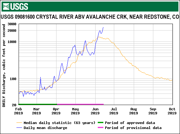
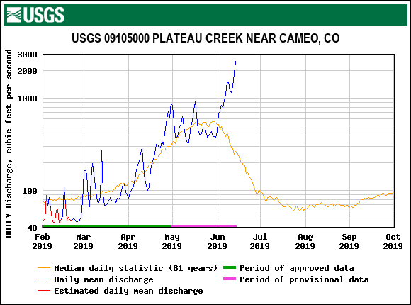
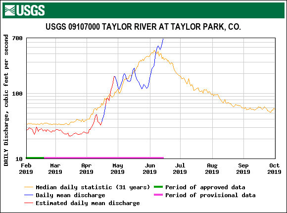
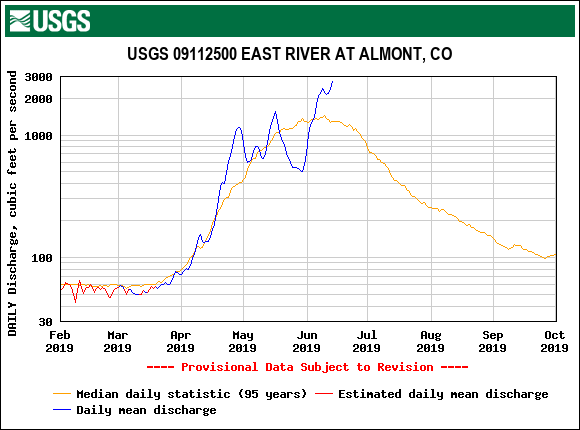
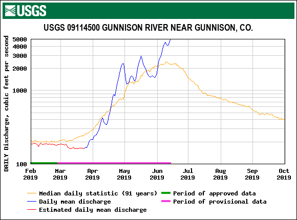
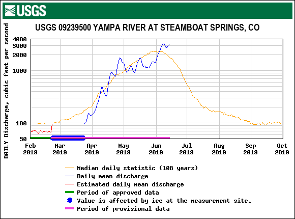
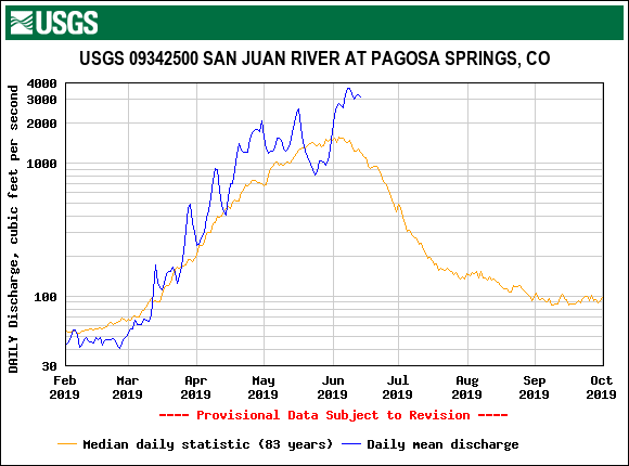
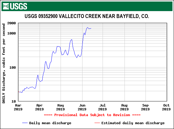
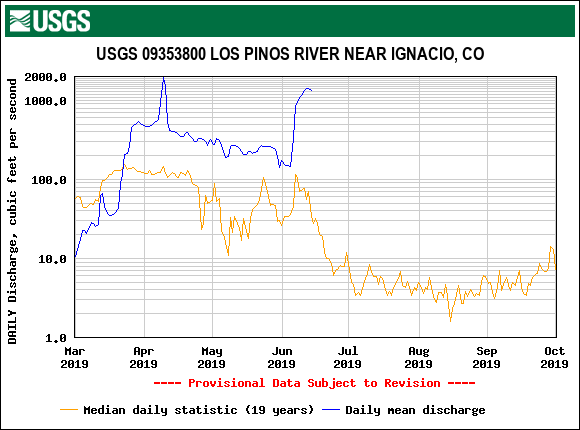
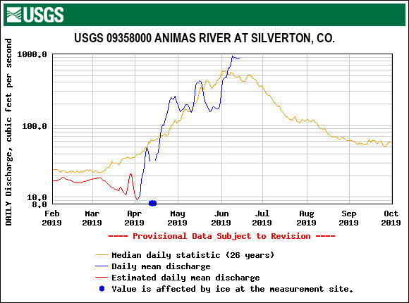
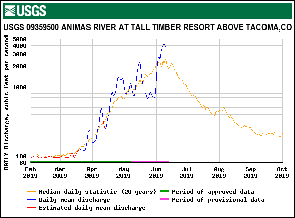
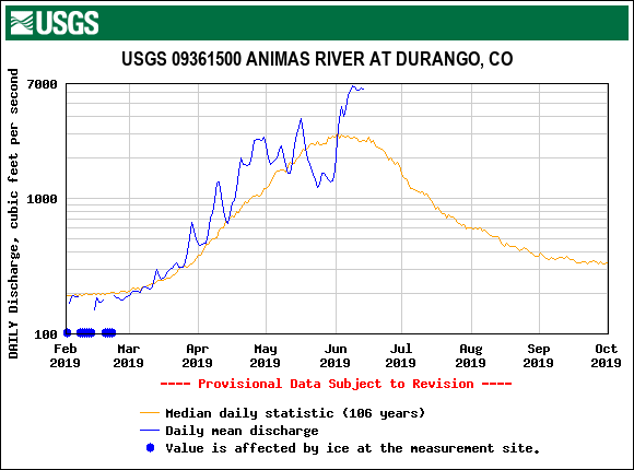
Over the last week snowmelt has been in full swing. Many streams have just reached forecasted peak discharge or expected to hit peak this week. Some passing storms and cooler temperatures slowed snowmelt the first of the week followed by a leveling off and then an uptick again. The first half of this week looks to bring a good chance of showers and thunderstorms. Temperatures and mostly sunny conditions are expected to return to near normal by Wednesday and continue into the weekend.
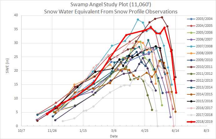
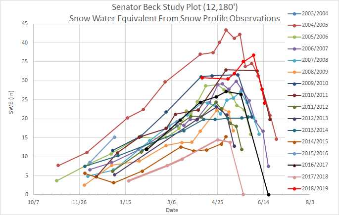
There is about 11” of SWE at SASP (11,060’) and 24” at SBSP (12,200’). So there is still a lot of snow in the high country and even though peak flows may be over soon streams will be running full well into the foreseeable future.
Last week and into this week we visit CODOS sites to collect all-layers-merged samples for mineral composition and source analysis.
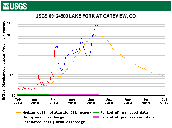
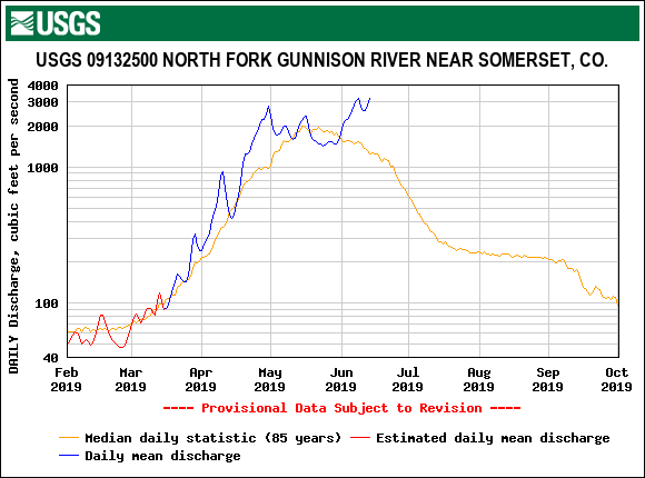
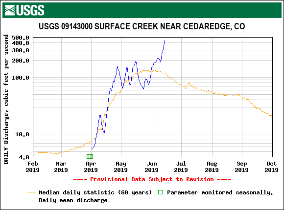
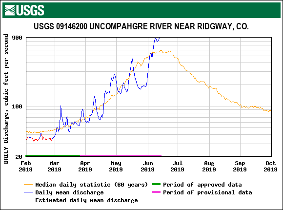
Please see table of melt rates at select locations, SWE. streamflow, and weather images below.
More soon.
Below: SWE observations at Swamp Angel and Senator Beck Study Plots.
Below: Daily melt rates at select SNOTEL sites.

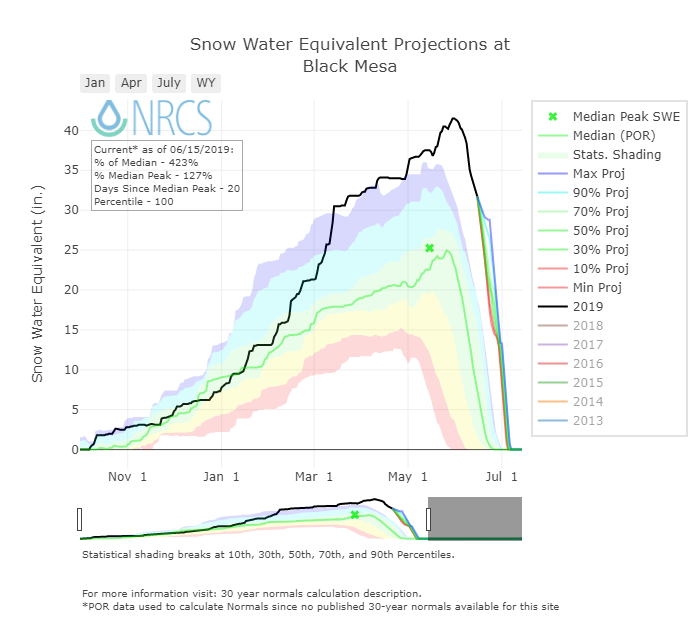
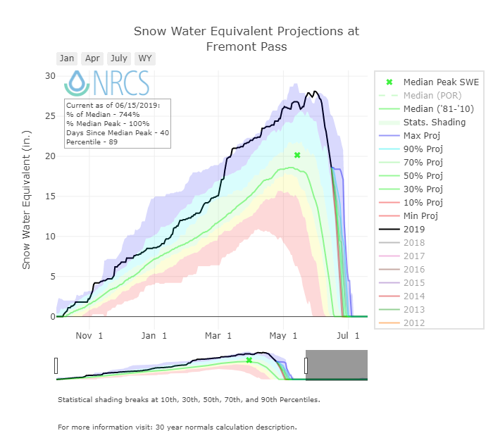
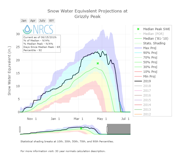
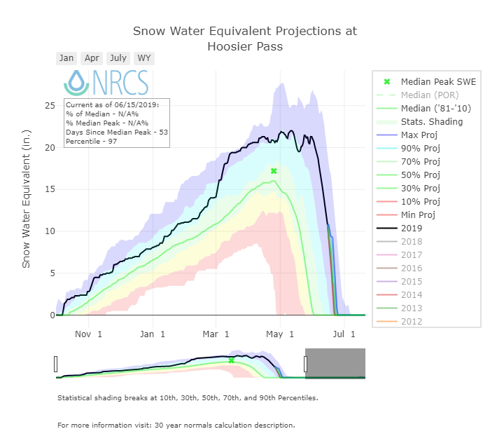
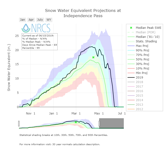
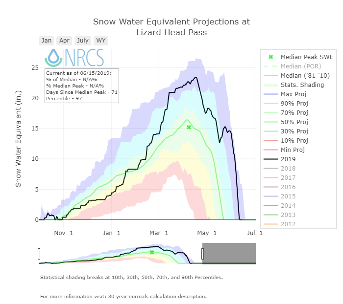
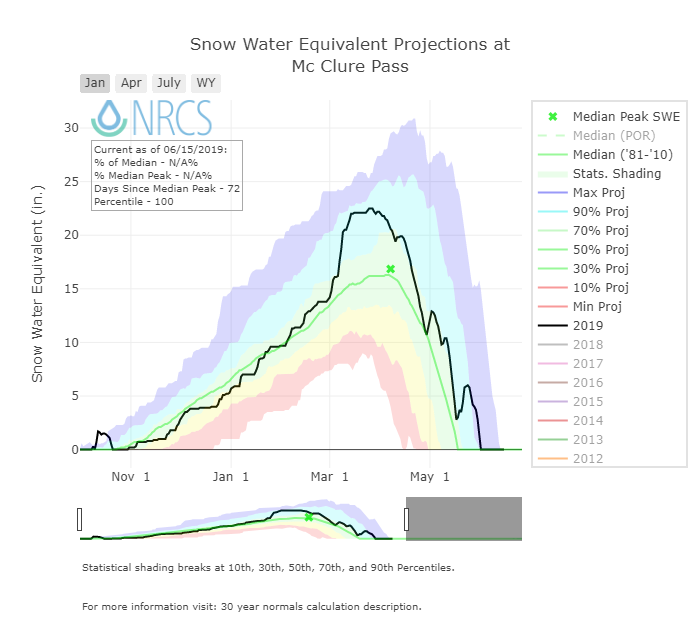
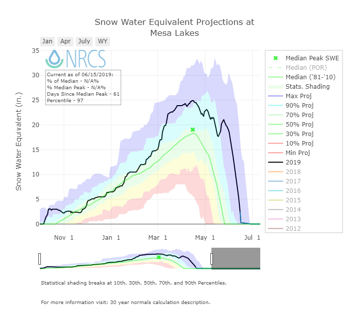
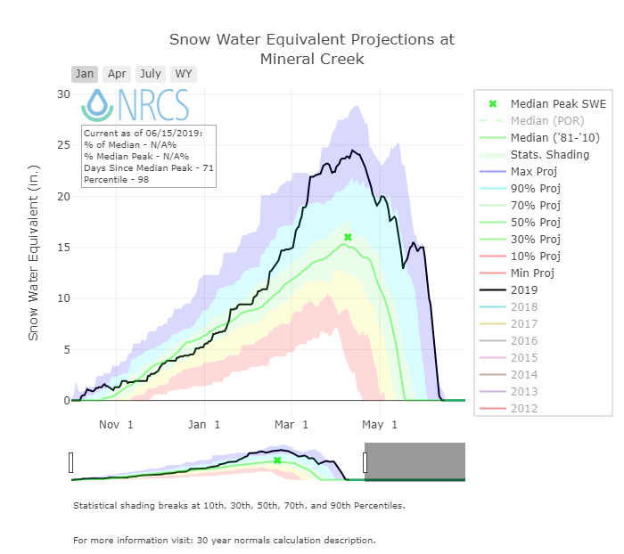
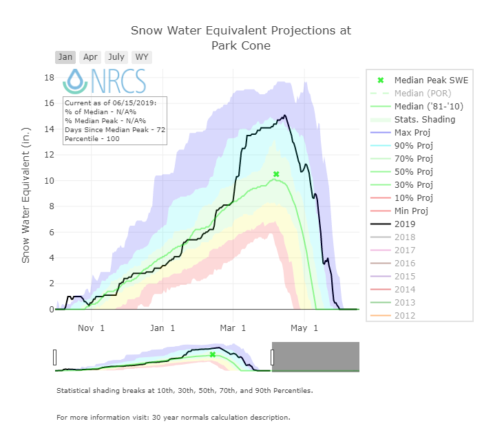
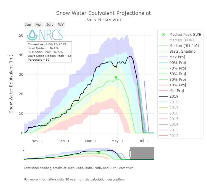
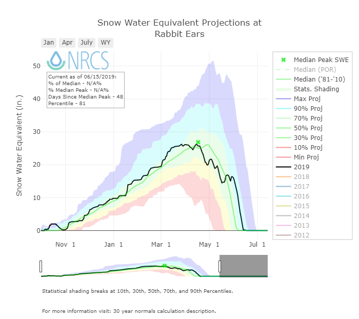
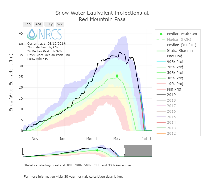
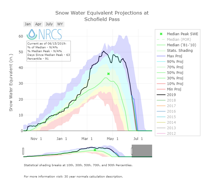
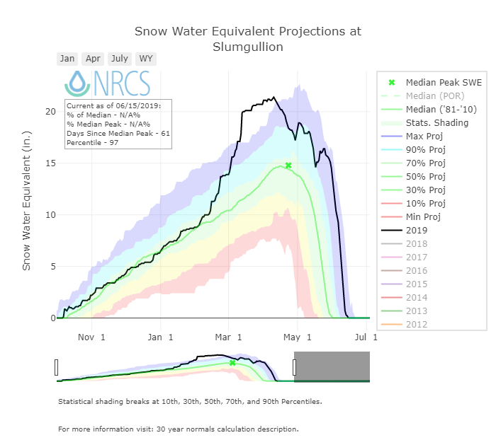
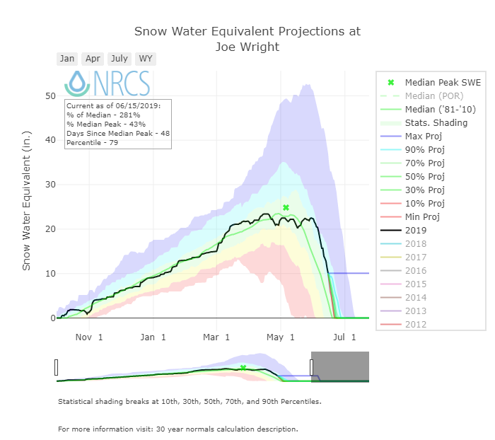
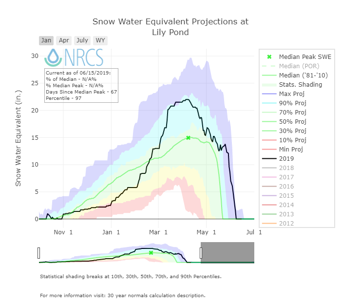
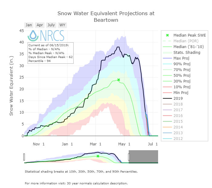
Below: Plots of individual SNOTEL stations.

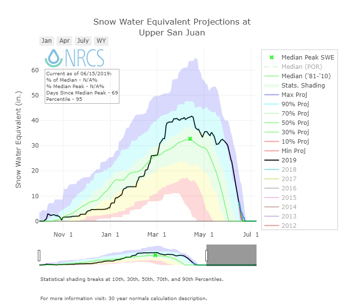
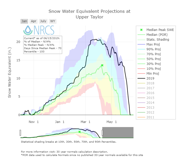
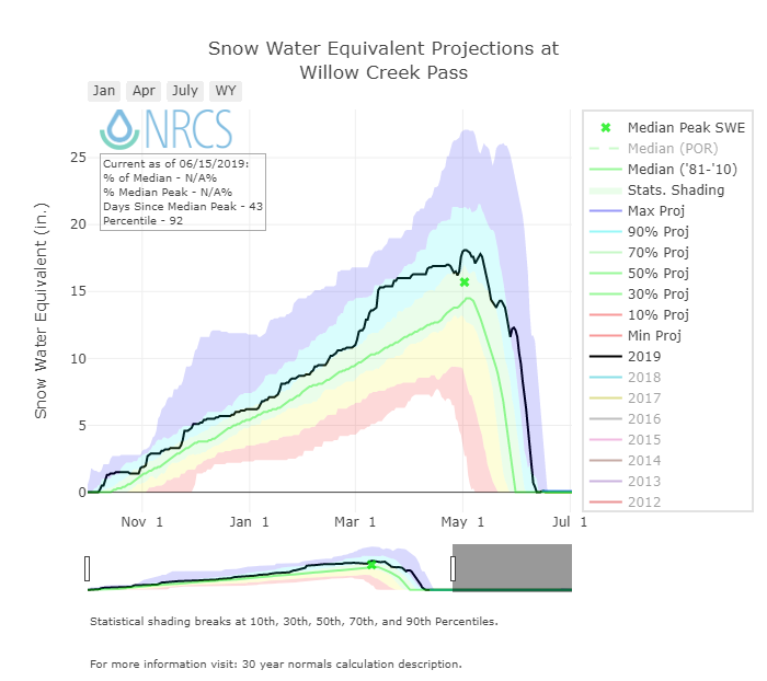
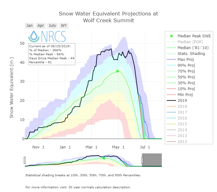
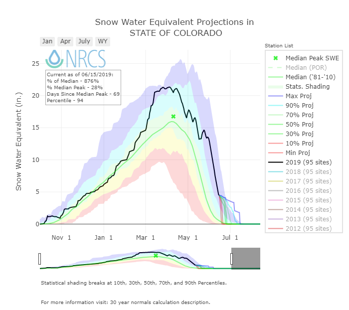
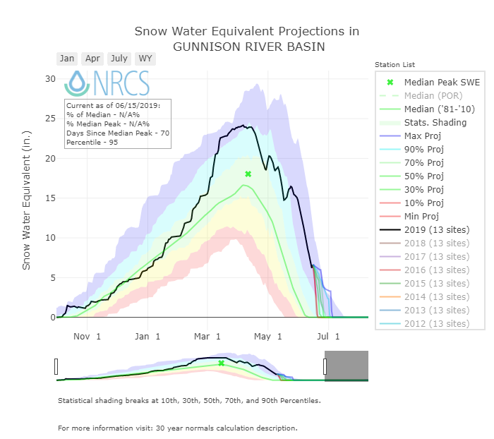
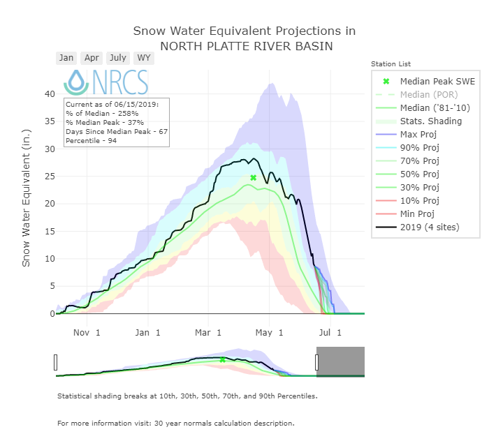
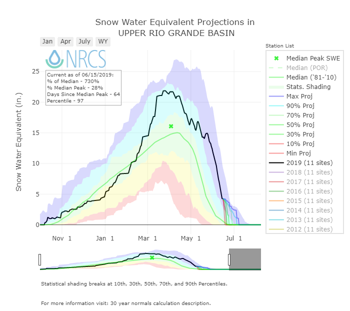
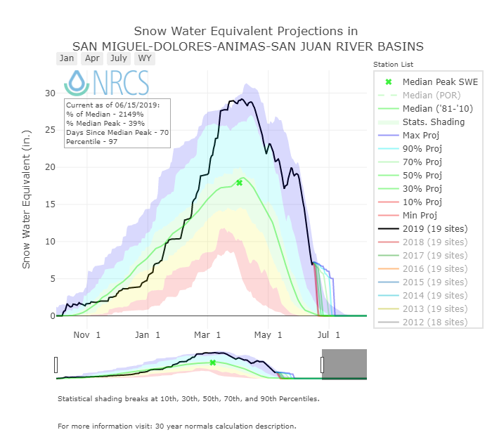
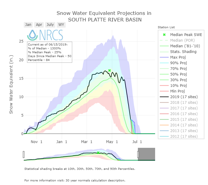
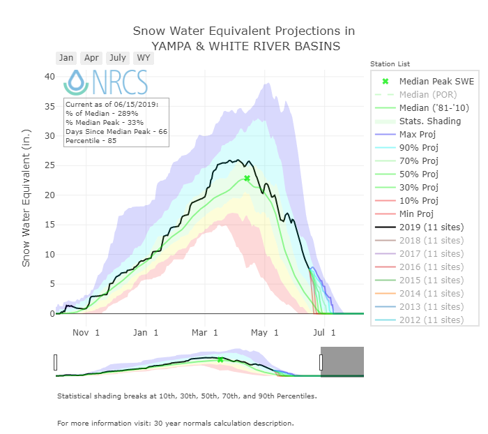
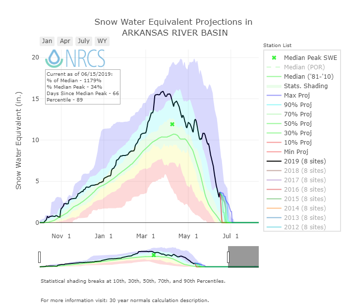
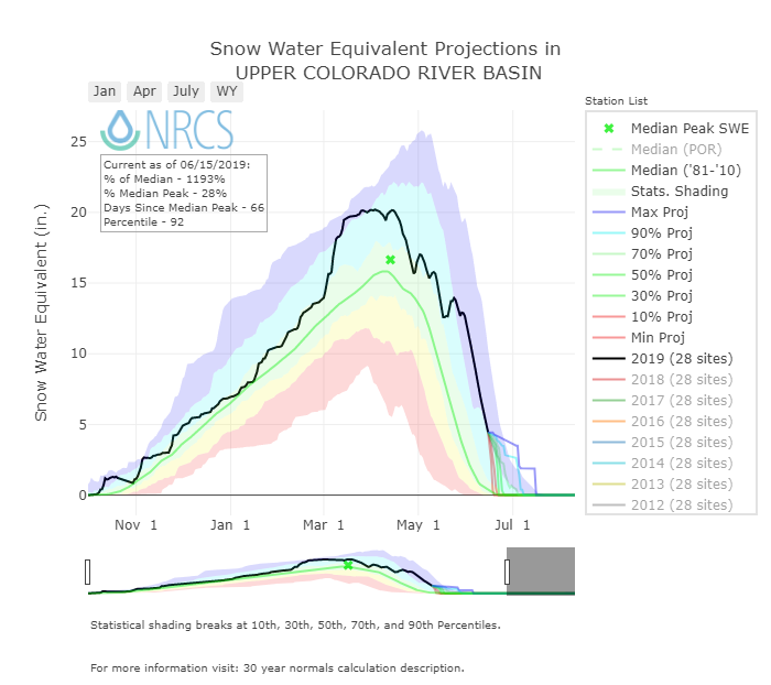
Below: Plots of basin SWE
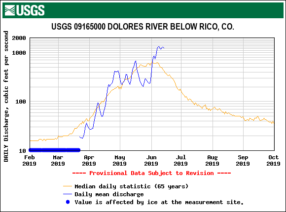
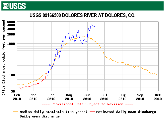
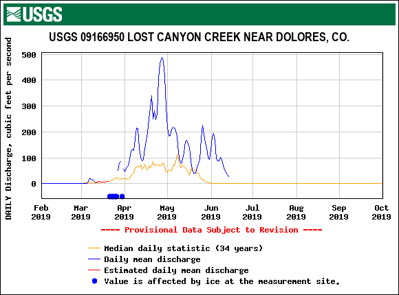
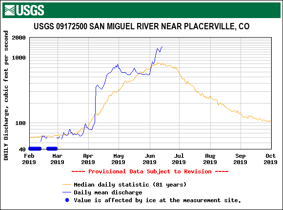
Below: Hydrographs from around the state of Colorado.