June 20, 2019: 1” Precip, Wintry Weekend, Journal Publication
Greetings from Silverton,
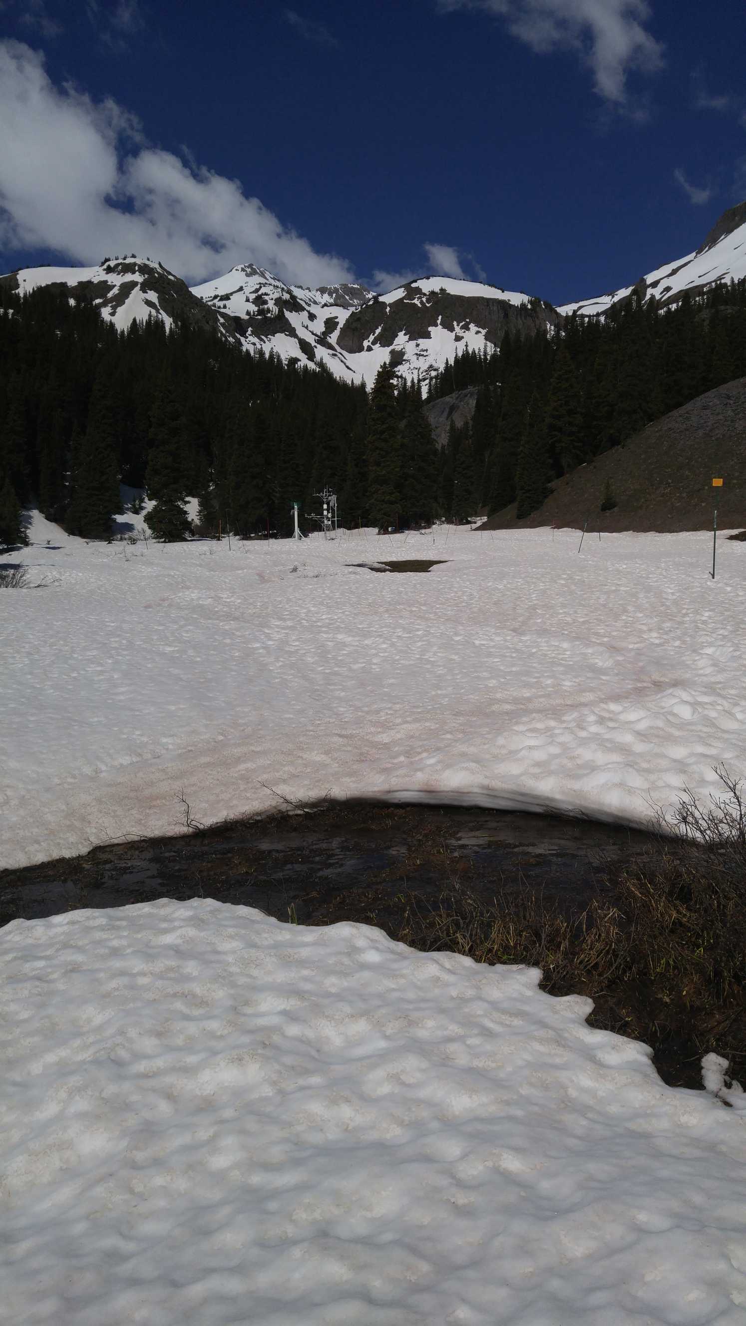
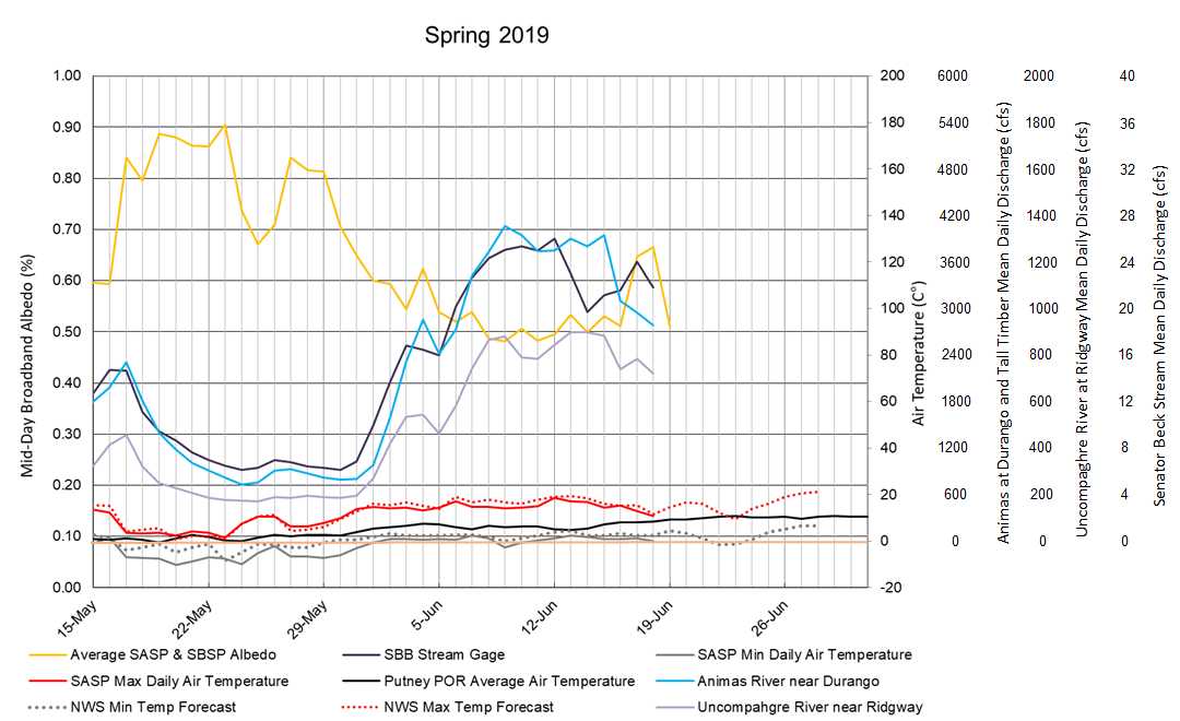
A skimming of new snow is visible above treeline today. In the last 2 days (June 17-18) SASP received 1”of precipitation. This morning during my visit to SASP (11,060’) no accumulation was observed, but there was a trace of cleaner new snow in shaded areas with open areas catching the morning sun already completely showing surface dust. SBSP (12,200’) recorded ~1” of snow accumulation under the snow depth sensor so clearly more precipitation fell as snow at higher elevations. The effect on albedo is evident, over the last couple days SASP’s albedo increased 9% and SBSP increased 24% (see plots below). This albedo reset and the cooler temperatures tapped the brakes on snowmelt yet again. But it is quick to deteriorate, as of Wednesday average albedo dropped 15%. The forecast is for more wintry weather to pick up going into the weekend. On Thursday models are in good agreement for light precipitation beginning late afternoon and continuing into Friday with showers and chances of thunderstorms increasing. And this is exciting, starting Friday temperatures are expected to start dropping (below freezing at night around Red Mt Pass) with snow levels to be near 10,000’. This round looks to favor Northern and Central Mountains. Some of the higher areas could see 1-2” of snow. So it appears going into the weekend snowmelt will be hampered by potential storms and even maybe snow in the high country.
Still 16” SWE at Red Mt SNOTEL and at SBSP there is still 23”. We are assuredly on track, especially with the inclement weather this weekend, for this to be the latest date snow melts out at SASP not to mention SBSP. Please see plots pertaining to peak discharge in SBB below. Every 5-years we do a plant survey where ecologists document vegetation types, abundance, and location in order to understand changes due to climate change and other factors in our research basin. This year snow in the upper basin will prevent this from taking place so we are forced to postpone until next year.
Journal Publication: Finally, after much work from many folks a publication of which our Senator Beck Study Basin data is included was published. The paper is titled “Meteorological and evaluation datasets for snow modelling at 10 reference sites: description of in situ and bias-corrected reanalysis data”. The work describes in situ meteorological forcing and evaluation data, and bias correction reanalysis forcing data, for cold region modelling at 10 sites. These long term datasets are the reference sites chosen for evaluating models participating in the Earth System Model-Snow Model Intercomparison Project. The paper can be downloaded at the following link: https://www.earth-syst-sci-data.net/11/865/2019/
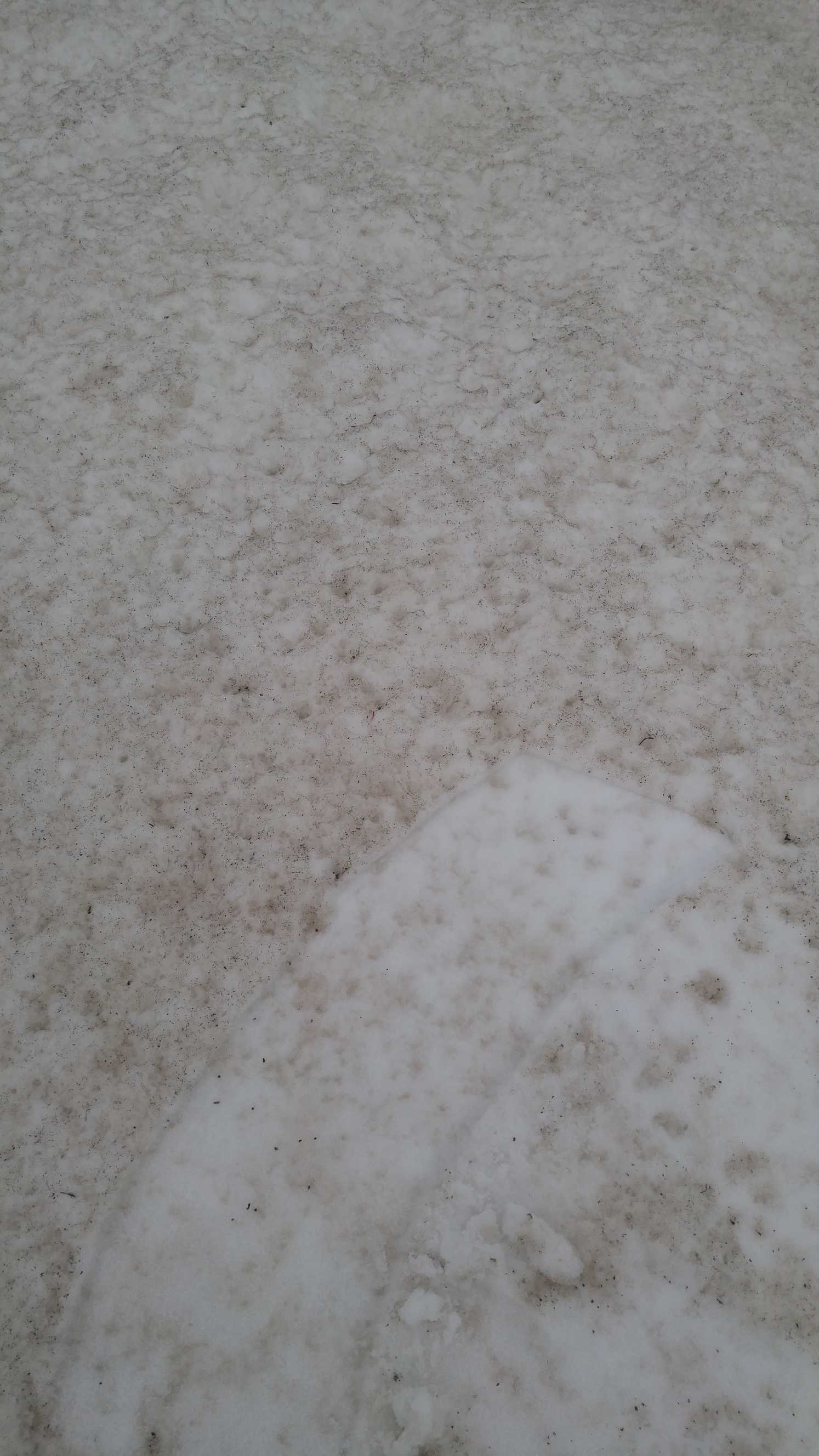
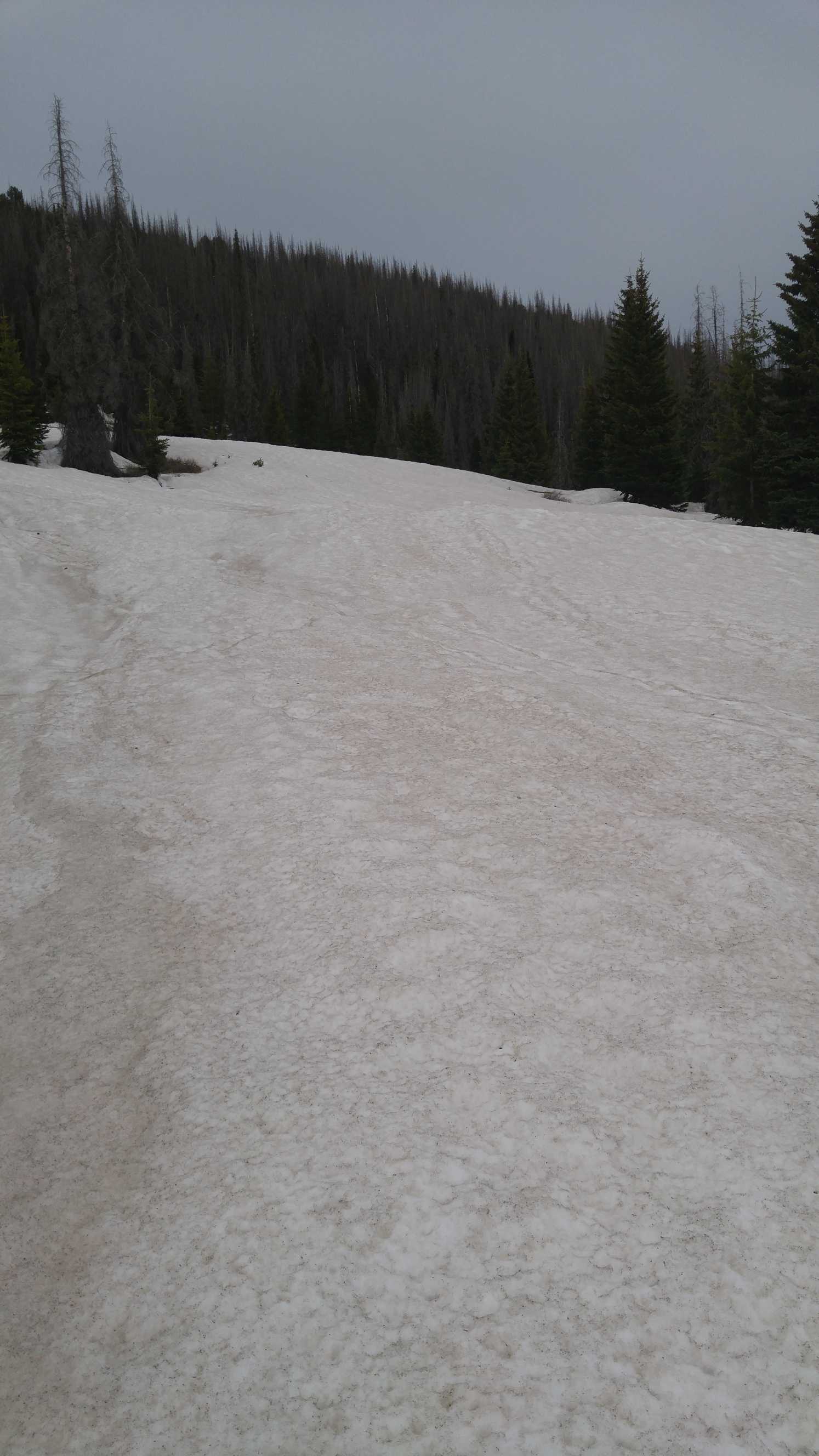
Below: Picture of snow surface at Irwin/Kebler Pass on June 7, a very dirty surface that is comparable to Wolf Cr Pass visited June 18. SASP dust conditions are not as severe as either Irwin/Kebler or Wolf Cr Pass (pictures below) at these observation points. Some pretty bad dust conditions have been observed at Fremont Pass, Independent Pass, and Collegiate Peaks with full emergence, and interestingly more severe than what has been observed at some surrounding CODOS sample sites.

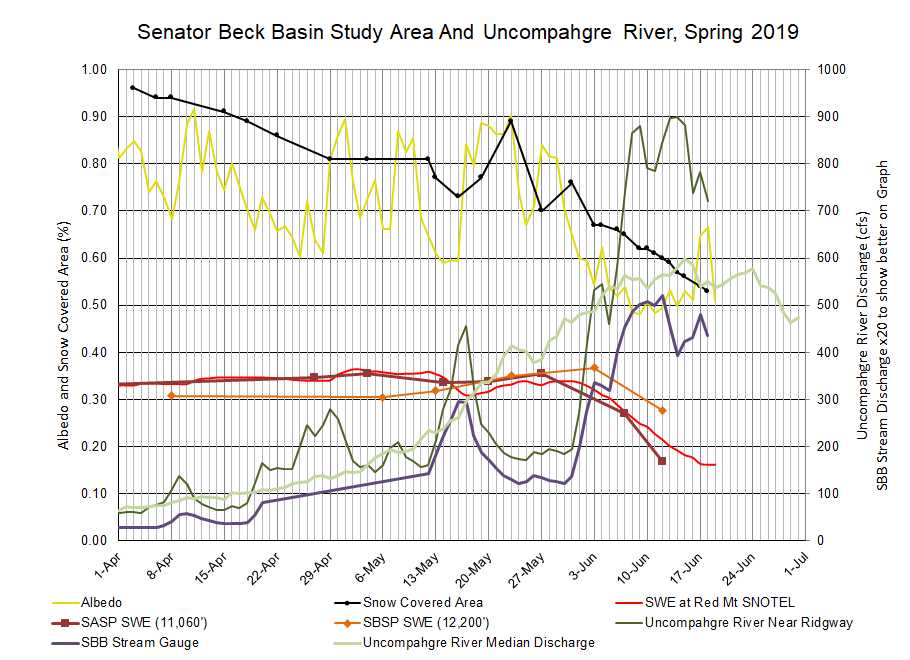
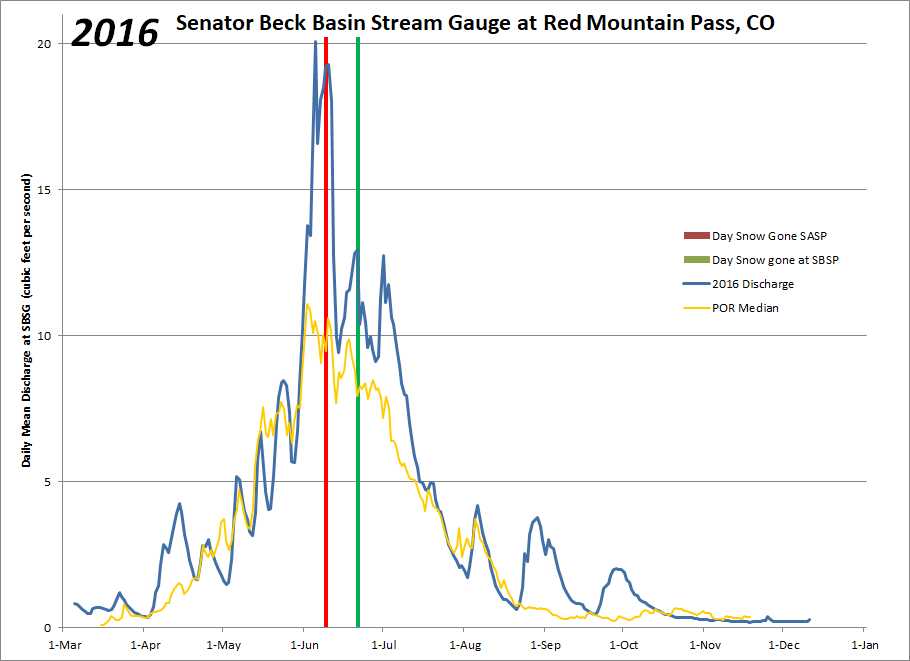
Below: A comparable year to this year is WY2011. In 2011 snow was gone at SASP on June 23 and June 29 at SBSP. Currently with 8” SWE left at SASP and assuming a melt rate of 1”/day (see CODOS Update from June 16), snow will not be gone until around June 27, at earliest I would think with the current weather forecast. At SBSP it looks to be around the second week of July under that melt rate assumption. Typically, when snow has left SASP is when we see peak discharge (or the first peak) in SBB, and when snow is gone at SBSP is when we see the second peak which can be bigger than the first. This year is rather unique - like 2011 - with lots of snow and a periodic stormy conditions slowing melt, but I think we still have not seen the peak at our high elevation gage. This is an interesting year and will be great to have in the record books.
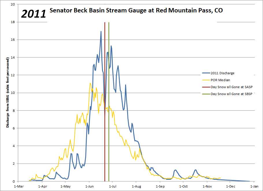
Below: Typically, when SASP melts out that usually means ~50% of snowmelt (flows between March 1 - June 30) have passed through the gage at SBB (Q50). Again this year is unique with snowmelt going well into July. 2011 in the below plot is the upper right most dot.

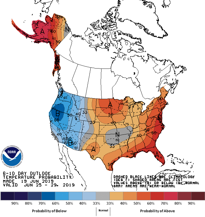
Below: The 6-10 day outlook for June 25-29. It is expected to return to sunny and dry conditions on Sunday