June 4, 2019: CODOS Tour Part II, Dust Emerged at SASP
Greetings from Silverton,
The last of the CODOS sites were visited this past week and revealed similar conditions as we reported in the May 31 CODOS Tour Part I update. Namely, dust is state-wide and has just emerged or will be emerging within next few days depending on location. Below we show pictures and describe location of dust layers, and likely emergence if not already, of each CODOS sample site. The basic gist is dust events #3 - #6 (D3-6) have combined into one band just underneath surface at most sites at the time of our visit. Once fully exposed the dust will consolidate more so on the surface, currently at most locations it takes up a ~4” band in the snowpack due to layers merging and melt water leeching. At all the sites dust severity looks to be in the moderate category, but this may change once dust is coalesced at surface and fully visible. But regardless of a descriptive label, this dust is severe enough that it will definitely enhance snowmelt rates of a big snowpack.
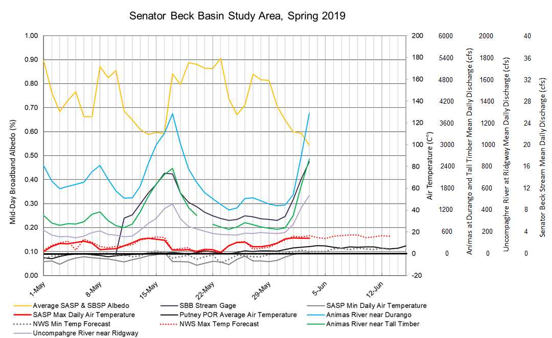
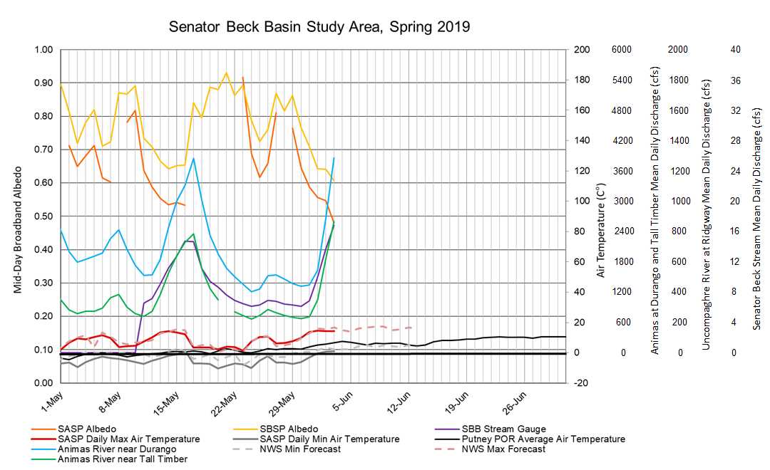
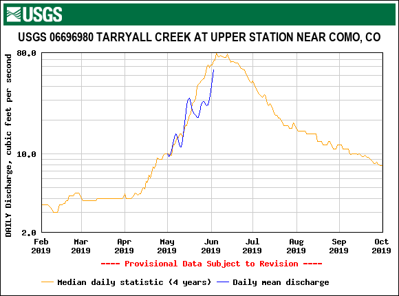
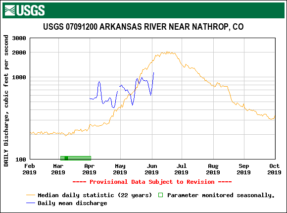
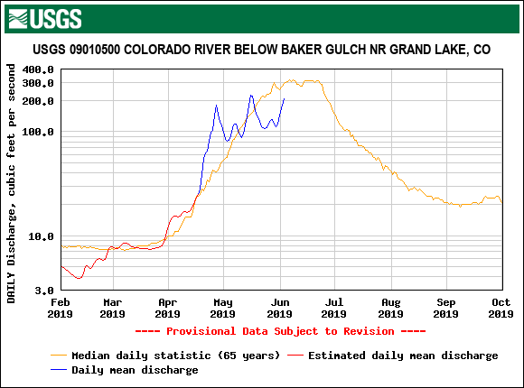
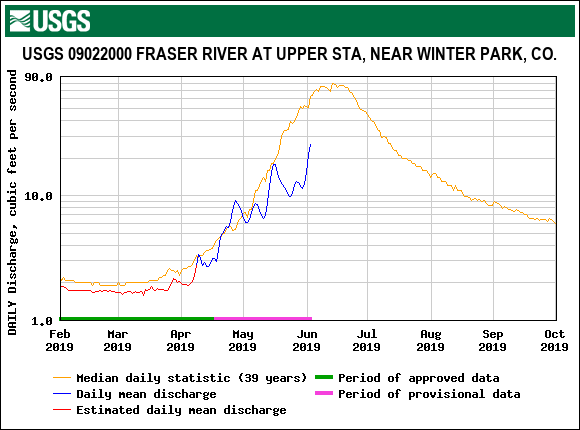
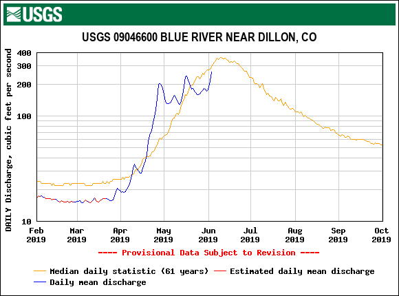
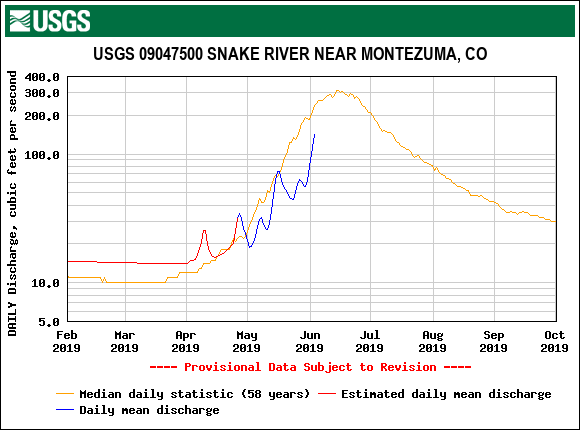
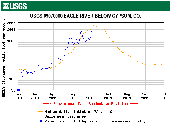
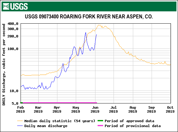
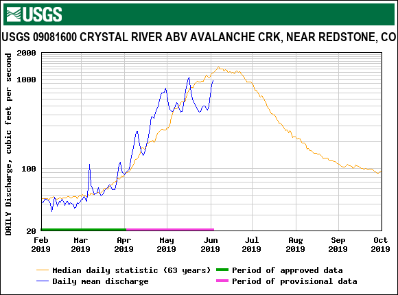
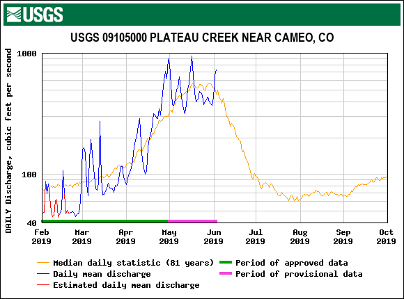
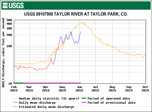
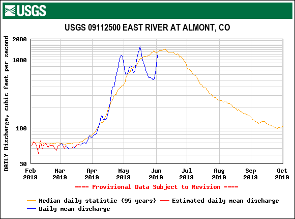
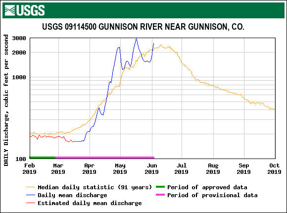
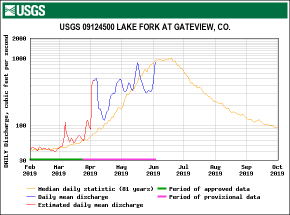
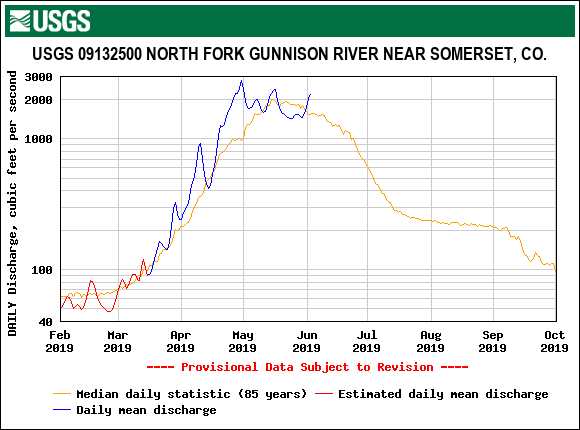
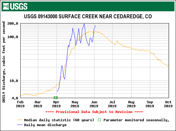
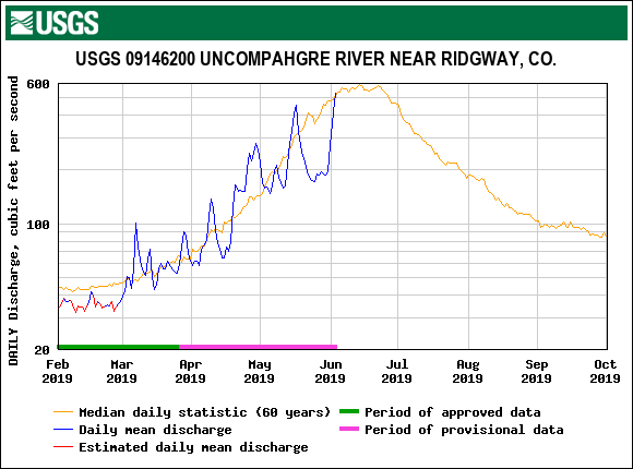
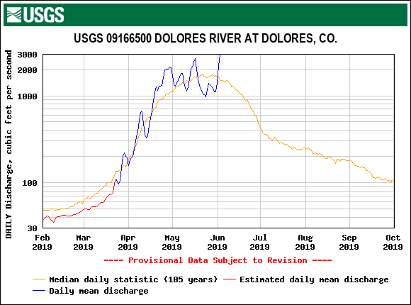
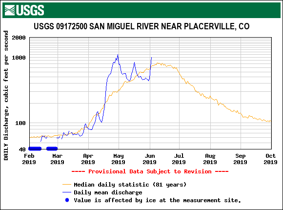
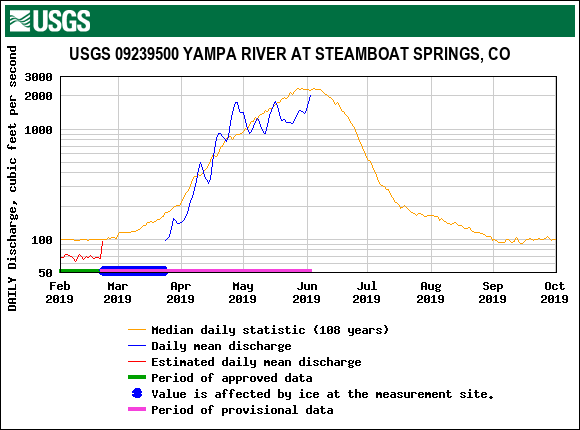
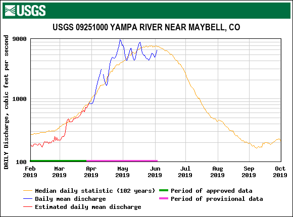
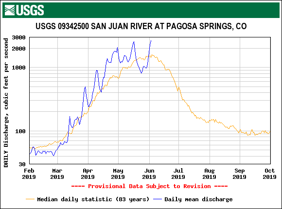
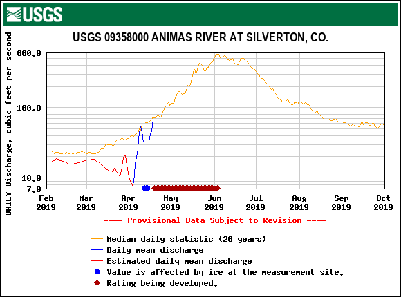
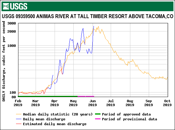
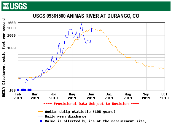
We are in it now. Dust has emerged or is in the final stages of doing so, the weather has been mostly sunny and warm for the last 6 days, and streamflows have spiked and will continue to rise (see hydrographs below). The forecast calls for chances of thunderstorms thru Friday with the best chances Wednesday/Thursday. This might serve to provide enough cloud cover and cooler temperatures to slow snowmelt temporarily. As of this writing on June 4 here in Silverton there are high overcast clouds and blustery conditions but there have also been periods of sunny and warm this morning. If the higher elevations were to see a skimming of snow (hail/graupel) from one of these storms it would provide a very brief (1-day) albedo reset that would likely result in a very brief pause in the hydrograph. But at this point it looks like the best chances of precipitation is in the form of rain. Towards the weekend and early next week it looks to be mostly sunny skies and near normal temperatures - snowmelt will continue with dust now fully prepared to help.
We intend to track snowmelt, streamflows, and weather conditions closely the next few weeks. Please contact us if you have any questions or if we can provide additional data that may be helpful.
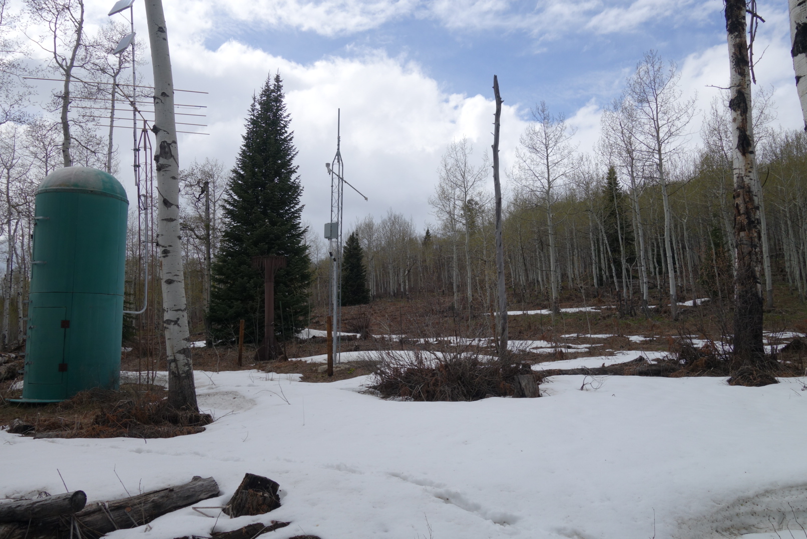
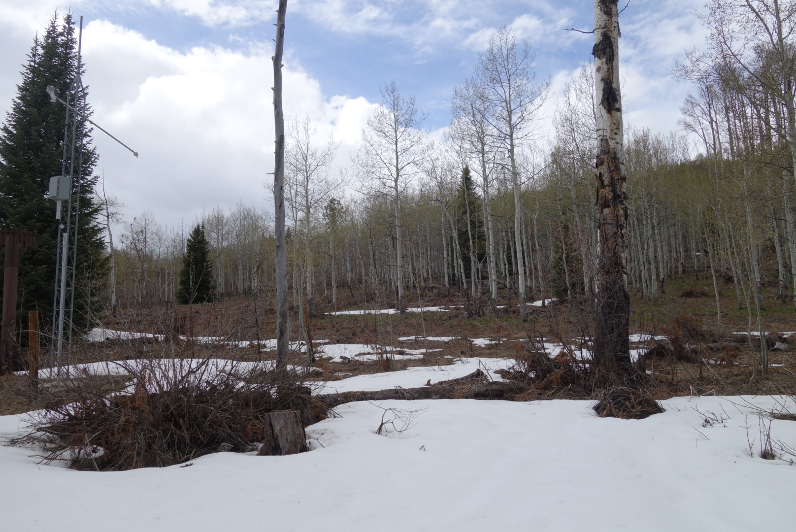
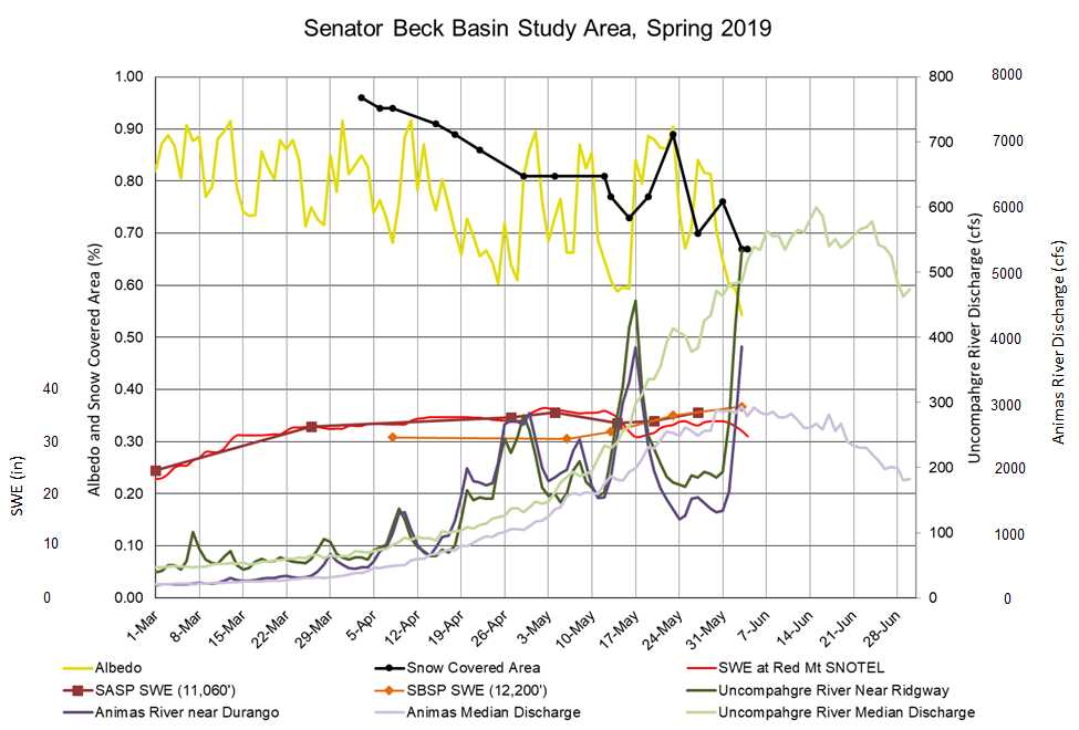
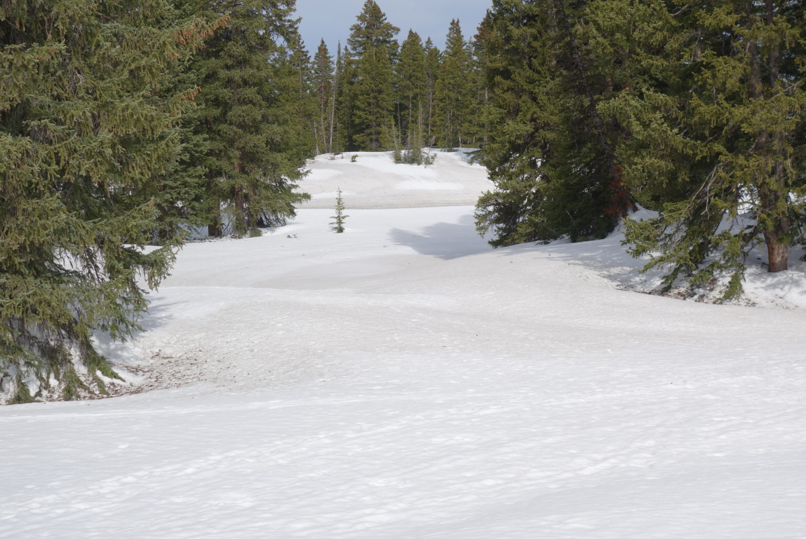
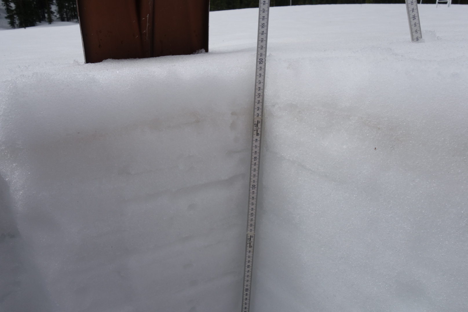
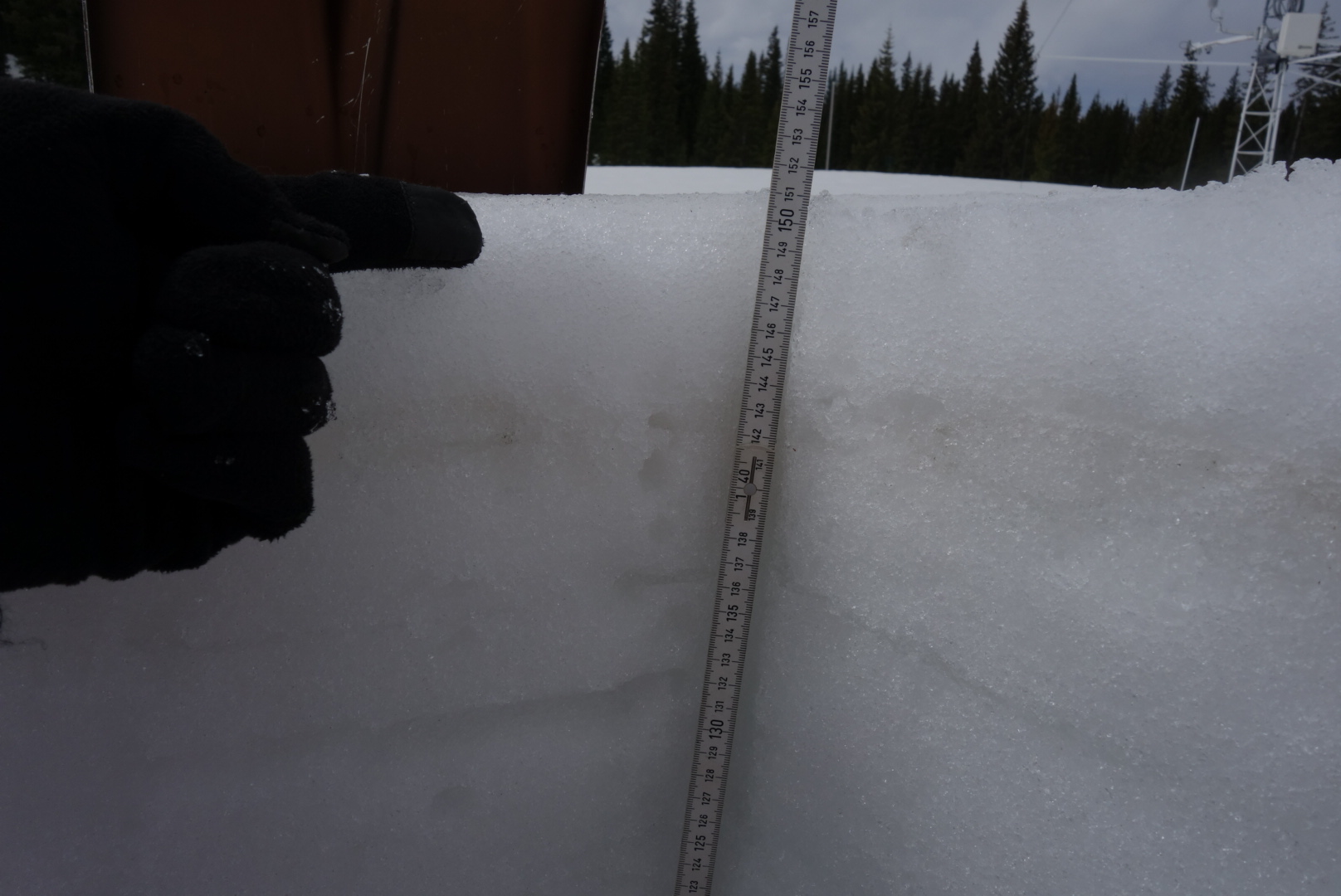
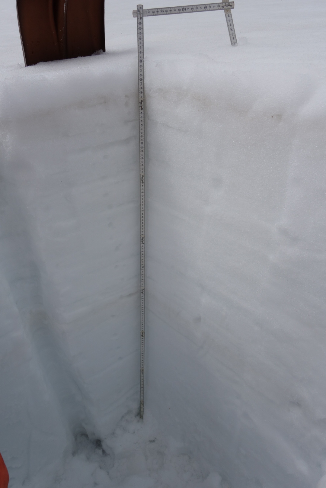
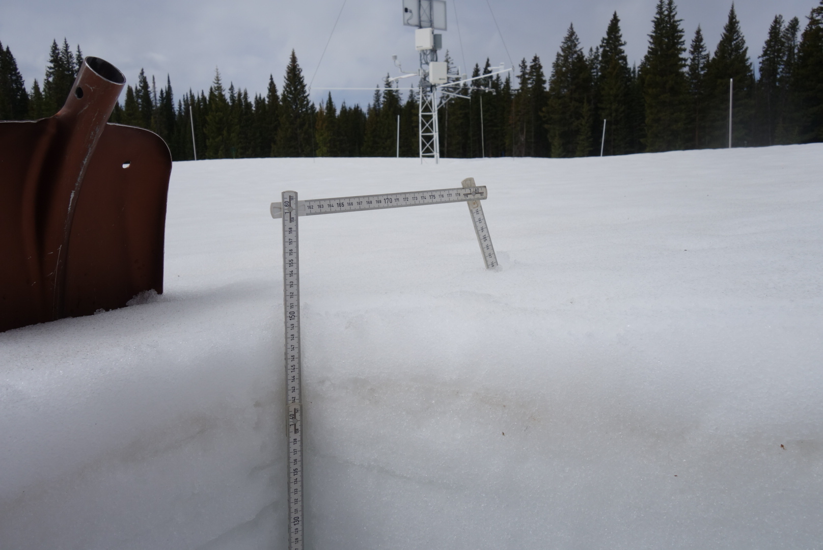
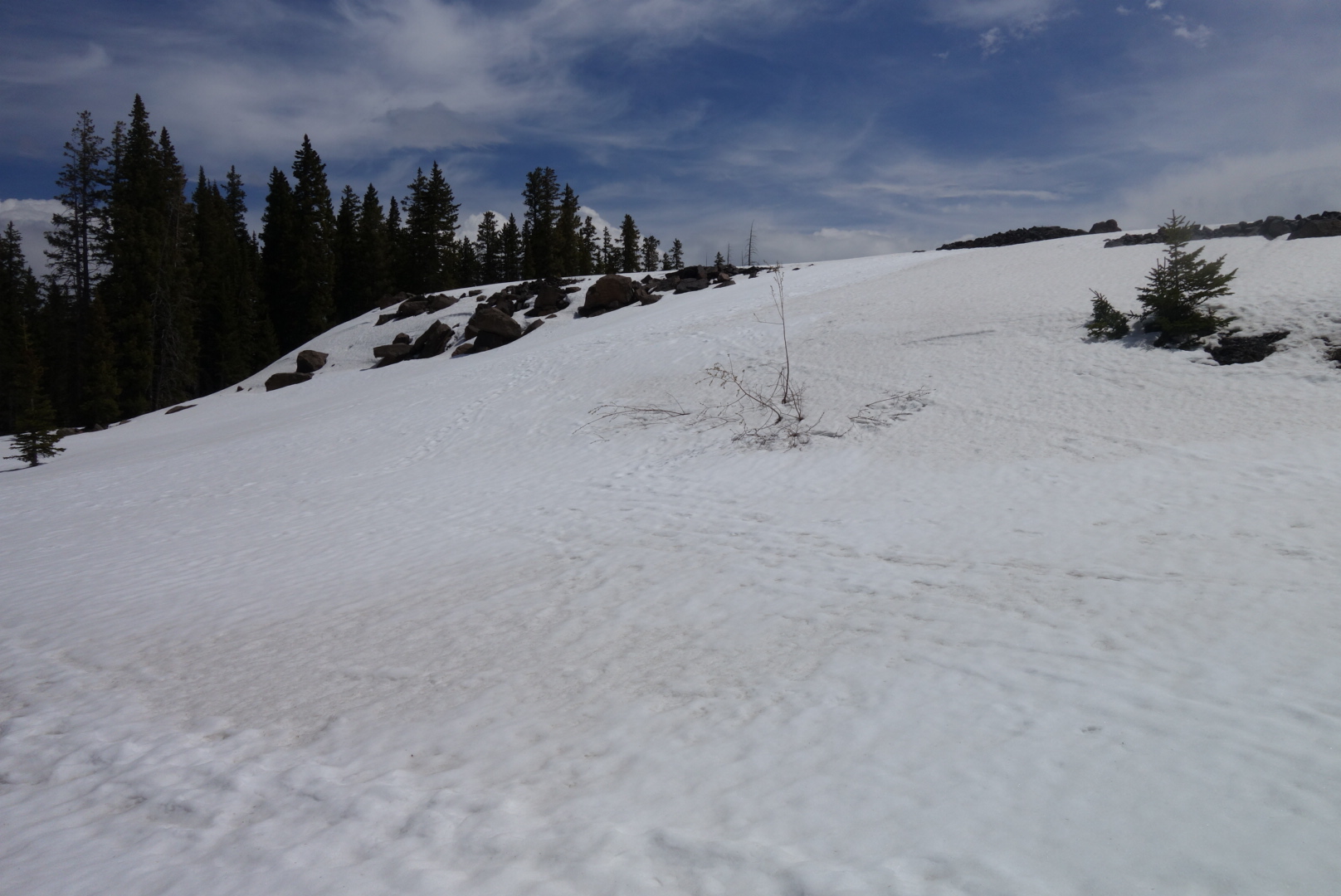
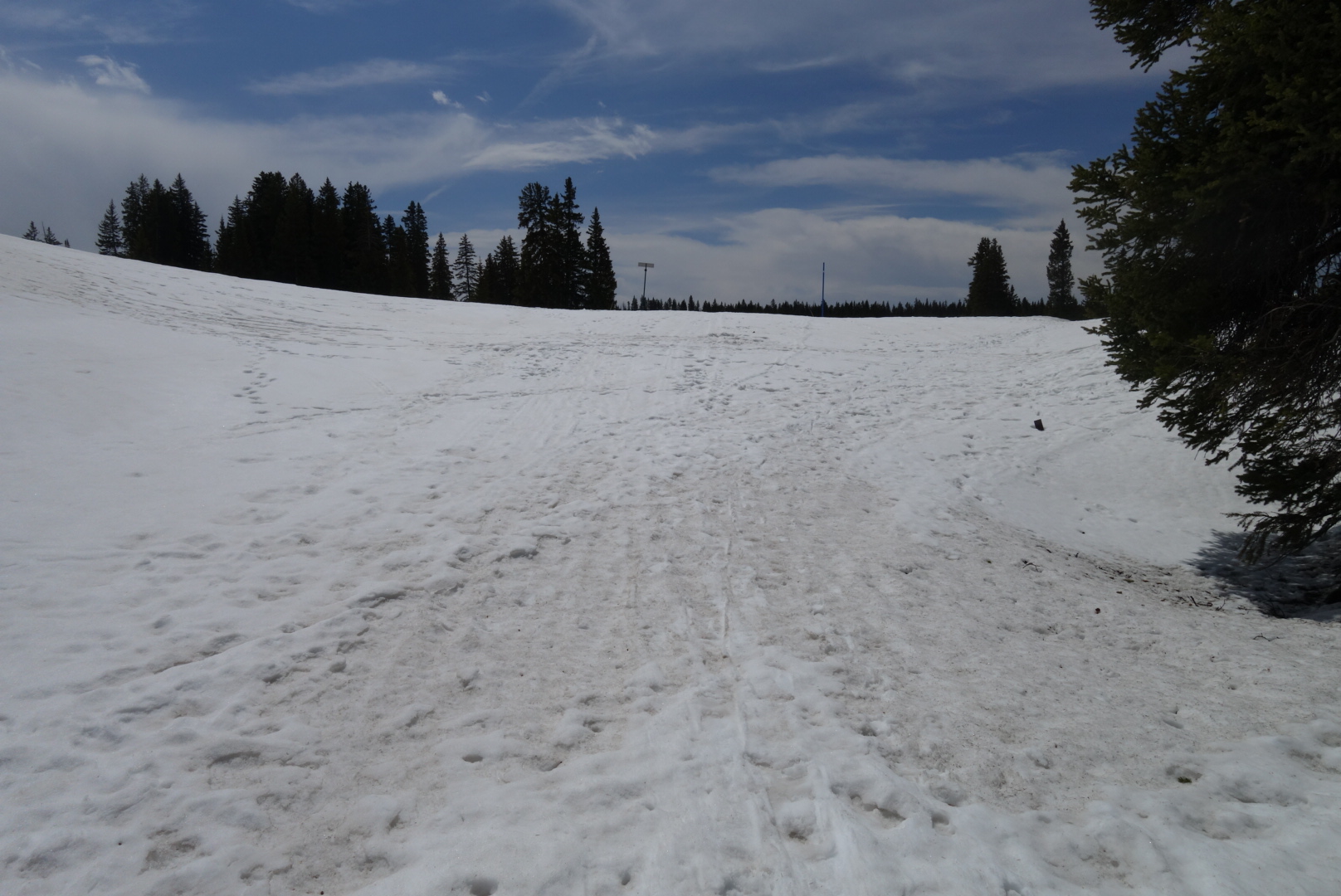
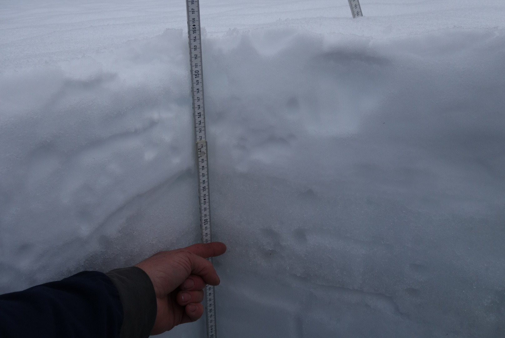
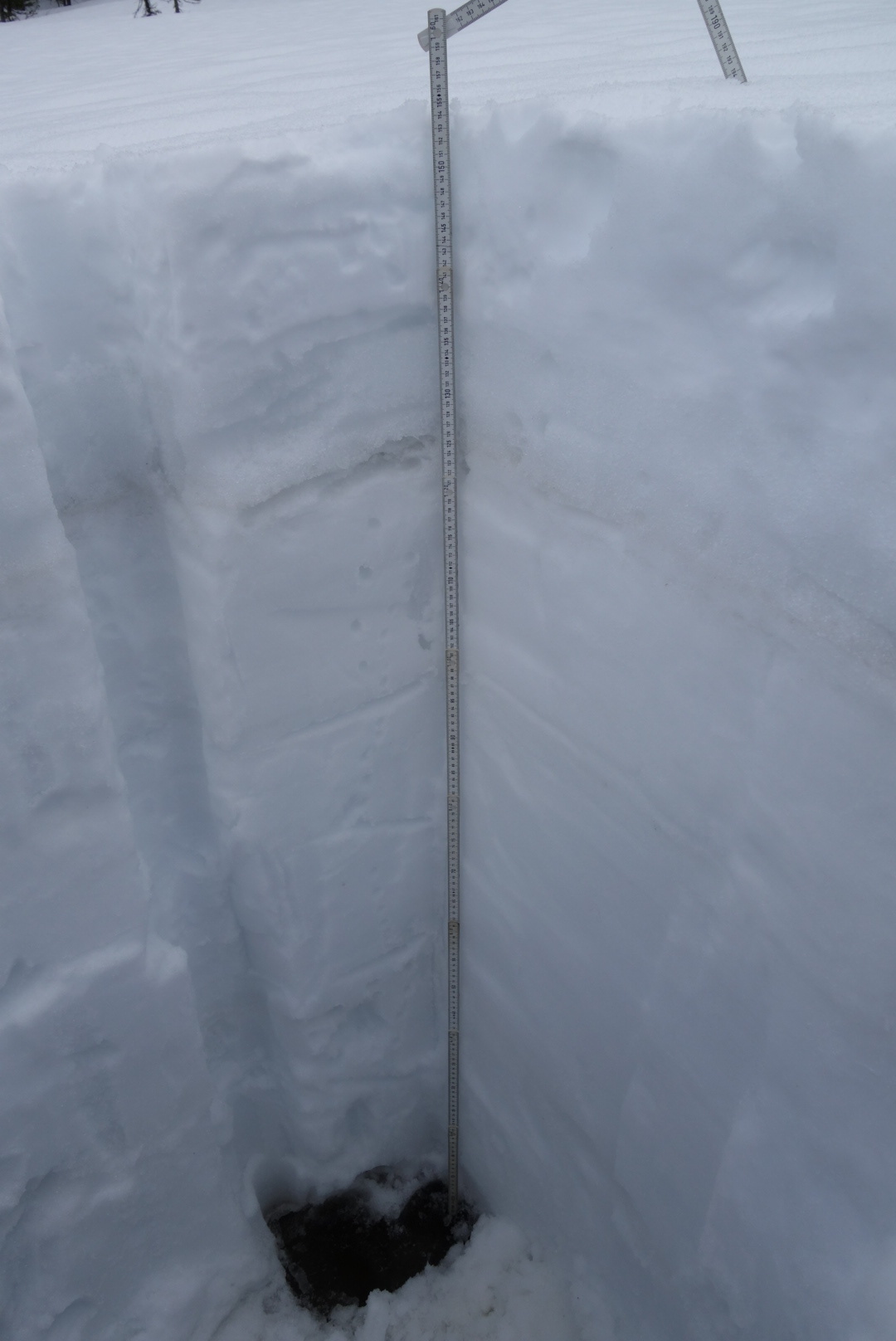
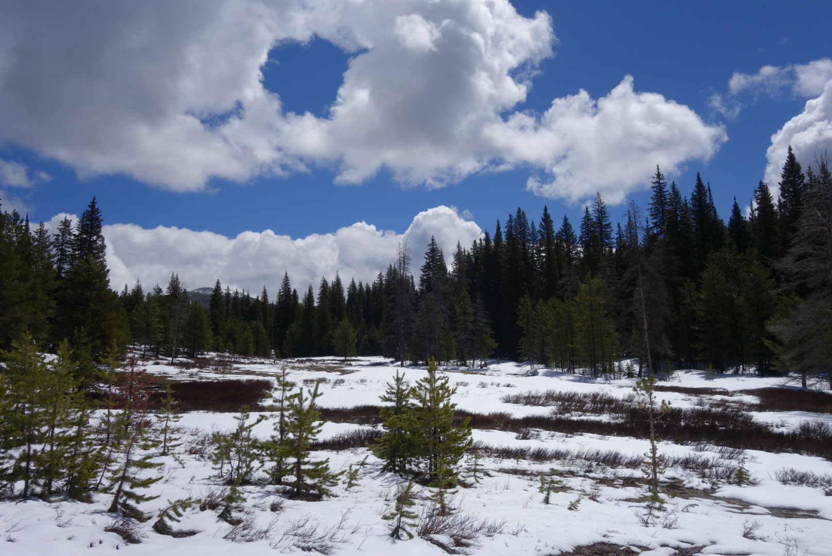
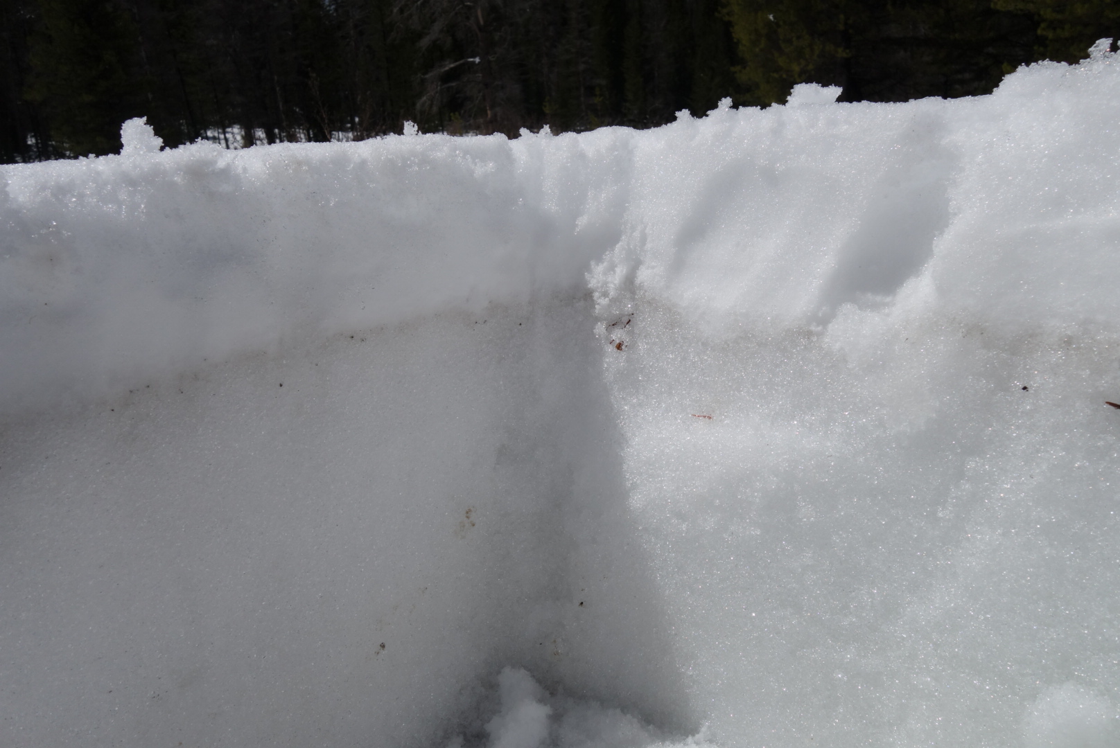
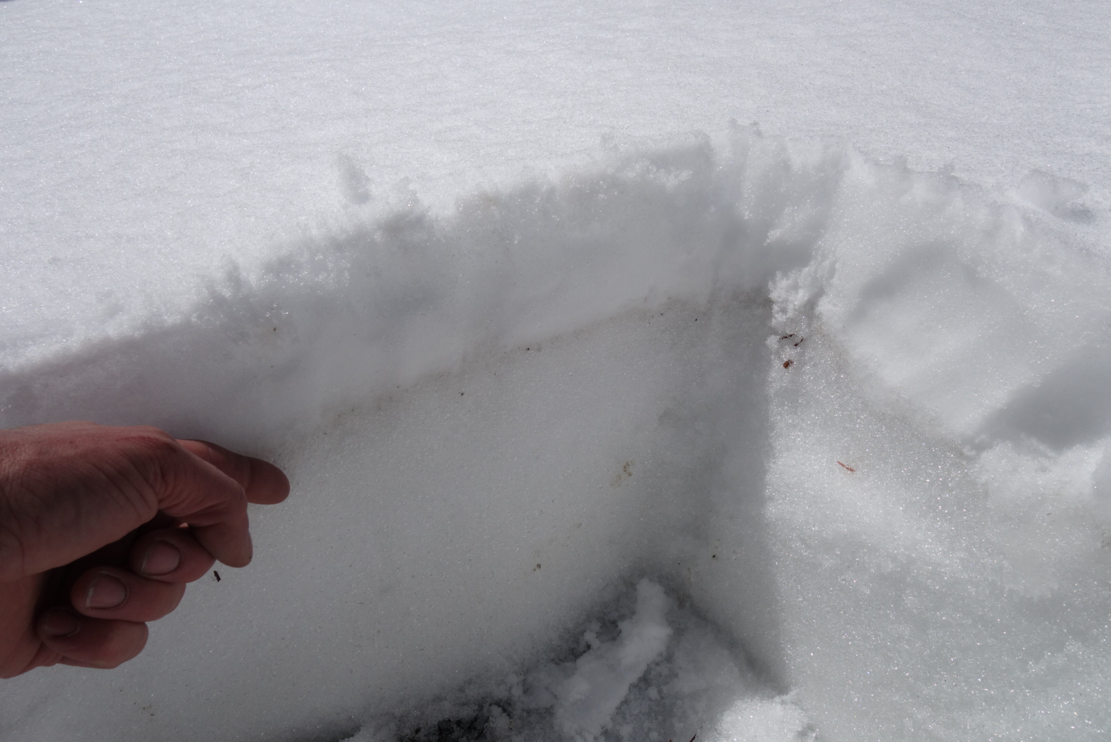
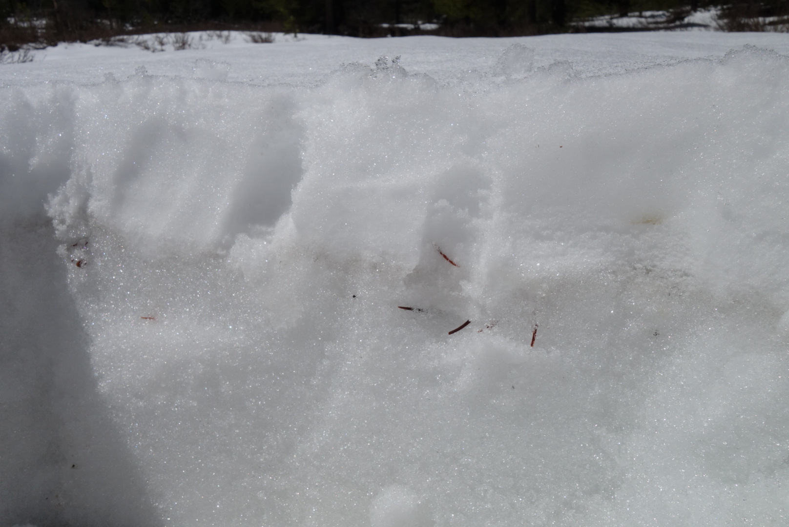
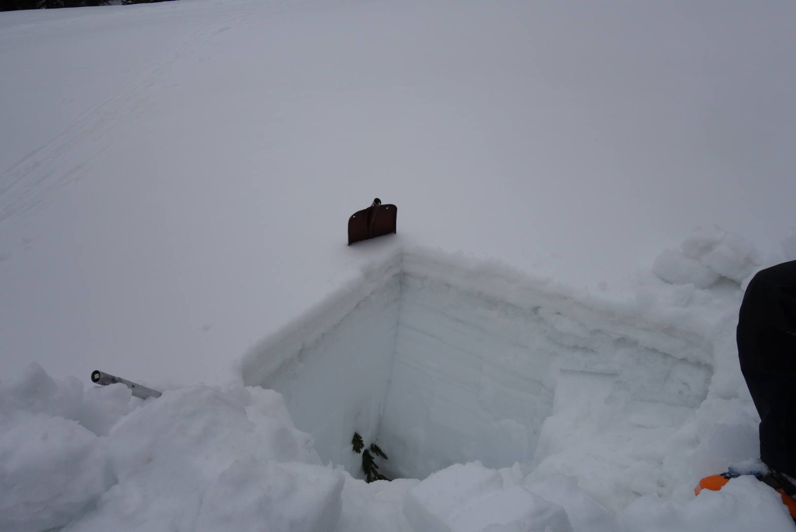
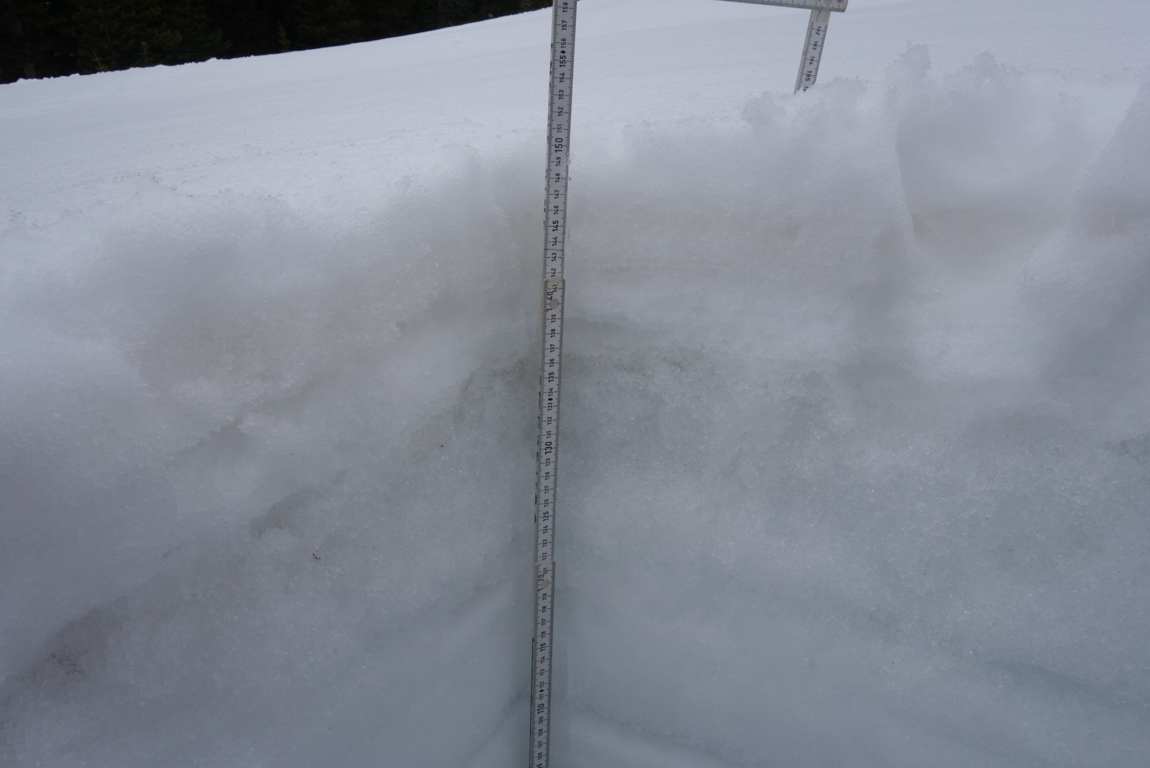
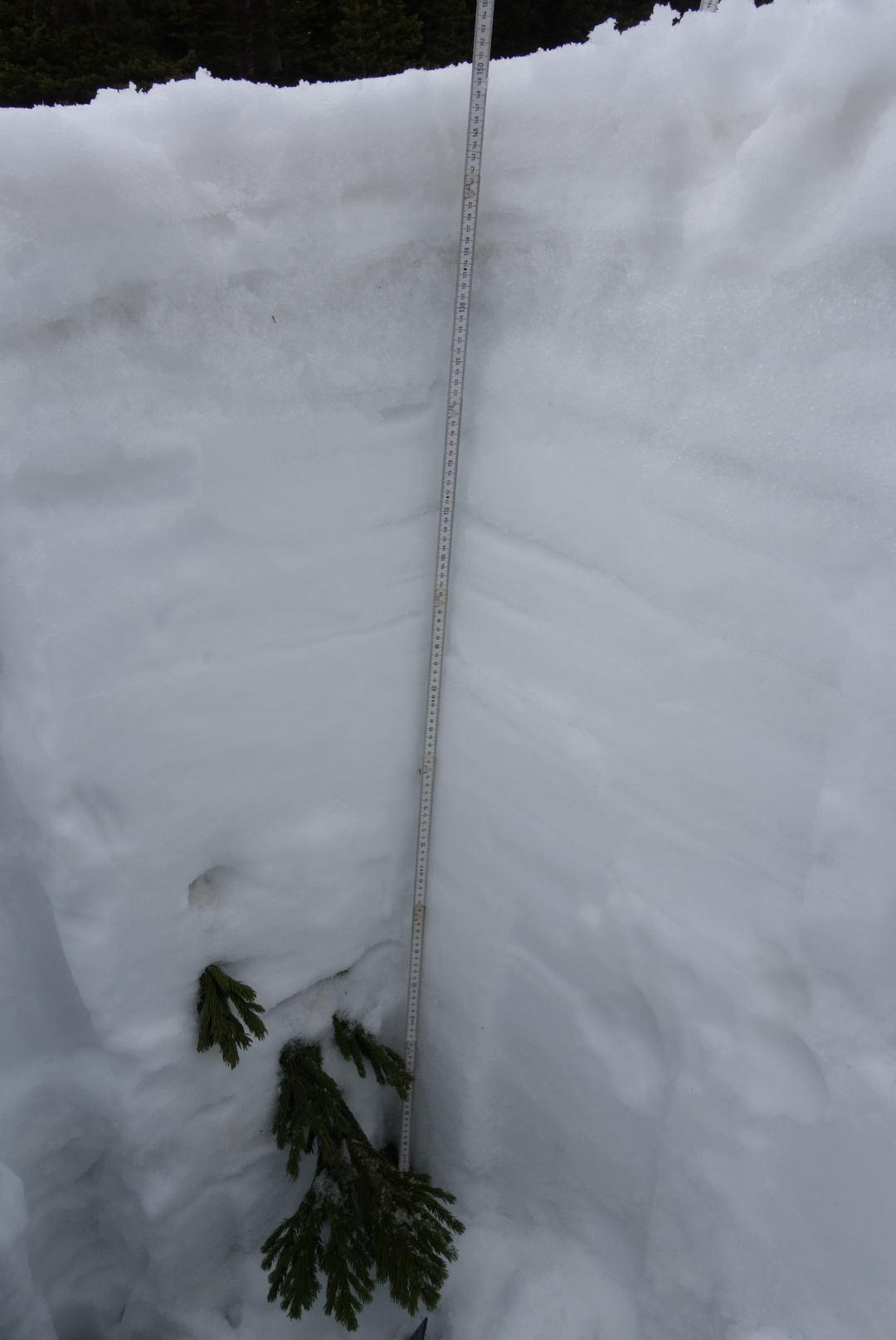
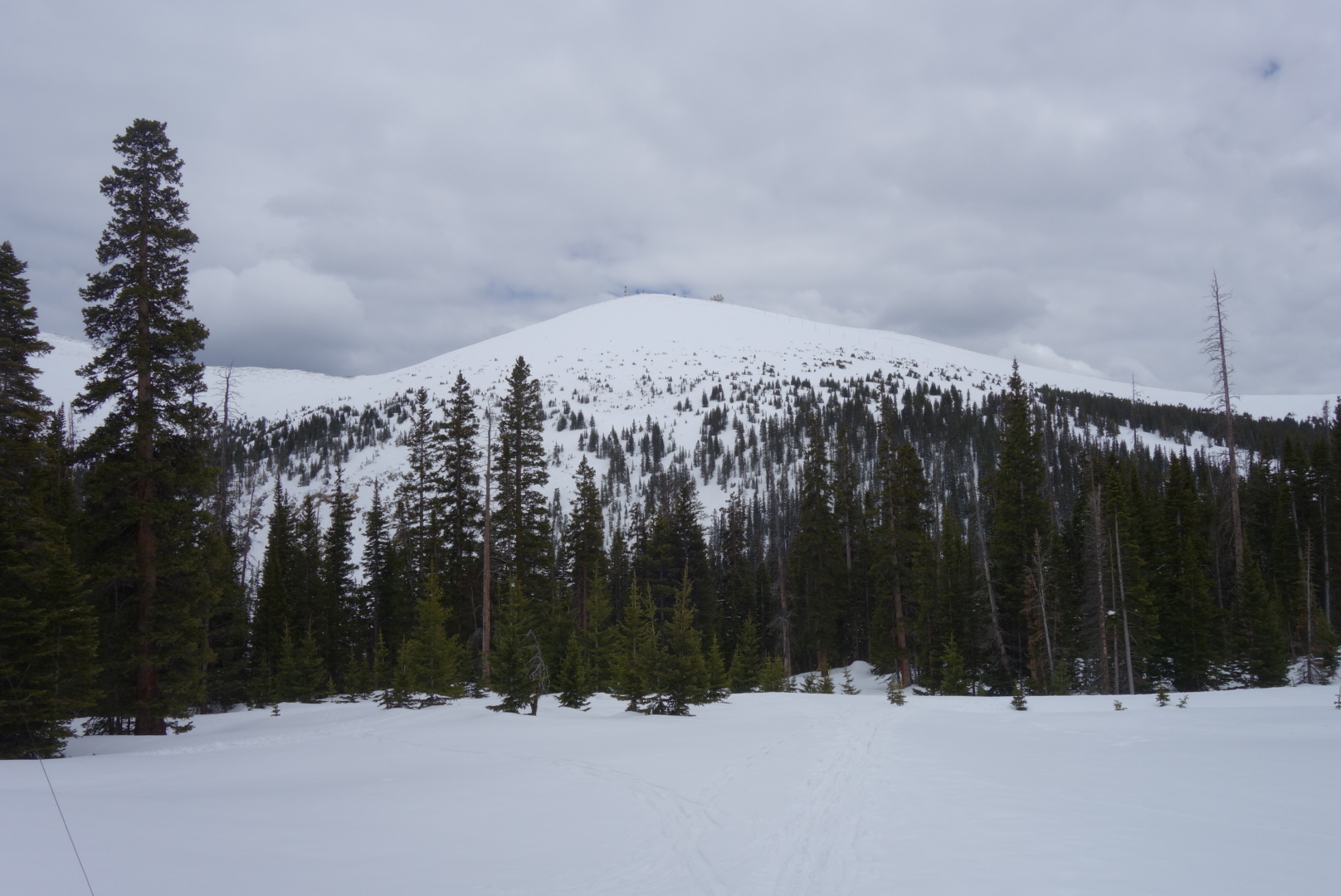
Swamp Angel Study Plot - June 4, 2019
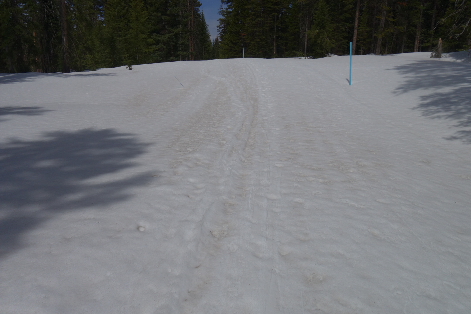
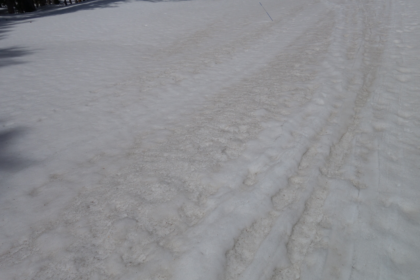
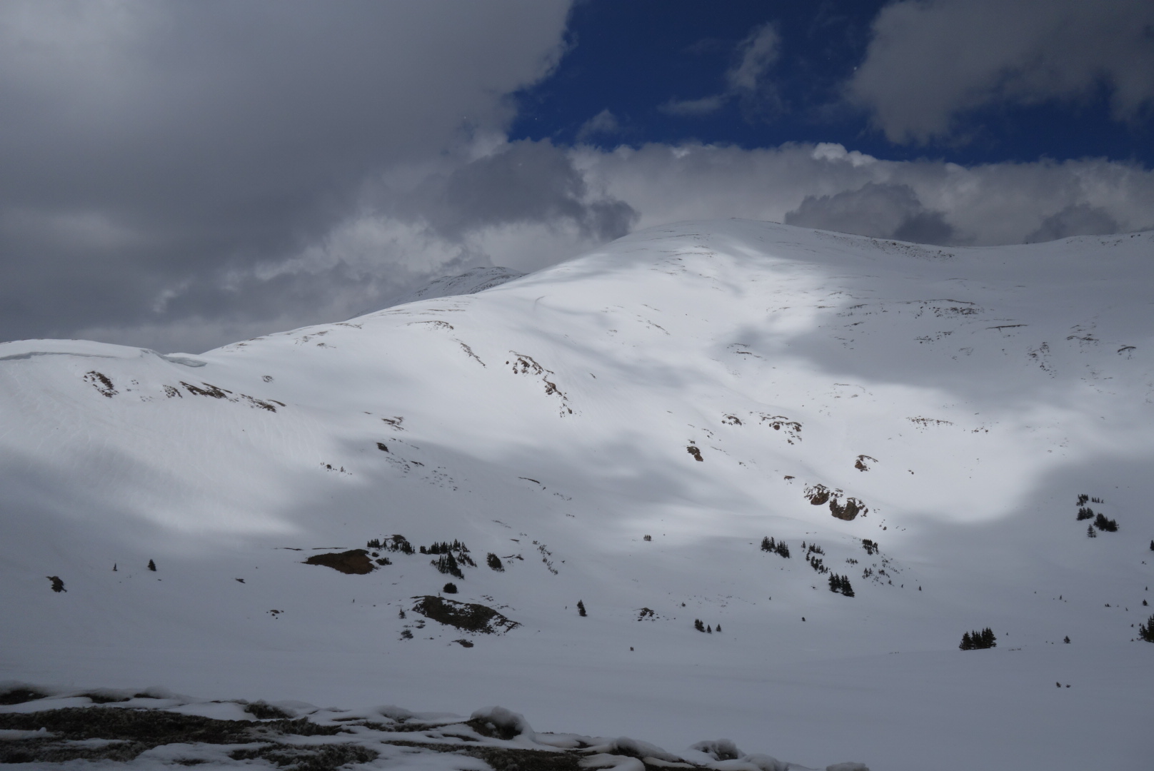
Dust layers D3-6 have emerged at the surface at SASP and the surrounding area. D2, the last relevant dust layer is under the surface by about 8”. We have seen pretty steep upward trends in the hydrographs these last 5 days, with dust exposure now being more widespread this will continue, maybe lessened a bit depending on chances of thunderstorms and cloud cover next few days. The first two pictures below show sloughs that have ran on dust interfaces. In the second picture you can see how the dust was concentrated by the slide at the base of the slope


Below: Plots of streamflow, albedo, and air temperature forecast. No surprise to see the sharp albedo degradation (especially at the lower elevation SASP site) and sharp turn northwards in the hydrographs. Snow covered area of the Animas Basin will deplete quickly going into next week. SWE at Red Mt SNOTEL, SASP, and SBSP is starting it’s dive towards zero.
GRAND MESA - JUNE 2, 2019
At Grand Mesa dust was evident on the surface (D6) and our snow profile revealed majority of dust (D3-5) is about 3” under the surface, or about 1.3” of SWE lies on top of this major dust band. Total snow depth was 5’ and D2 is located half way down at 2.5’ depth. Profile SWE was 29.5”, on the same day Mesa Lakes SNOTEL reported 17.6”. Dust will continue to emerge rapidly, Mesa Lakes lost 1” SWE from June 2-3, within next couple days - if not already - D3-6 will be fully at the surface.
RABBIT EARS - May 30, 2019
On May 30 SWE at Rabbit Ears was 25.2” in the CODOS snow profile while Rabbit Ears SNOTEL reported 16.4” on the same day. Dust was evident on the surface and there was roughly 1’ snow accumulation, 3.5” of SWE, on top of the D3-6 dust band. Currently there is closer to 8” (~1” SWE) on top of this dust. Full emergence of D3-6 in this area will take a few more days, once it does D2 will be 1’ underneath the D3-6 exposed dust. When the snow is at 3.3’ depth all dust layers will be merged and emerged.
Willow Creek - May 30, 2019
Snow is near gone at this sample site. The existing ~1’ snowpack had about 3” of new snow accumulation on the dust layer as of our May 30 visit. Willow Creek SNOTEL lost nearly 4” SWE since that day and currently reports 8.3” SWE. Dust is at the surface and remaining snow is melting quickly.
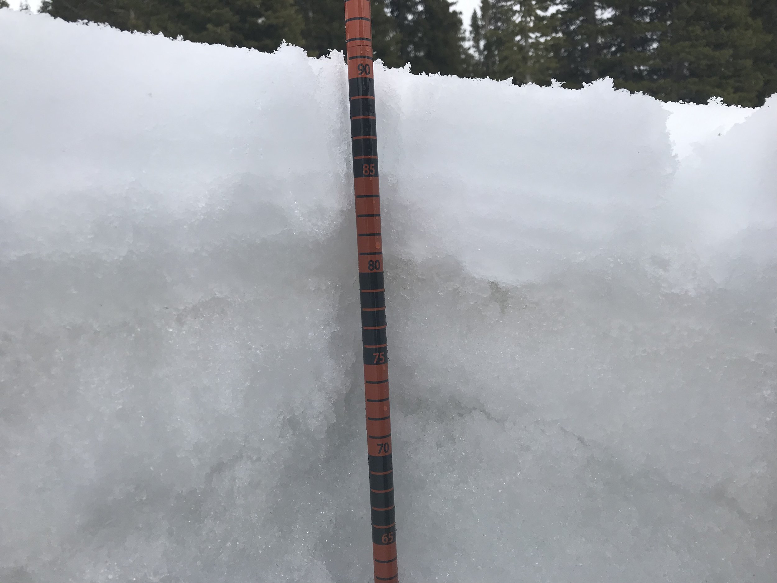
Berthoud Pass - May 31, 2019
This snowpack contained 21” water while collocated Berthoud SNOTEL reported 20.1” SWE. Since then ~3” SWE has been lost so the D3-6 that you see in the below picture is likely emerged and at surface.

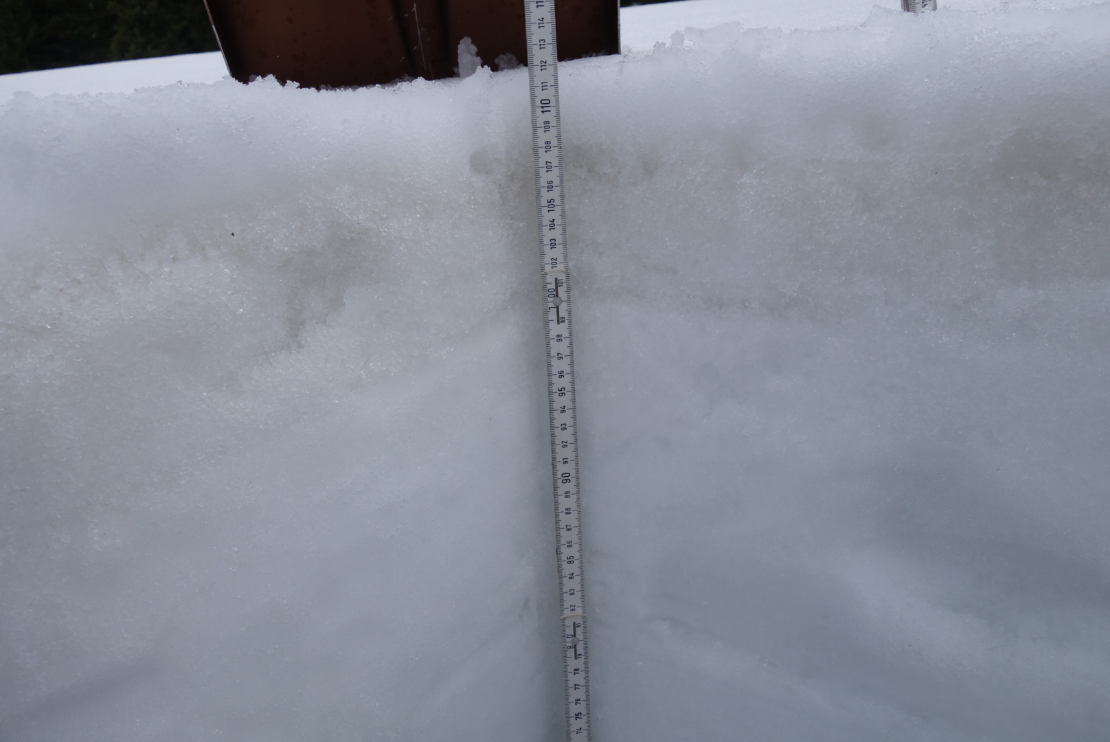
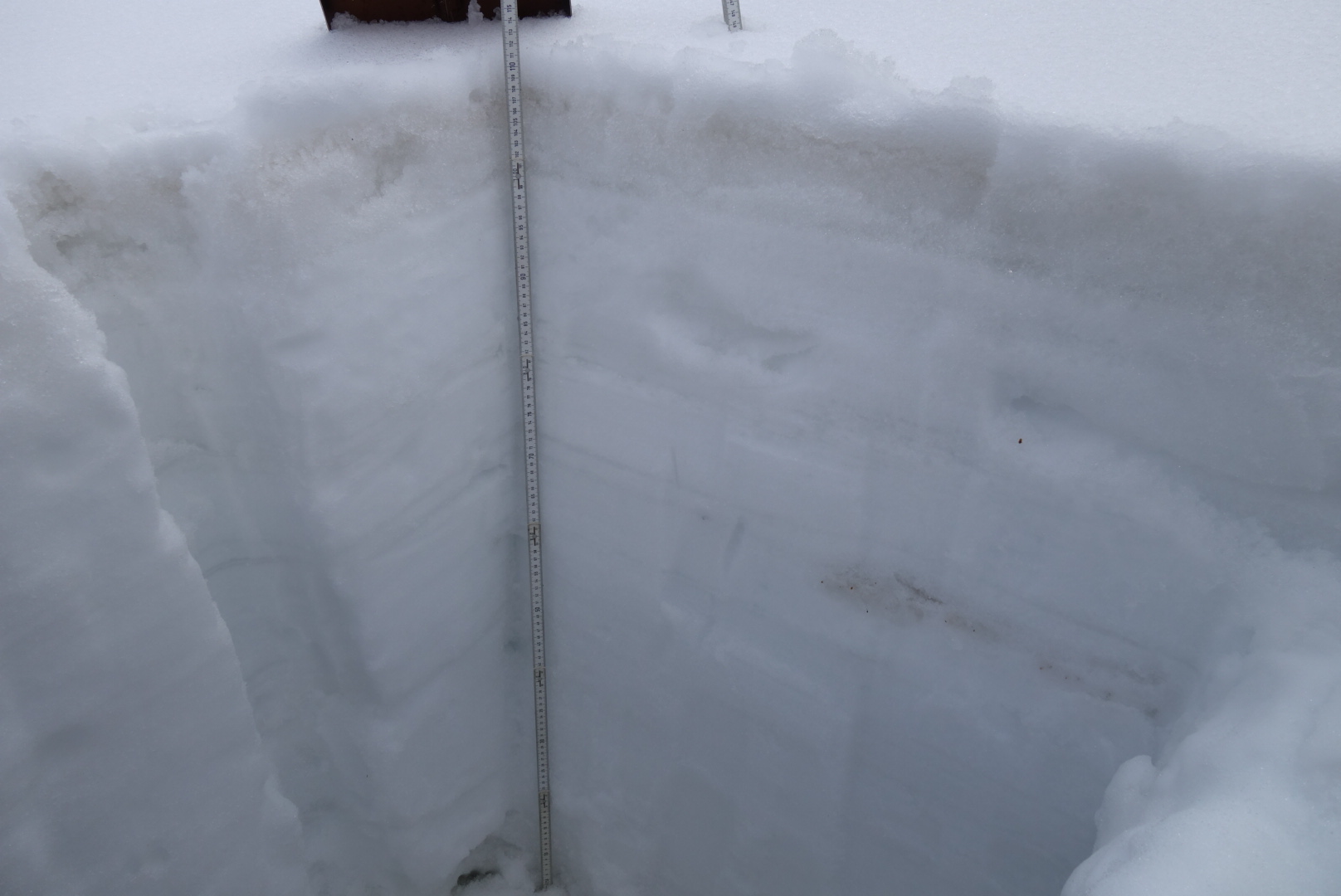
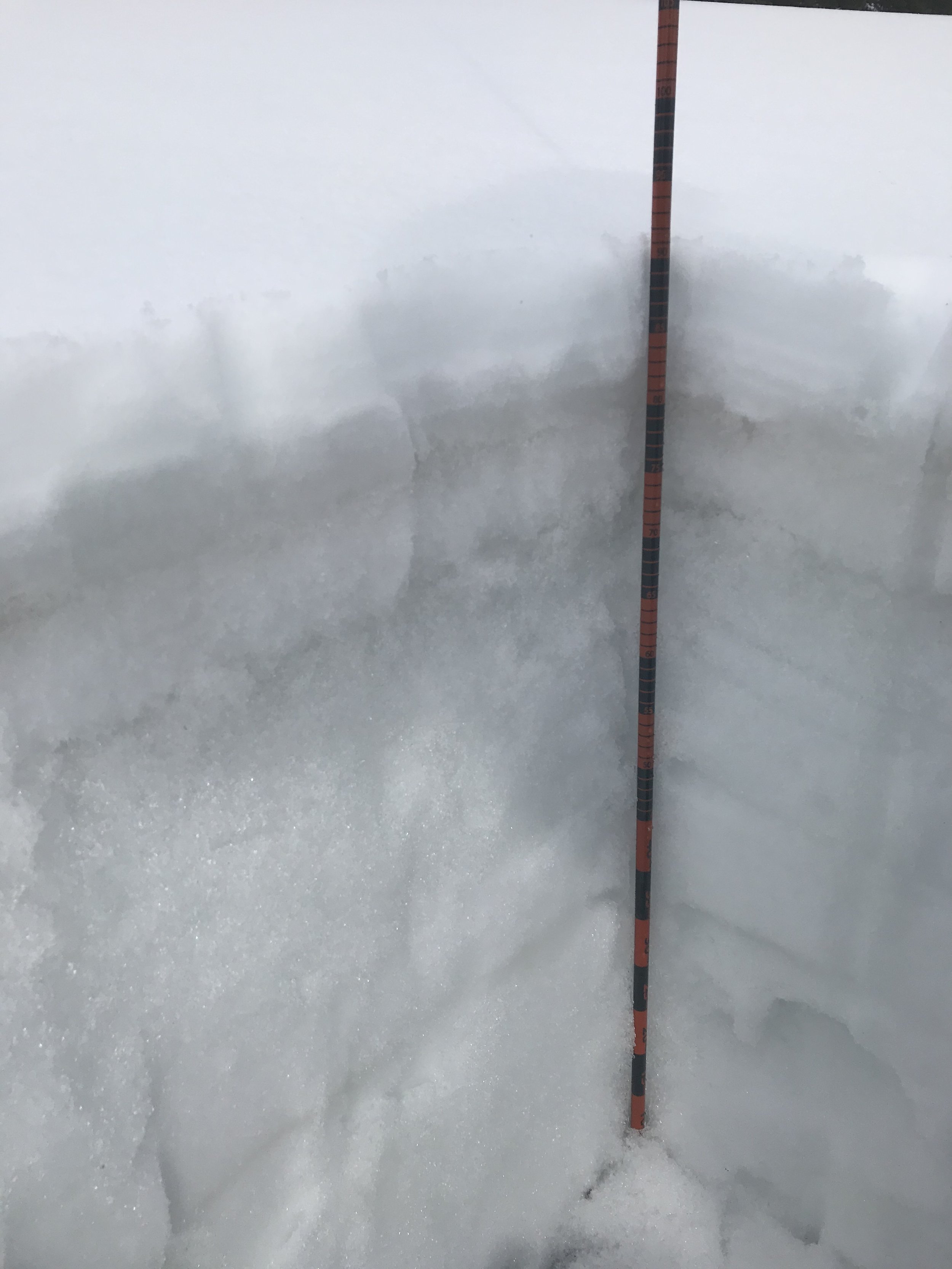
Loveland Pass - May 30, 2019
Dust layer D3-6 was just under the surface at Loveland Pass on May 30. At that time 5” of snow accumulation (2” of SWE) comprised the area above and containing the dust band. Our snow profile had 19” of SWE while nearby Grizzly Peak SNOTEL reported 18.8” SWE. Since then the snowpack has lost 2.5” SWE. The second picture below shows it well. Currently I expect this band of dust to be in the process of emerging.

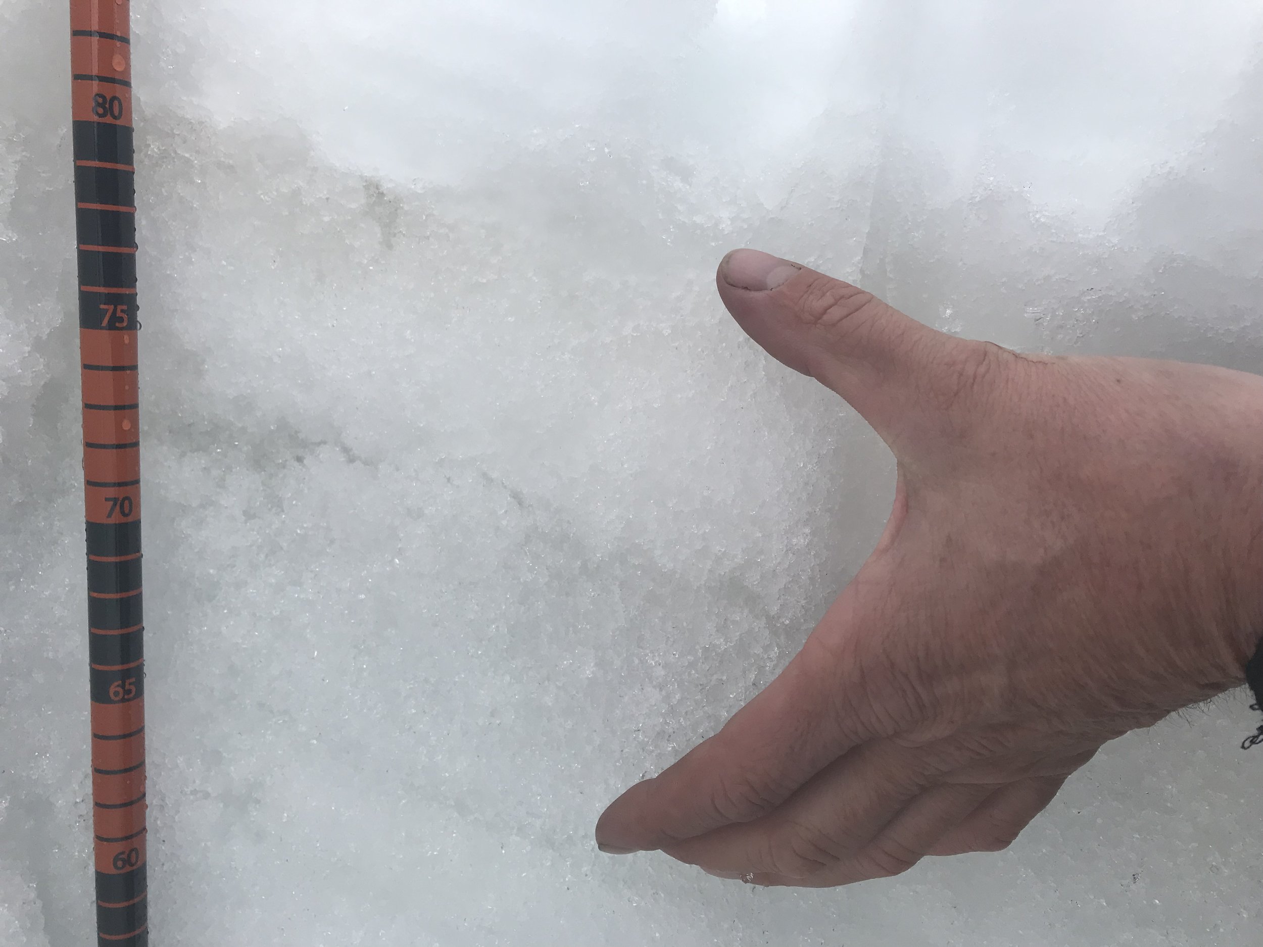
Hoosier Pass - May 30, 2019
We measured 12” SWE at Hoosier Pass while Hoosier SNOTEL reported 21.3”. You have read this story before, D3-6 was 4” under surface. Judging by SNOTEL data the dust is just on the cusp of emerging, likely just at the time of this reading.

McClure Pass - May 29, 2019
McClure Pass was essentially snow free. When this picture was taken on May 29th McClure SNOTEL reported 3.7” SWE, the pillow is under the metal cross arm holding the snow depth sensor. I think the tree (drifting or/and shade) keeps snow on the pillow longer than the majority of surrounding landscape.