May 31, 2019: CODOS Tour Part I, Warm-up in Forecast
Greetings from Silverton,
We started the May CODOS tour of Colorado on Tuesday. To offer timely reports of our observations I am issuing the information in two updates. This Update covers Park Cone near Taylor Park Reservoir, Spring Creek at Spring Creek Pass, Wolf Creek at Wolf Creek Pass, and our SASP in Senator Beck Study Basin. Please see a summary for each site below. The dust severity at these sites are in the moderate category (average if you like), but with this dust at near-surface of a very unique snowpack, its impact on how snowmelt plays out may very well be more than “moderate”
The short-term forecast is holding this week pretty much as predicted. Since Monday we have received 1” of precipitation and this has provided another skimming of clean snow on the surface of the snowpack. Yesterday in Silverton was sunny in the morning and then cool and overcast in the afternoon. The current forecast calls for a warm up through the weekend, then dry and warm southwest flow with temperatures 5 - 10 degrees (F) above normal by Monday (60 degrees F in Silverton). Possible showers and thunderstorms by Wednesday which may also bring increased cloud cover to reduce solar radiation and temperatures a bit. If you are interested in streamflow peaks now is the time to keep your eyes glued to the weather forecast, and our updates of course.
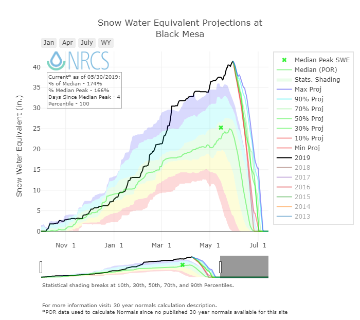
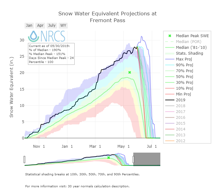
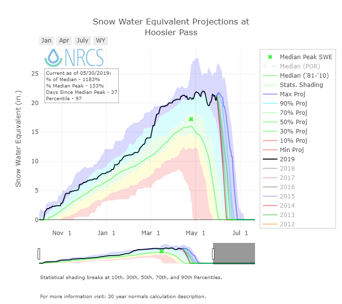
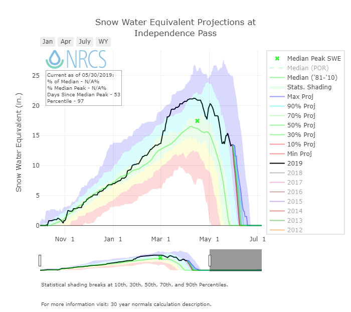
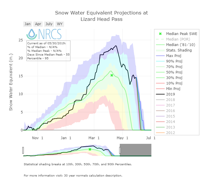
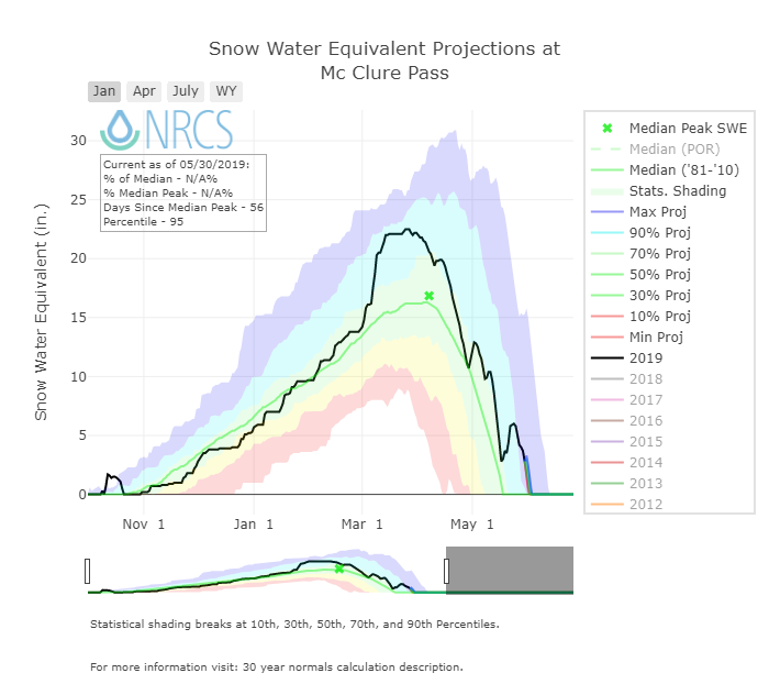
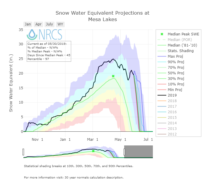
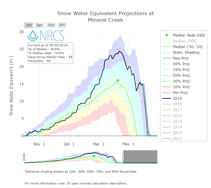
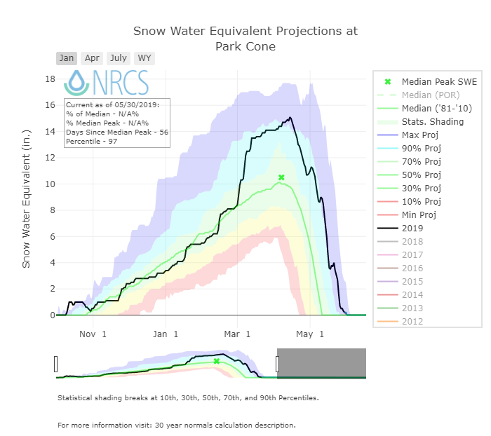
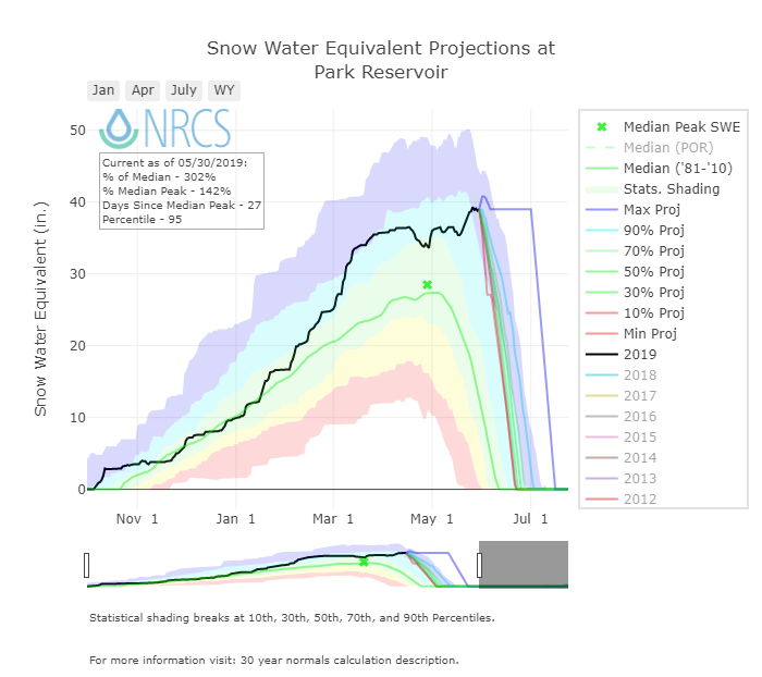
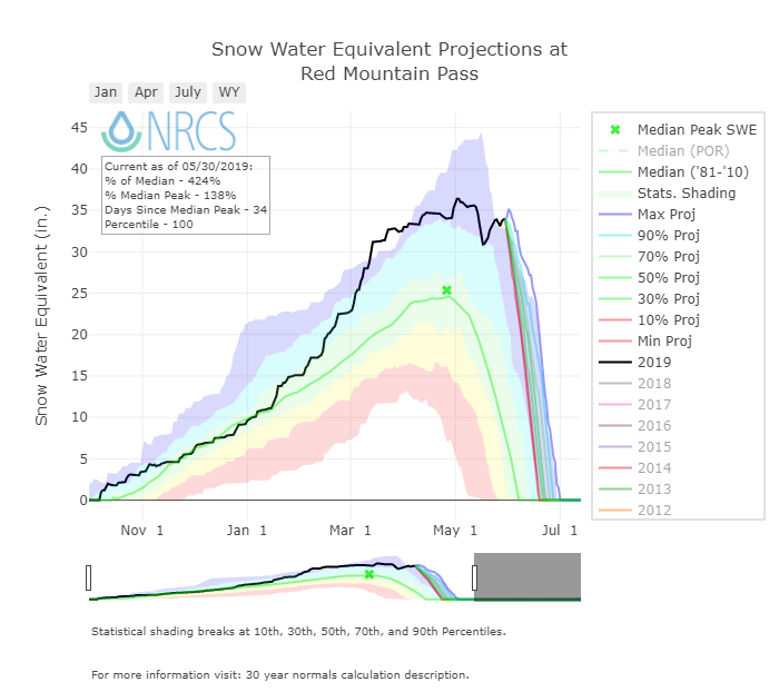
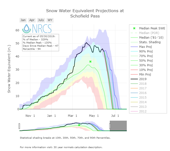
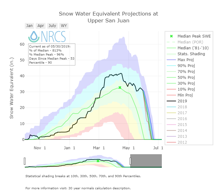
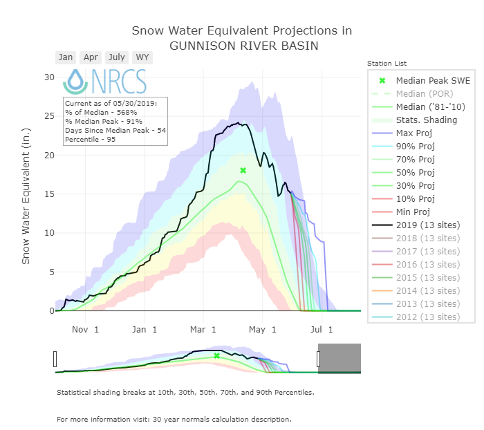
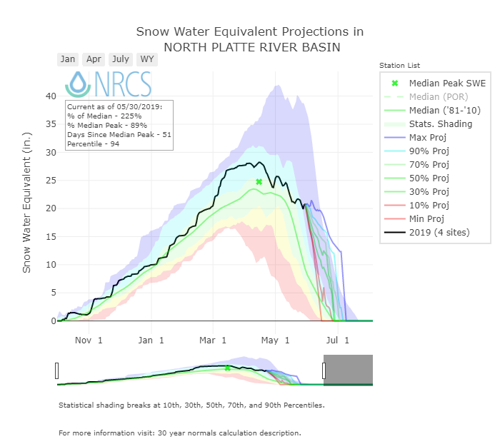
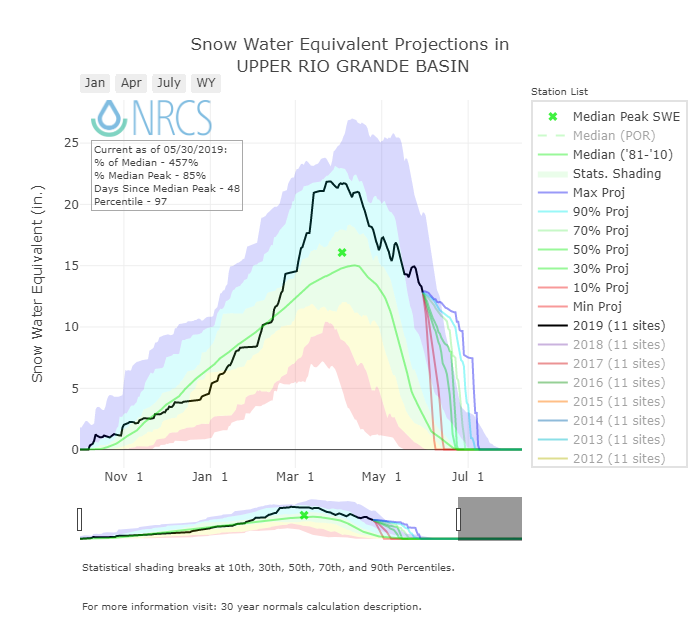
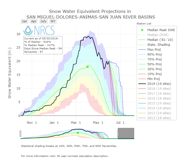
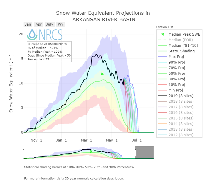
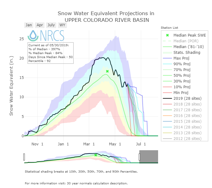
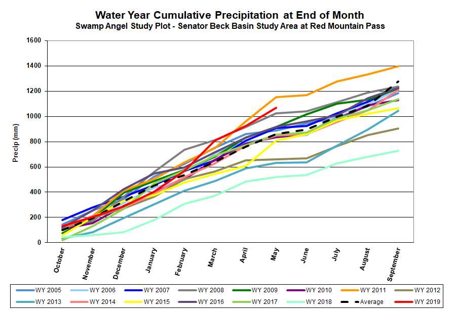
A number of SNOTEL sites are at or just below their Peak SWE for the season (Fremont, Hoosier, Mesa, Red Mt, Schofield, etc.) the rest still show a lot of snow to be melted (see SNOTEL plots below). Wolf Creek SNOTEL for example is just under it’s peak SWE value reported back in April and very well above median Peak SWE that normally occurs around May 1 (45” currently vs. 35” median). As we head into the higher sun angles of June, with majority of dust near surface, and with these huge amounts of snow to melt, we have the set-up for a lot of snow melting fast. It hinges on the intensity and duration of hot/sunny conditions and if we receive periodic storms that tap the brakes on snowmelt with albedo resets. Brian McInerney, NWS Hydrologist out of Salt Lake, posted a nice, short summary that sets the scene well. The summary is Utah based but I know the comparative years he discusses applies at least to the San Juan Mountains.
More soon.
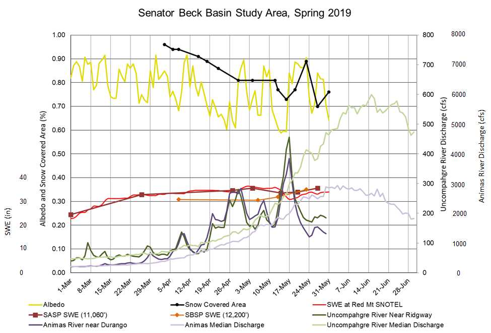
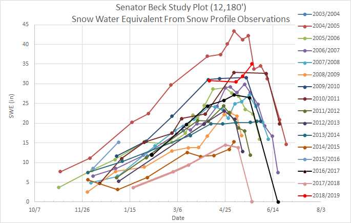
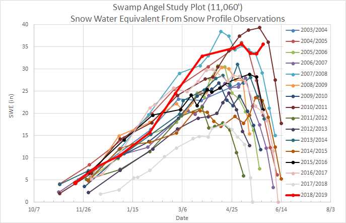
Below: We need to get up to Senator Beck Study Plot this week to collect SWE after the recent storm, but it is likely we have just hit Peak SWE at SBSP and we may even measure the most SWE we have ever seen on this date in our period of record.

Park Cone - May 28, 2019
For the last few days Park Cone SNOTEL has been snow free, see picture below of the recently exposed pillow. The area around Park Cone - particularly the CODOS sample area - is mostly snow free. Snow is more prevalent at surrounding elevations higher than Park Cone. There was plenty of snow cover left to gather all-layers-merged dust samples for USGS analysis. Dust severity of all dust occurrences amounted to moderate end of season conditions.


Spring Creek - May 29, 2019
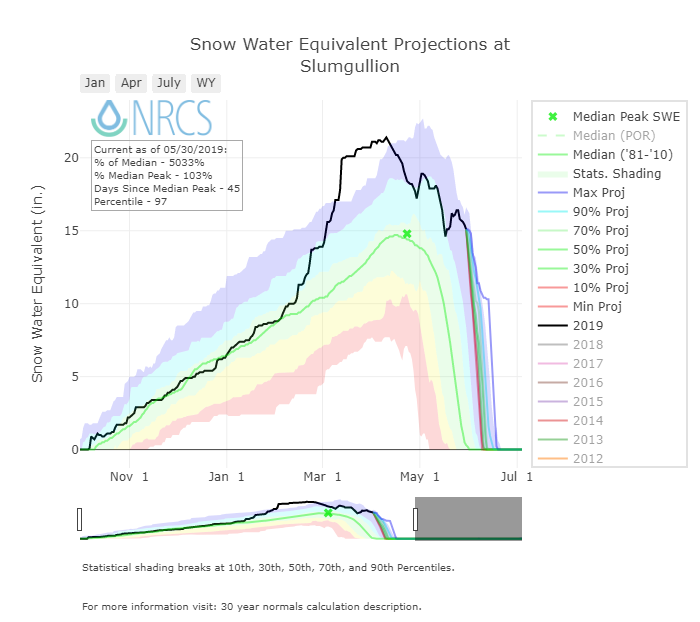
SWE at Spring Creek Pass was 8.6”. SWE at nearby Slumgullion SNOTEL was 15.4”, usually on this date it is just now hitting zero. Dust is across the landscape and of average (moderate) severity. In the pictures below the brown/orange shades on the snow surface is very visible dust if you are there in person. At the sample site dust is fully emerged but just about 100’ away I found it ~3’ under the surface. With the recent precipitation events this is not surprising. So likely over the remainder of this week dust in that area will become fully emerged. We collected all-layers-merged at this location as well.


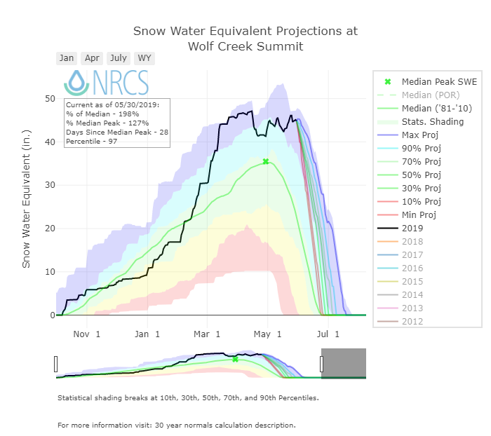
Wolf Creek - May 29, 2019
SWE at the CODOS Wolf Creek sample site on May 29 was 34.6”. At nearby Wolf Creek SNOTEL on this date reads 45.1”, usually on this date it measures half that amount. Being located in the Southern San Juans it is not surprising there are more dust layers in the 6.6’ snowpack and that these layers are more severe compared to Spring Creek and Park Cone, but compared to itself over the last decade it appears to be falling in the moderate category so far. The coalesced dust layers 6” under the surface are still a very dirty band that will emerge to the surface likely when hot/sunny conditions move into Colorado this weekend. We noted light dust on the surface (D7) and the layers just underneath are likely D4-6. At 1.6’ (D3), 3.3’ (D2), and 4’ (D1) below the surface are also dust layers that are very apparent and will play a big role in reducing albedo once the snowpack melts down to these levels. As we are going into June with hot temps and higher sun angles the dust near surface will immediately and significantly increase snowmelt rates, and as snowmelt continues melt rates will further increase with the emerging layers in the snowpack.


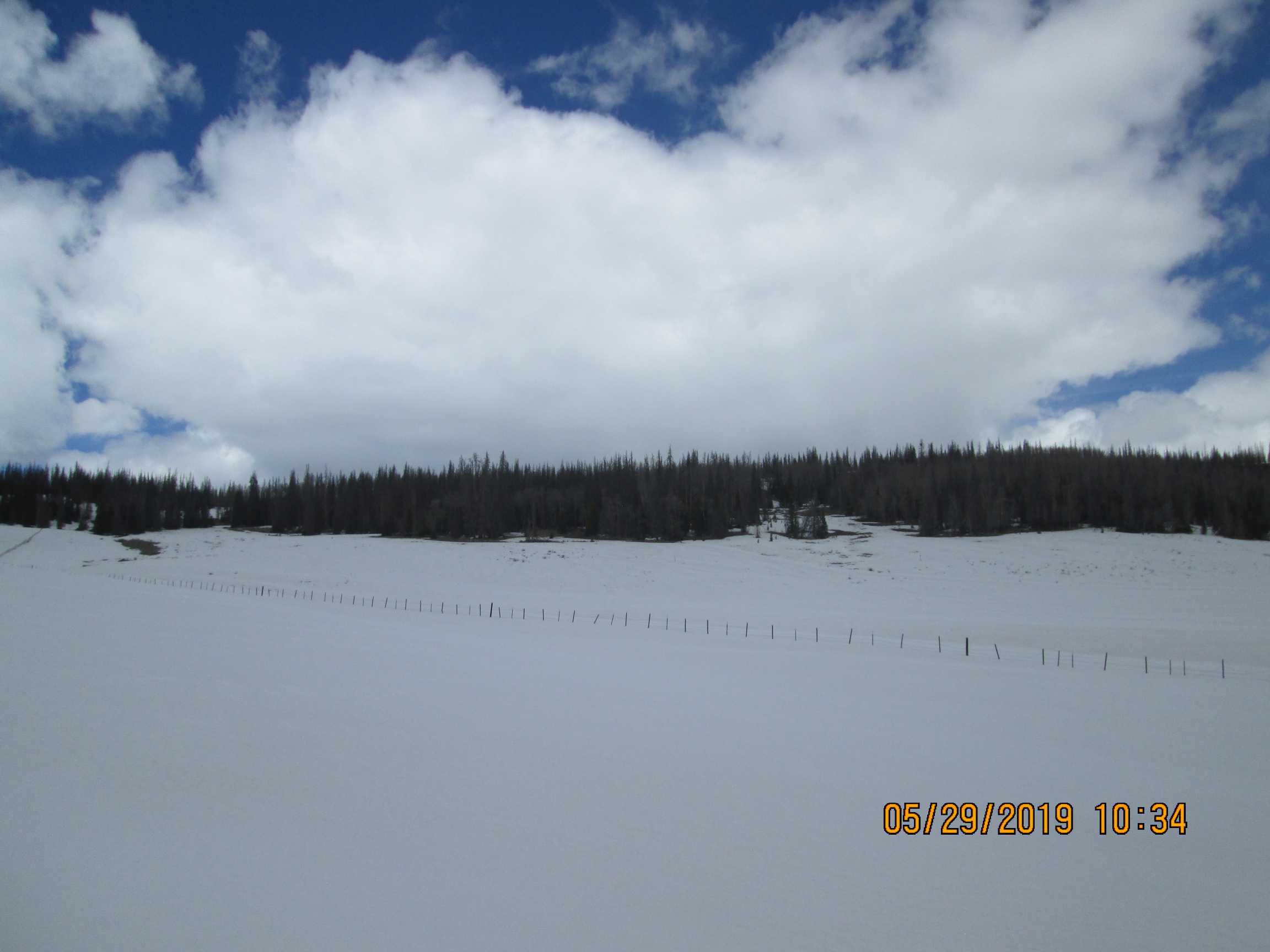
Swamp Angel Study Plot - MAy 31
We checked in this morning (May 31) to assess conditions at Swamp Angel and see how dust is emerging at that location. Not much has really changed since our latest report on SASP on May 28. Since the beginning of the week we have received 1” of precip and a good skimming of clean snow now on the surface. There is a dust layer (D7) about 6” under surface and the really dirty layer is still about 8” beneath the surface. It will take a few days for D7 to emerge and then another couple days (depending) for D3-D7 to merge at the surface and really speed up melt. The main dust layer is already emerging at the surface on more exposed slopes, but currently it is not widespread. The first picture below shows dust emerging on the mountain face (use your imagine with this poor quality photo). So the warm up that we are going into will immediately start to degrade snow grains at the surface (older, larger snow grains have a lower albedo) but it will take a few days to fully expose the near surface dust, once that happens conditions on the snow will be ripe for rapid melt, it will then depend on the weather on how things unfold.


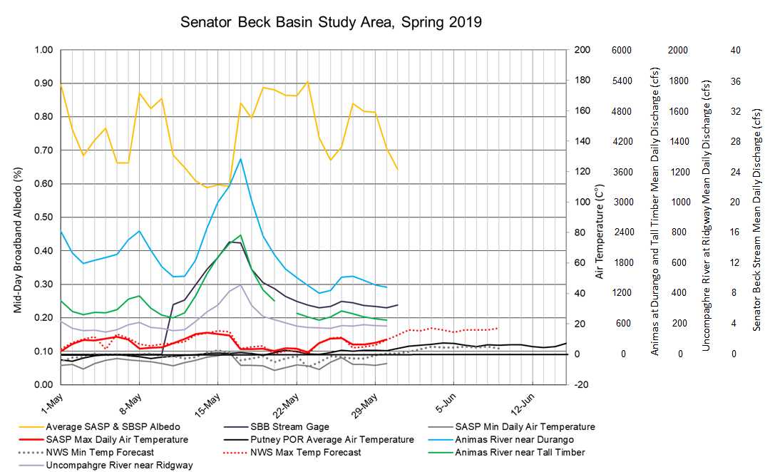
Below: Plots of streamflows from SBB, albedo, and temperature forecast. I show these plots to illustrate relationship of albedo and streamflow. Usually there is a 1-2 lag between increasing/decreasing albedo and decreasing/increasing streamflow. The temperature forecast is an attempt to get an idea of what the weather will do (hence albedo/streamflow) in the short-term.