Greetings From Silverton,
During the afternoon on Wednesday, March 6, and going into evening, along with the very wet snow (almost rain) falling in Silverton we observed more than just a wet, slushy layer of snow. During the afternoon hours this deposition on the snow took on a pinkish hue. Once buried by further snow deposition and observing this layer in the snowpack it was even more apparent. It looks we have experienced a pretty solid dust event in the North San Juans. Reports from Rico and Telluride also support our observations in Silverton (see picture below). Once we visit SASP we will provide details about the severity and areal extent of this D2 event. With roughly a month of the snow accumulation season remaining - and optimistic active weather patterns in the forecast - it is hopeful this dust will remain buried in the near term.
We are now getting into dust-on-snow season. Most of the dust cameras in the Southwest currently show sporadic snowcover and over the last couple days have shown snow flurries. The majority of the dust source region has received greater than 200% of normal precipitation for the Water Year. But this precipitation was also falling on a very parched landscape. One point I neglected to mention in Storm Reports is the normal, to slightly below normal, air temperature we have been experiencing. Below normal or normal air temperatures have not been common for a long period of time now, which reduce evaporative demand. Going into this dust season I recall WY2017, a good snow year and also a wet winter in the Southwest, wetter than what many people have observed in many years. Nonetheless in WY2017 we observed 4 dust events that still equated to “average” conditions for the southwest mountains, and minimum conditions going towards Central and Northern Colorado. So even with abundant moisture in the source region receiving dust in the spring months is still a likelihood.
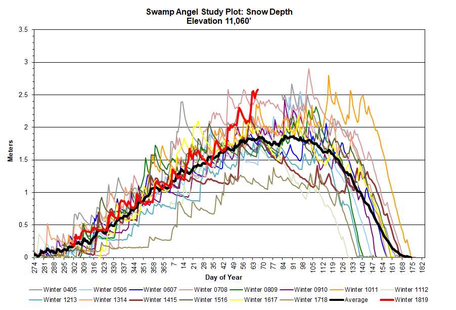
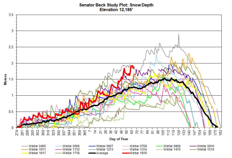
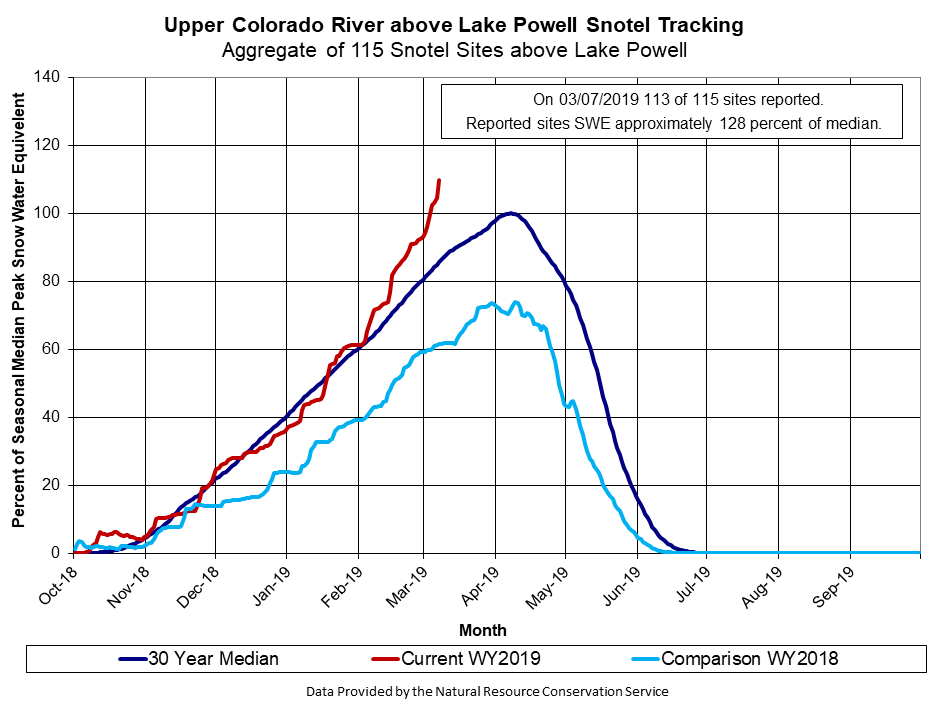
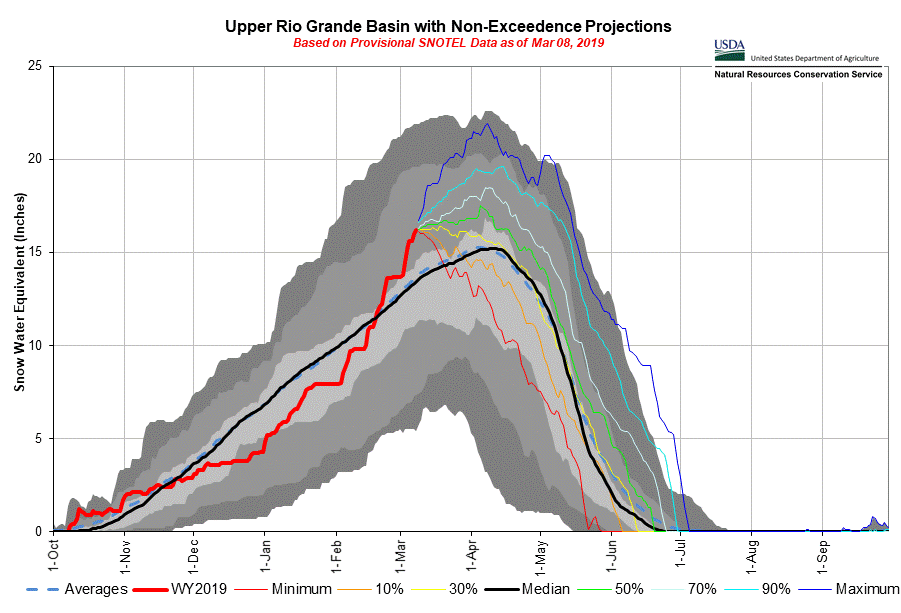
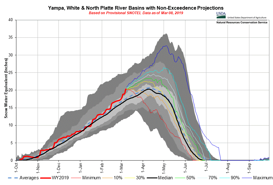
And the precipitation keeps coming. Very little snow accumulation has occurred over the last three days but we have received 1.6” of precipitation. Since March 1 we have recorded 100 mm (3.9”) of precipitation at SASP and the way it’s still snowing now we will easily hit 4” or more for the last 8 days. Please see snow depth and precipitation plots below, I had to change the scale on the Y-axis for both precip and depth to accommodate this bountiful last couple months.
More soon

Photo taken near Rico by Skippie Zeller

Wind rose for D2. Wind gusts reached 80 mph out of the southwest during this time-frame.