

MARCH 2018 CODOS TOUR SUMMARY
The Senator Beck Basin has received two dust events so far this season. The first event (D1) is located at the bottom of the snowpack and will be inconsequential to runoff. The second event (D2) came in on February 18th with very high sustained winds and snow. It is becoming evident based on how D2 was deposited that location and amount of dust deposition varies greatly, based largely on prevailing winds and proximity to the southwesterly storm track during the storm as well as local landscape features. Last week in the San Juan’s D2 had remained buried at some locales and fully exposed in others. This week, after receiving a winter storm on March 15-16 and another winter storm in the making as of this writing, D2 will be expected to stay buried for some days following the current precipitation event.
From March 14-17, CODOS teams visited 12 dust on snow study sites throughout the state to assess snowpack and dust conditions on the statewide scale. D2 was found in most pits, from the northern sites at Rabbit Ears Pass and Willow Creek Pass, to the Front Range and Central and Southwest Colorado. At some sites, the dust is buried and of relatively low intensity, meaning that the dust that exists in the snowpack is not of grave concern yet hydrologically. Other locations, like McClure Pass, Wolf Creek, Swamp Angel, the dust layer is a higher severity and when exposed will have greater muscle in influencing snowmelt timing/rates. Please see the site specific snowpack descriptions below.
Snowpack conditions statewide are slim, with most CODOS sites having a snowpack well below average. By the CSAS Dust Enhanced Runoff Classification (DERC) almost all CODOS sites are showing “low” SWE Conditions. Fortunately, we are also seeing mostly “min” dust conditions.
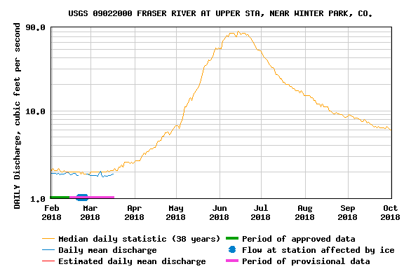
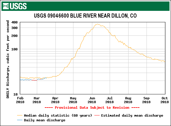
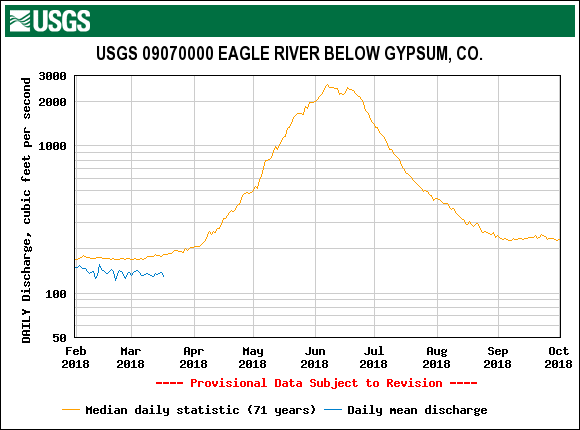
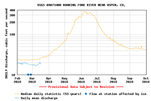
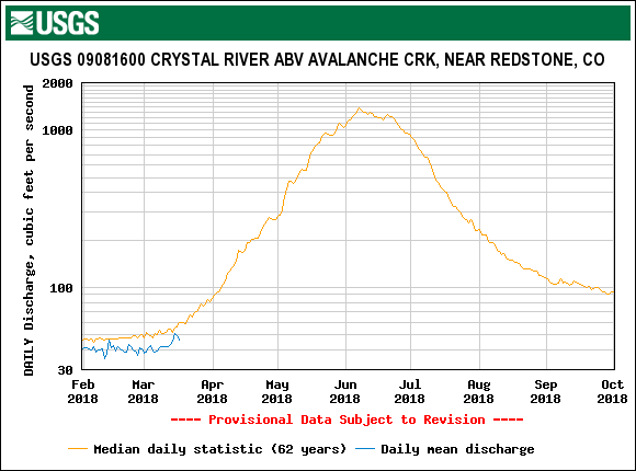
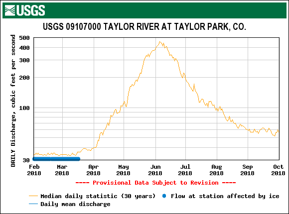
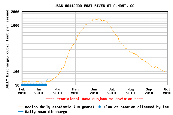
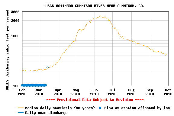
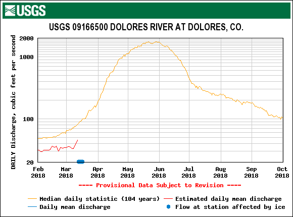
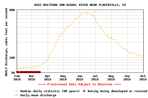
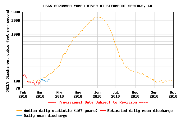
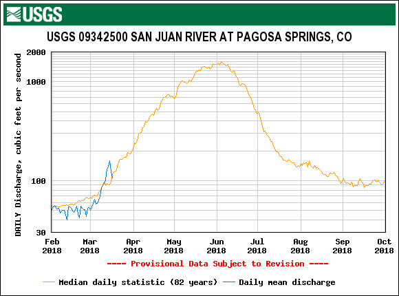
Streamflow is average or below average for the date at most sites statewide, with most sites running within 25% of the daily median and about one third of sites flowing below the 25th percentile. This may be due in part to recent colder and unsettled weather which has brought snow to most of the state. With the melt season approaching and warm temperatures forecasted for the long-term we expect the streamflow to increase statewide in the coming days and weeks.
SNOWPACK PROFILES

Full-depth snow profiles were performed at all eleven CODOS sites from March 14-17, documenting the presence/absence of dust-on-snow. Measurements including SWE, snow depth, wetness and mean (bulk) density of the snowpack at these CODOS sites also assist with verification of conditions as reported by their nearby SNOTEL stations. A brief statement of snowpack and dust conditions at each CODOS site is provided below.

Mean measured snow temperatures, by CODOS site, in March for years 2013-2018 from snowpack profiles. Temperature measured at 10 cm (4”) intervals from the ground up.
These profiles also document the remaining cold content of the snowpack as spring approaches. One CODOS site (McClure Pass) has an isothermal snowpack at 0.0° C throughout, and another (Park Cone) is very near isothermal (see table below). Similar March 2017, March 2018 snowpack temperatures are similar to March 2014 and 2016 conditions, but 2018 data was collected around 1 week earlier.
Snowpack Summary
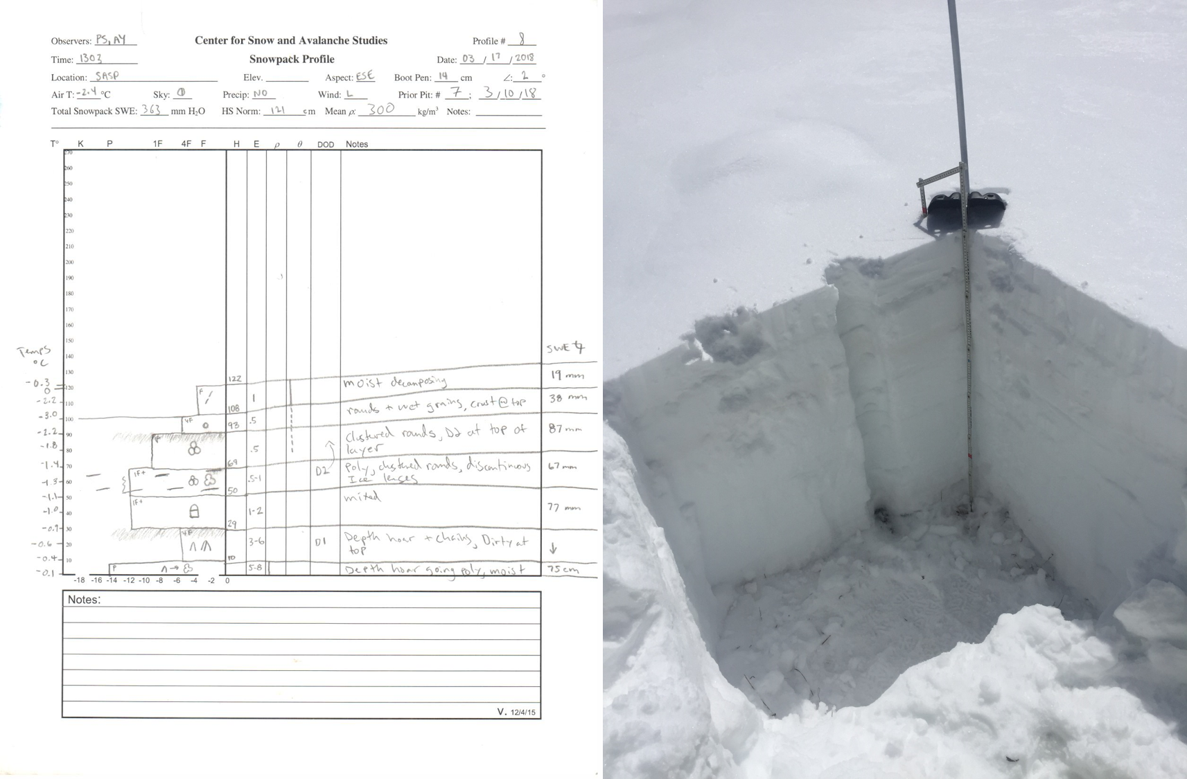
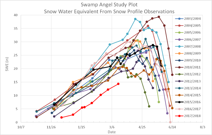
Swamp Angel: Dust observed in pit but not on surrounding landscape. D2 is about 12" (30 cm) below the surface and D1 is in the basal facets. Snowpack deteriorates rapidly below 10,000 feet. Significant ice lenses observed below D2. SWE = 14.3” (363 mm). Snowdepth = 4.0’ (1.21 m). Prior to precipitation on March 15-16, D2 was intermittently on the surface around the San Juans, primarily on the Telluride side and around Silverton on landscape types you might expect this high wind dust event to be deposited, such as lee aspects and eddies, and areas where not much subsequent snow accompanied the dust event. With the snow accumulation on March 15-16 plus the accumulation we are currently seeing (~10” total) will keep D2 buried throughout the San Juans for at least a number of days following current storm.
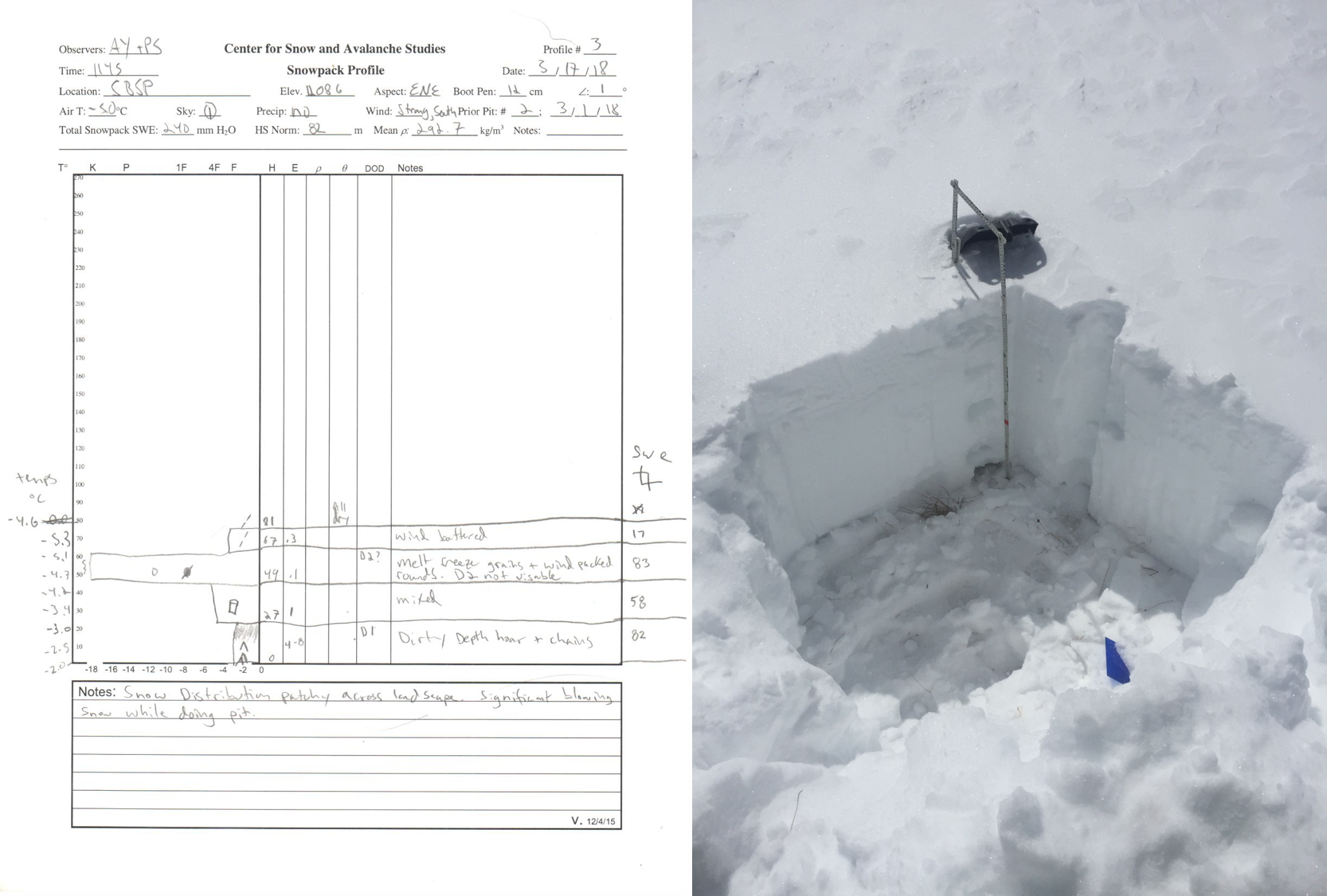
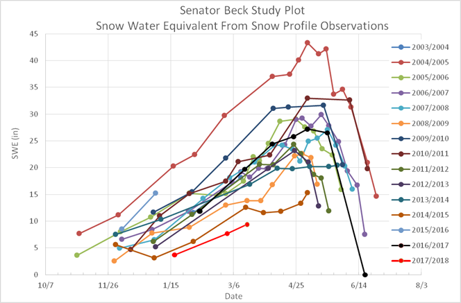
Senator Beck: D1 observed in pit in basal depth hoar, D2 not visible in pit or on landscape. Observations taken on March 17 following ~2” new snow accumulation at higher elevations. Snowpack is shallow composed of facets and hard wind slabs. SWE = 9.4” (240 mm). Snowdepth = 2.7’ (0.82 m)
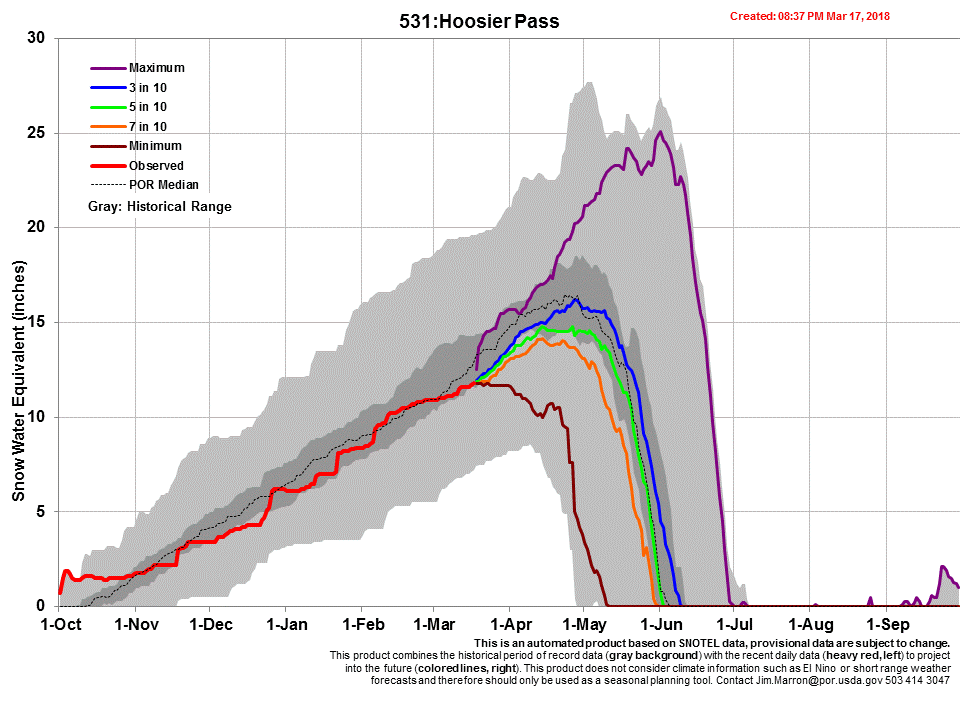
Hoosier Pass: Dust observed in pit but not on landscape. D2 is 12" (30 cm) below the surface and D1 is visible in the basal facets. Snow is very wind affected. Snowpack deteriorates rapidly below pass with loss of elevation. SWE = 11.1” (283 mm). Snowdepth = 3.3’ (1.0 m)
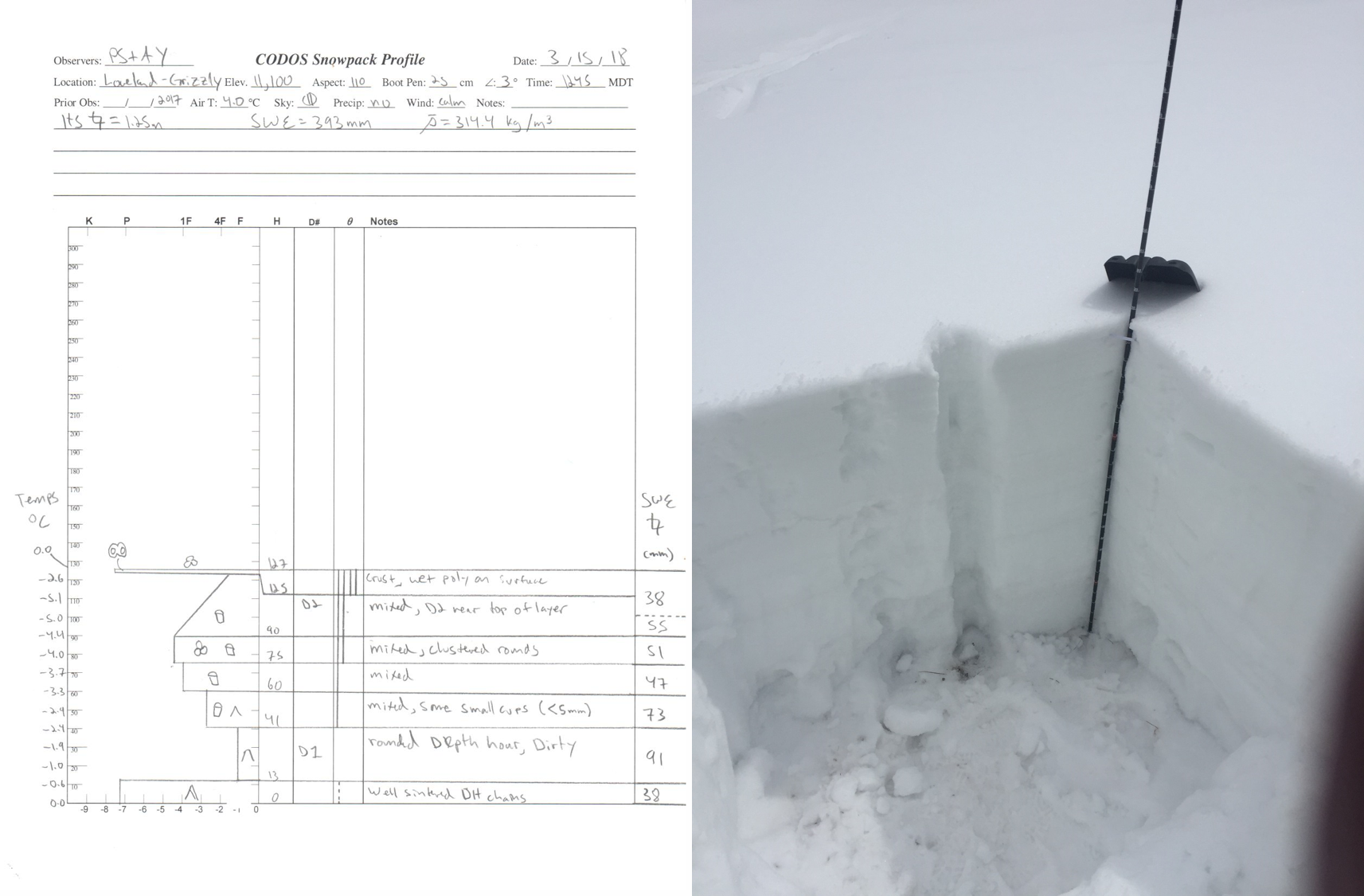
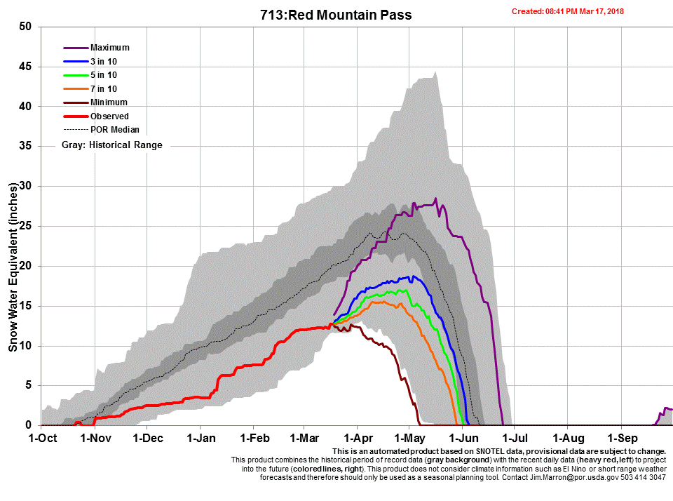
Loveland Pass: Dust observed in pit but not on landscape. Some dust possibly observed in cornices and wind features. D2 is diffuse but only 4" (10 cm) below surface and D1 is visible in depth hoar at the bottom of the snowpack. Snowpack deteriorates rapidly below 11,000’. SWE = 15.5” (393 mm). Snowdepth = 4.1’ (1.25 m)
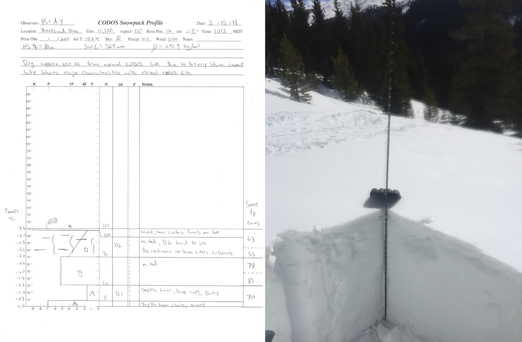
Berthoud Pass: Dust observed in pit but not on landscape. Many percolation columns and ice lenses found in the layer containing D2, which is faint and 8" (20 cm) below the surface. D1 is visible in the basal facets. Snowpack deteriorates rapidly below 11,000’. SWE = 12.8” (324 mm). Snowdepth = 3.6’ (1.11 m)
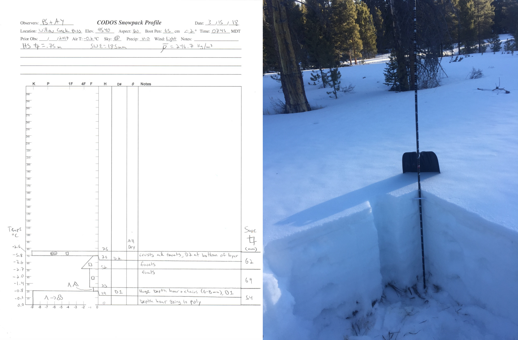
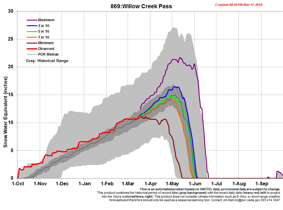
Willow Creek Pass: Faint dust observed in pit but not on landscape. D2 is on the underside of a surface crust and is only about 2" (5 cm) below the surface. D1 is present in the depth hoar near the bottom of the snowpack. Snowpack around pit site is very low, and almost non-existent below the pass and pit site. SWE = 7.3” (185 mm). Snowdepth = 2.5’ (0.75 m)
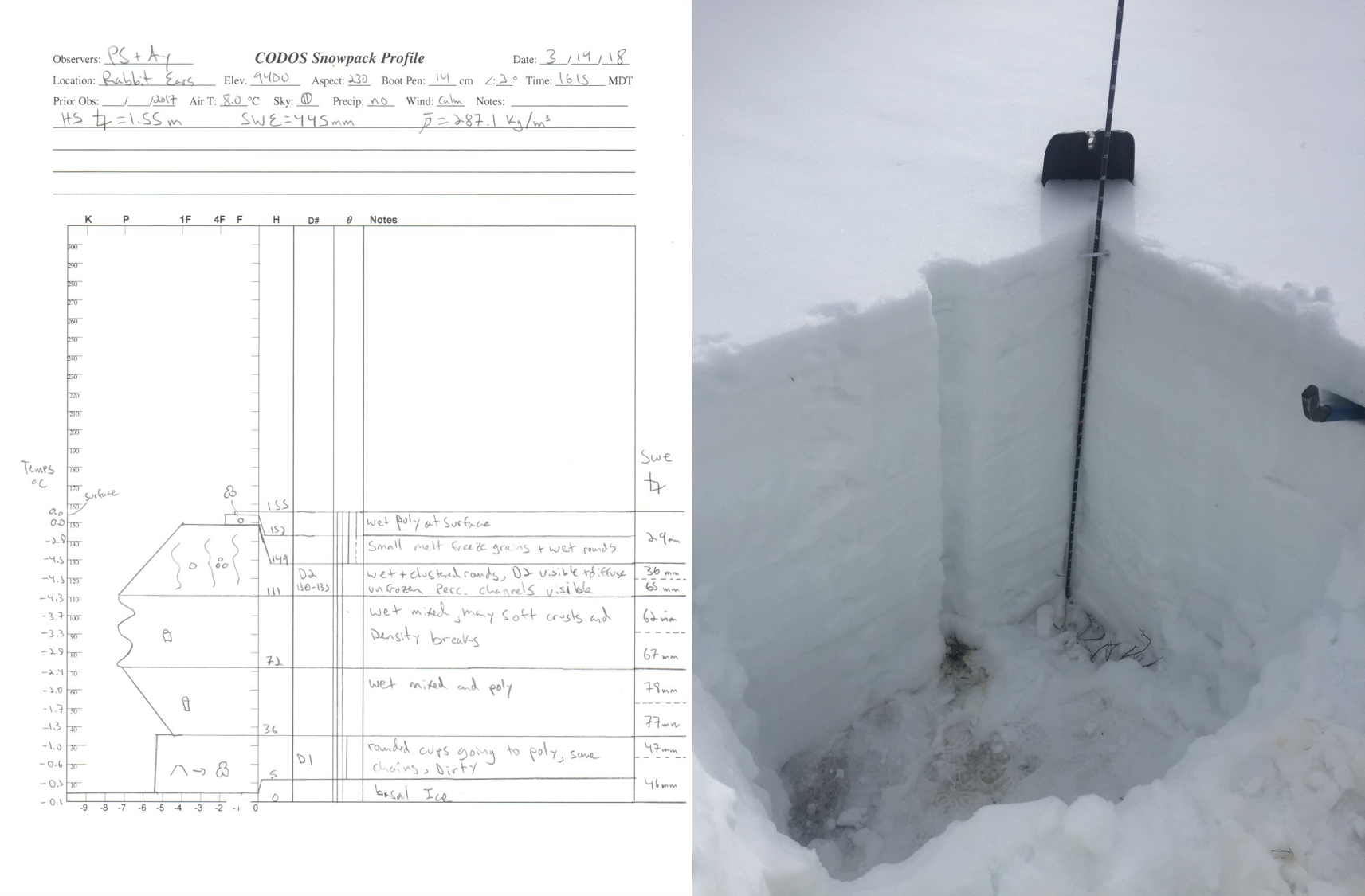
Rabbit Ears Pass: Dust observed in pit but not on landscape. Extensive percolation columns found in the layer containing D2, which is visible but very diffuse about 10" (25 cm) below the surface. D1 is present in the basal facets. Snowpack deteriorates rapidly below 9000’. SWE = 17.5” (445 mm). Snowdepth = 5.1’ (1.55 m)
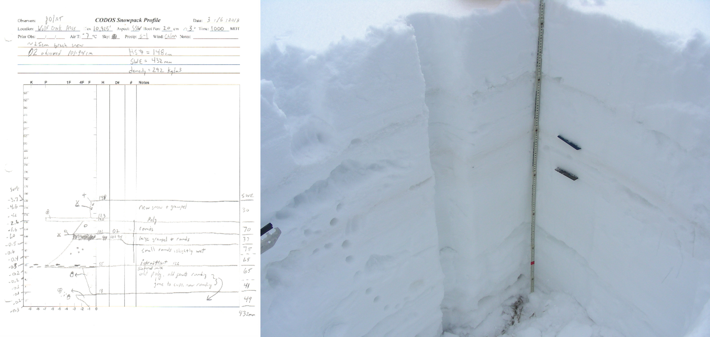
Wolf Creek Pass: Dust very obvious 18” (46 cm) below snow surface. Distinct and very noticeable. Fresh snow accumulation (~10”) around Wolf Creek Pass. SWE = 17” (432 mm). Snowdepth = 4.8’ (1.48 m).
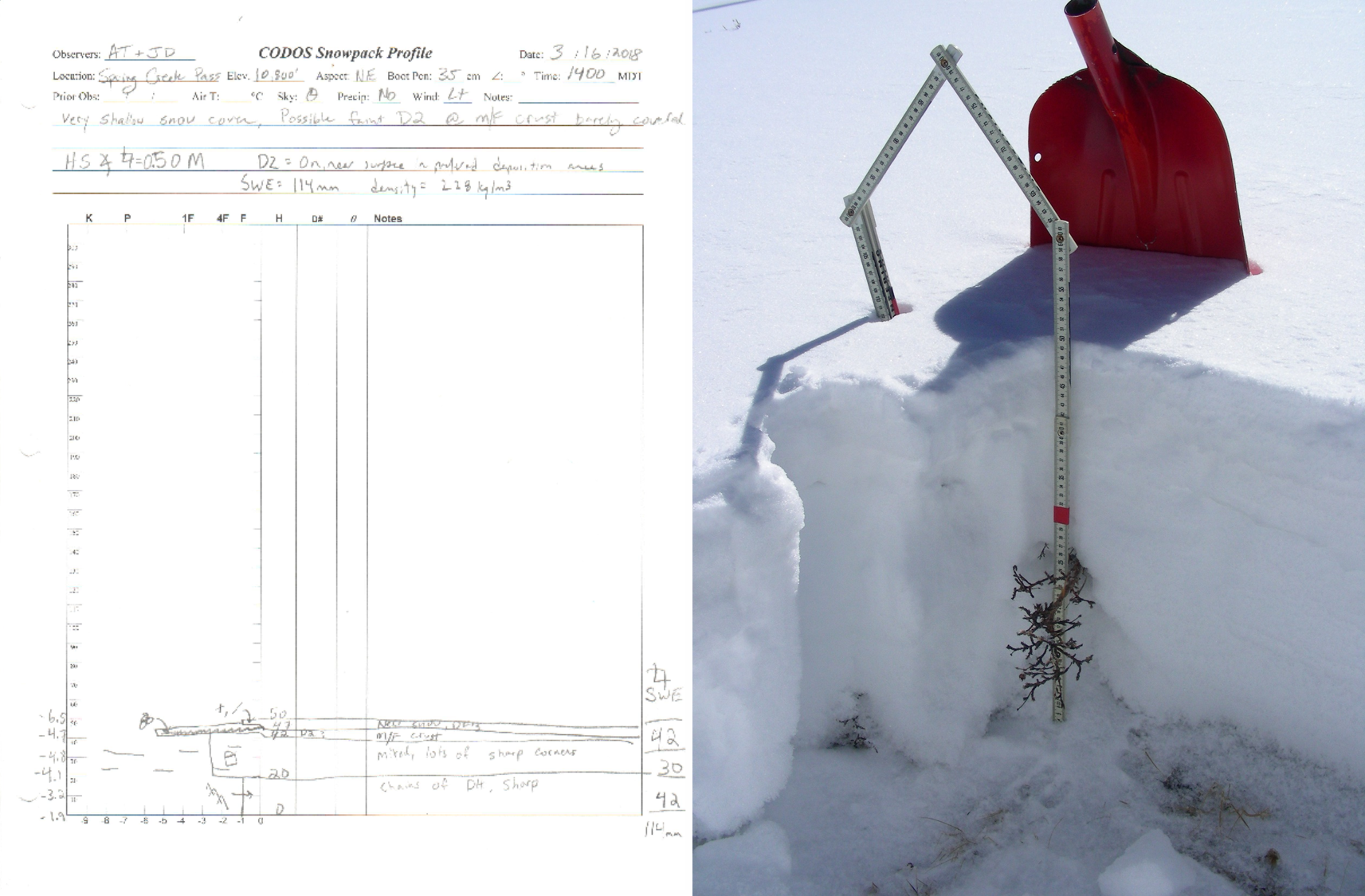
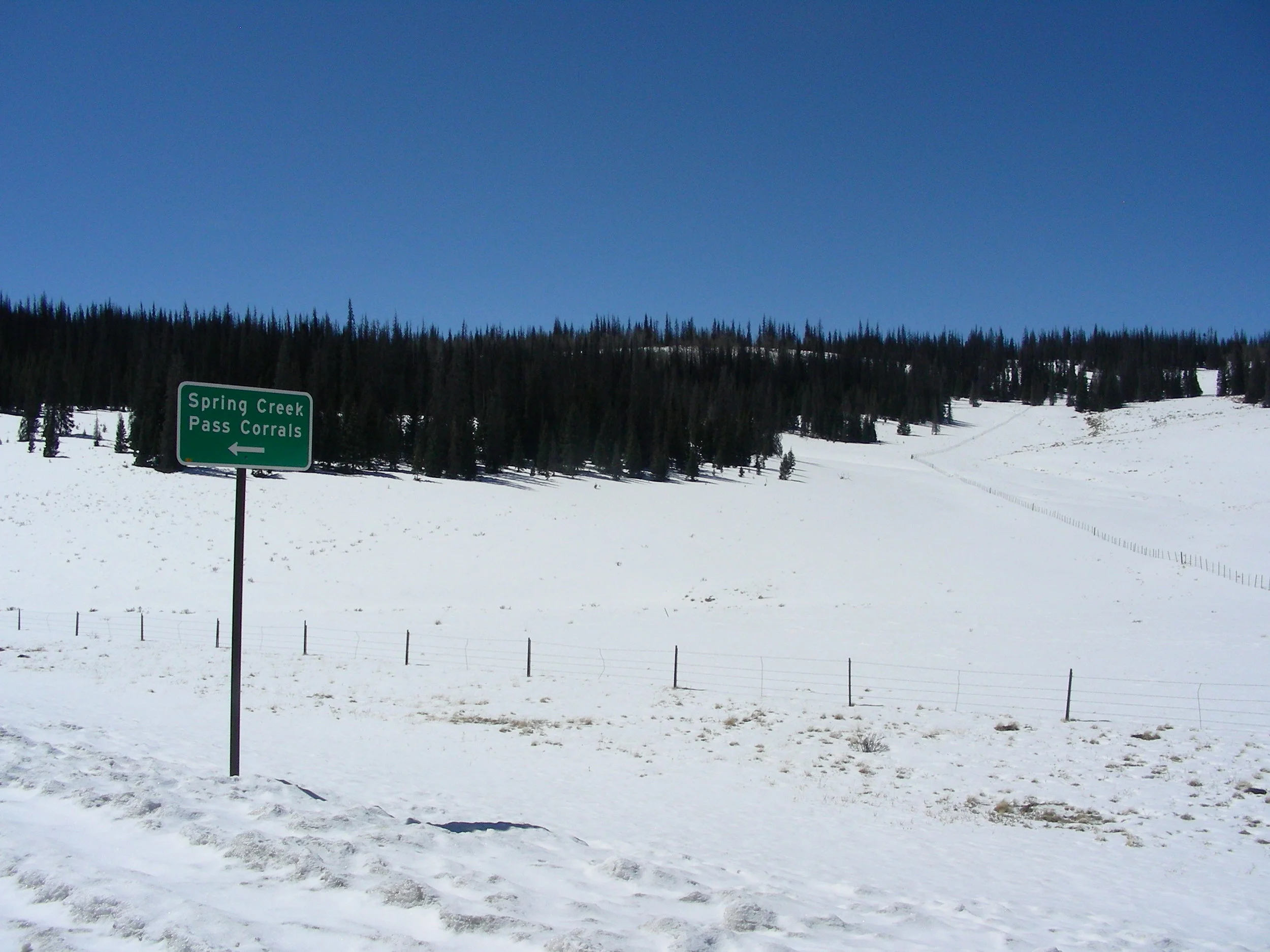
Spring Creek Pass: Dust not obvious in snow profile but apparent across landscape in preferential deposition areas, generally light in nature. Shallow and sparse snow cover. SWE = 4.5” (114 mm). Snowdepth = 1.7’ (0.50 m).
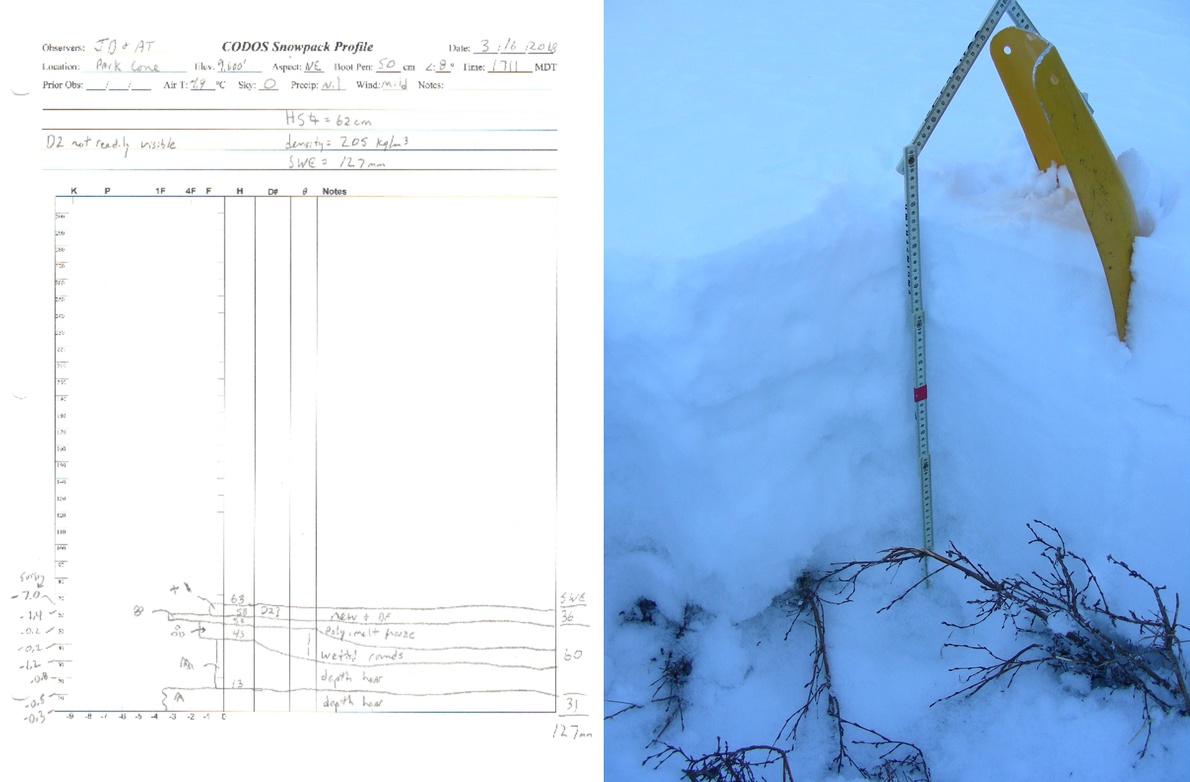
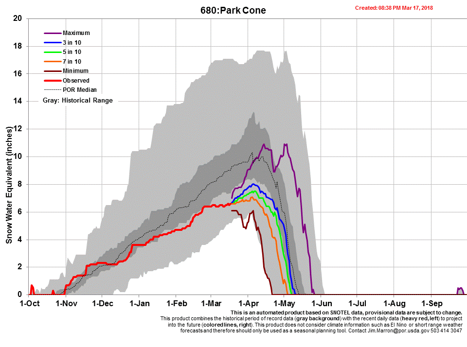
Park Cone: Dust not apparent in snow profile or in immediate vicinity of sample site. But observations around Crested Butte indicate D2 is at – or just under the surface after this current storm – showing itself in preferential locations across the landscape. SWE = 5” (127 mm). Snowdepth = 2.0’ (0.63 m).
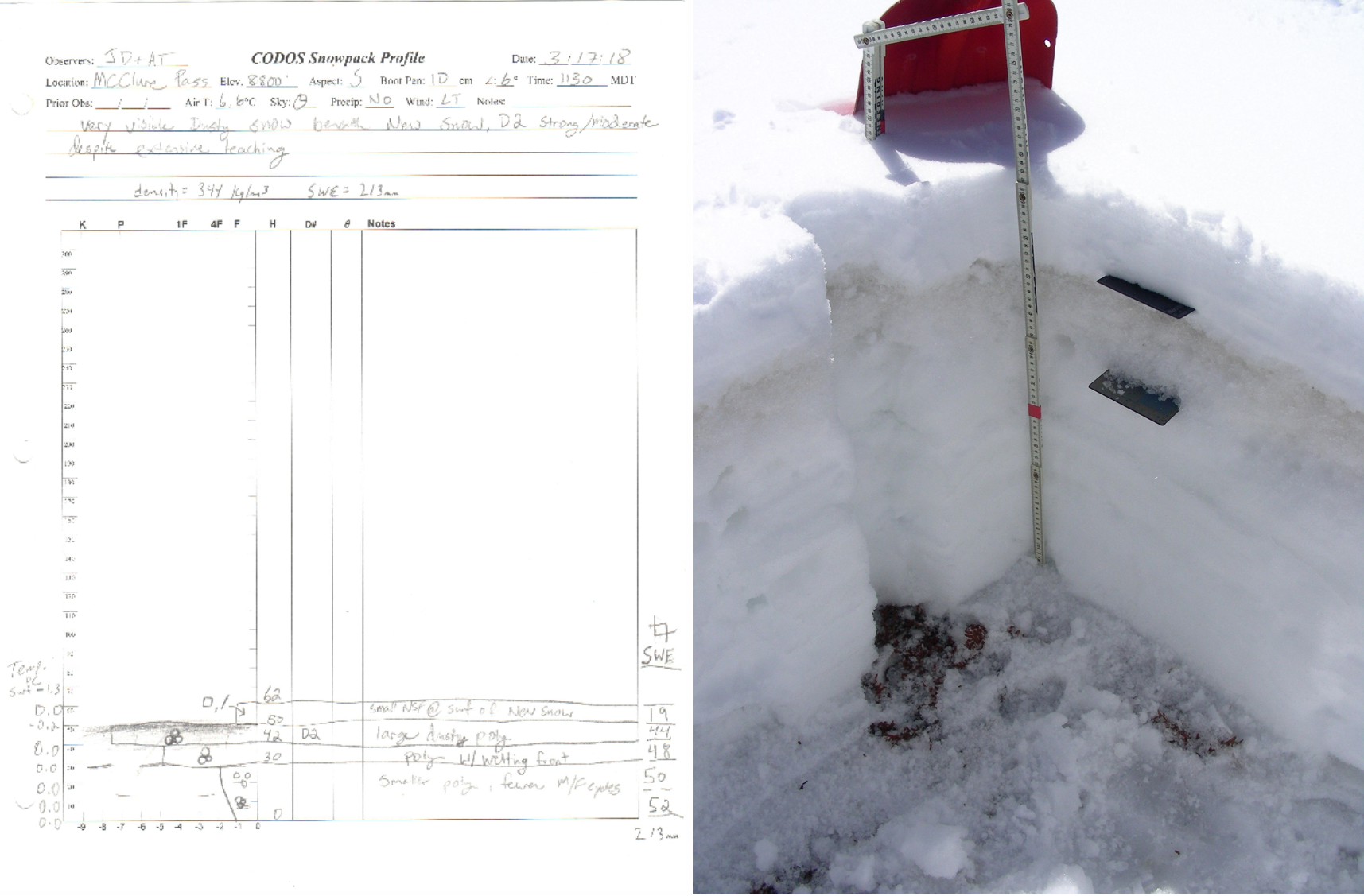
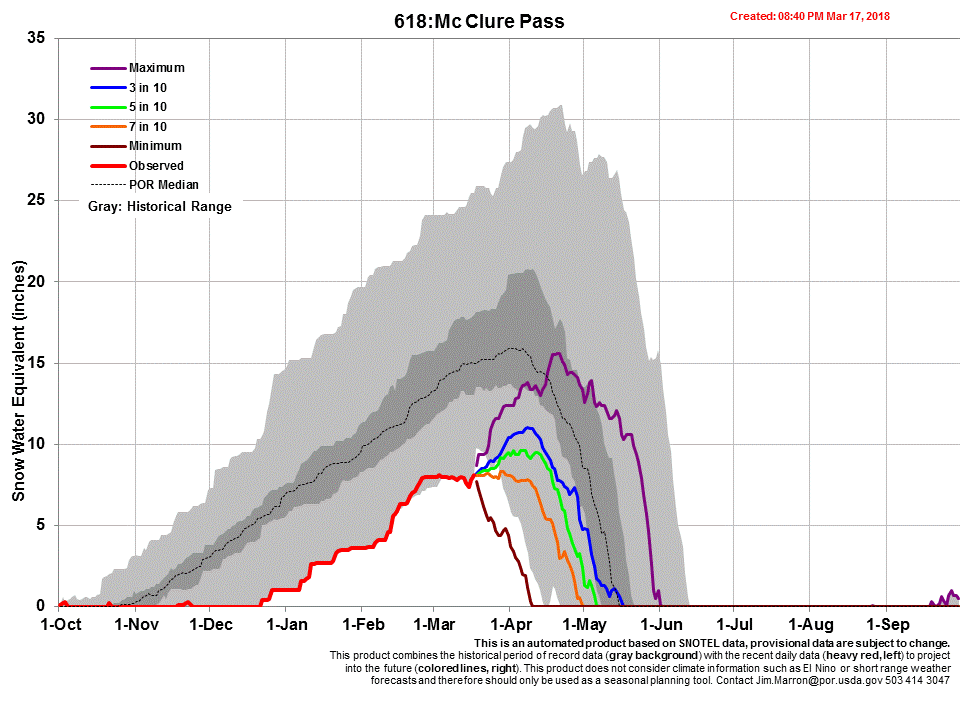
McClure Pass: Dust very obvious 4.7” (12 cm) below snow surface. Strong/moderate despite extensive leaching. Snowpack isothermal and moist. Sparse snow cover just below McClure Pass summit. Shallow snowpack. SWE = 8.8” (213 mm). Snowdepth = 2.0’ (0.62 m).
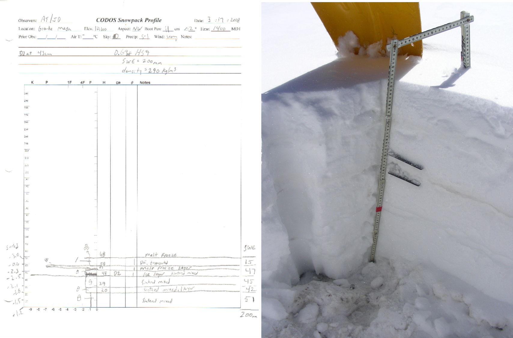
Grande Mesa: Dust obvious 10” (25 cm) below snow surface, mild/moderate in severity. Dust observed in natural depressions and eddies on landscape. SWE = 7.8” (200 mm). Snowdepth = 2.2’ (0.68 m).


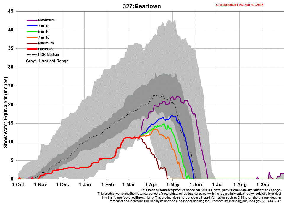
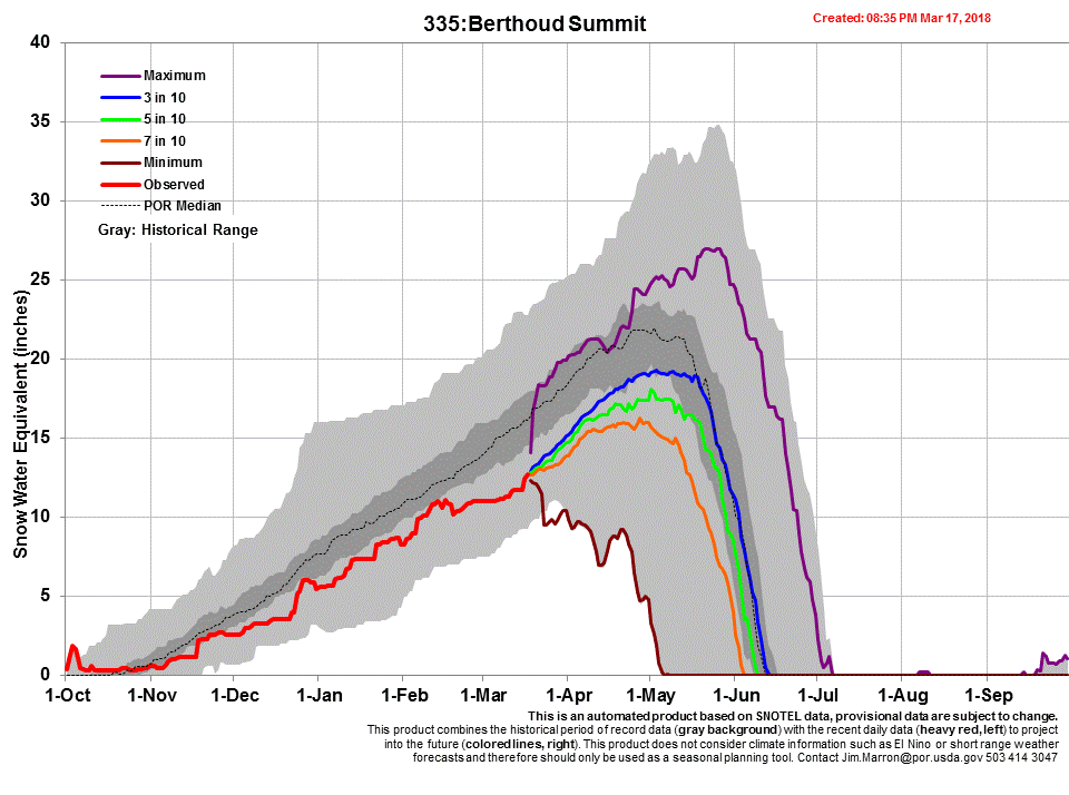
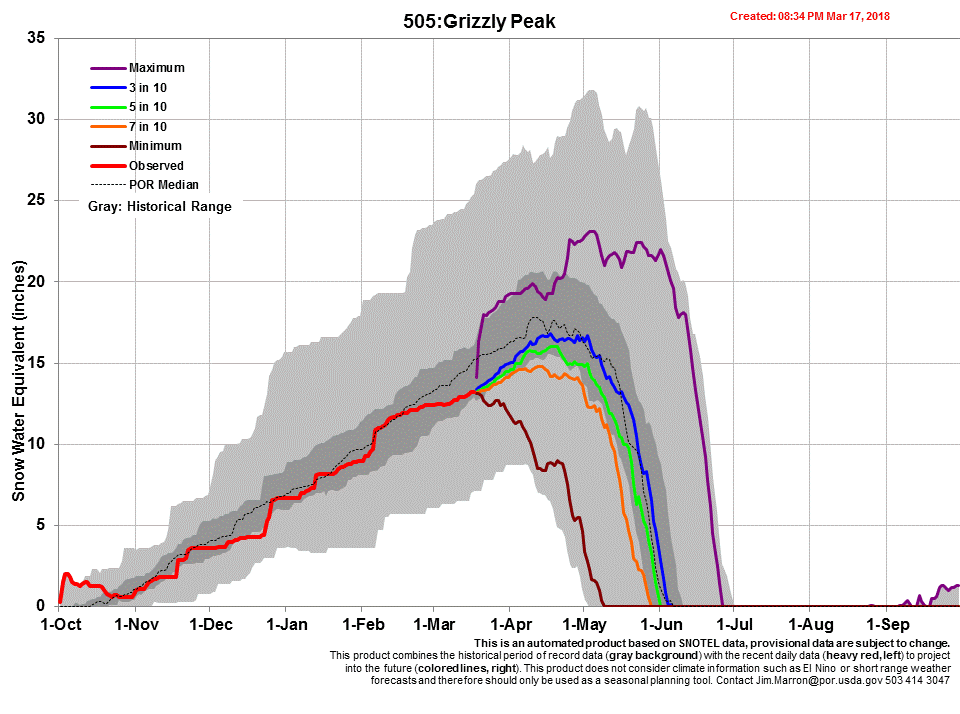
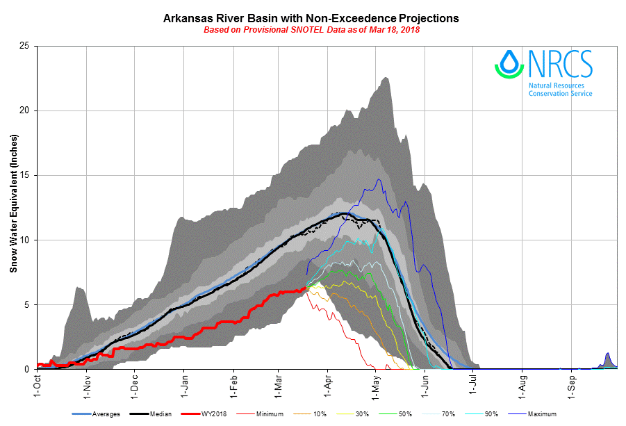
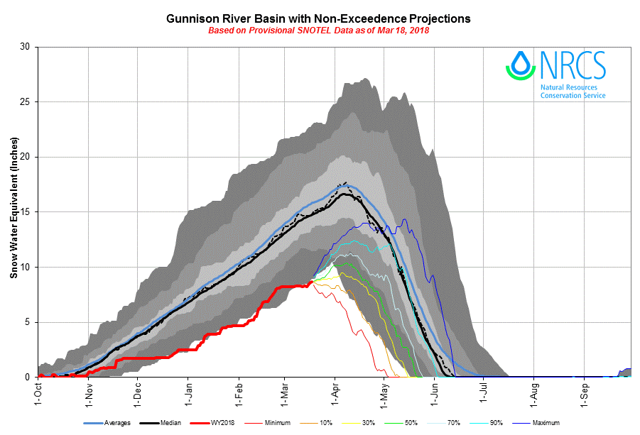
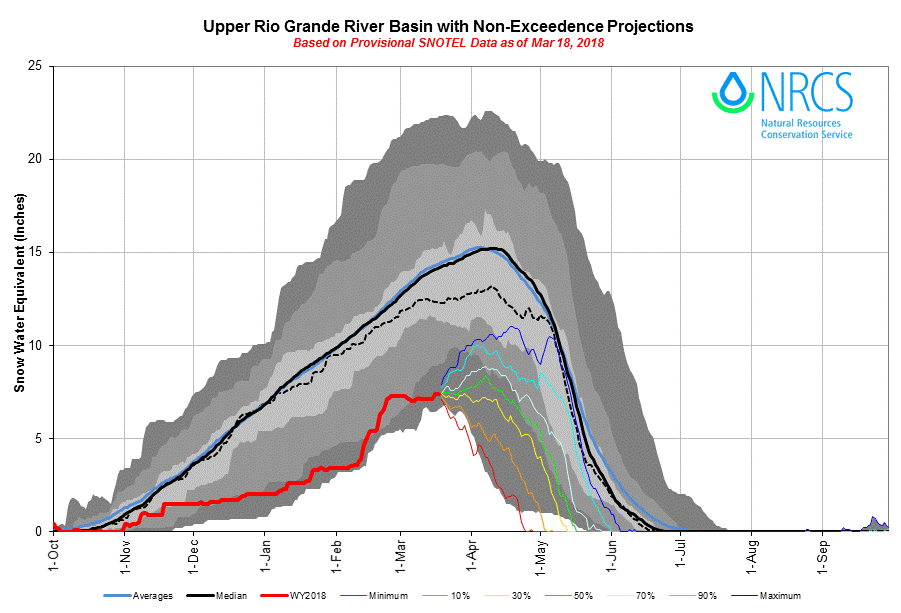
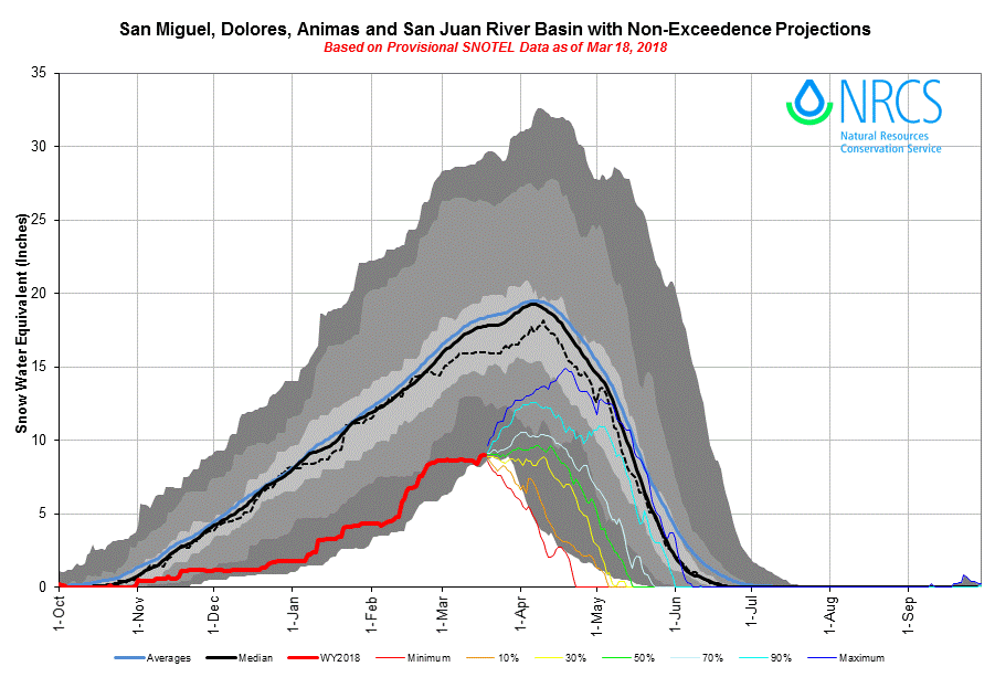
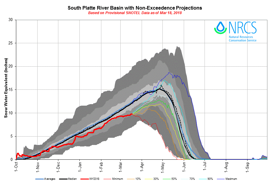
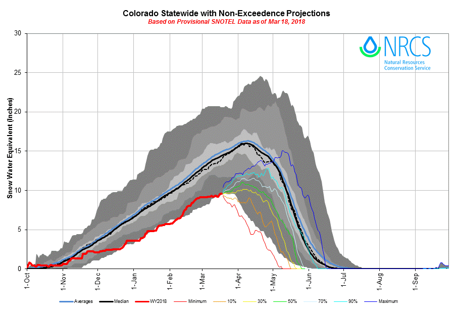
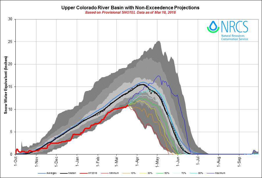
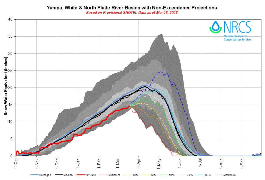
The basin-scale SWE plots shown below aggregate all SNOTEL sites within their respective watersheds and project the non-exceedance probabilities of future snowpack formation and ablation in those basins, based on historic data.
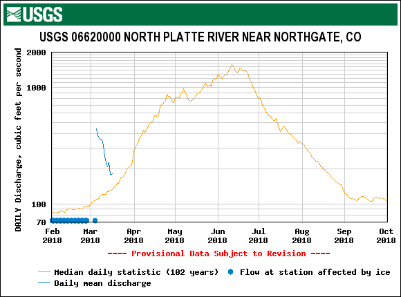
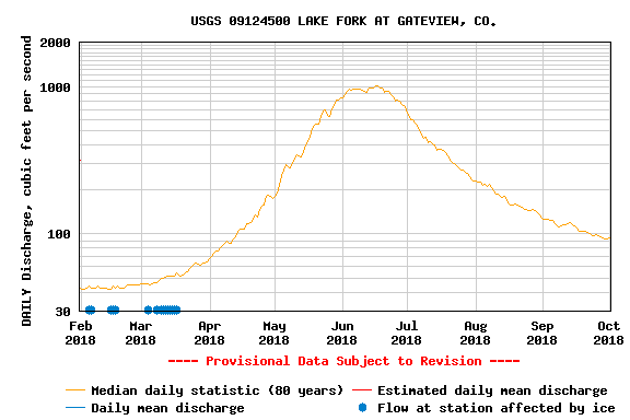
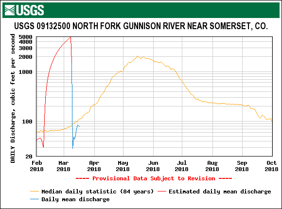
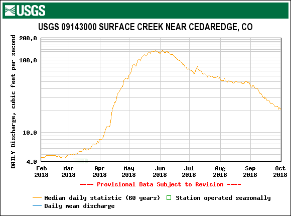
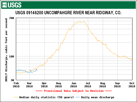
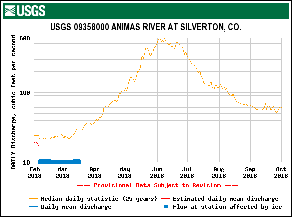
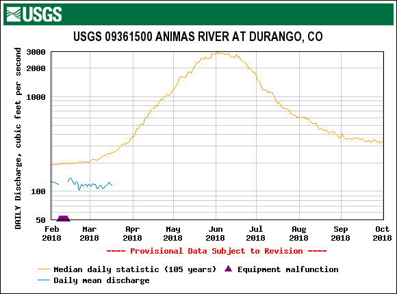
STREAMFLOW
WEATHER AND CLIMATE FORECASTS
Thus far the winter in Colorado has been underwhelming to say the least. Weather and climate are complex systems and it is impossible to point at a single reason for the warm weather and low precipitation felt in most mountain ranges in the state. However, it is well understood that these conditions have been associated with a moderate La Niña event. El Niño Southern Oscillation (ENSO) is large-scale Ocean-Atmospheric condition relating to sea surface temperatures in the equatorial pacific. This condition fluctuates back and forth between El Niño and La Niña patterns, with the middle of this shift being neutral, typically on a period of 1-5 years. The La Niña conditions we’ve been experiencing are well documented as being associated with warm, dry weather in the Southwest and Four Corners states. See https://www.climate.gov/enso for more info on ENSO.
The good news is that ENSO Conditions have returned nearly to neutral, increasing the likelihood of springtime precipitation in the region. The bad news is that despite this swing, most long range forecasting models suggest a continuation of the warm, dry weather that we have been experiencing throughout the winter. As we said above, Weather and Climate are complex systems and there is more than just ENSO conditions at play here. Below are the three-month outlooks for April-June and the one-month outlooks for just April (higher resolution and probability of accuracy than the three-month) addressing temperature and precipitation likelihoods.
DUST ENHANCED RUNOFF CLASSIFICATION
In our March 1st SWE Update we used the DERC model for WY2018 to classify watersheds by either “Low”, “Avg”, or “High” March 1 SWE domains. All major basins fell under the “Low” category, and all SNOTEL stations we monitor except for Hoosier and Grizzly (which was “Avg”) and Willow Creek (which was "High") was categorized as “Low”.
With two dust-on-snow event so far this season, anything can happen, it is still too soon to firmly classify dust events as either “Min”, “Avg”, or “Max” Dust. CODOS will identify prior season hydrographs that best compare to current conditions as dust and spring precipitation conditions unfold.