Greetings from Silverton,
On May 21 we reported 1' of new snow accumulation with 1.7" additional SWE at Senator Beck Basin (SBB) - with Colorado as a whole benefiting from a productive weather system May 16-18. Over the last few days dust layers D1-D4 have slowly showed itself in certain areas of the landscape. And, this morning at Swamp Angel Study Plot (SASP), we observed D1-D4 to once again be located just slightly beneath the snow surface from ~2 cm new snow accumulation last night, but will most definitely be fully exposed later this afternoon at SASP as well as essentially all of the surrounding landscape with the exception of high elevation north facing terrain. Observed SWE at SASP is currently 20.4", down 1.2" from our last observation on May 19.
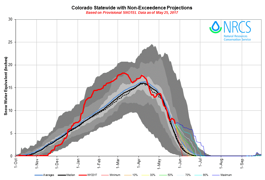
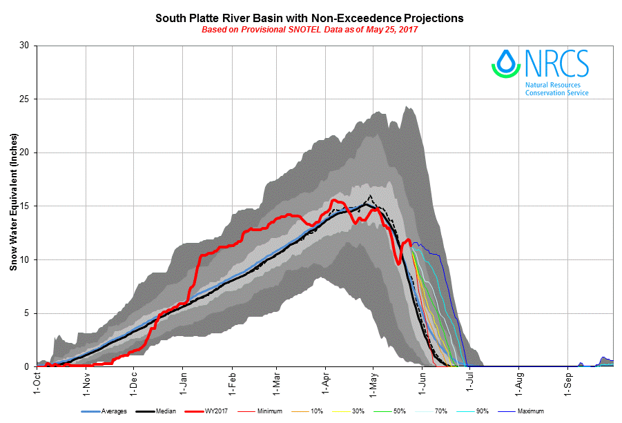
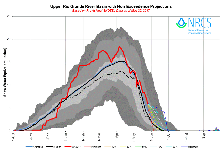
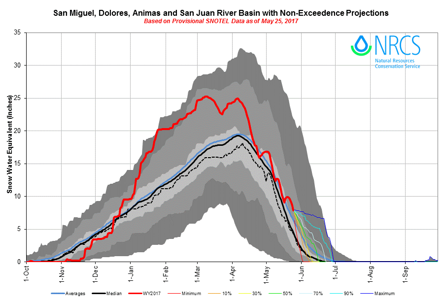
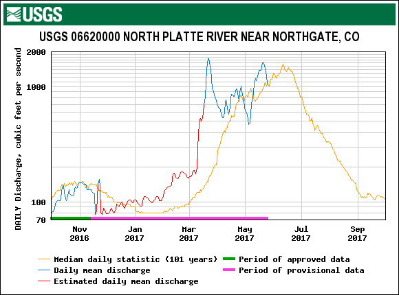
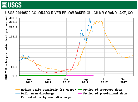
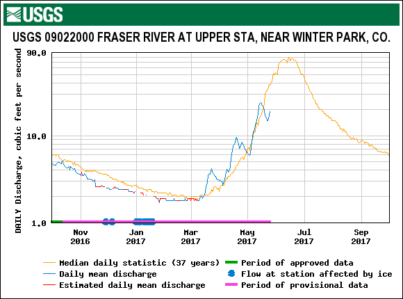
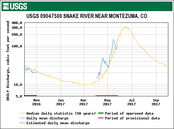
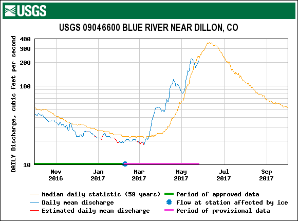
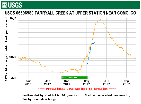
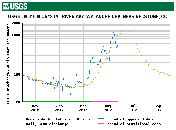
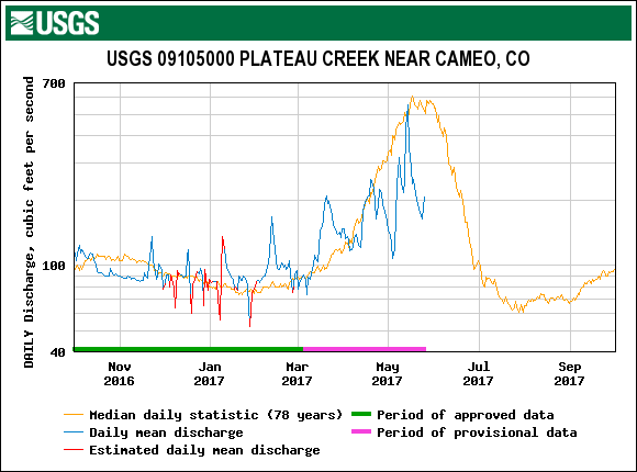
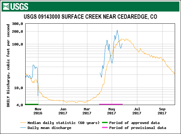
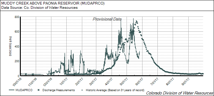
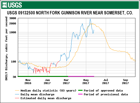
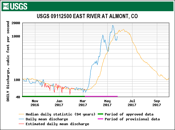
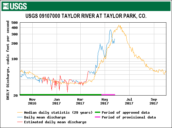
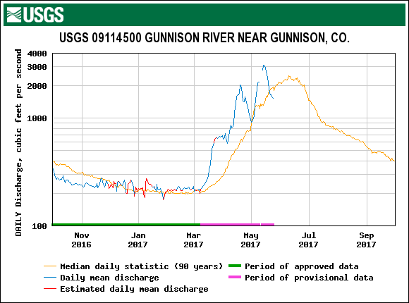
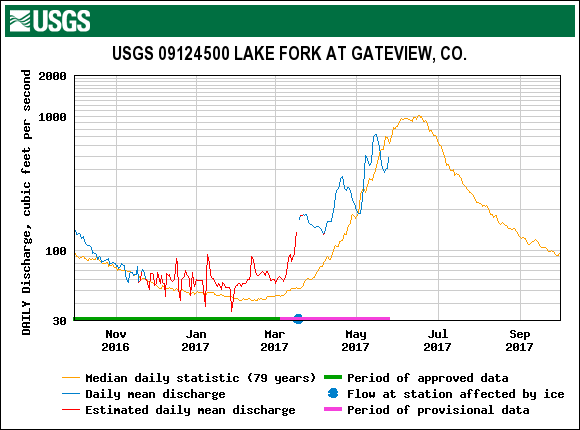
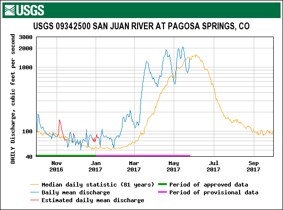
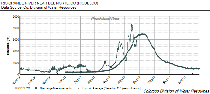
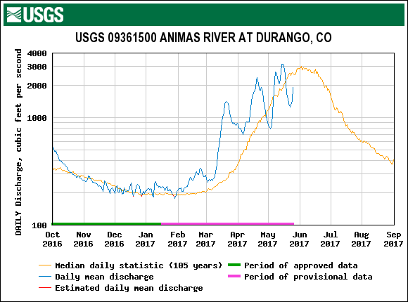
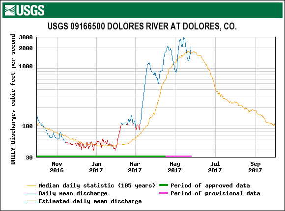
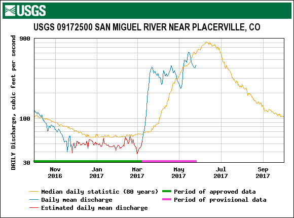
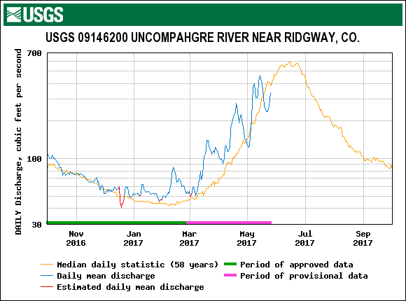
After Colorado experiencing a warmer than normal February, the warmest March on record, and an overall warmer April, it was reasonable to assume we would be in for an early snowmelt. But, in a fashion similar to May 2016, May 2017 is shaping up to be cooler than normal (for the most part) with greater than average precipitation. Much like May 2016, we have experienced a number of stormy periods that brought decreased air temperatures, overcast conditions, and additional snow which provided additional SWE as well as albedo re-sets to the snowpack by temporarily burying the concentrated dust layer. Last year, stormy periods temporarily buried concentrated dust layers until May 31 when we reported full dust exposure in all dust impacted areas of Colorado. With this dust exposed, along with persistent very warm/sunny weather, streamflows surged and we observed peak discharge (record peak) at SBB on June 6, as did many streams around Colorado. At this point in time Senator Beck SWE conditions are very near where they were this time last year, as is streamflow, and dust conditions are classification the same as last year (average) - although this year is more on the lighter side of average. Statewide, streamflow dropped last week to below median values with the addition of new snow in all mountain ranges. This past weeks' warm temperatures have brought flows up to near or median values again in nearly all basins in Colorado, and with the weather in the forecast we can expect that steady rise to continue, especially after this weekend. Even though the forecast is calling for periods of rain/snow over the next few days, it sure is starting to feel like summer. The plot of streamflow and SWE below may provide some plausible indication of how the remainder of snowmelt will unfold at SBB and elsewhere.
A short wave trough of low pressure which has caused windy conditions and isolated thunderstorms over western Colorado will persist through the weekend. During this time precipitation will be scattered and insignificant. Winds will increase Friday night into Saturday before dissipating by Sunday night. Yesterday, and currently, these winds are moving through the southern Colorado plateau, and may be strong enough to mobilize and transport dust to the mountains of Southern Colorado, but as of this morning we did not observe any new dust.
After the weekend a long wave ridge of high pressure will move into the four corners area. This will result in warm/sunny and calm conditions for the region which will persist into the forecastable future. More mountainous areas may see some very light and scattered precipitation and occasional increased cloud cover during this time from weak orographic activity. These thunderstorms are unlikely to result in significant accumulation of precipitation.
Please see plots below.
Stream discharge at SBB. Discharge so far this WY2017 (blue line) is compared with WY2016 (red line) and period of record (yellow line). Current SWE conditions are shown in purple. And WY2016 SWE conditions are shown in green. Additional snow and albedo resets with a cooler than average May in 2016 and 2017 (so far, these last 4 weeks) have delayed snowmelt, and streamflow appears on track for peaking near the median time-frame. Given our current status, it will be interesting to see how runoff compares with last year, there are of course many differences, but it may be useful to look at the influence of other variables, like soil moisture.
May 26 at SASP. D1-D4 will be once again exposed on snow surface today. Albedo at SASP for this past week suggests the dust was exposed for a couple days prior to last night's light precipitation.
With D1-D4 now exposed, warm/sunny June weather approaching, snowmelt is expected to increase along with streamflow.
Departure from normal temperature for the last 30 days
Percent of normal precipitation for the last 30 days
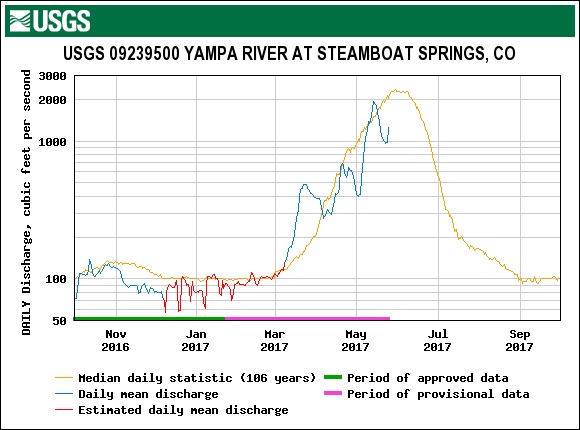
STREAMFLOW
SWE CONDITIONS
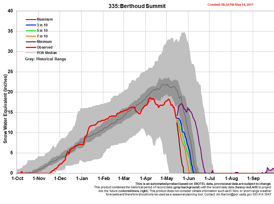
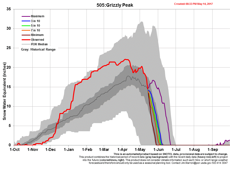
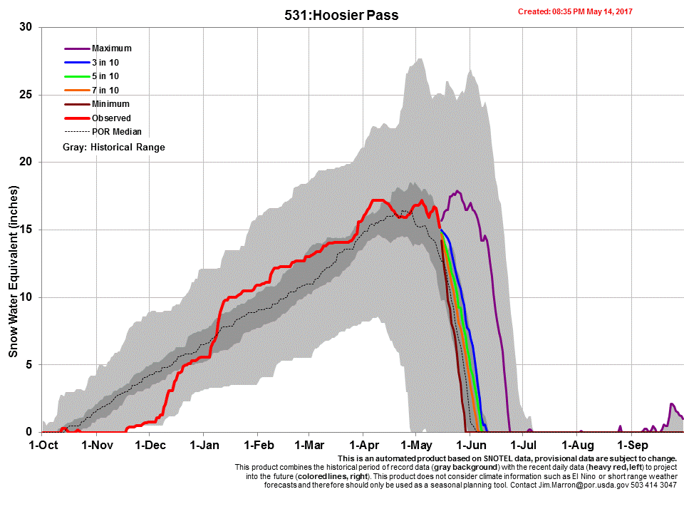
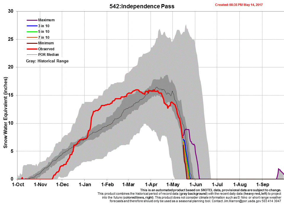
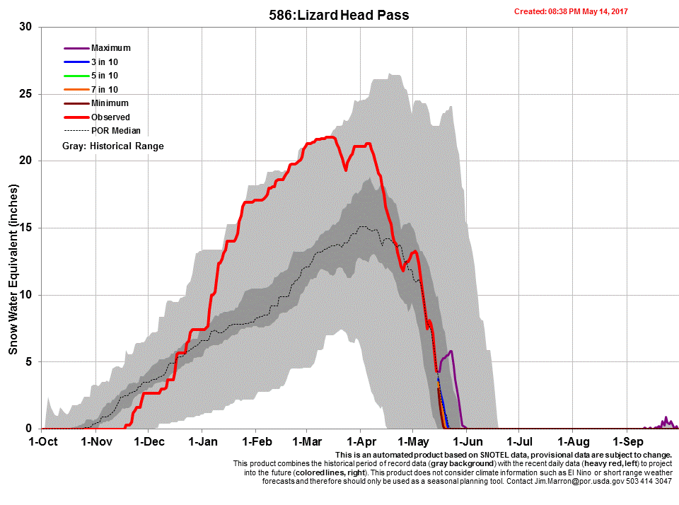
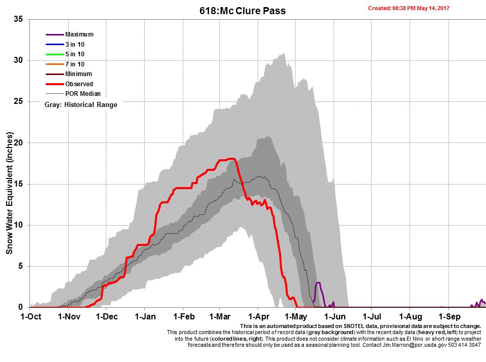
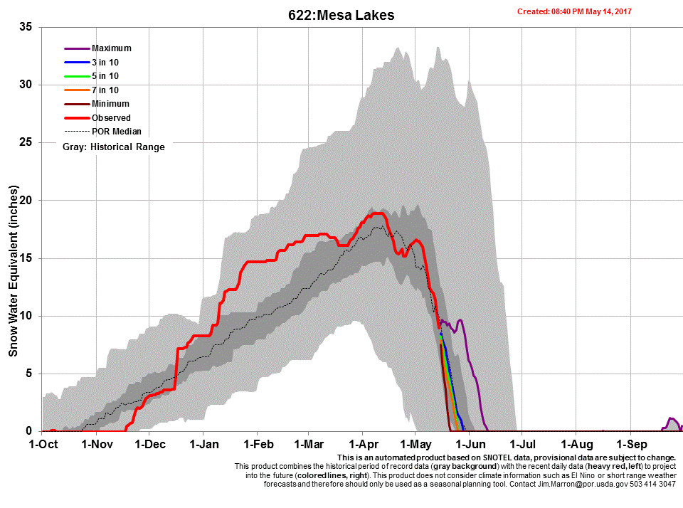
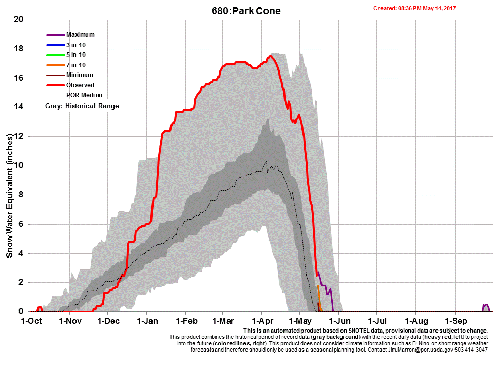
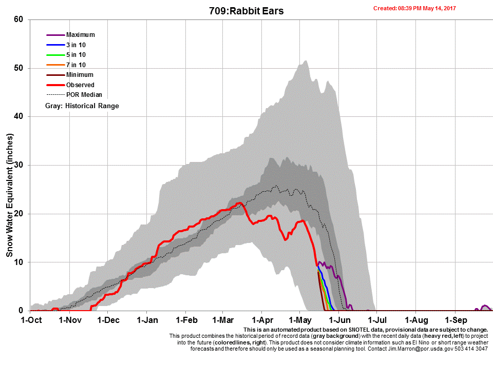
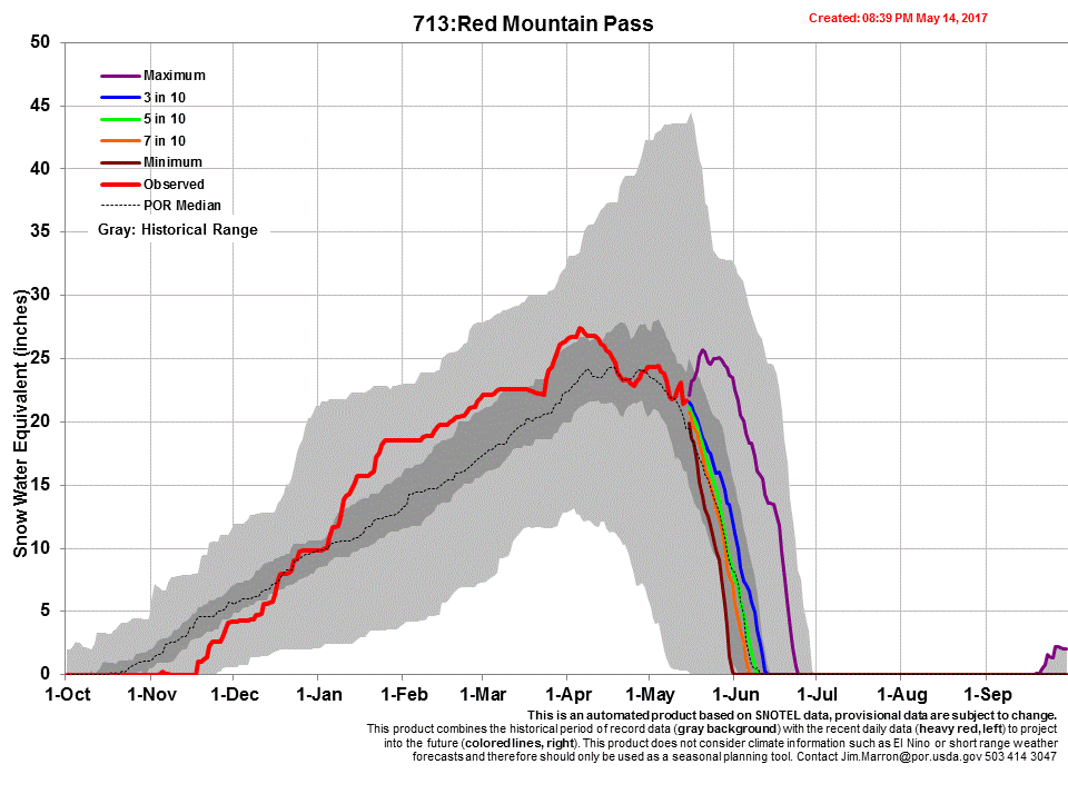
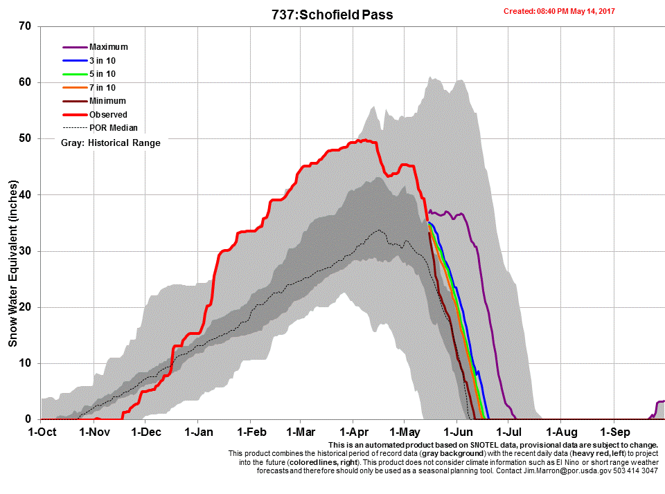
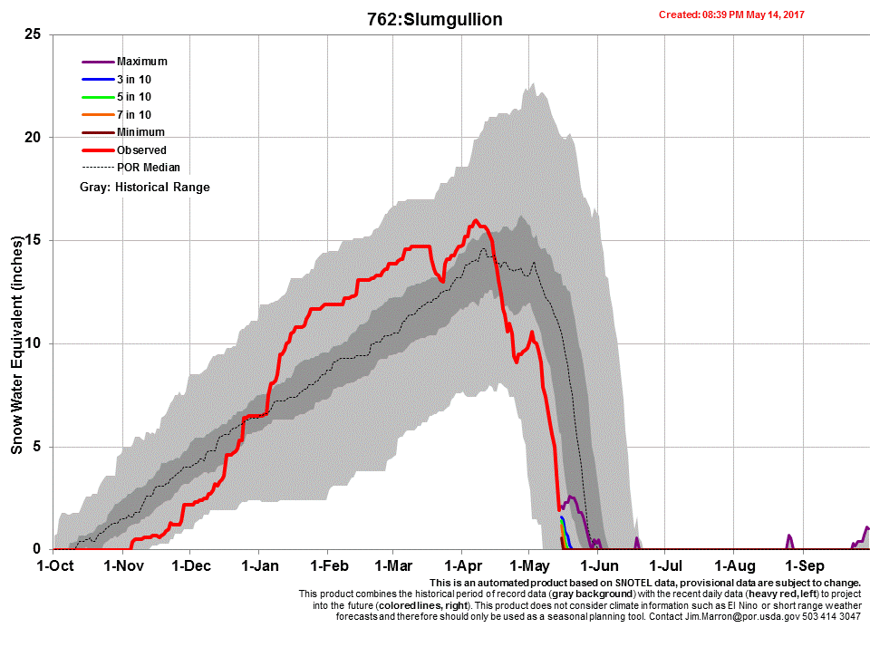
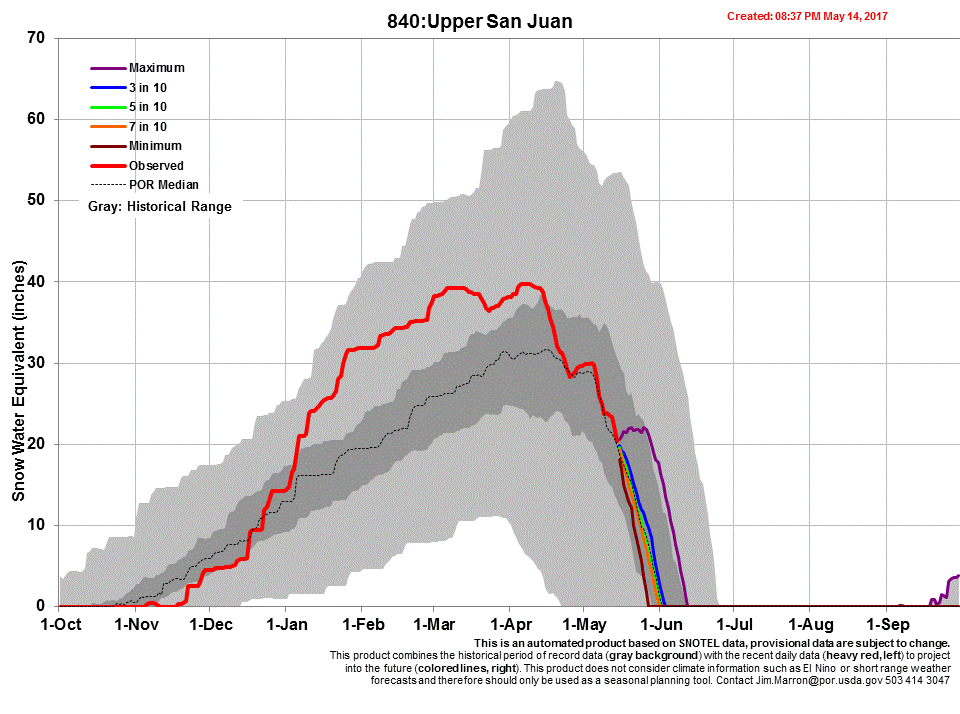
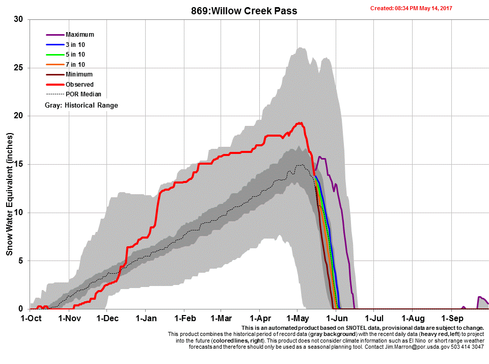
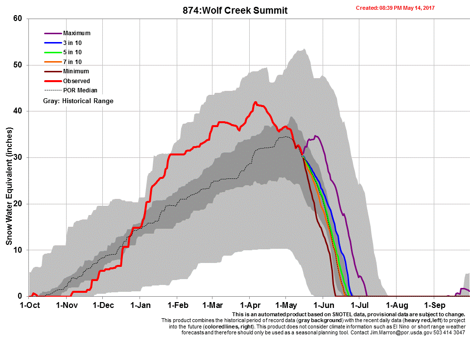
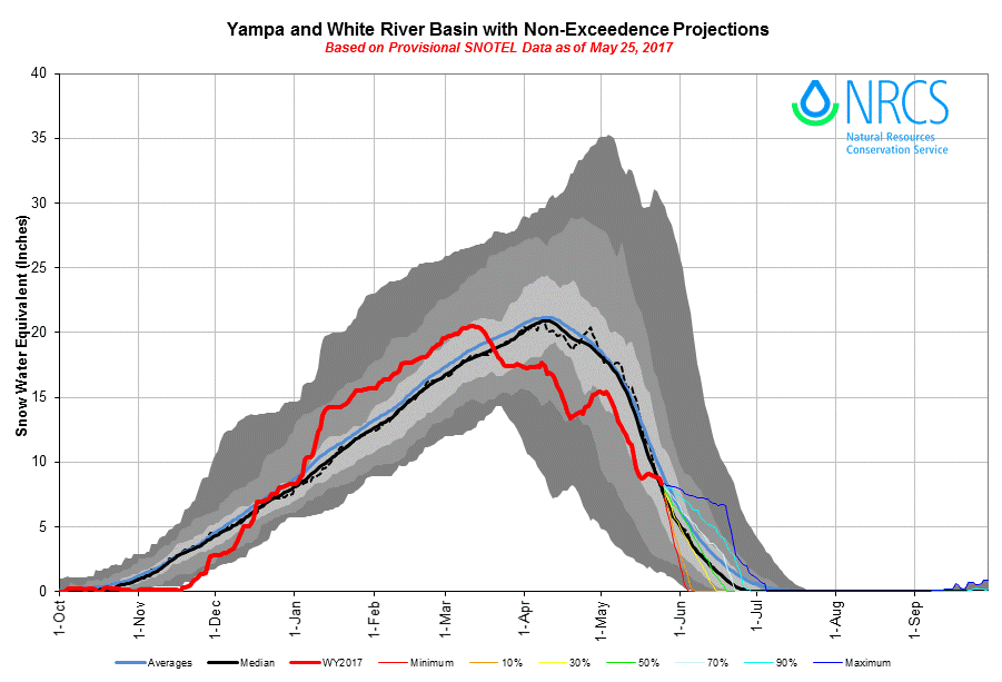
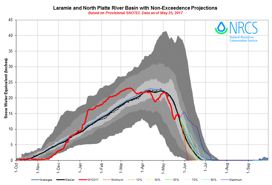
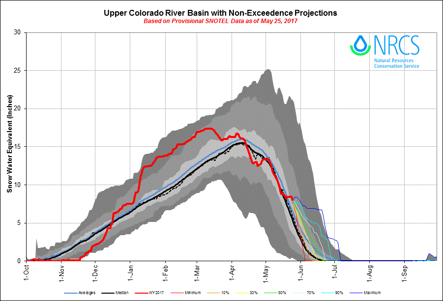
BASIN SWE CONDITIONS