

May 20, 2019: New Dust Events D5 and D6, 2” New Precip, Stormy Week Continues
Greetings from Silverton,
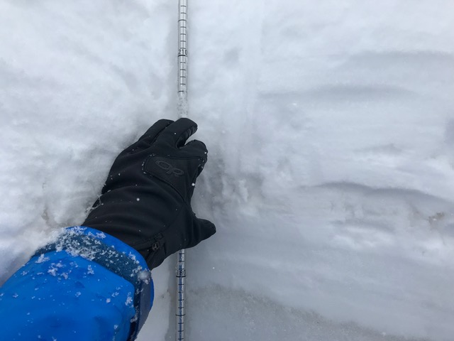
A lot has happened in the last few days. From May 11 - May 16 we saw the warm-up increase streamflows and also as forecasted we saw storms move in Thursday night decreasing the rate of snowmelt and reducing streamflows. Thursday, May 16, and into Thursday night we saw dust event #5 being deposited in the San Juan Mountains. This was a dry event, it came in on the storm front and deposited just prior to precipitation, so it takes on a stark desiccated look, as if someone sprinkled dust on the snow as opposed to mixing dust with the snow. D5 looks to be the most severe event to date. It fell on top of dust events #3 and #4 which were in the process of coalescing at the surface of the snowpack during the 6 day warm-up. Dust D3-D5 was immediately covered by 2-3” of snow at SASP. But wait, there’s more, since then we have received an additional 2” of precipitation and about 10” new snow accumulation at SASP and 16” at SBSP. But with this precipitation also came dust event #6. Dust came mainly on the forefront of the weekend storm but is noticeable throughout the new accumulation - which will help speed snowmelt down to the main D3/4/5 layer. Pictures below illustrate it pretty well.
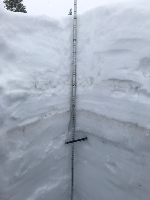
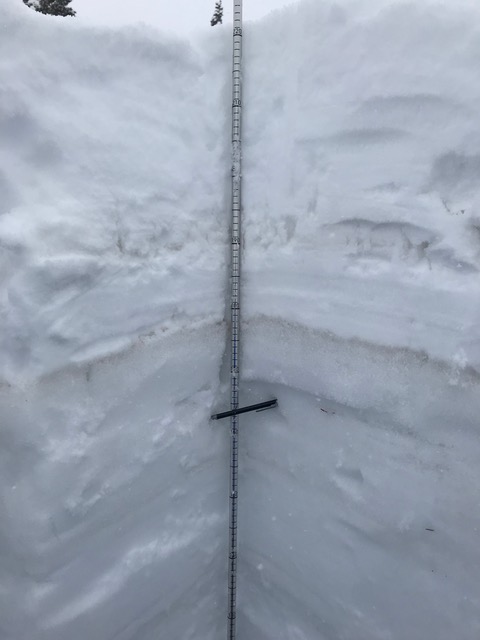
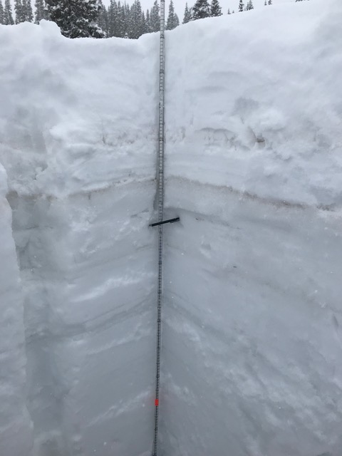
The D3 band of dust has been getting dirtier and dirtier the last three weeks with D4 deposition on May 1, D5 on May 16 and D6 shortly thereafter. The frequent spring storms have kept a lid on this upmost dust layer from being exposed for a long duration. Going into the last 11 days of May, as extended snowmelt periods get pushed further down the road this dust will be just under the surface and will quickly emerge with nice weather, ready to greatly enhance melt of a ripe snowpack when given the chance.
Stormy conditions look to stick around thru this coming Thursday evening. A drier southwest flow develops Friday and another low comes into the Great Basin by Sunday and tracks through our area early next week. In general the longer range forecast calls for increased chance of above normal precipitation and increased chance of below normal air temperatures (see images below).
We plan to do a CODOS tour the end of May, hopefully well timed to assess snowpack conditions as we go into June.
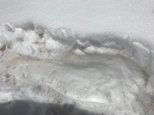
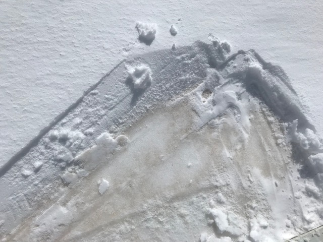
Below: Dust event #5. Pictures were taken on Friday, May 17 after the dry dust was deposited and after a few inches of snow buried dust.
Below: Wind rose plot for D5.

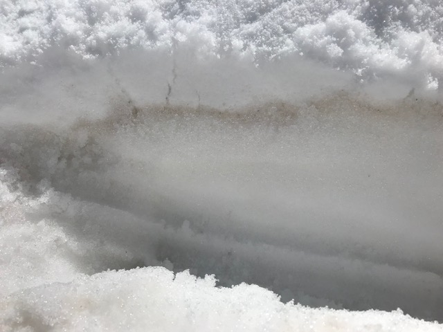
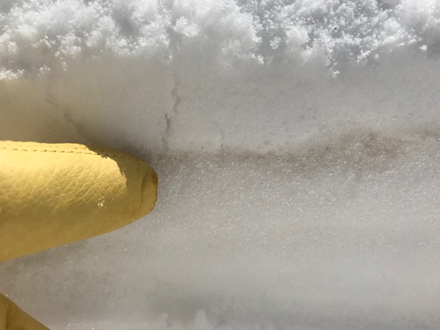
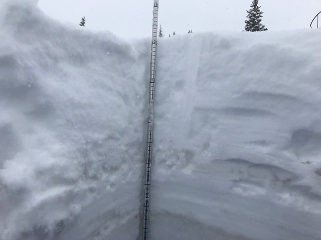
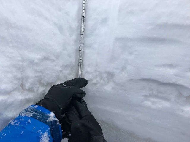
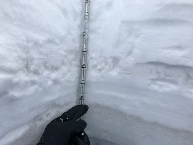
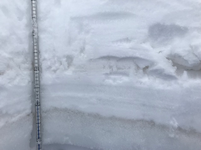
Below: Photos of snow profile at SASP (11,060’) on May 20, 2019. D3/4/5 is the obvious dark band. D6 is the chalky looking snow roughly 8 cm (3”) above the dark band. D6 is also diffuse in the new snow accumulation.
Below: Wind rose plot for D6

Below: Forecast calls for storminess through Thursday (albedo will remain high) then Friday a warm up begins with sunnier conditions when we’ll likely see albedo start to degrade and streamflows start to increase, increasing more so after the forecasted low moves through early next week.


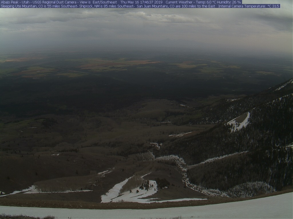
Below: Picture taken near Cortez on May 20, courtesy of Susan Behery.
